
Where Flight Simulation Enthusiasts Gather from Around the World!
AVSIM Library - Search Results

| Category: Flight Simulator 2004 - Aircraft Repaints, Textures and Modifications | |
| de Havilland Canada DHC-2 Beaver "Rocky's Flying Beaver" - REDUX |

|
Images related to this file:
File Description:

A complete redux package of my previous release of the "Rocky's Flying Beaver N57576"... this package adds support for the Amphibious, Float, Ski, Wheel, & Tundra models (by request)... as well as I have toned down the white color to reduce the glare and recovered some details lost in the previous release (my bad; eye strain and too much coffee to blame)... I've also added a bit of "grunge" (not too much) to give a little more character to the paint scheme (by request).
| Filename: | de_Havilland_Canada_DHC2_Beaver_Rockys_Flying_Beav.zip |
| License: | Freeware |
| Added: | 11th February 2013, 14:10:51 |
| Downloads: | 220 |
| Author: | Greg Spellmen |
| Size: | 7.18 MB |
| Category: Flight Simulator 2004 - Scenery | |
| Kugaaruk CYBB and DEW Pelly Bay CWPB in Nunavut, Canada |
|
Images related to this file:
File Description:
Kugaaruk is on the coast of northern mainland Canada on the Boothia Peninsula, 60 miles into a deep north-south fjord-like inlet called Pelly Bay. The name was changed from Pelly Bay in 1999, and the population is around 800. Gjoa Haven is 150 miles to the west, and Hall Beach just over 200 miles to the east. Six miles south of the village, and connected by a gravel road, there is a NWS station and what remains of a DEW Auxiliary Site; the DEW site was closed in 1992, a year after the NWS station became operational. There is also a 3,350 feet long gravel runway beside Barrow Lake 2 miles east of the site, Pelly Bay CWPB. Kugaaruk airfield is adjacent to the village and the 5,000 feet of 100 feet wide gravel runway is aligned 049T/229T where T stands for "true" as opposed to magnetic. There are flights by First Air and Canadian North and the AI includes a daily flight of each from Yellowknife via Gjoa Haven (as per real life) plus a cargo visit by Buffalo. Although the runway is long enough to accomodate a 737 it is not licensed for regular scheduled jet flights; the reason for this is that the approach lighting is "inadequate". Included here is a new .bgl for Gjoa Haven which will remove the small hold short line from the gravel; my mistake.
| Filename: | Kugaaruk_CYBB_and_DEW_Pelly_Bay_CWPB_in_Nunavut_Ca.zip |
| License: | Freeware, limited distribution |
| Added: | 25th November 2012, 00:43:07 |
| Downloads: | 429 |
| Author: | Roger Wensley |
| Size: | 6.1 MB |
| Category: Flight Simulator 2004 - Aircraft Repaints, Textures and Modifications | |
| Air Canada "Star Alliance" Boeing 767-333/ER (C-FMWY) |
|
Images related to this file:
File Description:
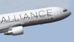
This is a repaint of the excellent SkySpirit2010 Boeing 767-300ER, in Air Canada "Star Alliance-15years sticker" livery, C-FMWY. Model included. The textures are saved in 32bit format for quality graphics. Its features are Opening doors & Cargo doors, detailed textures, accurate paint, dynamic shine & effects, dynamic flexing wings that respond to turbulence, fully independent suspension, trim animation, gear steering, accurate flight dynamics, spoiler animation, crash effects, reflective cockpit windows, transparent navigation light lenses and many more. Visit SkySpirit2010's facebook page: https://www.facebook.com/groups/SkySprit2010/
| Filename: | Air_Canada_Star_Alliance_Boeing_767333ER_CFMWY.zip |
| License: | Freeware |
| Added: | 8th April 2013, 22:51:52 |
| Downloads: | 696 |
| Author: | Stefan Bree / FSRepaintsGER, SkySpirit2010 |
| Size: | 10.57 MB |
| Category: Flight Simulator 2004 - Scenery | |
| Byron Bay CWBB plus Edinburgh Island CWEI in Nunavut, Canada |
|
Images related to this file:
File Description:
Byron Bay was a DEW line station on the south coast of Victoria Island, 105 miles east of Lady Franklin Point. It closed in 1993. The buildings are still there, slowly accumulating the patina so admired by collectors on Antiques Roadshow. The runway is just over 4,500 feet and aligned 58T-238T. At the mid point between Lady Franklin Point and Byron Bay there is a North Warning Site on the highpoint of Edinburgh Island, just south of the closed Ross Point station on the "mainland" Victoria Island. The runway is just over 1,400 feet and is also up on the top of the island. There is a steep road down 600 feet to the coast for the annual fuel resupply and maintenance.
| Filename: | Byron_Bay_CWBB_plus_Edinburgh_Island_CWEI_in_Nunav.zip |
| License: | Freeware, limited distribution |
| Added: | 11th November 2012, 21:07:05 |
| Downloads: | 246 |
| Author: | Roger Wensley |
| Size: | 2 MB |
| Category: Prepar3D V5 - AI Aircraft | |
| P3DV4-5 FSPXAI Embraer E175 Air Canada Express fleet update |
|
Images related to this file:
File Description:
Textures only for the FSPXAI - EMBRAER E-JET FOR P3D4/5 AI-TRAFFIC payware. Two variations: old and new colors. Included registrations real traffic. By Joel Branchu. May 2022
| Filename: | P3DV45_FSPXAI_Embraer_E175_Air_Canada_Express_flee.zip |
| License: | Freeware |
| Added: | 25th May 2022, 01:38:11 |
| Downloads: | 48 |
| Author: | Joel Branchu |
| Size: | 2.54 MB |
| Category: Flight Simulator 2004 - AI Aircraft | |
| LADE-Lineas Aereas del Estado De Havilland Canada DHC-6 |
|
Images related to this file:
File Description:
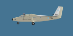
Repaint of the Henry Tomkiewicz/Project AI Twin Otter in LADE-Lineas Aereas del Estado colours. Includes files for both HTAI and Project AI versions and comes with a FSX prop texture, FS9 prop texture is included too.
| Filename: | LADELineas_Aereas_del_Estado_De_Havilland_Canada_D.zip |
| License: | Freeware |
| Added: | 14th October 2013, 20:28:59 |
| Downloads: | 392 |
| Author: | Chris Peschke,PAI |
| Size: | 269.9 KB |
| Category: Flight Simulator 2004 - Scenery | |
| CEN5 - Cold Lake Regional & revised CYOD - Cold Lake, Alberta, Canada |
|
Images related to this file:
File Description:
CYOD was made by John Stinstrom and you should download and install it first; there is also a "fix" for the apron lights textures. I am posting a modified AFCAD for CYOD with John's knowledge; this changes gates and atc identifications for the gates, so that with my version of the CYOD AI there are pairs of F18s taking off every 20 minutes or so. This means that the nearby Cold Lake Regional CEN5 works within the busy environment of flights to and from the nearby base. There is also a Hawker Hunter that drops in, and transport planes. The planes are listed so that you will know which are required to be downloaded. CEN5 may have "Regional" attached to its name, but there are now no scheduled flights and it is a peaceful and relaxed little airfield. There is fuel, and a little clubhouse building, and some hangars. There is ai for it here, using original FS9 planes so no downloads are required. Right hand circuits for runway 25 to stay as far away as possible from CYOD, and it is the CYOD tower that controls all flights in the area.
| Filename: | CEN5__Cold_Lake_Regional___revised_CYOD__Cold_Lake.zip |
| License: | Freeware, limited distribution |
| Added: | 11th May 2014, 13:41:51 |
| Downloads: | 489 |
| Author: | Roger Wensley |
| Size: | 12.25 MB |
| Category: Flight Simulator 2004 - Scenery | |
| Watson Lake CYQH and CEJ9 in the Yukon Territories, Canada |
|
Images related to this file:
File Description:
Watson Lake is at 2,200 feet asl on the east side of the Rockies, in the Yukon Territories. The town is less than five miles north of the border with BC and is built around Wye Lake, just a few miles southeast of the much larger Watson Lake. Whitehorse is some 200 miles to the west, and Fort Nelson 220 miles to the east. The airport was built during WW2 and there remains one surviving original hangar, along with later additions. Unusually, the town of Watson Lake came into being because of the airport's existence, though with the closure of one mine that the airport used to serve and the serial closure of another (closed four times?) both the airport and the town (population 500) are in a downward spiral. The airport is 5 miles to the west of the town. There were two runways, but one is now closed and the remaining one is 08-26, 5,500 feet and 150 feet wide. There are two aprons, the northern one being half-used by CL 415 fire-fighting planes (included in the AI, along with Central Mountain Air). All the buildings for CYQH are modeled specifically, but the CJE9 shed is a guess.
| Filename: | Watson_Lake_CYQH_and_CEJ9_in_the_Yukon_Territories.zip |
| License: | Freeware, limited distribution |
| Added: | 14th July 2014, 21:38:57 |
| Downloads: | 443 |
| Author: | Roger Wensley |
| Size: | 17.6 MB |
| Category: Flight Simulator 2004 - AI Aircraft | |
| French Air Force de Havilland Canada DHC-6 - Retro Traffic |
|
Images related to this file:
File Description:
FS2004 French Air Force DHC-6 - Retro Traffic. Air Force (Armee de l'Air) De Havilland DHC6 for late 80's retro AI traffic. Ten aircraft; textures only for for Henry Tomkiewicz De Havilland DHC-6 freeware AI model. Flight plans included. By Jacques Capdeville.
| Filename: | French_Air_Force_de_Havilland_Canada_DHC6__Retro_T.zip |
| License: | Freeware |
| Added: | 30th August 2014, 14:30:07 |
| Downloads: | 334 |
| Author: | Jacques Capdeville |
| Size: | 848.06 KB |
| Category: Flight Simulator X - AFCAD Files | |
| CYWG - Winnipeg James Armstrong Richardson International Airport / Winnipeg, Manitoba, Canada |
|
Images related to this file:
File Description:
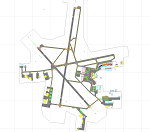
CYWG - Winnipeg James Armstrong Richardson International Airport / Winnipeg, Manitoba, Canada
This airport update was made with the latest version of ADE (Airport Design Editor) and made for FSX as a replacement for the stock (default) airport. I found that most stock airports in FSX lack a decent amount of character and realism and this area in particular was dreadful! The stock airport was rather inaccurate. I've made several additions to the airport which are listed below. All these enchancements are as close to the real airport as I can get with stock library objects. I've used satellite images, terminal photos and maps throughout the whole process so building locations are as accurate as possible. Happy landings in the beautiful Canada!
Features:
*Greatly expanded parking apron
*Brand new main terminal building with its 11 jetways and regional airline parking and parking garage
*Old terminal (soon to be demolished) with construction vehicles
*Hangar and other airport buildings added
*Cargo terminal with parking
*Military cargo area
*Airport vehicles and objects throughout the airport
*Main road in front of airport added with static vehicles
*Airport fire station with fire trucks
*Static de-icing area with vehicles
*Old runway 7/25 which was demolished in the 1990s and FSX inexplicably included has been removed
| Filename: | CYWG__Winnipeg_James_Armstrong_Richardson_Internat.zip |
| License: | Freeware |
| Added: | 24th July 2012, 08:12:46 |
| Downloads: | 2,961 |
| Author: | Jaison Diaz |
| Size: | 163.14 KB |


© 2001-2026 AVSIM Online
All Rights Reserved
Privacy Policy |