
Where Flight Simulation Enthusiasts Gather from Around the World!
AVSIM Library - Search Results

| Category: Flight Simulator X - Scenery | |
| KSFO San Francisco Inlt (Asbuilt Scenery v1a) |

|
File Description:
Scenery and airport design (using AFX and FSX developer tools) adds photo-based terrain in and around the airport with seasonal and night variations. All runways and taxiways are placed at correct geographic coordinates. Shoulders along the runways and taxiways have been added and surfaces changed to present an appearance that looks a little more realistic than the default airport. Default scenery for terminals and buildings are reused, parking and jetways have been adjusted to match current assignments. A current copy of the FAA Airport Diagram is included for reference.
| Filename: | KSFO__San_Francisco_Inlt_Asbuilt_Scenery_v1a.zip |
| License: | Freeware, limited distribution |
| Added: | 15th May 2008, 23:52:00 |
| Downloads: | 13,302 |
| Author: | Dan Downs |
| Size: | 1.82 MB |
| Category: Flight Simulator X - Scenery | |
| Doel PowerPlant Antwerp |
|
File Description:
Doel PowerStation (Nuclear power plant) Belgium.
EB00 (zero-zero)
The Power plant of Doel NW of Antwerp is one of the major landmarks for the southwest of the Netherlands and the northwest of Belgium.
The Powerplant is so huge that it’s plainly visible from EHLE (Lelystad) at 1500ft, about 150 -200 kilometers north in reality.
This scenery not only places the power plant correct in FSX corrected for Ultimate terrain X Europe, but it also adds several ships on the Schelde river and in port.
Have fun and happy landings.
| Filename: | Doel_PowerPlant_Antwerp.zip |
| License: | Freeware, limited distribution |
| Added: | 13th January 2009, 14:28:30 |
| Downloads: | 3,050 |
| Author: | Joost Visser / ADE |
| Size: | 284.79 KB |
| Category: Flight Simulator X - Scenery | |
| Formosa X RCTP Taiwan Taoyuan International Airport (2/2) |
|
Images related to this file:
File Description:
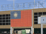
This project improves the default FSX scenery to better represent the appearance of Taoyuan International Airport as it is in 2011. All airport buildings and nearby landmarks were were custom-made using gMax, including animated radars and People Movers. Runways, taxiways, and aprons have been repositioned based on satellite imagery. Aircraft parking had been updated using the latest real-world AIP. A photoreal terrain of the Taoyuan area, plus landclass improvements, is also included. Part 1 of this package contains the airport scenery. Part 2 contains background photoreal textures and landclass files.
| Filename: | Formosa_X_RCTP_Taiwan_Taoyuan_International_Airpor.zip |
| License: | Freeware |
| Added: | 17th May 2011, 03:00:04 |
| Downloads: | 14,113 |
| Author: | Houting Chiang, Rudolf Liu, Jack Su, Mike Huang |
| Size: | 96.79 MB |
| Category: Flight Simulator X - Scenery | |
| Formosa X RCTP Taiwan Taoyuan International Airport (1/2) |
|
Images related to this file:
File Description:
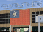
This project improves the default FSX scenery to better represent the appearance of Taoyuan International Airport as it is in 2011. All airport buildings and nearby landmarks were were custom-made using gMax, including animated radars and People Movers. Runways, taxiways, and aprons have been repositioned based on satellite imagery. Aircraft parking had been updated using the latest real-world AIP. A photoreal terrain of the Taoyuan area, plus landclass improvements, is also included. Part 1 of this package contains the airport scenery. Part 2 contains background photoreal textures and landclass files.
| Filename: | Formosa_X_RCTP_Taiwan_Taoyuan_International_Airpor.zip |
| License: | Freeware |
| Added: | 17th May 2011, 02:59:37 |
| Downloads: | 16,747 |
| Author: | Houting Chiang, Rudolf Liu, Jack Su, Mike Huang |
| Size: | 15.39 MB |
| Category: Flight Simulator X - Missions | |
| Save The Ring - V2 |
|
Images related to this file:
File Description:
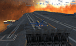
Unfortunately there was a problem with the first version of this mission. (Thanks to Eskil who analysed the problem).
This is again the complete mission.
This adventure starts in Hamburg (Germany) and will bring you to several places in the north of germany (and Europe).
Your will fly together with a german Co-Pilot and a british special agent.
Your Co-Pilot knows the terrain of north germany and he informs you step by step about the points of interest of the mission.
You have to find and save the ring.
Now Have fun!
| Filename: | Save_The_Ring__V2.zip |
| License: | Freeware |
| Added: | 20th January 2017, 17:43:05 |
| Downloads: | 357 |
| Author: | Ruediger Rook |
| Size: | 66.31 MB |
| Category: Flight Simulator X - Scenery | |
| KNHK - NAS Patuxent River - Patuxent River, MD |
|
Images related to this file:
File Description:

By request, here is an improved version of the stock NAS Patuxent River. I added Military_Cargo and Military_Combat parking spaces. I added the fire station and fire trucks. I removed and replaced many default buildings, added additional buildings, and added the control tower. Added static fuel trucks, static airplanes and helicopters, parking lots with cars and light poles. Added, removed, or adjusted taxiways and aprons as needed. I moved one apron to be compatible with the Ultimate Terrain coastline, but it should also be fine with default scenery.
| Filename: | KNHK__NAS_Patuxent_River__Patuxent_River_MD.zip |
| License: | Freeware |
| Added: | 10th June 2010, 00:52:06 |
| Downloads: | 2,601 |
| Author: | Jim Cook |
| Size: | 17.37 KB |
| Category: Flight Simulator 2004 - Scenery | |
| Idaho County S80 Airport |
|
File Description:
Another small airport in beautiful Idaho. Near the mountains but not in them, this airport offers easy access and 24 hour operation. The airport NOTAM mentions skydiving activity, so I'm guessing the large circular dirt area is a landing target for the skydivers. All aprons were redrawn and buildings replaced according to better match Google Earth images. The landclass was modified to reduce the nearby city to a more realistic size and replace the farmland surrounding the airport.
This scenery was designed for Ultimate Terrain and may or may not work with the default scenery.
| Filename: | Idaho_County_S80__Airport.zip |
| License: | Freeware |
| Added: | 27th July 2008, 11:51:45 |
| Downloads: | 496 |
| Author: | Sidney Schwartz |
| Size: | 651.96 KB |
| Category: Flight Simulator X - AFCAD Files | |
| Mount Pleasant Landing Strip Airport (67NJ), NJ |
|
File Description:
Located 01 miles S of Hainesburg, New Jersey on 192 acres of land, Mount Pleasant Landing Strip Airport is a private turf field. The strip itself is 2100 feet in length over fairly level ground. There is no hard-surfaced grass runway in place, so setting your mesh to the highest resolution is recommended as you will be landing on bare terrain. Next to Runway 06 is a path through the trees you can taxi along to get to a hangar - although it is not available for transient aircraft and is closed. Collision with the trees along the path near the hangar and the static aircraft parked near it is disabled to make it easier to move through this relatively tight area. Immediately beyond the hangar is a clearing with ample room to turn around to taxi back out. You can also start parked in front of the hangar. The windsock is located a few feet west of the hangar and is not lit. The runway also has no edge lighting so daytime VFR operations only are recommended for this airfield.
Scenery constructed with use of satellite images/streetview/aerial photos - the author has not been there in person.
This scenery is meant to be used in conjunction with MegaScenery Earth New York 007. It is not required, but apron use is minimized to allow satellite scenery to show through as much as possible, and objects are placed based on the MSE textures - lack of it may make scenery look out of place.
| Filename: | Mount_Pleasant_Landing_Strip_Airport_67NJ_NJ.zip |
| License: | Freeware |
| Added: | 7th February 2011, 23:49:26 |
| Downloads: | 198 |
| Author: | Drew Sikora |
| Size: | 468.64 KB |
| Category: Flight Simulator X - AFCAD Files | |
| Salem Airfield Airport (NJ74), NJ |
|
File Description:
Located 01 miles E of Salem, New Jersey on 14 acres of land, Salem Airfield is a private turf strip 2200' in length. The hard surface runway has been removed so have your mesh settings as high as possible to get the most out of landing/taking off on actual terrain. The surrounding area has been highly detailed with as much forestation as possible included to block out the horizon as much as possible considering the many open spaces surrounding the airport. Tie downs are located next to the middle of the runway, look for the marker cones or start in any RAMP_GA_SMALL parking locations. A hangar is available as well, and attendant is on call on NAV2 to open the door. You can start inside the hangar in the DOCK_GA parking spot or outside the hangar in the RAMP_GA parking spot. All parking is for aircraft with wingspans no greater than 40 feet. There is no fuel available. The field is lit for night use, but the windsock is not so check your weather before flying in!
Scenery constructed with use of satellite images/streetview/aerial photos - the author has not been there in person.
This scenery is meant to be used in conjunction with MegaScenery Earth New Jersey/Delaware 004. It is not required, but apron use is minimized to allow satellite scenery to show through as much as possible, and objects are placed based on the MSE textures - lack of it may make scenery look out of place.
| Filename: | Salem_Airfield_Airport_NJ74_NJ.zip |
| License: | Freeware |
| Added: | 10th August 2011, 02:05:51 |
| Downloads: | 176 |
| Author: | Drew Sikora |
| Size: | 910.96 KB |
| Category: Flight Simulator 2004 - Scenery | |
| OSM World: South America |
|
Images related to this file:
File Description:
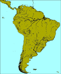
OSM World is a community project! If you wish to help, check the documentation and contact the author!
Welcome to OSM Wold: South America! This is a vector data scenery package covering the South American area. Coastlines, Rivers, lakes, roads, railways, and power lines with detail never before seen! All in an autogen-compatible density! You can see roundabouts, train terminals, harbor areas in a resolution of a point every 10 meters. At this same resolution a vectorial city class places residential (in small and big building variations, depending on surface area) and industrial areas exactly where they are supposed to be. This gives the city areas a resolution far superior to the capacity of FS-2004 default landclass bitmaps, limited to approximately 1 Km x 1 Km squares. OSM World: South America will even give you small roads leading to small towns (even a few houses across)! From big highway intersections, including ramps, to the tiniest rural pathways covering the entire South american area! Wherever in South America you fly, there is something to see!
You can enjoy this scenery near coastlines too! harbor areas and extremely detailed coastal topology (try the southern Chile). This scenery makes sure that the ocean is always flat, you can forget about the climbing water often found around photo-sceneries! This scenery is best paired with a good set of terrain meshes (like the freeware global SRTM mesh by Stephen Rothlisberger , available here: http://simviation.com/1/fs2004terrainmesh).
| Filename: | OSM_World_South_America.zip |
| License: | Freeware |
| Added: | 5th August 2015, 02:31:08 |
| Downloads: | 3,109 |
| Author: | Mario Noriega, Luis Miguel Hernandez |
| Size: | 64.37 MB |


© 2001-2026 AVSIM Online
All Rights Reserved
Privacy Policy |