
Where Flight Simulation Enthusiasts Gather from Around the World!
AVSIM Library - Search Results

| Category: Flight Simulator 2004 - Scenery | |
| Lake Edward elevation modification |

|
Images related to this file:
File Description:
Modified HP and HL files to raise the level of Lake Edward to fit with terrain with 76m mesh.
The water area around Entebbe airport has also been modified.
Victoria-Nile River has been moved south of Chobe Safari Lodge Strip which was in the river before.
Some modified files for airstrips in Uganda.
| Filename: | Lake_Edward_elevation_modification.zip |
| License: | Freeware |
| Added: | 25th October 2022, 14:30:54 |
| Downloads: | 94 |
| Author: | John Tennent |
| Size: | 759.5 KB |
| Category: Flight Simulator 2004 - Scenery Design | |
| FSDEM 1.1 |
|
File Description:
FSDEM is a graphical tool designed to help on the editing and correction of NASA SRTM (Shuttle Radar Topography Mission) terrain elevation meshes, and to create terrain mesh scenery to be used in Microsoft Flight Simulator 2002/2004.
Program main features:
This version fixes some bugs and adds minor improvements. See the included file history.htm for details.
| Filename: | FSDEM_11.zip |
| License: | Freeware, limited distribution |
| Added: | 4th August 2004, 20:51:02 |
| Downloads: | 5,125 |
| Author: | Emerson de Oliveira |
| Size: | 377.03 KB |
| Category: Flight Simulator X - Scenery Design | |
| Terrain Design |
|
Images related to this file:
File Description:
Terrain Design for Flight Simulator X
This simple illustrated document explains the basic concepts in Flight Simulator X terrain, and how to change them using SBuilder for FS X. Make new water bodies, roads, vehicle traffic, airport flattens, remove autogen, add more detail - anybody can do it easily and quickly.
My most sincere apologies - I am unable, for lack of free time, to offer support of any kind. For questions or problems, please post in the Avsim scenery design forum.
| Filename: | Terrain_Design.zip |
| License: | Freeware |
| Added: | 14th December 2009, 13:29:15 |
| Downloads: | 18,390 |
| Author: | Luis Feliz-Tirado |
| Size: | 3.9 MB |
| Category: Strike Fighters: Project 1 - Mods, Utilities and Patches | |
| Israel Terrain |
|
File Description:
Israel terrain contains the areas of complete Israel and parts of Syria, Jordan, Lebanon and Egypt. It covers all aereas, were Israel and Egypt fought their wars each other. If you want hedgehoping in Jordan valley, tank killing in Sinai penisula or want to learn how heavy the famous SAM screen along the Suez canal is, then try this terrain.
| Filename: | Israel_Terrain.zip |
| License: | Freeware |
| Added: | 26th February 2004, 03:42:24 |
| Downloads: | 1,105 |
| Author: | Michael |
| Size: | 1.91 MB |
| Category: Strike Fighters: Project 1 - Mods, Utilities and Patches | |
| Suez Terrain |
|
File Description:
Suez Terrain is an updated version version of Israel terrain. It covers the areas from North Egypt to South Syria, including the Sinai penisula and the entire territory of Israel and Palestine and major parts of Jordan Kingdom. The frontline is set for borders before 1967 6 days war, so that you can use it for campaigns of Suez Crisis, Operation Kadesh and 6 Days war.
Suez terrain has at the moment 94 target areas.
| Filename: | Suez_Terrain.zip |
| License: | Freeware |
| Added: | 6th February 2005, 04:22:49 |
| Downloads: | 881 |
| Author: | Michel Gepard |
| Size: | 3.76 MB |
| Category: Strike Fighters: Project 1 - Mods, Utilities and Patches | |
| Taiwan Terrain |
|
File Description:
Complete Taiwan 1958 Terrain for SFP1, including airbases, cities and roads.
| Filename: | Taiwan_Terrain.zip |
| License: | Freeware |
| Added: | 4th March 2005, 18:30:47 |
| Downloads: | 1,714 |
| Author: | Edward Deisler, USAFMTL |
| Size: | 7.73 MB |
| Category: Flight Simulator X - Scenery | |
| CYXX (2012) Version 2 for FS9, FSX and Prepar3D |
|
Images related to this file:
File Description:
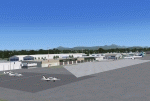
CYXX (2012) portrays the Abbotsford (British Columbia, Canada) Airport - home of the Abbotsford Air Show - and surrounding area as it appeared in late 2012. Abbotsford lies just east of Vancouver and only a short distance north of the US border. CYXX is home to Conair Aviation (a large operator of forest fire-fighting air-tankers), Cascade Aerospace (a major aircraft maintenance operation) and several helicopter training, service and operations facilities.) The recently completed major runway and taxiway extensions are reflected in CYXX (2012). This add-on includes a large selection of custom AI and static aircraft painted to represent airline and privately-owned aircraft based or often seen at CYXX, including every aircraft type currently operated by Conair. CYXX (2012) is compatible with BC Roads (FS9 only), Vancouver+, ORBX FTX USA Canada Pacific Northwest and both FS9 and FSX versions of Ultimate Terrain.
Generally, this new version is visually identical to its predecessor - even though quite different internally. As well, to the extent possible, it is compatible with Prepar3Dv2.
| Filename: | CYXX_2012_Version_2_for_FS9_FSX_and_Prepar3D.zip |
| License: | Freeware, limited distribution |
| Added: | 20th June 2014, 11:41:28 |
| Downloads: | 4,771 |
| Author: | Don Grovestine |
| Size: | 108.71 MB |
| Category: Flight Simulator 2004 - Scenery Design | |
| FS Resample Tools v0.95 Beta |
|
File Description:
This comprehensive, but easy to use, program will allow you to create custom terrain (photo-real ground textures) or altitude mesh for Microsoft Flight Simulator.
Just provide a source image and indicate the geographical extents and the scenery is created in a few quick steps.
Also includes a top-of-the-line resample filter that lets you resize your image to Microsoft terrain requirements.
Elrond has graciously consented to have this program placed in the AvSim library.
| Filename: | FS_Resample_Tools__v095_Beta.zip |
| License: | Freeware |
| Added: | 21st September 2003, 18:45:14 |
| Downloads: | 3,001 |
| Author: | Elrond Elvish |
| Size: | 728.39 KB |
| Category: Flight Simulator 2004 - Aircraft Repaints, Textures and Modifications | |
| Northern Air Cargo Boeing 747-8F (N366WA) |
|
Images related to this file:
File Description:

SkySpirit Boeing 747-8F Northern Air Cargo (N366WA). This livery is on a fictional airframe. Northern Air Cargo is an American cargo airline based in Anchorage, Alaska, USA. It operates services within Alaska and to Canada and mainland USA. Its main base is Ted Stevens Anchorage International Airport, with a hub at Fairbanks International Airport. Model design by Hiroshi Igami. This is a "Livery Only". You will need to obtain a SkySpirit 747-8F base package.
| Filename: | Northern_Air_Cargo_Boeing_7478F_N366WA.zip |
| License: | Freeware, limited distribution |
| Added: | 22nd December 2014, 00:05:38 |
| Downloads: | 392 |
| Author: | Danny Cummings |
| Size: | 17.54 MB |
| Category: Flight Simulator X - Scenery | |
| N52 - Lakes, Streams and St.Lawrence River with iced cover. Province of Quebec (Canada) |
|
File Description: This scenery replaces the FSX 'winter' water polygons by an iced cover for
lakes, rivers and St.Lawrence river of Province of Quebec, Canada, under N52.
Only compatible with Gilles Gauthier's Quebec mesh and landscape sceneries
and Jean-Pierre Fillion AI ships routes. (See www.quebecfsx.org).
| Filename: | N52__Lakes_Streams_and_StLawrence_River_with_iced_.zip |
| License: | Freeware, limited distribution |
| Added: | 18th September 2013, 13:06:36 |
| Downloads: | 522 |
| Author: | Gilles Gauthier and Jean-Pierre Fillion |
| Size: | 54.08 MB |


© 2001-2026 AVSIM Online
All Rights Reserved
Privacy Policy |