
Where Flight Simulation Enthusiasts Gather from Around the World!
AVSIM Library - Search Results

| Category: Prepar3D V5 - Aircraft Repaints, Textures and Modifications | |
| Air Canada B744PW (C-GAGA | 1975) |

|
Images related to this file:
File Description:
AIR CANADA (C-GAGA | 1975) livery, lovingly and entirely free-hand drawn created for PMDG B744 QOTSIIv3 for P3Dv4/v5 simulation.
To install either the clean or the weathered version, please use PMDG Operation Center.
Credits:
-PMDG B747 QOTSIIv3 paint-kit
-Brian Thibodeaux, to whom I thank for giving a concession for using his weather files, with my adaptation on this project.
Please note:
This entire artwork is classified as freeware (NON-COMMERCIAL USE) as the use of this product is for personal use ONLY.
| Filename: | Air_Canada_B744PW_CGAGA__1975.zip |
| License: | Freeware |
| Added: | 5th January 2021, 22:28:57 |
| Downloads: | 86 |
| Author: | Luca Collina |
| Size: | 121.27 MB |
| Category: Prepar3D V1-4 - Scenery | |
| CYYC - Calgary International Airport - Alberta, Canada |
|
File Description:
Prepar3D Scenery--Calgary International Airport (CYYC), Alberta, Canada. This is Ray Smith's file CYYC_RS_FSX.ZIP, modified with his permission. This airport update is for CYYC with two optional files made only for Prepar3D, one version with the crosswind runways operating where all four runways will be used for takeoff and landing and one version as the default runway operation. Assigned parking as per their website with extra parking. The Calgary Airport Authority will be implementing concourse name and gate number changes, these are now updated to this plan, the new IFP international concourse under construction with many of the buildings added, the new runway 17L/35R now included with ILS also added for it, taxiways and taxi signs updated to the latest charts, Barlow Trail NE removed, lighted helipad, extra fuel trucks, support vehicle roads rebuilt and many other scenery improvements, airport views are from inside the new control tower (when in tower view) and the old control tower dismantled. By Robert Catherall.
| Filename: | CYYC__Calgary_International_Airport__Alberta_Canad.zip |
| License: | Freeware |
| Added: | 8th October 2015, 21:56:51 |
| Downloads: | 1,291 |
| Author: | Robert Catherall |
| Size: | 900.21 KB |
| Category: Flight Simulator X - Scenery | |
| CYYZ - Toronto/Pearson Intl, Ontario, Canada |
|
Images related to this file:
File Description:
This is a reasonably accurate and up-to-date version of Toronto/Pearson Intl airport and made only for FSX users, do not use in P3D: there is one file with the Crosswind runways operating where all 5 runways will be used for takeoff/landing and one file as the default/Stock airport 2 runway operation, assigned parking now updated as per their website where possible, including gates for the A380, taxiways and taxi signs updated to the latest charts, the Fedex ramp and buildings completely replaced, extra fuel trucks, support vehicle roads rebuilt and many other scenery improvements and objects added to further enhance this airport, airport views are from the roof of the Terminal 1 apron control tower (when in tower view) please view the readme before installation
| Filename: | CYYZ__TorontoPearson_Intl_Ontario_Canada.zip |
| License: | Freeware, limited distribution |
| Added: | 4th December 2019, 05:18:12 |
| Downloads: | 44,696 |
| Author: | Ray Smith |
| Size: | 4.69 MB |
| Category: Flight Simulator 2004 - Scenery | |
| CYKY - Kindersley Regional Airport, Saskatchewan, Canada |
|
Images related to this file:
File Description:

CYKY Kindersley Regional Airport is located in the west-central part of the province of Saskatchewan, Canada. The airport is located 4.6 km north of the town. The scenery consists of custom models of all the buildings at the airport, runway signs, runway and taxiway lighting, rotating beacon, static aircraft, vehicles, animated highway traffic and oil pump jacks, trees that properly change with the seasons, custom tarmac and runway textures, and seasonal ground textures for the airport and surrounding area.
| Filename: | CYKY__Kindersley_Regional_Airport_Saskatchewan_Can.zip |
| License: | Freeware |
| Added: | 14th June 2012, 13:44:10 |
| Downloads: | 1,292 |
| Author: | Gregory Putz |
| Size: | 84.58 MB |
| Category: Flight Simulator 2004 - Scenery | |
| CYVQ - Norman Wells - Northwest Territories, Canada |
|
Images related to this file:
File Description:
Norman Wells is the last of a series of airfields that are along (or close to) the Mackenzie River and in the Northwest Territories. It is 290 miles southeast of Inuvik and just 40 miles northwest of Tulita. The town growth was accelerated by the discovery of oil in the 1930's and the building of a small refinery in 1937, which is included here; there are now around 840 folks living in the town. The airport is adjacent to the town and has just under 6,000 feet of asphalt runway. North Wright Airways is headquartered there and this is reflected in the AI, which is for all of the newly-posted Mackenzie River postings. There is also helicopter AI, Canadian North, First Air, and there are GA flights. There is a mandatory frequency and the Norman Wells tower is manned 24 hours a day so you will follow atc instructions. In real life the terminal is on two levels; this steep change in terrain level is not possible to achieve in FS9 so although I made it as a two level terminal (ready for the FSX version?) it is here modified into a single level building. There are several "taxiways" which lead to the runway but are without hold short markings. These have been shown but are not included as AI routes. The helicopters presumably hover-taxi to the runway across grass (and snow) in real life; the AI helicopter will taxi on wheels. Note that at mixed-use airports planes and helicopters all follow the same rules of procedure.
| Filename: | CYVQ__Norman_Wells__Northwest_Territories_Canada.zip |
| License: | Freeware, limited distribution |
| Added: | 12th July 2014, 11:22:10 |
| Downloads: | 477 |
| Author: | Roger Wensley |
| Size: | 14.57 MB |
| Category: Flight Simulator 2004 - Scenery | |
| Pemberton CYPS in British Columbia Canada |
|
Images related to this file:
File Description:
Pemberton is a small village in the Coast Mountains of British Columbia, with a permanent population of under 3,000 and reliant on logging and increasing tourism. It is around 40 miles north of Squamish and 15 miles north of Whistler and the flight north is best described as scenic. The Nairn Falls, a scenic attraction for tourists, are close by. The runway is 3,920 feet of asphalt aligned 06-24, between and close to the join of the Lillooet River and the Green River. The airfield buildings are to the north of the runway, and at the eastern end is a Fire Base for the expected summer forest fires. To the south and west is the Pemberton Golf Course. All the buildings are replicated, and once again this is not an airport, it is an airfield without any lighting and typical of my future posts which are updated versions of airfield scenery made some time ago and not posted. This one is probably more intricate than most that will follow. The lack of lighting is actually very sensible as landing in the mountains in the dark..... Gun Lake is included here, but not for regular use as it is a deserted dirt strip 40 miles to the north that was once used for fire fighting and there is nothing to see. Just a part of the scenery in this area of BC. If you want to follow this trip on Google Earth the next stop is Cache Creek. If you find a defect, email me. Do not email me about the strange doors to the front of the Blackcomb hangar. I was surprised when I saw it and then discovered that the "doors" are actually flexible curtains that are rolled up and down and if rolled down too far...
I have the ok to use the Bell 212 CCG helicopter as a scenery object, but not to post the entire object library of the Red Deer CYQF scenery; if you have the scenery it should show up here.
| Filename: | Pemberton_CYPS_in_British_Columbia_Canada.zip |
| License: | Freeware, limited distribution |
| Added: | 17th November 2020, 17:29:13 |
| Downloads: | 114 |
| Author: | Roger Wensley |
| Size: | 16.18 MB |
| Category: Flight Simulator X - Scenery | |
| Besnard Lake Airstrip - CS26 - Saskatchewan Canada |
|
Images related to this file:
File Description:
This is a tiny airstrip in the northern saskatchewan ATM this airstrip has a flat runway this is just a early version i will be releasing another update after the holidays with Colins Camp & outfitters added to it.
| Filename: | Besnard_Lake_Airstrip__CS26__Saskatchewan_Canada.zip |
| License: | Freeware |
| Added: | 22nd December 2019, 05:48:18 |
| Downloads: | 80 |
| Author: | James Charles |
| Size: | 4.35 KB |
| Category: Flight Simulator 2004 - Aircraft Repaints, Textures and Modifications | |
| Air Canada Boeing 737 MAX 8 |
|
Images related to this file:
File Description:
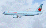
FS2004/FSX Boeing 737 MAX 8 Series. Developed by Tenkuu Developers Studio (TDS). Model features high resolution textures, dynamic flexing wings, nose gear steering, rudder lock, ground spoilers, low speed aileron locks at high speed, fully animated control surfaces, fully independent suspension, trim animation, opening passenger doors, rolling wheels, animated thrust reversers with reverser block doors, detailed textures, full night lighting, ground service vehicles and more. Package contains model and all files necessary for immediate flight. Model design by Hiroshi Igami. Flight dynamics design by Nick Wilkinson and David Biggar. Master textures by Kyle Schurb, Carlos Eduardo Salas and Stian Svensen.
| Filename: | Air_Canada_Boeing_737_MAX_8.zip |
| License: | Freeware |
| Added: | 3rd September 2014, 12:55:13 |
| Downloads: | 1,340 |
| Author: | Carlos Eduardo Salas / Tenkuu Developers Studios |
| Size: | 9.66 MB |
| Category: Flight Simulator 2004 - AI Aircraft | |
| Air Canada Jazz Dash 8-300 |
|
File Description:
Air Canada Jazz Bombardier Dash 8-300. Includes 4 variations (Green, Orange, Red, Yellow). To be used with The Fruit Stand Dash 8-300 for AI Traffic. Base Files package available separately: (tfsdh3.zip).
Does not include prop textures, use those included in the base model package. Includes only 1 default Lightmap.
| Filename: | Air_Canada_Jazz_Dash_8300.zip |
| License: | Freeware, limited distribution |
| Added: | 1st May 2009, 19:48:42 |
| Downloads: | 3,688 |
| Author: | John Massey |
| Size: | 858.15 KB |
| Category: Flight Simulator X - AFCAD Files | |
| Active ILS - Trenton Ontario Canada (CYTR) |
|
File Description:
This AFCAD style airport for Trenton Ontario is 100 percent FSX compliant. The bgl file fixes the ILS Localizer and Glideslope Transmitters for CYTR that were inadvertently misplaced. Added parking spots and other AFCAD style airport features.
| Filename: | Active_ILS__Trenton_Ontario_Canada_CYTR.zip |
| License: | Freeware, limited distribution |
| Added: | 9th February 2007, 04:37:05 |
| Downloads: | 1,738 |
| Author: | Jim Vile |
| Size: | 6.55 KB |


© 2001-2026 AVSIM Online
All Rights Reserved
Privacy Policy |