
Where Flight Simulation Enthusiasts Gather from Around the World!
AVSIM Library - Search Results

| Category: Flight Simulator X - AFCAD Files | |
| Greater Moncton International Airport / Canada (CYQM) |

|
Images related to this file:
File Description:
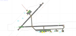
CYQM - Greater Moncton International Airport / Moncton, New Brunswick, Canada
This airport update was made with the latest version of ADE (Airport Design Editor) and made for FSX as a replacement for the stock (default) airport. I found that most stock airports in FSX lack a decent amount of character and realism and this area in particular was dreadful! The stock airport was rather inaccurate. I've made several additions to the airport which are listed below. All these enchancements are as close to the real airport as I can get with stock library objects. I've used satellite images, terminal photos and maps throughout the whole process so building locations are as accurate as possible. Happy landings in the beautiful Canada!
Features:
*Expanded parking apron
*Main terminal building with it's 2 jetways and additional parking for regional jets/turboprops
*Seperate parking aprons for GA traffic near the old terminal
*Hangar and other airport buildings added
*Airport vehicles and objects throughout the airport
*Main road in front of airport added with static vehicles
*Parking lots with static vehicles
*Airport fire station with fire trucks
*Static de-icing vehicles
| Filename: | Greater_Moncton_International_Airport__Canada_CYQM.zip |
| License: | Freeware |
| Added: | 21st July 2012, 02:41:58 |
| Downloads: | 816 |
| Author: | Jaison Diaz |
| Size: | 10.6 KB |
| Category: Flight Simulator 2004 - Scenery | |
| Shea Field CSF7, Casselman Ontario Canada |
|
Images related to this file:
File Description:
Shea Field is a recently-licensed privately-owned grass airfield in Ontario, 25 miles southeast of ottawa, and south of Highway 417. When I visited I was greeeted by the horse, peering around the end of it's stable shed at the corner of apron and runway. I walked over to the house and rang the doorbell and the dog said hello and that exhausted all social contact. The hangar is large but I have no idea what is inside. There was one plane parked on the apron with a skirt of uncut grass so presumably it hasn't flown for a few months. It was a Citabria in what looked like good condition; I don't have a Citabria to park there so I put a Cub. My favourite building is the old barn, leaning to one side as if seeking support for an elbow. To the north there are some farm sheds and grain silos, and to the northwest a tall mast; avoid it. To find the field without a gps follow the 417 and look for the tall mast just west of a major highway wiggle.
| Filename: | Shea_Field_CSF7_Casselman_Ontario_Canada.zip |
| License: | Freeware, limited distribution |
| Added: | 5th August 2012, 13:35:12 |
| Downloads: | 215 |
| Author: | Roger Wensley |
| Size: | 2.62 MB |
| Category: Flight Simulator 2004 - Scenery | |
| Chisasibi CSU2 in northern Quebec, Canada |
|
Images related to this file:
File Description:
Chisasibi is in northern Quebec on the east shore of James Bay, 60 miles from the corner of James Bay and Hudson Bay. Originally called Fort George and founded at the mouth of La Grande Riviere around the Hudson Bay trading post that was established in 1803, the town had to move 5 miles upstream in 1981 when the Quebec hydro project increased the flow rate of the river. The name was changed to Chisasibi at the time of the move (Chisasibi = Great River in Cree) and the population (750 as early as 1940) has now grown to around 2,000. There is a paved road east to Radisson that connects to the north-south James Bay road, which was built at the time of the hydro project work. The original Fort George airport runway is still visible but not usable, just south of the original town site. Chisasibi airport is to the west of the new town, and the gravel runway is 3,792 feet long and aligned 14/32, which is approximately parallel to the river. There is officially no fuel available, but there is JetA on site for Air Creebec in a tank protected by used fuel drums (filled with sand?). The terminal and the garage building are both relatively new; the terminal dates from 2002 and has unusual touches. There are two AI flights by Air Creebec each day plus other private planes.
| Filename: | Chisasibi_CSU2_in_northern_Quebec_Canada.zip |
| License: | Freeware, limited distribution |
| Added: | 27th February 2013, 21:24:47 |
| Downloads: | 287 |
| Author: | Roger Wensley |
| Size: | 2.79 MB |
| Category: Flight Simulator 2004 - AI Flight Plans | |
| Air Canada Express Winter 2012/2013 |
|
Images related to this file:
File Description:

This is part of our flightplans for the Winter 2012/2013 season. The team aims to provide high quality flightplans for the FS community. Each flightplan has been tested using many resources, and our goal is to make a realistic representation of each airline's route network.
| Filename: | Air_Canada_Express_Winter_20122013.zip |
| License: | Freeware, limited distribution |
| Added: | 22nd December 2012, 18:52:42 |
| Downloads: | 1,532 |
| Author: | Rob Corp & Alpha India Group |
| Size: | 59.15 KB |
| Category: Flight Simulator 2004 - AI Flight Plans | |
| Air Canada Winter 2012/2013 Update |
|
Images related to this file:
File Description:

This is part of our flightplans for the Winter 2012/2013 season. The team aims to provide high quality flightplans for the FS community. Each flightplan has been tested using many resources, and our goal is to make a realistic representation of each airline's route network. Updated because of changes to the aifp.cfg file included.
| Filename: | Air_Canada_Winter_20122013_Update.zip |
| License: | Freeware, limited distribution |
| Added: | 22nd December 2012, 19:43:01 |
| Downloads: | 2,021 |
| Author: | Rob Corp & Alpha India Group |
| Size: | 44.35 KB |
| Category: Flight Simulator 2004 - Scenery | |
| CWCP - Cape Parry - Northwest Territories, Canada |
|
Images related to this file:
File Description:
This is a DEW line Main Station on the shore of the Canadian mainland at the far northern tip of Cape Parry. It is 60 miles north of Paulatuk, which is at the base of the Parry Peninsula, and 120 miles south of Sachs Harbour on Banks Island. The station ceased operations in 1989 and a North Warning System automated station was opened in the same year; the NWS station is not shown in this scenery as I have no information regarding it's location or layout. The runway is just over 5,000 feet of gravel 150 feet wide, aligned 037T at an elevation of 119 feet ASL. There is a large apron with a large hangar and a small shelter building for passengers. There are of course no lights, signage, or windsock. The station is up on the hill at 210 feet ASL. This is one of the more interesting stations in terms of size and complexity.
| Filename: | CWCP__Cape_Parry__Northwest_Territories_Canada.zip |
| License: | Freeware, limited distribution |
| Added: | 25th December 2012, 19:07:24 |
| Downloads: | 302 |
| Author: | Roger Wensley |
| Size: | 1.61 MB |
| Category: Flight Simulator 2004 - Scenery | |
| Attawapiskat CYAT in northern Ontario, Canada |
|
Images related to this file:
File Description:
Attawapiskat is on the north bank of the river of the same name, around 7 miles upstream from where the river meets the west shore of James Bay at its mid point. The top end of the Bay is around 140 miles north, Moosonee is around the same to the south, and the east shore 140 miles to the east. The town has a population of around 1,600, although this varies with the seasons as hunting and the traditional way of life on the land is still important to the Cree-speaking inhabitants. The airport is just to the north of the town with a gravel runway almost 3,500 feet long, and I have included the recently installed PAPI. The Canada Flight Supplement does not say anything about fuel being available so I presume the tanks beside the apron are no longer in use. There is also no apron lighting, unless it has been installed recently. There are flights by Air Creebec and by several other smaller airlines and I have included both Air Creebec and Wasaya; their textures are available for download and the planes are as listed in the AI folder.
| Filename: | Attawapiskat_CYAT_in_northern_Ontario_Canada.zip |
| License: | Freeware, limited distribution |
| Added: | 3rd January 2013, 01:37:50 |
| Downloads: | 376 |
| Author: | Roger Wensley |
| Size: | 3.54 MB |
| Category: Flight Simulator 2004 - Scenery | |
| CYSK - Sanikiluaq - Southern Nunavut, Canada Revised |
|
Images related to this file:
File Description:
Sanikiluaq is on one of the Belcher Islands in Hudson Bay, near the northern end of James Bay, and this is a revised version. It corrects the terminal that I made with limited information and faded memories the first time, adds in signage, runway lights, taxiway lights, terminal night textures, and revised AI. The "spare" parking space is the one next to the 4 gas drums on a pallet; line up with the traffic cone. It presumes you have already installed my September 2010 Sanikiluaq post, and this version is not complete by itself.
| Filename: | CYSK__Sanikiluaq__Southern_Nunavut_Canada_Revised.zip |
| License: | Freeware, limited distribution |
| Added: | 15th January 2013, 17:35:52 |
| Downloads: | 248 |
| Author: | Roger Wensley |
| Size: | 2.78 MB |
| Category: Flight Simulator 2004 - Scenery | |
| Kangiqsujuaq CYKF in northern Quebec, Canada |
|
Images related to this file:
File Description:
Kangiqsujuaq is on the north coast of Quebec, 85 miles west of Quaqtaq and 125 miles east of Salluit, while across the Hudson Strait and 100 miles away on Baffin Island is Kimmirut. The town grew around two trading posts, the first opened by Revillon Freres in 1910, and the second by the Hudson Bay Company in 1914. A school was opened in 1960, and a clinic in 1961. The town was known as Wakeham Bay until 1961, and now has a population of around 700. The airport is to the south of the town and up on the hill at 511 feet ASL (this has been remeasured since 2004 and is now known to be 501). The gravel runway is just over 3,500 feet long and aligned 15/33; there is no PAPI, but there is fuel available, both 100LL and JetA. There are flights by Air Inuit.
| Filename: | Kangiqsujuaq_CYKF_in_northern_Quebec_Canada.zip |
| License: | Freeware, limited distribution |
| Added: | 27th January 2013, 00:55:00 |
| Downloads: | 231 |
| Author: | Roger Wensley |
| Size: | 2.31 MB |
| Category: Flight Simulator 2004 - Scenery | |
| Kangiqsualujjuaq CYLU in northern Quebec, Canada |
|
Images related to this file:
File Description:
Kangiqsualujjuaq is in northern Quebec on the east side of Ungava Bay, which is to the east of Hudson Bay and around 150 miles wide and 120 miles deep. Kuujjuaq, the administrative capital of northern Quebec, is 100 miles to the southwest. The town is on the bank of the George River, and has also been known as Fort George River, George River, etc. There was a Hudson Bay trading post at the town's location as early as 1838, though it was closed and reopened more than once and the town did not grow because of the trading post; the Inuit lived on the coast during the summer but moved 30 miles inland in winter for trapping. A cooperative was formed in 1959 to market fish, and this was the creative force that brought about establishment of the town; a school was built in 1963.
The airport is to the north of the town in a valley between the surrounding hills at 215 feet ASL. The gravel runway is just over 3,500 feet long and aligned 16/34; there is no PAPI, but there is fuel available, both 100LL and JetA. There are flights by Air Inuit and a warning of caribou on the runway during October and November.
| Filename: | Kangiqsualujjuaq_CYLU_in_northern_Quebec_Canada.zip |
| License: | Freeware, limited distribution |
| Added: | 1st February 2013, 21:24:55 |
| Downloads: | 277 |
| Author: | Roger Wensley |
| Size: | 2.76 MB |


© 2001-2026 AVSIM Online
All Rights Reserved
Privacy Policy |