
Where Flight Simulation Enthusiasts Gather from Around the World!
AVSIM Library - Search Results

| Category: Flight Simulator 2004 - AI Aircraft | |
| Businesswings DeHavilland Canada DHC6 Twin Otter |

|
Images related to this file:
File Description:
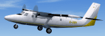
Textures only for the Businesswings DHC6. Reg:D-IVER. PAI/HTAI (Henry Tomkiewicz) DHC6 base model required. Modified prop texture also included for use in FSX. See ReadMe for details.
| Filename: | Businesswings_DeHavilland_Canada_DHC6_Twin_Otter.zip |
| License: | Freeware, limited distribution |
| Added: | 6th July 2011, 23:33:06 |
| Downloads: | 407 |
| Author: | Symon Long |
| Size: | 107.39 KB |
| Category: Flight Simulator 2004 - Scenery | |
| Umiujaq CYMU in Northern Quebec, Canada |
|
Images related to this file:
File Description:
Umiujaq is a small village on the east coast of Hudson Bay, in Quebec, around 140 miles south of Inukjuak and 100 miles north of Kuujjuarapik; the latter is where some 500 inhabitants moved from in 1986 to avoid the effects of a hydroelectric dam project and founded Umiujaq. The airfield is a mile and a half inland and southeast of the village, and the 3,520 feet of gravel runway is aligned 03/21, and these are magnetic bearings as Inukjuak is not in the Northern Domestic Airspace zone. There is no fuel available, unless there is some 100LL in drums. The visiting AI airline is Air Inuit from Montreal.
| Filename: | Umiujaq_CYMU_in_Northern_Quebec_Canada.zip |
| License: | Freeware, limited distribution |
| Added: | 22nd December 2011, 01:00:20 |
| Downloads: | 633 |
| Author: | Roger Wensley |
| Size: | 1.95 MB |
| Category: Flight Simulator 2004 - Scenery | |
| CYSM - Fort Smith, Northwest Territories, Canada |
|
Images related to this file:
File Description:
Fort Smith is just north of the border between Alberta and Northwestern Territories, midway between Lake Athabasca to the southeast in (mostly) Saskatchewan (80 miles) and Great Slave Lake to the north west (90 miles). The runways all used to be larger, and while I don't know the history it looks as if it is ex-military and these are the remains of what were once 10,000 feet of asphalt. The main runway is now 11/29 and 6,000 feet long, and the secondary one is 1,800 feet of mostly gravel. There is an airline based at the field, Northwestern Air, and fuel (both 100LL and JA-1) is available at a self service point so long as you give it a credit card to read while you fill. The town of Fort Smith is two miles east of the airfield, on the bank of the Slave River and where there are some rapids that require a portage to get around them. Before aviation came along the river was a major route to the north and all those furry animals, which was why the Hudson's Bay Company established an outpost there in 1872. Today it has a population of 2,400 and the main activities are government administration of much of the Northwest Territories, education, and tourism.
| Filename: | CYSM__Fort_Smith_Northwest_Territories_Canada.zip |
| License: | Freeware, limited distribution |
| Added: | 28th January 2012, 17:11:47 |
| Downloads: | 592 |
| Author: | Roger Wensley |
| Size: | 4.29 MB |
| Category: Flight Simulator 2004 - Scenery | |
| St Jovite CSZ3 in Quebec Canada |
|
Images related to this file:
File Description:
St Jovite is a grass strip in Quebec near the town of St Jovite and the Mont Tremblant tourist area. This updated version has specifically modeled buildings etc. The unlighted runway is 3,300 feet long, aligned 02/20, and there is now fuel available, so that's a change for the better. However, there is also a landing fee and charges for overnight parking, though the fee is waived if you buy fuel. Based upon my experience of St Jovite there is no AI required for added realism; you will be the only plane visiting and that will be totally realistic. There must be a busy time, but I have never seen it. The aerial picture shows St Jovite from the south, with Lac Ouimet and Mont Tremblant beyond.
| Filename: | St_Jovite_CSZ3_in_Quebec_Canada.zip |
| License: | Freeware, limited distribution |
| Added: | 25th November 2011, 17:29:25 |
| Downloads: | 306 |
| Author: | Roger Wensley |
| Size: | 2.5 MB |
| Category: Flight Simulator 2004 - Scenery | |
| Chesterfield Inlet CYCS in Nunavut, Canada |
|
Images related to this file:
File Description:
Chesterfield Inlet is a small village on the west coast of Hudson Bay, with a population of 340 or so. It is the oldest community in Nunavut and was established around a Hudson Bay Company post in 1911, 55 miles north of Rankin Inlet (Sid and Pete's post). The airfield is close to the village and has a gravel runway 3,600 feet long aligned 124T/304T (true, not magnetic). Fuel is available with 2 hours prior notice, and the visiting AI airlines are First Air and Calm Air.
| Filename: | Chesterfield_Inlet_CYCS_in_Nunavut_Canada.zip |
| License: | Freeware, limited distribution |
| Added: | 6th December 2011, 20:27:39 |
| Downloads: | 379 |
| Author: | Roger Wensley |
| Size: | 2.21 MB |
| Category: Flight Simulator 2004 - Scenery | |
| Yellowknife Floats CEN9 - Northwest Territories, Canada |
|
Images related to this file:
File Description:
Yellowknife float base is on the shore of Yellowknife Bay, which is on the north side of Great Slave Lake. The float base is on two sides of Latham Island and the promontory that reaches out to it, which is where the town of Yellowknife was originally founded, and float planes land either in Back Bay (to the west) or in East Bay (guess where?). Where the south end of the island meets the promontory there are two inlets and two companies; Air Tindi in the eastern part and North Airways in the western. These two companies have bespoke buildings. I have used other buildings from other sceneries to model the "feel" of the original Yellowknife and the docks along the shore. One thing I could not do, and that was to recreate at its correct height "the rock", which is the raised centre of the promontory; FS9 resisted terrain readjustments beyond a certain point.
| Filename: | Yellowknife_Floats_CEN9__Northwest_Territories_Can.zip |
| License: | Freeware, limited distribution |
| Added: | 1st February 2012, 23:53:17 |
| Downloads: | 920 |
| Author: | Roger Wensley |
| Size: | 12.38 MB |
| Category: Flight Simulator 2004 - Scenery | |
| Rockcliffe CYRO update in Ontario, Canada |
|
Images related to this file:
File Description:
This is Rockcliffe in late 2011, on the day before the old clubhouse was demolished. It is based on the original scenery by Flight Ontario and follows on from my previous updates, but this is a new version rather than an update and REPLACES the previous versions. The difference is in the bespoke detail: runway and taxiway lighting (the taxiway lighting is limited, as in real life, to taxiway C); signage throughout including runways, taxiways, refuelling, and parking; refuelling tanks and pumps; fence visibility strips; updated ground markings for the Rockcliffe Flying Club apron and the runway; revised apron texture in front of the new hangar; smaller items such as trash cans and external electrical distribution box for heating cables. There are also, from previous updates, the new clubhouse, the new maintenance hangar, and from the original scenery the Museum complex.
| Filename: | Rockcliffe_CYRO_update_in_Ontario_Canada.zip |
| License: | Freeware, limited distribution |
| Added: | 28th February 2012, 13:13:33 |
| Downloads: | 564 |
| Author: | Roger Wensley |
| Size: | 5.01 MB |
| Category: Flight Simulator 2004 - Scenery | |
| Tuktoyaktuk CYUB in Northwest Territories, Canada |
|
Images related to this file:
File Description:
Tuktoyaktuk is on the northern coast of Canada, 70 miles north of Inuvik and to the east of the Mackenzie River delta. It has a population of around 900 and because of its natural harbour is a centre for oil exploration activity on the surrounding land and on the Beaufort Sea, with sizeable but now under-used yards dating back to the peak of activity in the late 1970's. On land work is restricted to the winter half of the year, as only the freeze-up makes it possible to move on land with heavy equipment, and during the winter further supples are driven over an ice road from Inuvik up to Tuk. The ice-free summer months are used for floating equipment from Yuk along the coast on barges and then up the rivers to inland sites in preparation for the winter activity. Before the oil there was a DEW line station here, and there is still an automated station on the same site and included here, as are the yards. The airfield is on the coast close to the town and the yards, at 15' ASL. The gravel runway 09/27 is 5,000' feet long and 150' wide; both thresholds are displaced by 200', but of course there are no markings on the gravel. The large apron is on the north side at the centre of the runway and is large enough to accomodate several large planes. Inuvik revised should be installed first, now Tuk, then last of the three Sachs Harbour which has AI for Aklak Airlines flights (operated by Kenn Borek) for all three airfields. There is a separate AI file included here, featuring freight delivery by Buffalo Airways and small planes.
| Filename: | Tuktoyaktuk_CYUB_in_Northwest_Territories_Canada.zip |
| License: | Freeware, limited distribution |
| Added: | 14th May 2012, 17:19:20 |
| Downloads: | 618 |
| Author: | Roger Wensley |
| Size: | 8.99 MB |
| Category: Flight Simulator 2004 - Scenery | |
| Mountain View CPZ3 in Ontario, Canada |
|
Images related to this file:
File Description:
This is Mountain View, a small RCAF airfield at the eastern end of Lake Ontario on Prince Edward Island, some 40 miles west of Kingston. Mountain View is used for training during the summer months, and part of this training is for C-130 crews, who practice landing on rough or unprepared landing strips. The crews are based at Trenton, which is a large base 10 miles to the northwest on the mainland. There are (or were, I haven't seen it recently) numerous parked and ancient fighter planes such T-33's and Canadair Tutors; these could also have possibly been used for summer training or perhaps were just stored. Last summer there were only two hangars left standing; in 2002 there were five. In real life you would be on the lookout not only for C-130's but also (at certain times during the summer) for parachutists and also gliders. This airfield is one that you will fly over and not land on; I confess that I have cheated with the length of the 06L-24R gravel "practice" runway, so that it became possible for the FS version of a touch-n-go with a C-130 to be completed without using the grass. The aerial photograph shows the new "practice" gravel runway under construction.
| Filename: | Mountain_View_CPZ3_in_Ontario_Canada.zip |
| License: | Freeware, limited distribution |
| Added: | 9th March 2012, 15:05:57 |
| Downloads: | 350 |
| Author: | Roger Wensley |
| Size: | 7.26 MB |
| Category: Flight Simulator 2004 - Scenery | |
| CYKY - Kindersley Regional Airport, Saskatchewan, Canada |
|
Images related to this file:
File Description:
CYKY Kindersley Regional Airport is located in the west-central part of the province of Saskatchewan, Canada. The airport is located 4.6 km north of the town. The scenery consists of custom models of all the buildings at the airport, runway signs, runway and taxiway lighting, rotating beacon, static aircraft, vehicles, animated highway traffic and oil pump jacks, trees that properly change with the seasons, custom tarmac and runway textures, and seasonal ground textures for the airport and surrounding area.
| Filename: | CYKY__Kindersley_Regional_Airport_Saskatchewan_Can.zip |
| License: | Freeware |
| Added: | 14th June 2012, 13:44:10 |
| Downloads: | 1,288 |
| Author: | Gregory Putz |
| Size: | 84.58 MB |


© 2001-2026 AVSIM Online
All Rights Reserved
Privacy Policy |