
Where Flight Simulation Enthusiasts Gather from Around the World!
AVSIM Library - Search Results

| Category: Flight Simulator 2004 - AI Aircraft | |
| Royal Aviation Canada Lockheed L-1011 |

|
Images related to this file:
File Description:

Royal Aviation Canada textures for Dee Waldron's AI Lockheed L1011 TriStar package, available here on AVSIM.
Excellent lo-poly model for traffic use, or even a little flying around. Model by Dee Waldron,
paint kit by Henry Tomkiewicz. This package just replaces the corrupted package due to the AVSIM hack. Nothing has changed.
| Filename: | Royal_Aviation_Canada_Lockheed_L1011.zip |
| License: | Freeware |
| Added: | 8th December 2009, 10:30:46 |
| Downloads: | 296 |
| Author: | Holger Ludwig |
| Size: | 202.81 KB |
| Category: Flight Simulator X - Scenery | |
| Davie Shipbuilding Near Quebec City - Canada |
|
File Description:
This scenery includes the Davie Shipbuilding shipyard located west of Quebec city on the south shore of the St-Lawrence river. It is an important VFR landmark for the pilots approaching Quebec from the east.
| Filename: | Davie_Shipbuilding_Near_Quebec_City__Canada.zip |
| License: | Freeware |
| Added: | 17th January 2010, 02:07:34 |
| Downloads: | 3,606 |
| Author: | Pierre Baillargeon |
| Size: | 6.05 MB |
| Category: Flight Simulator 2004 - Scenery | |
| Snowden Farm CF39, in Ontario Canada |
|
Images related to this file:
File Description:
Another airfield close to Highway 11, further south towards Lake Simcoe. Snowden Farm is a bit over five miles south of Huntsville and east of of highway 11. The grass runway 12/30 is just over 2,000 feel long and sandwiched between Penfold Lake to the north, and on the south side a large pond with a creek that connects to the much larger Mary Lake to the east. There is a hangar and a shed at the eastern end of the runway. There is one airfield scenery file, and two landclass files to provide the grassed area and the large pond and creek. I presume that the pond was just a little too small to register with Ultimate Terrain. The scenery might work without Ultimate Terrain but I haven't tested it, and for sure without it Penfold Lake and probably Mary Lake won't appear.
| Filename: | Snowden_Farm_CF39_in_Ontario_Canada.zip |
| License: | Freeware, limited distribution |
| Added: | 5th February 2010, 03:51:07 |
| Downloads: | 298 |
| Author: | Roger Wensley |
| Size: | 837.43 KB |
| Category: Flight Simulator X - Aircraft Repaints, Textures and Modifications | |
| Air Canada Star Alliance Boeing 767 |
|
Images related to this file:
File Description:
This is a repaint for the Captain Sim 767 Captain (http://www.captainsim.com/products/b767/), to use this repaint, only the Base Pack is required. This repaint depicts the aircraft with registration code C-FMWY. It's a Boeing 767-333 operated by Air Canada, painted in the Star Alliance colours. Repaint by Lars Domen
| Filename: | Air_Canada_Star_Alliance_Boeing_767.zip |
| License: | Freeware, limited distribution |
| Added: | 18th March 2010, 09:07:46 |
| Downloads: | 1,465 |
| Author: | Lars Domen |
| Size: | 3.46 MB |
| Category: Flight Simulator 2004 - Scenery | |
| Pontiac Airpark CPC7 in Quebec Canada |
|
Images related to this file:
File Description:
Pontiac Airpark is in Quebec on the north bank of the Ottawa River, some 20 miles northwest of Ottawa in Canada. It is a new airfield and in fact is still under construction, though the east-west runway has been in use since late last year. This east-west runway is 3,400 feet long and gravel, though it will later be lighted, and then asphalted. The second runway will be just under 2,000 feet and unlighted gravel, and at its southern end there are docks for float planes. The float base is already in use; CPC7 is the ICAO code for the float base. There are lots for sale, and the idea is to build your house right on the airfield so there is no driving necessary between house and plane, thus leaving more time for what is important. There will be updates as things progress.
| Filename: | Pontiac_Airpark_CPC7_in_Quebec_Canada.zip |
| License: | Freeware, limited distribution |
| Added: | 1st May 2010, 00:33:40 |
| Downloads: | 342 |
| Author: | Roger Wensley |
| Size: | 7.06 MB |
| Category: Flight Simulator 2004 - Scenery | |
| Factory Field CF40 in Quebec Canada |
|
Images related to this file:
File Description:
Factory Field (my name for it) is in Quebec on highway 321 a few miles north of St Andre Avellin, and 40 miles ENE of Ottawa. The runway is 3,500 feet long and asphalt and went out of regular use in the early 1990's when the airfield was closed. It was sold in 1995 to a company (ELP) that has built up a factory for manufacturing and fitting snow ploughs and other pneumatically operated equipment to trucks, and who now use the runway for testing their snow ploughs. In between times, as it is not marked closed with an "X", it is also occasionally used by customers who fly in, usually to get the drivers there to take delivery of completed trucks. The surface is good and there are no obstructions but also no markings, though with 3,500 feet of 100 feet wide asphalt there is plenty of space and it doesn't much matter.
| Filename: | Factory_Field_CF40_in_Quebec_Canada.zip |
| License: | Freeware, limited distribution |
| Added: | 13th May 2010, 22:11:41 |
| Downloads: | 348 |
| Author: | Roger Wensley |
| Size: | 1.27 MB |
| Category: Flight Simulator 2004 - Aircraft Repaints, Textures and Modifications | |
| De Havilland Canada DHC-2 Beaver |
|
Images related to this file:
File Description:
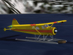
By request.
The repaint is based on the color scheme of aircraft N101SY.
Texture files only. The original Beaver model by Aerosoft (http://www.aerosoft-shop.com/) is required. Thanks to the Aerosoft crew for allowing me to upload this repaint and for making the aircraft in the first place.
| Filename: | De_Havilland_Canada_DHC2_Beaver.zip |
| License: | Freeware, limited distribution |
| Added: | 15th May 2010, 22:35:29 |
| Downloads: | 681 |
| Author: | Nathan Havercroft / Aerosoft |
| Size: | 1.61 MB |
| Category: Flight Simulator 2004 - Scenery | |
| FS2004 Scenery for Penticton CYYF Canada |
|
Images related to this file:
File Description:
Scenery for Penticton Airport (CYYF). Re-load of files lost in library hack.
| Filename: | FS2004_Scenery_for_Penticton_CYYF_Canada.zip |
| License: | Freeware, limited distribution |
| Added: | 27th May 2010, 09:29:55 |
| Downloads: | 618 |
| Author: | John Stinstrom |
| Size: | 2.82 MB |
| Category: Flight Simulator 2004 - Scenery | |
| Hope Field near Ottawa Ontario, Canada |
|
Images related to this file:
File Description:
The field is newly included in the Canada Flight Supplement. Unusually for a grass field the runway has the numbers marked out in white; given that this is a private airfield that does not invite unexpected guests and has only one plane based there, and presuming that the owner can remember his own runway headings, it is unlikely that these will still be there in a year's time. There is no hangar as yet. To the west is highway 416 and to the east is the Rideau River, both of which run north-south. Lke Rockcliffe (which is to the north) the airfield is right on the edge of the Ottawa control zone, so you should already be below 1,500 feet ASL when approaching from the south and talking to Ottawa tower when arriving from the north. The runway is 07/25 and 2,800 feet long, which should be enough for almost anybody, and the field is at 315 feet ASL. Manotick is a mile to the north east on the Rideau River and the Rideau Valley Airpark CPL3 is six miles south in the bend of the Rideau where it turns west.
| Filename: | Hope_Field_near_Ottawa_Ontario_Canada.zip |
| License: | Freeware, limited distribution |
| Added: | 10th July 2010, 19:34:51 |
| Downloads: | 201 |
| Author: | Roger Wensley |
| Size: | 3.15 MB |
| Category: Flight Simulator 2004 - Scenery | |
| Hall Beach CYUX in Nunavut, Canada |
|
Images related to this file:
File Description:
Hall Beach is on the Melville Peninsula, part of the mainland of Canada, south and west of Baffin Island. It is around 40 miles south of Igloolik and 50 miles west of Rowley, both of them my previous posts. The airfield was built to support the construction and operation of a main DEW line radar station and to support the rest of the associated chain. Because of the employment opportunities this brought, a village developed nearby. The airfield continues in regular use and the runway, though still gravel, is 5,400' long and 150' wide and lighted; the alignment is 124T and 304T as this is in northern domestic airspace and bearings are given as 'true" and not "magnetic". There are scenery folders for the village, roads, grass, etc, and AI for two airlines with regular service to Hall Beach.
| Filename: | Hall_Beach_CYUX_in_Nunavut_Canada.zip |
| License: | Freeware, limited distribution |
| Added: | 22nd November 2011, 14:33:08 |
| Downloads: | 458 |
| Author: | Roger Wensley |
| Size: | 3.83 MB |


© 2001-2026 AVSIM Online
All Rights Reserved
Privacy Policy |