
Where Flight Simulation Enthusiasts Gather from Around the World!
AVSIM Library - Search Results

| Category: Flight Simulator 2004 - Scenery | |
| Homer PaHO in Alaska US missing parked planes |

|
Images related to this file:
File Description:
These are the parked planes and their textures that I forgot to include in the Homer PAHO scenery post. Apologies.
| Filename: | Homer_PaHO_in_Alaska_US_missing_parked_planes.zip |
| License: | Freeware, limited distribution |
| Added: | 28th July 2021, 17:02:25 |
| Downloads: | 99 |
| Author: | Roger Wensley |
| Size: | 3.45 MB |
| Category: Flight Simulator 2004 - Scenery | |
| Cordova Smith PACV & Municipal CKU in Alaska US |
|
Images related to this file:
File Description:
Cordova is on the south coast of Alaska, around 150 miles east of Anchorage and 45 miles south of Valdez. The town is mainly built on a small but relatively flat area between the east side of Prince William Sound and Eyak Lake, and has a population of around 2,350 in 2010, the approximate date of this scenery.
The Municipal Airfield CKU is on the north side of Eyak Lake to the east of Cordova, with the runway that is 1,800 feet of unlit gravel squeezed between the lake and the road that runs around the lake. The hangars and parking aprons are reached by taxiing across, and to some extent along, the road. Float planes are also taken from the lake to an apron to the west of the runway.
Cordova Airport PACV (named in the real world "Merle K. (Mudhole) Smith", and I will leave you to research this) is known as Cordova Smith in FS9 and is 10 miles to the east of the town on relatively flat ground between mountains to the north and the sea to the south. The runway is 8,080 feet of lit asphalt aligned 09-27 with ILS on runway 27 and VASI on both ends. The aprons are to the north side of the runway and are reached by back-taxiing; there are no taxiways parallel to the runway. The main apron serves Alaska Air via the western of two taxiways. The GA parking and hangars are mainly reached by using the eastern taxiway, though there is in fact a connecting taxiway between the two (for GA, but definitely not for airliner use). The taxiway further to the west serves the separated Alaska Coastguard apron and hangar, which is mainly for helicopter use. There is a nominally grass runway 1,900 feet long and aligned 16-34 to the south of the main runway; in fact it appears to be more gravel than grass. I have left this inactive as otherwise AI Alaska Air planes would be attempting to use this when the wind made it seem like a good idea.
The AI includes Alaska Air (twice a day) and also Coastguard helicopters, along with GA.
| Filename: | Cordova_Smith_PACV__Municipal_CKU_in_Alaska_US.zip |
| License: | Freeware, limited distribution |
| Added: | 22nd January 2022, 21:53:03 |
| Downloads: | 148 |
| Author: | Roger Wensley |
| Size: | 16.93 MB |
| Category: Flight Simulator 2004 - Aircraft Repaints, Textures and Modifications | |
| Alaska Air Dot Com Boeing 737-700 (N774AS) |
|
File Description:
Repaint by Frank van Gool - [email protected]. Livery developed for PMDG B737-700
Paintkit by PMDG www.precisionmanuals.com. This is a livery only, PMDG aircraft needed.
Note: the original aircraft, N774AS, is a B737-4Q8. Because I like this livery I decided to
create it for the 737-700. You won't see this c/s with this registration irl.
| Filename: | Alaska_Air_Dot_Com_Boeing_737700_N774AS.zip |
| License: | Freeware |
| Added: | 1st May 2004, 01:19:36 |
| Downloads: | 1,910 |
| Author: | Frank van Gool |
| Size: | 2.2 MB |
| Category: Flight Simulator 2004 - AI Aircraft | |
| Alaska Airlines Boeing 737-400 'Disneyland 50th Anniversary' |
|
File Description:
AI Aardvark Boeing 737-400. N971AS is Alaska's second Disney logojet, appearing in April 2005 to commemorate Disneyland's 50th Anniversary. (The original Disney Logojet N784AS remains active.) Both 32-bit and DXT3 textures included. Requires AIA file aiafs9up.zip for model and FDE.
| Filename: | Alaska_Airlines_Boeing_737400_Disneyland_50th_Anni.zip |
| License: | Freeware, limited distribution |
| Added: | 23rd May 2005, 20:58:57 |
| Downloads: | 5,698 |
| Author: | AI Aardvark, Dave Wilkins |
| Size: | 1.26 MB |
| Category: Flight Simulator 2004 - Aircraft Repaints, Textures and Modifications | |
| Alaska Airlines "New 2016 Livery" Boeing 737-700 |
|
Images related to this file:
File Description:
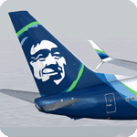
Alaska unveiled completely new branding in January 2016, with a modernized eskimo and a new color scheme. This is the first 737-700 painted in the new livery. Model developed by Tenkuu Developers Studio, features high resolution textures, dynamic flexing wings, nose gear steering, rudder lock, ground spoilers, low speed aileron locks at high speed, fully animated control surfaces, fully independent suspension, trim animation, opening passenger doors, rolling wheels, animated thrust reversers with reverser block doors, detailed textures, full night lighting, ground service vehicles and more. Model design by Hiroshi Igami. Flight dynamics design by Nick Wilkinson, with assistance from David Biggar. Master textures and paint kit by Kyle Schurb. Painted on the great TDS model. Enjoy!
| Filename: | Alaska_Airlines_New_2016_Livery_Boeing_737700.zip |
| License: | Freeware |
| Added: | 19th September 2016, 21:16:10 |
| Downloads: | 1,130 |
| Author: | Joe Shimmel | Tenkuu Developers Studio |
| Size: | 10.91 MB |
| Category: Flight Simulator 2004 - Aircraft Repaints, Textures and Modifications | |
| Alaska Airlines "New 2016 Livery" Boeing 737-800 |
|
Images related to this file:
File Description:
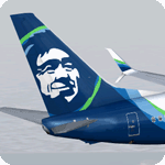
Even though a minor refresh to the Alaska livery was introduced in February 2015, the company unveiled completely new branding in January 2016, with a modernized eskimo and a new color scheme. Model developed by Tenkuu Developers Studio, features high resolution textures, dynamic flexing wings, nose gear steering, rudder lock, ground spoilers, low speed aileron locks at high speed, fully animated control surfaces, fully independent suspension, trim animation, opening passenger doors, rolling wheels, animated thrust reversers with reverser block doors, detailed textures, full night lighting, ground service vehicles and more. Model design by Hiroshi Igami. Flight dynamics design by Nick Wilkinson, with assistance from David Biggar. Master textures and paint kit by Kyle Schurb. Painted on the great TDS model. Enjoy!
| Filename: | Alaska_Airlines_New_2016_Livery_Boeing_737800.zip |
| License: | Freeware |
| Added: | 30th January 2016, 21:19:20 |
| Downloads: | 1,459 |
| Author: | Joe Shimmel | Tenkuu Developers Studio |
| Size: | 9.25 MB |
| Category: Flight Simulator 2004 - Scenery | |
| Prudhoe Bay area on Alaska North Slope US |
|
Images related to this file:
File Description:
The Prudhoe Bay area of the Alaska north slope is dominated by all the equipment and machinery that is necessary for the extraction of oil and its transfer by the pipeline that reaches south to Valdez. Prudhoe Bay airport is now closed, and its replacement just to the south is Deadhorse PASC, with numerous storage, maintenance, and accomodation areas immediately to the north of the apron, and others adjacent to the road between the two. The runway is just under 6,500 feet with approach lights at both ends and ILS on 04 (true heading of 75 degrees). This scenery reflects the overall situation in 2011 and oil production facilities and buildings are included here. The airport buildings and those close to the airport are replicas of the real life buildings; while as distance increases the accuracy fades somewhat there are everywhere replica trucks and cross country vehicles that are true to life. Deadhorse handles around 7,000 passengers per month as staff are rotated in and out on Alaska Air and ERA flights and by oil company private flights. There are also freight flights to complement the trucking effort up the Dalton Highway. The Alaska Airlines terminal building and ERA (the red buildings nearby) are at one end of the apron, while at the other end is a very large and new green terminal, storage, hangar building built by the airport authority. All of the airport components, runways, taxiways, and aprons, are built up on a gravel base to raise them above the surrounding terrain that floods with melting snow, freezes, or dries out, according to the seasons. There are other new airstrips included here that serve the oil industry. Around 33 miles to the east is Badami PABP airport servicing a subsiduary oil producing area, with 5,000 feet of gravel runway. Some 28 miles to the west of Deadhorse is Ugnu-Kuparuk UBW with just over 6,000 feet of gravel (gravel in 2011, it is now asphalted) servicing oil production by Conoco Phillips, which uses 737's to fly staff in and out. A further 32 miles west is Alpine AK15 with 5,400 feet of gravel and also served by the Conoco Phillips 737's. To the south of Alpine and connected by road is the village of Nuiqsut. To the north of Alpine and reachable only by air in the delta of the Sagavanirktok River is CD-3, an oil collection and pump station area with another gravel runway of 3,000 feet. Other airstrips that were prviously posted are now updated, Nuiqsut and Oliktok. I experimented, but decided against trying to reproduce the several hundred miles of pipelines. The are new AI aircraft, and there are notes regarding downloading. There is a new "cement" texture (not its name, but used as that by SBuilder) for the built up gravel bases. It is slightly darker than the original but not so much that any previous use will be spoilt. You may wish to download my "Alaska Frozen Rivers and Lakes" which freezes lakes and the northern sea and makes them landable on wheels.
| Filename: | Prudhoe_Bay_area_on_Alaska_North_Slope_US.zip |
| License: | Freeware, limited distribution |
| Added: | 19th December 2017, 00:38:06 |
| Downloads: | 590 |
| Author: | Roger Wensley |
| Size: | 28.54 MB |
| Category: Flight Simulator 2004 - Scenery | |
| Elim ELI and Moses Point MOS in Alaska |
|
Images related to this file:
File Description:
Elim is a coastal village 90 miles east of Nome, living from fishing and with a population of around 330. The airfield has a gravel runway 3,000 feet long. The majority of flights to and from the airfield originate in Nome, but there are also others to and from nearby fields such as Golovin, Unalakleet, Shaktoolik, and Koyuk. A further 7 miles or so east of Elim is another field called Moses Point MOS, which is included here and was an Army Airforce field before being transferred to the private ownership of the Elim Native Corporation. Until Elim ELI was established (date unknown, but after 1988) this served the village of Elim and although the runway is now unlit and not in very good condition (translate that as "full of potholes") it is stated that the longer runway can still be used if Elim is not adequate. However, the note is undated and there are no details of how often it is used or even if it is actually still currently in use. There is one hangar still in existence; all the rest has been demolished and (mostly) removed. A note here about my scenery making. This is post number 502 and there will not be many more to follow this as I am almost at the end of the photos I either took or found for scenery purposes. There is a limit to what can be located online and I have already been making use of the little there is; eg Unalakleet. So, if you are near an airport (preferably Canadian or Alaskan) and have a camera..... Let me know.
| Filename: | Elim_ELI_and_Moses_Point_MOS_in_Alaska.zip |
| License: | Freeware, limited distribution |
| Added: | 2nd August 2019, 16:11:35 |
| Downloads: | 103 |
| Author: | Roger Wensley |
| Size: | 4.69 MB |
| Category: Flight Simulator 2004 - Scenery | |
| Homer PaHO in Alaska US missing parked planes |
|
Images related to this file:
File Description:
These are the parked planes and their textures that I forgot to include in the Homer PAHO scenery post. Apologies.
| Filename: | Homer_PaHO_in_Alaska_US_missing_parked_planes.zip |
| License: | Freeware, limited distribution |
| Added: | 28th July 2021, 17:02:11 |
| Downloads: | 57 |
| Author: | Roger Wensley |
| Size: | 3.45 MB |
| Category: Flight Simulator 2004 - Scenery Design | |
| Ketchikan and Annette Island, Southeast Alaska Background Bitmaps |
|
File Description:
This package DOES NOT contain finished FS scenery products! Instead, the three bitmaps (N54.3-55.4 W130.6-131.9) are meant to be used for FS landscape scenery design with Ground2K4 (by Christian Fumey) or similar utilities. Source data are public domain Landsat 7 TM satellite images, at 15-m and 30-m ground resolution. I used professional GIS software for the geographic transformation to lat/long-WGS84 projection, and photo processing software for channel merging and image enhancements. Each image has been tested in Ground2K4 for accurate placement. Note: these images have been ECW-compressed and need special (free) software for decompressing (instructions included).
| Filename: | Ketchikan_and_Annette_Island_Southeast_Alaska__Background_Bitmaps.zip |
| License: | Freeware, limited distribution |
| Added: | 8th March 2004, 16:00:20 |
| Downloads: | 377 |
| Author: | Holger Sandmann |
| Size: | 14.92 MB |


© 2001-2026 AVSIM Online
All Rights Reserved
Privacy Policy |