
Where Flight Simulation Enthusiasts Gather from Around the World!
AVSIM Library - Search Results

| Category: Flight Simulator 2002 - AI Flight Plans | |
| Canada and Alaska Enabled Airports |

|
File Description:
A selection of 7 non active airports around Alaska and Western Canada can now be used. This package adds gates and full ATC at Terrace (CYXT), Smithers (CYYD), Masset (CZMT), Prince Rupert (CYPR), Powell River (CYPW), Yakutat (PAYA) and Ketchikan Intl (PAKT). Includes an AI traffic file and screenshots. Requires AFCAD, TTools and Joe Spencers Northwoods SAR scenery.
| Filename: | Canada_and_Alaska_Enabled_Airports.zip |
| License: | Freeware |
| Added: | 6th October 2002, 12:42:29 |
| Downloads: | 885 |
| Author: | Lee Navin |
| Size: | 980.88 KB |
| Category: Flight Simulator 2002 - AI Flight Plans | |
| Air Canada Flight Plans |
|
File Description:
Flight plans for Air Canada, Jazz Central Mountain Air and other smaller affiliats of Air Canada.Flights are based from Pearson and Toronto Island to all the major airports in Canada as well as many smaller cities.Flights from Ottawa to Montreal and Quebec City are also Here. All Jazz and C.M.Air flight within Alberta to BC and Saskatchawan are done.I have also included 14 AFCAD files for the necessary airports within Canada.Fights are based from AC schedule's for September to present.By Al J Sibley
| Filename: | Air_Canada_Flight_Plans.zip |
| License: | Freeware |
| Added: | 3rd November 2002, 18:03:43 |
| Downloads: | 3,268 |
| Author: | Al J Sibley |
| Size: | 238.18 KB |
| Category: Flight Simulator 2004 - Scenery | |
| Southern Ontario Canada LOD 9 Mesh |
|
File Description:
Please note that I forgot to cut the one side of the screenshots so the right side of the image is what was present on my second monitor which in the first two pictures was my background.
The default mesh for Southern Ontario Canada was pretty flat and did not show the small rolling hills that are present throughout the province. This is LOD9 (90 meter) mesh that covers ALL of Southern Ontario from Elliot Lake, Sudbury and North Bay in the North, to near Montreal in the east, to Windsor in the southwest and all points in between. This mesh covers the entire area of Ontario shown in the Toronto VNC.
| Filename: | Southern_Ontario_Canada_LOD_9_Mesh.zip |
| License: | Freeware, limited distribution |
| Added: | 16th January 2004, 02:01:29 |
| Downloads: | 6,545 |
| Author: | David Voogd |
| Size: | 41.32 MB |
| Category: Flight Simulator 2004 - Scenery | |
| Alps LOD10 Topo Mesh - Austria and Italy |
|
Images related to this file:
File Description:
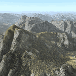
Yet another terrain mesh package of the European Alps? Well, this one is different in that it is NOT primarily based on the Shuttle Radar (SRTM) data with their incomplete coverage of prominent peaks and ridges. Instead, most of the source data for this project were developed over many months by Jonathan de Ferranti using detailed topographic maps. While Jonathan's work is unrelated to flight simulation he kindly gave me permission to compile his data for use in FS. The result is a wonderful improvement in detail and accuracy over any existing SRTM- or DTED-based mesh file, freeware or commercial (a link to an extensive set of screenshot comparisons is included in the read-me file).
I've compiled the source data at LOD10 (38-m) grid resolution because the coverage area is smaller than most existing mesh files. Thus, anyone can use these files without having to first uninstall their current mesh set. Also included are LOD9 and LO8 buffer mesh files. Note: if you own Austria Professional 2004 with its 1:50,000 scale terrain mesh then you don't need this package!
| Filename: | Alps_LOD10_Topo_Mesh__Austria_and_Italy.zip |
| License: | Freeware, limited distribution |
| Added: | 30th May 2010, 09:46:58 |
| Downloads: | 62,972 |
| Author: | Holger Sandmann, Jonathan de Ferranti |
| Size: | 73.32 MB |
| Category: Flight Simulator 2004 - Scenery | |
| Alps LOD10 Topo Mesh - Switzerland and France |
|
Images related to this file:
File Description:
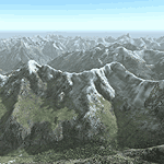
Yet another terrain mesh package of the European Alps? Well, this one is different in that it is NOT primarily based on the Shuttle Radar (SRTM) data with their incomplete coverage of prominent peaks and ridges. Instead, most of the source data for this project were developed over many months by Jonathan de Ferranti using detailed topographic maps. While Jonathan's work is unrelated to flight simulation he kindly gave me permission to compile his data for use in FS. The result is a wonderful improvement in detail and accuracy over any existing SRTM- or DTED-based mesh file, freeware or commercial (a link to an extensive set of screenshot comparisons is included in the read-me file).
I've compiled the source data at LOD10 (38-m) grid resolution because the coverage area is smaller than most existing mesh files. Thus, anyone can use these files without having to first uninstall their current mesh set. Also included are LOD9 and LO8 buffer mesh files. Note: if you own Switzerland Professional with its high-resolution terrain mesh then you don't need this package, at least not the Switzerland files!
| Filename: | Alps_LOD10_Topo_Mesh__Switzerland_and_France.zip |
| License: | Freeware, limited distribution |
| Added: | 30th May 2010, 09:51:03 |
| Downloads: | 59,016 |
| Author: | Holger Sandmann, Jonathan de Ferranti |
| Size: | 50.03 MB |
| Category: Flight Simulator X - Scenery | |
| Smithers, CYYD |
|
File Description:
Contained is an approximation of CYYD, Smithers Regional Airport, BC, made using the fsx object placement tool. Just pop it in your fsx\add on scenery\scenery folder. This scenery works well with Combat Planes Northern Adventures sampler. Notice that any xml mission file can be converted to a permanent bgl file for personal use with the bgl compiler of the SDK or Abacus Scenery Shortcut. For example, the Combat Planes Terrace Airport, CYXT. Thus, with this file and the above mentioned, one can have a nice circuit to fly from Smithers through Terrace down to Sandspit and back up to the Sitkine Area, to be improved in the future no doubt with Tongass Fjords II. FSG North America terrain mesh highly recommended.
| Filename: | Smithers_CYYD.zip |
| License: | Freeware |
| Added: | 17th February 2007, 15:36:47 |
| Downloads: | 1,452 |
| Author: | Joe Solomon |
| Size: | 26.78 KB |
| Category: Flight Simulator 2004 - Scenery | |
| Minstrel Island CAX7 float base in British Columbia, Canada |
|
Images related to this file:
File Description:
This is the third in a series of new and renovated float bases in BC. Minstrel Island is on the south side of Knight Inlet and 25 miles west of Knight Inlet Lodge (the previous post in this series). There is a resort on the island, though it is hidden from the air by the trees. Fuel and oil are both available at the dock, and there is a 17 feet tidal range, which would be interesting of it could be replicated in FS. The AI is an adaptation of that for CF36 and involves a GA Cessna, and a Seair Beaver flying from Campbell River to Knight Inlet Lodge via Minstrel Island. Again, because of large hills the landing of the AI may or may not take place, depending on wind direction and whether or not they fly into solid rock before landing. Take off and departure will take place. Ultimate Terrain Alaska/Canada would be a definite plus to get the water in the right shape and place. This scenery will not work without it.
| Filename: | Minstrel_Island_CAX7_float_base_in_British_Columbi.zip |
| License: | Freeware, limited distribution |
| Added: | 3rd January 2017, 15:38:57 |
| Downloads: | 228 |
| Author: | Roger Wensley |
| Size: | 3.54 MB |
| Category: Flight Simulator X - Scenery | |
| Mesh South America / MeSA A02 |
|
File Description:
FSX Mesh South America Project:
This terrain mesh file is a part of a whole project covering all the Continent of South America and some islands, divided in tiles identified in a map by its column (letters) and rows (numbers).
Those files were multi-LOD compiled from 90m SRTM2 source data, reprocessed with 3DEM to remove voids and spikes, providing a 76.4m (LOD9) horizontal resolution topography intended for use only in FSX updated with SP1.
Although not well documented, to improve performance, the updated FSX loads DEM files in threads and only the closer terrain (about 5 NM from the point of view) is rendered in high detail, while at far distances FSX shows up its default low resolution mesh, when there is not a third part terrain mesh compiled in all others intermediate level of details (multi-LOD).
THIS FILE:
FSX_MeSA_A02
Column A x Row 02
This file covers the area inside the boundaries:
N = 11º 15' N; S = 5º 37,5' N;
W = 90º 0' W; E = 82º 30' W;
AUTHORS:
Hely Heck Junior - Magrao ( [email protected] )
and Jose Lobo ( [email protected] )
TerraBrasilis: www.terra-brasilis.org
| Filename: | Mesh_South_America__MeSA_A02.zip |
| License: | Freeware |
| Added: | 11th June 2007, 00:02:15 |
| Downloads: | 1,595 |
| Author: | Hely Heck Jr. and José Lôbo |
| Size: | 10.95 MB |
| Category: Flight Simulator X - Scenery | |
| Mesh South America / MeSA A03 |
|
File Description:
FSX Mesh South America Project:
This terrain mesh file is a part of a whole project covering all the Continent of South America and some islands, divided in tiles identified in a map by its column (letters) and rows (numbers).
Those files were multi-LOD compiled from 90m SRTM2 source data, reprocessed with 3DEM to remove voids and spikes, providing a 76.4m (LOD9) horizontal resolution topography intended for use only in FSX updated with SP1.
Although not well documented, to improve performance, the updated FSX loads DEM files in threads and only the closer terrain (about 5 NM from the point of view) is rendered in high detail, while at far distances FSX shows up its default low resolution mesh, when there is not a third part terrain mesh compiled in all others intermediate level of details (multi-LOD).
THIS FILE:
FSX_MeSA_A03
Column A x Row 03
This file covers the area inside the boundaries:
N = 5º 37,5' N; S = 0º 0' S;
W = 90º 0' W; E = 82º 30' W;
AUTHORS:
Hely Heck Junior - Magrao ( [email protected] )
and José Lôbo ( [email protected] )
TerraBrasilis: www.terra-brasilis.org
| Filename: | Mesh_South_America__MeSA_A03.zip |
| License: | Freeware |
| Added: | 11th June 2007, 00:02:40 |
| Downloads: | 1,424 |
| Author: | Hely Heck Jr. and José Lôbo |
| Size: | 1.52 MB |
| Category: Flight Simulator X - Scenery | |
| Mesh South America / MeSA A01 |
|
File Description:
FSX Mesh South America Project:
This terrain mesh file is a part of a whole project covering all the Continent of South America and some islands, divided in tiles identified in a map by its column (letters) and rows (numbers).
Those files were multi-LOD compiled from 90m SRTM2 source data, reprocessed with 3DEM to remove voids and spikes, providing a 76.4m (LOD9) horizontal resolution topography intended for use only in FSX updated with SP1.
Although not well documented, to improve performance, the updated FSX loads DEM files in threads and only the closer terrain (about 5 NM from the point of view)is rendered in high detail, while at far distances FSX shows up its default low resolution mesh, when there is not a third part terrain mesh compiled in all others intermediate level of details (multi-LOD).
THIS FILE: FSX_MeSA_A01
(Column A x Row 01)
This file covers the area inside the boundaries:
N = 16º 52,5' N; S = 11º 15' N;
W = 90º 0' W; E = 82º 30' W;
AUTHORS:
Hely Heck Junior - Magrao ( [email protected] )
and Jose Lobo ( [email protected] )
TerraBrasilis: www.terra-brasilis.org
| Filename: | Mesh_South_America__MeSA_A01.zip |
| License: | Freeware |
| Added: | 11th June 2007, 00:03:00 |
| Downloads: | 1,960 |
| Author: | Hely Heck Jr. and José Lôbo |
| Size: | 49.55 MB |


© 2001-2026 AVSIM Online
All Rights Reserved
Privacy Policy |