
Where Flight Simulation Enthusiasts Gather from Around the World!
AVSIM Library - Search Results

| Category: Flight Simulator X - Scenery | |
| Branson Airport KBBG--New Airport, Scenery, and Flight Plans |

|
Images related to this file:
File Description:
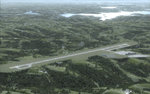
This project adds a new, detailed Branson Airport KBBG (Missouri) to FSX, which opened in May 2009, and is a privately developed commercial airport. The construction of the airport, which involved the flattening of several Ozark Mountains, is claimed to be the largest earthmoving project in Missouri history. As a result, the airport actually sits on a manmade plateau, surrounded by rolling hills. The airport uses the ICAO identifier BBG, however, the airlines use the IATA code BKG. The airport is served by AirTran, Frontier, and ExpressJet (Branson AirExpress), and is located in hilly terrain. Aircraft equipped with a terrain avoidance warning system may experience system activation on final approach. Birds are in the vicinity of the airport. AFCAD with sloping terrain created using Airport Design Editor X v1.47.07, and the hilltops were cleared and flattened and roads were added using SBuilderX 3.13. The terminal, hangar, FBO, and cars were added and modified from stock FSX scenery, using the FSX Object Tool, to resemble as closely as possible the actual airport.
| Filename: | Branson_Airport_KBBGNew_Airport_Scenery_and_Flight.zip |
| License: | Freeware |
| Added: | 5th August 2010, 01:08:33 |
| Downloads: | 2,005 |
| Author: | Carlyle Sharpe |
| Size: | 6.02 MB |
| Category: Flight Simulator X - Scenery | |
| Whale Island (Hi Resolution Photo and mesh), New Zealand |
|
Images related to this file:
File Description:
Whale Island (Maori Name: Moutohora) is a small island located off the Bay of Plenty coast of New Zealand's North Island. It is located about 12 kilometers north of the town of Whakatane. A whaling station existed on the island during the 19th century. The 1.43 km island is a remnant of a complex volcano which has eroded, leaving two peaks. This is still an area of volcanic activity and there are hot springs on the island in Sulphur Valley, McEwans Bay, and Sulphur Bay.
This Hi Resolution scenery was created from a 0.25m pixel resolution Ortho-rectified Aerial mosaic owned by Environment Bay of Plenty (The Bay of Plenty Regional Council) and flown in 2007. The imagery has been slightly de-sampled for use in Flight Simulator X and utilizes the a custom hi resolution 5m Mesh derived from photogrammetry data off the photos. The textures are intended for summer daylight flying only, although due to the evergreen nature of New Zealand's native bush, the Islands appearance remains relatively constant throughout the year.
The island contains a small helicopter pad which is used for checking the various radio antennas on the Island. There is also a small Department of Conservation hut near the south western tip of the Island. These objects have been added from the FSX library of objects. Make sure to turn up your graphics sliders to make the most of this data! To find the Island fly north from Whakatane airport.
| Filename: | Whale_Island_Hi_Resolution_Photo_and_mesh_New_Zeal.zip |
| License: | Freeware, limited distribution |
| Added: | 20th January 2010, 10:12:14 |
| Downloads: | 4,650 |
| Author: | Tim Barnes |
| Size: | 9.94 MB |
| Category: Flight Simulator X - Original Aircraft | |
| Space 1999 - Hawk |
|
File Description:
The Hawk fighter from the 70's TV show "Space 1999"
FEATURES:
- VStol and extreme altitude capable
- 2100+ kias top speed
- Stable and Strong under Extreme G loads
- Ultra efficient , High Thrust
- Dynamic VC
- Custom effects
.
* Original Lightwave mesh by Eric Peterson.
- for FSX ONLY by Bruce Fitzgerald.
| Filename: | Space_1999__Hawk.zip |
| License: | Freeware |
| Added: | 24th June 2008, 23:00:11 |
| Downloads: | 1,619 |
| Author: | Bruce Fitzgerald |
| Size: | 2.81 MB |
| Category: Flight Simulator 2004 - Scenery | |
| Rouen Photoscenery v2.11 |
|
Images related to this file:
File Description:
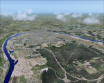
Rouen photoscenery. Around 200 square km summer photoscenery including Rouen city and LFOP airport background. It does not contain night or seasonal textures. It includes an optimized re-mesh and some characteristics 3D elements. It is provided with part of the custom autogen cover, specially around the AD.
| Filename: | Rouen_Photoscenery_v211.zip |
| License: | Freeware, limited distribution |
| Added: | 4th January 2010, 19:13:48 |
| Downloads: | 3,973 |
| Author: | Alain Nicco |
| Size: | 7.57 MB |
| Category: Flight Simulator 2002 - Scenery | |
| Ajaccio Campo dell Oro v 1.3 |
|
File Description:
Ajaccio Campo dell Oro v1.3.The major airport of the "Island of Beauty". This final release corrects texture bugs and improves framerate with new trees and cars. It looks best with Thierry Pignot mesh of Corsica and Alexandre Cadel's scenery of Ajaccio. Requires Gerrish Gray's trees librairies(trees_v3).
| Filename: | Ajaccio_Campo_dell_Oro_v_13.zip |
| License: | Freeware |
| Added: | 19th October 2002, 14:41:44 |
| Downloads: | 3,972 |
| Author: | Christian Santoni |
| Size: | 1.58 MB |
| Category: Flight Simulator 2004 - Scenery | |
| Suisse 2004 Bad Ragaz LSZE |
|
File Description:
Last Suisse 2002 update for FS2004 and FS2002. Bad Ragaz is far East of Switzerland and has a very narrow runway and a special approach over a moutain with a restaurant. Be careful. Two files are included depending on which mesh you're using. Read the readme doc please.
| Filename: | Suisse_2004_Bad_Ragaz_LSZE.zip |
| License: | Freeware, limited distribution |
| Added: | 19th October 2003, 17:33:03 |
| Downloads: | 9,319 |
| Author: | Daniel Gauthier |
| Size: | 2.4 MB |
| Category: Flight Simulator 2004 - Scenery | |
| Falkland Islands |
|
File Description:
Replacement scenery for the Falkland Islands (Islas Malvinas), off the tip of South America. This includes mesh, coastlines, rivers and lakes, adjusted airports and new landclass which is a significant improvement on the default.
This is an update, with a few corrected lakes and fixed landclass for Port Stanley.
| Filename: | Falkland_Islands.zip |
| License: | Freeware, limited distribution |
| Added: | 28th June 2004, 18:00:38 |
| Downloads: | 7,141 |
| Author: | Jim Keir |
| Size: | 2.32 MB |
| Category: Flight Simulator 2004 - Scenery | |
| Lausanne-La Blécherette (LSGL) for Suisse 2004 |
|
File Description:
Last West Switzerland Airfield. As real as possible due to mesh limitation. Includes Suisse 2004 usual stuffs (seasonal texture, landclass, VAC) as well as the main Lausanne Hospital (CHUV) to flight to, from the REGA base. Works very fine in FS2002 too. Read doc to install correctly the scenery.
| Filename: | LausanneLa_Blcherette_LSGL_for_Suisse_2004.zip |
| License: | Freeware, limited distribution |
| Added: | 14th February 2005, 13:38:12 |
| Downloads: | 9,318 |
| Author: | Daniel Gauthier |
| Size: | 4.81 MB |
| Category: Flight Simulator X - Scenery | |
| Okanagan Landclass, Rivers and Lakes |
|
File Description:
Okanagan Landclass for FSX, enhanced version.
Inspired by the excellent bc_landclass collection by Martin Eldridge
Covers the Okanagan Valley from N50 37 50 south to the US Border.
(Roughly: Grindrod, BC to Oroville, WA)
reworked the vegetation in the valleys (crops/grass/woods/shrub) to better match real life.
Added/reworked minor towns and settlements:
Grindrod, Enderby, Armstrong, Coldstream, Lumby, Cherryville, Oyama, Winfield, Peachland, Naramata, Okanagan Falls, Oliver, Cawston, Keremos, Olalla, Scott, WA
and added/reworked major cities:
Vernon, Kelowna, Summerland, Penticton, Osoyoos, Oroville, WA.
This version also adds numerous lakes and streamlines to the Southern Okanagan area.
| Filename: | Okanagan_Landclass_Rivers_and_Lakes.zip |
| License: | Freeware, limited distribution |
| Added: | 23rd June 2007, 20:45:29 |
| Downloads: | 2,279 |
| Author: | A. Sievert |
| Size: | 19.7 KB |
| Category: Flight Simulator 2004 - Scenery | |
| LTFD - Edremit Korfez Airport |
|
File Description:
Edremit is a district in the coasts of Aegean Sea, linking to Balýkesir province, in the Marmara region of TURKEY.
Korfez Airport(LTFD) is located in between Kaz mountains and the gulf of Erdemit.
Edremit was founded in BC 1443 with the name of Adramyteion.Here was the most important settlement at that time.
Geographical characteristics of Edremit are determined by Kazdaðý
(Goose Mountain) which enclose the location in north direction.
The South part of Kazdaðý that commands the Gulf is ripped by innumerable deep valleys.The streams sourced from Kazdaðý give life to Edremit Gulf by passing canyons, flowing over waterfalls.
| Filename: | LTFD__Edremit_Korfez_Airport.zip |
| License: | Freeware |
| Added: | 22nd April 2008, 17:36:45 |
| Downloads: | 1,254 |
| Author: | Gökhan Bayrakdar |
| Size: | 7.19 MB |


© 2001-2026 AVSIM Online
All Rights Reserved
Privacy Policy |