
Where Flight Simulation Enthusiasts Gather from Around the World!
AVSIM Library - Search Results

| Category: Flight Simulator 2004 - Aircraft Repaints, Textures and Modifications | |
| Northern Air Cargo Boeing 767-323FER (N379CX) |

|
Images related to this file:
File Description:

2004/FSX SkySpirit Boeing 767-323FER Northern Air Cargo (N379CX). NAC ordered and received their fist 767 in February 2018. Northern Air Cargo is an American cargo airline based in Anchorage, Alaska, USA. It operates services within Alaska and to Canada and mainland USA. Model design by Hiroshi Igami.
| Filename: | Northern_Air_Cargo_Boeing_767323FER_N379CX.zip |
| License: | Freeware, limited distribution |
| Added: | 11th June 2018, 17:48:55 |
| Downloads: | 409 |
| Author: | Danny Cummings |
| Size: | 11.86 MB |
| Category: Flight Simulator 2004 - Scenery | |
| Lake Manyara water level modification |
|
Images related to this file:
File Description:
Modified HP file for Lake Manyara. This modification is intended for use with 76m mesh only and lowers the lake level to fit with terrain.
Added files to move and modify HTLM Lake Manyara Airstrip.
| Filename: | Lake_Manyara_water_level_modification.zip |
| License: | Freeware |
| Added: | 25th October 2022, 14:30:48 |
| Downloads: | 66 |
| Author: | John Tennent |
| Size: | 35.75 KB |
| Category: Flight Simulator 2004 - AFCAD Files | |
| Sucre SLSU Bolivia |
|
Images related to this file:
File Description:
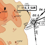
AFCAD file for FS2004 default scenery of Sucre SLSU Juanna A. De Padilla airport in Bolivia.
Brings runway to proper dimensions and adds approach (PAPI) lighting as in the real airport.
High elevation airport (9430 ft.) with surrounding terrain of the Bolivian Andes.
There is no night lighting at this airport. Approach charts included. Recommended mesh terrain: mesh_fermandois003_265585.zip
| Filename: | Sucre_SLSU_Bolivia.zip |
| License: | Freeware, limited distribution |
| Added: | 19th March 2010, 08:55:01 |
| Downloads: | 563 |
| Author: | Kyprianos Biris |
| Size: | 683.9 KB |
| Category: Flight Simulator 2004 - Sounds | |
| Miscellaneous ATC-AIRLINE Voicepack Mod - Vol. 13 |
|
Images related to this file:
File Description:

The 13th volume of ATC_AIRLINE vcpmod files for use with the editvoicepack program. This group includes some for Canada and Alaska and miscellaneous airlines someone requested a while back.
| Filename: | Miscellaneous_ATCAIRLINE_Voicepack_Mod__Vol_13.zip |
| License: | Freeware, limited distribution |
| Added: | 20th January 2016, 22:31:11 |
| Downloads: | 832 |
| Author: | Bill Grasha |
| Size: | 13.85 KB |
| Category: Flight Simulator 2002 - Scenery | |
| LightWeight Mesh terrain for Europe and the Mediterranean (Part 4 of 4) |
|
File Description:
Framerate and download friendly mesh terrain that covers the Faroe Islands, the Shetlands, most of Norway (including Spitsbergen/Svalbard) and Sweden, all of Finland and parts of Russia. It is bounded by W20-E20-N89-N60.
| Filename: | LightWeight_Mesh_terrain_for_Europe_and_the_Medite.zip |
| License: | Freeware |
| Added: | 25th July 2002, 16:26:09 |
| Downloads: | 10,944 |
| Author: | Svante Wendel |
| Size: | 14.29 MB |
| Category: Flight Simulator X - Scenery | |
| Manitoba Floatplane Bases |
|
Images related to this file:
File Description:
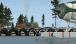
55 bases including 36 floatplane bases, 6 heliports and 13 airports/airstrips.
15 flights to get you started at unlisted bases. Requires Ultimate Terrain X - Canada.
By Mike Mann
| Filename: | Manitoba_Floatplane_Bases.zip |
| License: | Freeware, limited distribution |
| Added: | 25th January 2011, 15:00:31 |
| Downloads: | 1,329 |
| Author: | Mike Mann |
| Size: | 4.33 MB |
| Category: Flight Simulator 2004 - Aircraft Repaints, Textures and Modifications | |
| High Terrain Helicopters (C-GLHL) |
|
Images related to this file:
File Description:
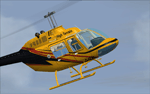
Repaint of Owen Hewitt & Stephen Pierce's excellent Bell 206B-3 in the real-world scheme of C-GLHL, operated by High Terrain Helicopters based in Nelson, British Columbia, Canada.
| Filename: | High_Terrain_Helicopters_CGLHL.zip |
| License: | Freeware |
| Added: | 15th January 2012, 08:24:52 |
| Downloads: | 175 |
| Author: | Adrian Thompson, Owen Hewitt, Stephen Pierce |
| Size: | 539.38 KB |
| Category: Flight Simulator 2002 - Scenery | |
| Old Severn Bridge |
|
File Description:
This freeware demo is part of Nick Ryall SW England Landmark Scenery available from
http://www.visualflight.co.uk/nickryall
This scenery represents the Old Severn bridge crossing the Severn estury UK and replaces the default bridge
The scenery has been designed primarily for use with addon VFR photographic scenery from Visual Flight and mesh terrain Lago's Terramesh for the UK.
It is part of a package which contains more than 50 VFR scenery Landmarks for the SW UK and is available for purchase at the Visual Flight website It does however work with Microsoft's default mesh terrain
| Filename: | Old_Severn_Bridge.zip |
| License: | Freeware |
| Added: | 10th March 2003, 13:08:41 |
| Downloads: | 1,461 |
| Author: | Nick Ryall |
| Size: | 374.01 KB |
| Category: Flight Simulator X - Scenery | |
| Mesh South America / MeSA E03 |
|
File Description:
FSX Mesh South America Project:
This terrain mesh file is a part of a whole project covering all the Continent
of South America and some islands, divided in tiles identified in a map by its
column (letters) and rows (numbers).
Those files were multi-LOD compiled from 90m SRTM2 source data, reprocessed
with 3DEM to remove voids and spikes, providing a 76.4m (LOD9) horizontal
resolution topography intended for use only in FSX updated with SP1.
Although not well documented, to improve performance, the updated FSX loads DEM
files in threads and only the closer terrain (about 5-10 NM from the point of view)
is rendered in high detail, while at far distances FSX shows up its default low
resolution mesh, when there is not a third part terrain mesh compiled in all
others intermediate level of details (multi-LOD).
THIS FILE:
FSX_MeSA_E03 (Column E x Row 03)
covers the area inside the boundaries:
N = 5º 37,5' N; S = 0º 0' S;
W = 60º 0' W; E = 52º 30' W;
| Filename: | Mesh_South_America__MeSA_E03.zip |
| License: | Freeware |
| Added: | 13th June 2007, 21:41:26 |
| Downloads: | 1,256 |
| Author: | Hely Heck Jr. and José Lôbo |
| Size: | 83.82 MB |
| Category: Flight Simulator X - Scenery | |
| FSX_MeSA_G08 |
|
File Description:
FSX Mesh South America Project:
This terrain mesh file is a part of a whole project covering all the Continent
of South America and some islands, divided in tiles identified in a map by its
column (letters) and rows (numbers).
Those files were multi-LOD compiled from 90m SRTM2 source data, reprocessed
with 3DEM to remove voids and spikes, providing a 76.4m (LOD9) horizontal
resolution topography intended for use only in FSX updated with SP1.
Although not well documented, to improve performance, the updated FSX loads DEM
files in threads and only the closer terrain (about 5-10 NM from the point of view)
is rendered in high detail, while at far distances FSX shows up its default low
resolution mesh, when there is not a third part terrain mesh compiled in all
others intermediate level of details (multi-LOD).
THIS FILE:
FSX_MeSA_G08 (Column G x Row 08)
covers the area inside the boundaries:
N = 22º 30' S; S = 28º 7.5' S;
W = 45º 0' W; E = 37º 30' W;
AUTHORS:
Hely Heck Junior - Magrao ( [email protected] )
and Jose Lobo ( [email protected] )
| Filename: | FSX_MeSA_G08.zip |
| License: | Freeware |
| Added: | 15th June 2007, 15:04:47 |
| Downloads: | 1,138 |
| Author: | Hely Heck Jr. and José Lôbo |
| Size: | 12 MB |


© 2001-2026 AVSIM Online
All Rights Reserved
Privacy Policy |