
Where Flight Simulation Enthusiasts Gather from Around the World!
AVSIM Library - Search Results

| Category: Flight Simulator 2004 - AI Aircraft | |
| Grant Aviation (Alaska, USA), Beechcraft B200 Super King Air (N90PB) |

|
Images related to this file:
File Description:

Beechcraft B200 Super King Air, N90PB. Missing aircraft for Grant Aviation (Alaska) Fall 2010 Flightplans by Steve Lewis (AVSIM), file: grant_aviation_f10.zip. Textures only for the Henry Tomkiewicz (HTAI) Beech b200, AI freeware model.
| Filename: | Grant_Aviation_Alaska_USA_Beechcraft_B200_Super_Ki.zip |
| License: | Freeware |
| Added: | 2nd January 2011, 21:58:59 |
| Downloads: | 572 |
| Author: | Jacques Capdeville |
| Size: | 214.89 KB |
| Category: Flight Simulator 2004 - Scenery | |
| Bear Lake Co. 1U7 Idaho Airport |
|
File Description:
Bear Lake is one of the largest natural lakes in the Western United States, known for its intense turquoise blue water. 45 miles of paved road surround the lake giving you lots of site seeing and abundant public beach access. Nearby Bear Lake Co. airport offers generous 5,700' and 4,600' paved runways and 24 hour operations. AI traffic inlcuded. What are you waiting for? This scenery was created using Ultimate Terrain but should work just as well with the default terrain.
| Filename: | Bear_Lake_Co_1U7_Idaho_Airport.zip |
| License: | Freeware |
| Added: | 1st November 2008, 04:00:09 |
| Downloads: | 930 |
| Author: | Sidney Schwartz |
| Size: | 1.01 MB |
| Category: Flight Simulator X - Scenery | |
| Pitt Stadiums Scenery |
|
File Description:
This scenery includes Hienz Field, PNC Park and Mellon Arena.. It was designed by Camilo Forero for FS9 default...
I have repositioned his objects to fit within FSX using Ultimate Terrain X
| Filename: | Pitt_Stadiums_Scenery.zip |
| License: | Freeware |
| Added: | 28th November 2007, 09:58:39 |
| Downloads: | 918 |
| Author: | Ray Lunning |
| Size: | 785.69 KB |
| Category: Flight Simulator 2004 - Scenery | |
| KCRW - Charleston-Yeager 2014 |
|
Images related to this file:
File Description:
Yeager Airport KCRW in Charleston, West Virginia, is a mid-size airport surrounded by beautiful terrain (see the section on Optional Mesh). The terminal can easily accommodate 737 class airliners as well as commuter turboprops, and there are GA and West Virginia National Guard ramps. This scenery reflects the current single runway configuration, the former second runway having been converted into taxiway C. It is a complete rebuild with all custom buildings and some photo ground textures. I have also redone the instrument approaches to match the current real ones, and they will automatically be listed and displayed on your GPS. Instrument Approach Plates are included.
This work is entirely my own, but I would like to thank Brandon DePalo for his very well done earlier version of KCRW. Without that, I would not have known about this airport.
| Filename: | KCRW__CharlestonYeager_2014.zip |
| License: | Freeware |
| Added: | 26th April 2014, 07:05:30 |
| Downloads: | 646 |
| Author: | Sidney Schwartz |
| Size: | 7.29 MB |
| Category: Flight Simulator X - Scenery | |
| Mesh for Northern Africa, Base Grid 0502 |
|
Images related to this file:
File Description:
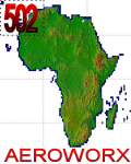
Highly detailed 76m SRTM mesh for Africa using the latest release of STRM Data V2.1. This file covers the Africa Area of base file 0502 (N23 and W00), North of the Equator, DO NOT DISABLE THE DEFAULT DEM 0502 FILE.
| Filename: | Mesh_for_Northern_Africa_Base_Grid_0502.zip |
| License: | Freeware |
| Added: | 12th January 2014, 08:43:02 |
| Downloads: | 2,499 |
| Author: | Martin du Preez, Hannes Steyn, Aeroworx |
| Size: | 138.53 MB |
| Category: Flight Simulator X - Scenery | |
| Mesh for Northern Africa, Base Grid 0702 |
|
Images related to this file:
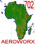
File Description: Highly detailed 76m SRTM mesh for Africa using the latest release of STRM
Data V2.1. This file covers the Africa Area of base file 0702 (N23 and E30),
North of the Equator, Arabia is not included, DO NOT DISABLE THE DEFAULT DEM
702 FILE.
| Filename: | Mesh_for_Northern_Africa_Base_Grid_0702.zip |
| License: | Freeware |
| Added: | 11th January 2014, 05:27:05 |
| Downloads: | 1,547 |
| Author: | Martin du Preez, Hannes Steyn, Aeroworx |
| Size: | 33.93 MB |
| Category: Flight Simulator X - Scenery | |
| Mesh for Southern Africa, Base Grid 0705 |
|
Images related to this file:
File Description:
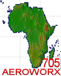
Highly detailed 76m SRTM mesh for Africa using the latest release of STRM Data V2.1. This file covers the Africa Area of base file 0705 (S23 and E30), South of the Equator, Madagascar included. DO NOT DISABLE THE DEFAULT DEM 705 FILE.
| Filename: | Mesh_for_Southern_Africa_Base_Grid_0705.zip |
| License: | Freeware |
| Added: | 13th January 2014, 12:51:14 |
| Downloads: | 2,621 |
| Author: | Martin du Preez, Hannes Steyn, Aeroworx |
| Size: | 43.04 MB |
| Category: Flight Simulator X - Scenery | |
| Mesh for Northern Africa, Base Grid 0703 |
|
Images related to this file:
File Description:
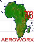
Highly detailed 76m SRTM mesh for Africa using the latest release of STRM Data V2.1. This file covers the Africa Area of base file 0703 (N23 and E30), North of the Equator, Arabia is not included, DO NOT DISABLE THE DEFAULT DEM 703 FILE.
| Filename: | Mesh_for_Northern_Africa_Base_Grid_0703.zip |
| License: | Freeware |
| Added: | 12th January 2014, 19:12:58 |
| Downloads: | 1,776 |
| Author: | Martin du Preez, Hannes Steyn, Aeroworx |
| Size: | 302.1 MB |
| Category: Flight Simulator 2004 - Scenery | |
| Europe SRTM mesh part 10: Lower Danube |
|
File Description:
Europe SRTM LOD9 mesh part 10 of 13: Covers a wide area centered over the Danube valley from Novi Sad to the Black Sea (42°N-46°N, 19°E-30°E). Includes Balkans & Transylvanian moutain ranges, and parts of the following countries: Romania, Bulgaria, Serbia and Albania.
This Europe SRTM project was optimized for the lowest HDD space use: Each part macthing exactly the boundaries of its neighbors, you'll have a complete corevage of Europe without gap or overlapping scenery. Based on SRTM Data v1 and v2 (3 arcsec, 90m) and sampled to LOD9 resolution (76m). Each SRTM tile was carefully checked and repaired with Blackart v4.02: water areas are now flattened (lighter mesh), and SRTM voids were treated taking advantage of Blackart's sophisticated interpolation algorithm. When required, biggest voids were patched with oversampled SRTM 30 arcsec data and/or manual input.
| Filename: | Europe_SRTM_mesh_part_10_Lower_Danube.zip |
| License: | Freeware, limited distribution |
| Added: | 19th October 2005, 17:55:10 |
| Downloads: | 11,734 |
| Author: | Yohann Baptiste |
| Size: | 39.14 MB |
| Category: Flight Simulator 2004 - Scenery | |
| Europe SRTM mesh Part 02: UK & Ireland |
|
File Description:
Europe SRTM LOD9 mesh part 2 of 13: Covers all of UK & Ireland except the Shetlands, and a tiny part of France (from Calais to Abbeville).
This Europe SRTM project was optimized for the lowest HDD space use: Each part macthing exactly the boundaries of its neighbors, you'll have a complete corevage of Europe without gap or overlapping scenery. Based on SRTM Data v1 and v2 (3 arcsec, 90m) and sampled to LOD9 resolution (90m). Each SRTM tile was carefully checked and repaired with Blackart v4.02: water areas are now flattened (lighter mesh), and SRTM voids were treated taking advantage of Blackart's sophisticated interpolation algorithm. When required, biggest voids were patched with oversampled SRTM 30 arcsec data and/or manual input.
| Filename: | Europe_SRTM_mesh_Part_02_UK__Ireland.zip |
| License: | Freeware, limited distribution |
| Added: | 19th October 2005, 16:11:56 |
| Downloads: | 17,957 |
| Author: | Yohann Baptiste |
| Size: | 36.17 MB |


© 2001-2026 AVSIM Online
All Rights Reserved
Privacy Policy |