
Where Flight Simulation Enthusiasts Gather from Around the World!
AVSIM Library - Search Results

| Category: Flight Simulator 2004 - Scenery | |
| Himalayas LOD9 Base Mesh, Volume 5 - Hindu Kush and Pamir |

|
Images related to this file:
File Description:
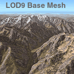
Detailed terrain mesh of the Hindu Kush and Pamir Ranges, N32-40 E70-76. The files in this package are based on Shuttle Radar (SRTM) Version 2 data but with many of the void areas, especially the most significant sections, filled with elevation data generated from topographic maps by Jonathan de Ferranti. While Jonathan's work is unrelated to flight simulation he kindly gave me permission to compile his data for use in FS. The result is a wonderful improvement in detail and accuracy over any existing mesh file, freeware or commercial, based on SRTM or DTED data alone.
Due to the large area of the Himalayas I've compiled the source data as two separate series: the "Himalayan Peaks" series covers prominent mountains and ranges in higher detail and locally overrides any existing LOD9 terrain mesh. In addition, the LOD9 "base mesh" series, with LOD8 and LOD7 "buffer" mesh files, covering the entire Himalayas, is meant for those who do not yet have an add-on terrain mesh of these beautiful mountains.
| Filename: | Himalayas_LOD9_Base_Mesh_Volume_5__Hindu_Kush_and_.zip |
| License: | Freeware, limited distribution |
| Added: | 29th May 2010, 08:57:29 |
| Downloads: | 7,610 |
| Author: | Holger Sandmann, Jonathan de Ferranti |
| Size: | 85.72 MB |
| Category: Flight Simulator 2004 - Scenery | |
| Himalayas LOD9 Base Mesh, Volume 2 - Southcentral Ranges |
|
Images related to this file:
File Description:
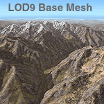
Detailed terrain mesh of the Southcentral Himalayan Ranges, N26-32 E82-90. The files in this package are based on Shuttle Radar (SRTM) Version 2 data but with many of the void areas, especially the most significant sections, filled with elevation data generated from topographic maps by Jonathan de Ferranti. While Jonathan's work is unrelated to flight simulation he kindly gave me permission to compile his data for use in FS. The result is a wonderful improvement in detail and accuracy over any existing mesh file, freeware or commercial, based on SRTM or DTED data alone.
Due to the large area of the Himalayas I've compiled the source data as two separate series: the "Himalayan Peaks" series covers prominent mountains and ranges in higher detail and locally overrides any existing LOD9 terrain mesh. In addition, a LOD9 "base mesh" series, with LOD8 and LOD7 "buffer" mesh files, covering the entire Himalayas, is meant for those who do not yet have an add-on terrain mesh of these beautiful mountains.
| Filename: | Himalayas_LOD9_Base_Mesh_Volume_2__Southcentral_Ra.zip |
| License: | Freeware, limited distribution |
| Added: | 29th May 2010, 09:05:56 |
| Downloads: | 9,455 |
| Author: | Holger Sandmann, Jonathan de Ferranti |
| Size: | 90.25 MB |
| Category: Flight Simulator 2004 - Scenery | |
| Himalayas LOD9 Base Mesh, Volume 3 - Southwestern Ranges |
|
Images related to this file:
File Description:
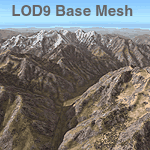
Detailed terrain mesh of the Southwestern Himalayan Ranges, N28-37 E78-82. The files in this package are based on Shuttle Radar (SRTM) Version 2 data but with many of the void areas, especially the most significant sections, filled with elevation data generated from topographic maps by Jonathan de Ferranti. While Jonathan's work is unrelated to flight simulation he kindly gave me permission to compile his data for use in FS. The result is a wonderful improvement in detail and accuracy over any existing mesh file, freeware or commercial, based on SRTM or DTED data alone.
Due to the large area of the Himalayas I've compiled the source data as two separate series: the "Himalayan Peaks" series covers prominent mountains and ranges in higher detail and locally overrides any existing LOD9 terrain mesh. In addition, the LOD9 "base mesh" series, with LOD8 and LOD7 "buffer" mesh files, covering the entire Himalayas, is meant for those who do not yet have an add-on terrain mesh of these beautiful mountains.
| Filename: | Himalayas_LOD9_Base_Mesh_Volume_3__Southwestern_Ra.zip |
| License: | Freeware, limited distribution |
| Added: | 30th May 2010, 10:00:26 |
| Downloads: | 155,812 |
| Author: | Holger Sandmann, Jonathan de Ferranti |
| Size: | 62.16 MB |
| Category: Flight Simulator 2004 - Scenery | |
| Himalayas LOD9 Base Mesh, Volume 1 - Southeastern Ranges |
|
Images related to this file:
File Description:
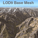
Detailed terrain mesh of the Southeastern Himalayan Ranges, N26-32 E90-98. The files in this package are based on Shuttle Radar (SRTM) Version 2 data but with many of the void areas, especially the most significant sections, filled with elevation data generated from topographic maps by Jonathan de Ferranti. While Jonathan's work is unrelated to flight simulation he kindly gave me permission to compile his data for use in FS. The result is a wonderful improvement in detail and accuracy over any existing mesh file, freeware or commercial, based on SRTM or DTED data alone.
Due to the large area of the Himalayas I've compiled the source data as two separate series: the "Himalayan Peaks" series covers prominent mountains and ranges in higher detail and locally overrides any existing LOD9 terrain mesh. In addition, a LOD9 "base mesh" series, with LOD8 and LOD7 "buffer" mesh files, covering the entire Himalayas, is meant for those who do not yet have an add-on terrain mesh of these beautiful mountains.
| Filename: | Himalayas_LOD9_Base_Mesh_Volume_1__Southeastern_Ra.zip |
| License: | Freeware, limited distribution |
| Added: | 29th May 2010, 09:01:26 |
| Downloads: | 10,308 |
| Author: | Holger Sandmann, Jonathan de Ferranti |
| Size: | 71.82 MB |
| Category: Flight Simulator 2004 - Scenery | |
| Qualicum Beach (CAT4) |
|
File Description:
This package adds detailed airport scenery to Qualicum Beach airport and French Creek marina on beautiful Vancouver Island, BC, Canada. Included are accurate renderings of almost all buildings on the airport, cars and ground objects, detailed ground/taxiway layout and general aviation traffic.
| Filename: | Qualicum_Beach_CAT4.zip |
| License: | Freeware, limited distribution |
| Added: | 17th July 2004, 01:14:30 |
| Downloads: | 6,320 |
| Author: | Ken Peters |
| Size: | 7.63 MB |
| Category: Flight Simulator 2004 - Scenery | |
| Sardegna & Corsica SRTM Mesh |
|
File Description:
This terrain mesh scenery covers Sardagna and Corsica islands in western mediterranean sea.
Based on SRTM Data (3 arcsec, 90m), generated with Matthew Styles's program "SRTM To BGL v1.04", sampled to LOD9 resolution (76m). Only tested with Fs2004, but this mesh should also run with FS2002.
| Filename: | Sardegna__Corsica_SRTM_Mesh.zip |
| License: | Freeware |
| Added: | 10th November 2003, 02:04:46 |
| Downloads: | 9,666 |
| Author: | Yohann Baptiste |
| Size: | 5.97 MB |
| Category: Flight Simulator 2004 - Scenery | |
| Azores Islands SRTM Terrain Mesh Fix for Sao Miguel Island Lakes |
|
File Description:
A set of flatten files that corrects the elevation of the five lakes on Sao Miguel island to make them fit better into Andreas Trawny's Azores mesh terrain.
| Filename: | Azores_Islands_SRTM_Terrain_Mesh_Fix_for_Sao_Migue.zip |
| License: | Freeware |
| Added: | 7th June 2004, 22:33:24 |
| Downloads: | 3,618 |
| Author: | Thomas Klink |
| Size: | 2.71 KB |
| Category: Flight Simulator 2002 - Scenery | |
| Flatten Banff Airport |
|
File Description:
As you may know, the FS2002 terrain engine generates canyons around the Banff Airport. The enclosed (small) bgl file is a simple way to flatten the area immediately surrounding this airstrip. Will work with default terrain, or with add on meshes such as my CdnRockies.bgl mesh.
| Filename: | Flatten_Banff_Airport.zip |
| License: | Freeware |
| Added: | 19th April 2003, 20:19:37 |
| Downloads: | 756 |
| Author: | Gary Snow |
| Size: | 1.43 KB |
| Category: Flight Simulator X - Scenery | |
| Labrador Landscape, Canada - 1/2 |
|
File Description:
Labrador (Province of Newfoundland and Labrador, Canada) elevation data (mesh-Lod10), land cover around airport, water polygons, rivers, stream lines, lanes and shorelines.
| Filename: | Labrador_Landscape_Canada__12.zip |
| License: | Freeware, limited distribution |
| Added: | 24th May 2010, 11:36:17 |
| Downloads: | 2,949 |
| Author: | Gilles Gauthier |
| Size: | 50.48 MB |
| Category: Flight Simulator X - Scenery | |
| Labrador Landscape, Canada - 2/2 |
|
File Description:
Labrador (Province of Newfoundland and Labrador, Canada) elevation data (mesh-Lod10), land cover around airport, water polygons, rivers, stream lines, lanes and shorelines
| Filename: | Labrador_Landscape_Canada__22.zip |
| License: | Freeware, limited distribution |
| Added: | 24th May 2010, 11:36:42 |
| Downloads: | 2,348 |
| Author: | Gilles Gauthier |
| Size: | 58.49 MB |


© 2001-2026 AVSIM Online
All Rights Reserved
Privacy Policy |