
Where Flight Simulation Enthusiasts Gather from Around the World!
AVSIM Library - Search Results

| Category: Flight Simulator 2004 - Scenery | |
| Terrain Mesh (LOD08) for Nunavut, Canada (File 4 of 4) |

|
File Description:
Re-uploaded file. FS2002 and FS2004. The files in this package contain a new 153m (LOD08) terrain mesh for Nunavut, Canada ( and northern part of Northwest Territories) to use with FS2002 and FS2004. The source data is GeoBase (CDED-1 : 250 000). All data were compiled and edited in MicroDEM 7.01 alpha and resampled to LOD08 (Level of Details), or 152.88 meters horizontal resolution, with the Microsoft Terrain Software Developer's Kit (SDK) utilities.
(Nunavut8a.zip, Nunavut8b.zip Nunavut8c.zip Nunavut8d.zip - 4 Parts).
| Filename: | Terrain_Mesh_LOD08_for_Nunavut_Canada_File_4_of_4.zip |
| License: | Freeware, limited distribution |
| Added: | 5th May 2010, 09:14:41 |
| Downloads: | 4,253 |
| Author: | Gilles Gauthier |
| Size: | 30.7 MB |
| Category: Flight Simulator 2004 - Scenery | |
| Terrain Mesh (LOD08) for Nunavut, Canada (File 1 of 4) |
|
File Description:
The files in this package contain a new 153m (LOD08) terrain mesh for Nunavut, Canada ( and northern part of Northwest Territories) to use with FS2002 and FS2004. The source data is GeoBase (CDED – 1 : 250 000). All data were compiled and edited in MicroDEM 7.01 alpha and resampled to LOD08 (Level of Details), or 152.88 meters horizontal resolution, with the Microsoft Terrain Software Developer's Kit (SDK) utilities.
(Nunavut8a.zip, Nunavut8b.zip Nunavut8c.zip Nunavut8d.zip - 4 Parts).
| Filename: | Terrain_Mesh_LOD08_for_Nunavut_Canada_File_1_of_4.zip |
| License: | Freeware, limited distribution |
| Added: | 30th December 2003, 23:41:21 |
| Downloads: | 4,791 |
| Author: | Gilles Gauthier |
| Size: | 32.24 MB |
| Category: Flight Simulator 2004 - Scenery | |
| Terrain Mesh (LOD08) for Nunavut, Canada (File 2 of 4) |
|
File Description:
FS2002 and FS2004. The files in this package contain a new 153m (LOD08) terrain mesh for Nunavut, Canada ( and northern part of Northwest Territories) to use with FS2002 and FS2004. The source data is GeoBase (CDED – 1 : 250 000). All data were compiled and edited in MicroDEM 7.01 alpha and resampled to LOD08 (Level of Details), or 152.88 meters horizontal resolution, with the Microsoft Terrain Software Developer's Kit (SDK) utilities.
(Nunavut8a.zip, Nunavut8b.zip Nunavut8c.zip Nunavut8d.zip - 4 Parts).
| Filename: | Terrain_Mesh_LOD08_for_Nunavut_Canada_File_2_of_4.zip |
| License: | Freeware, limited distribution |
| Added: | 30th December 2003, 23:42:23 |
| Downloads: | 3,892 |
| Author: | Gilles Gauthier |
| Size: | 22.71 MB |
| Category: Flight Simulator X - Scenery | |
| Northeast New Jersey 5 Meter Mesh Terrain |
|
Images related to this file:
File Description:
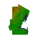
High Resolution Northeast New Jersey 5 Meter Mesh Terrain by Wally-Bob represents a significant improvement over FSX default 38 meter mesh terrain. The results are also dramatic compared to 10 meter compressed payware mesh as lossless compression compilation (read no data loss) is used. Lossless compiling produces renderings that have the Crispness of the Real World Terrain. Fly the Hudson River and view the Palisades as they are in real life, see the screen shots enclosed. High Quality 5 meter mesh terrain is a must have for mountainous areas especially where photo scenery is also used to render the virtual world. Manual includes FSX configuration and scenery installation tips. USGS LiDAR 1/9 Arc-Second source data.
| Filename: | Northeast_New_Jersey_5_Meter_Mesh_Terrain.zip |
| License: | Freeware, limited distribution |
| Added: | 26th February 2011, 21:35:52 |
| Downloads: | 1,101 |
| Author: | Walter Roberts |
| Size: | 135.89 MB |
| Category: Flight Simulator 2002 - Scenery | |
| Seattle, WA - High Resolution Terrain Mesh |
|
File Description:
Seattle, Washington area. The modest terrain in the Seattle area provides a nice example of a less obvious benefit of high resolution terrain mesh. The rendering of many small features missing entirely in the default mesh provides much richer detail and a greater sense of realism. (30m source -> 38.2m final).
| Filename: | Seattle_WA__High_Resolution_Terrain_Mesh.zip |
| License: | Freeware, limited distribution |
| Added: | 4th July 2002, 13:32:39 |
| Downloads: | 3,621 |
| Author: | Steve Greenwood |
| Size: | 3.75 MB |
| Category: Flight Simulator 2004 - AI Aircraft | |
| Wings of Alaska Float Package |
|
File Description:
AI floatplane package for the Wings of Alaska based in Juneau, Alaska. Includes texture's only for John Woodward's DH2 Beaver on floats (original model available here at avsim.com), AFCAD files for seaplane bases, dock scenery created using default objects and Abacus' EZ Scenery and flightplans based on Ultimate Traffic's summer 2006 schedules. The afcads and dock scenery are only compatible with Ultimate Terrain Alaska and Canada; they will not work with the default scenery. If someone wishes to modify the afcads for the default scenery, please feel free to do so.
| Filename: | Wings_of_Alaska_Float_Package.zip |
| License: | Freeware |
| Added: | 24th December 2009, 15:40:22 |
| Downloads: | 1,302 |
| Author: | Chris Peschke, John Woodward |
| Size: | 380.31 KB |
| Category: Flight Simulator 2004 - Scenery | |
| Some Islands of St.Lawrence river, Quebec, Canada |
|
File Description:
The files in this package contain some islands of St.Lawrence river and other sceneries of province of Quebec, Canada. For FS2004 only. To use with terrain mesh for parts of this province after some corrections : qclod09a.zip to qclod09e.zip (5 files).
Les fichiers contenus dans cette archive corrigent la representation qui est faite dans FS2004 de quelques iles du fleuve Saint-Laurent. D'autres scenes sont egalement jointes. L'utilisation du mesh du Quebec est recommandée : 5 fichiers - qclod09a.zip a qclod09e.zip
| Filename: | Some_Islands_of_StLawrence_river_Quebec_Canada.zip |
| License: | Freeware, limited distribution |
| Added: | 20th April 2004, 16:55:41 |
| Downloads: | 4,864 |
| Author: | Gilles Gauthier |
| Size: | 1.82 MB |
| Category: Flight Simulator 2002 - Scenery | |
| Venezuelan Andes 3-Arc Sec Terrain for FS2002 |
|
File Description:
This freeware add-on file will enhance your VFR Mountain flying experience with Microsoft FS2002. You will enjoy amazing elevation details for the Venezuelan Andes. Please see enclosed picture comparison with actual photograph and terrain mesh coverage. The terrain mesh was created using 3-Arc Second Digital Elevation Model (90 meters/pixel).
| Filename: | Venezuelan_Andes_3Arc_Sec_Terrain_for_FS2002.zip |
| License: | Freeware |
| Added: | 20th January 2023, 01:16:05 |
| Downloads: | 22 |
| Author: | P.Miliani |
| Size: | 3.72 MB |
| Category: Flight Simulator 2002 - AFCAD Files | |
| Replacements For 63 Airports Around Vancouver BC, Canada |
|
File Description:
Replaces default Afcads of 63 airfields using Vancouver, BC, Canada. Enables ATC at each field. Lee Swordy's AFCAD and Mike Holland's GA Maker used to install fields and generate GA traffic.
| Filename: | Replacements_For_63_Airports_Around_Vancouver_BC_C.zip |
| License: | Freeware |
| Added: | 4th June 2003, 02:05:37 |
| Downloads: | 678 |
| Author: | John Brace |
| Size: | 101.93 KB |
| Category: Prepar3D V1-4 - Scenery | |
| ITALY ETM20m - Enhanced Terrain Mesh vol. 00 ver 1.10 |
|
Images related to this file:
File Description:
File Description:
Italy - ETM Enhanced Terrain Mesh 0.73 arc sec (20 meters). This Terrain Mesh is fully compatible with FSX/P3D (all versions). This is a work in progress. Volume 00 - Sicily, Aeolian Islands, Egadi Islands, Ustica Island and Pelagie Islands.
----------------------
MIND OUT THERE! THIS VERSION REPLACE THE PREVIOUS (vers. 1.00). BECAUSE THERE WAS AN ERROR IN THE MESH MAP; THE MALTESE ARCHIPELAGO WAS FLATTENED. THIS VERSION FIXES IT.
| Filename: | ITALY_ETM20m__Enhanced_Terrain_Mesh_vol_00_ver_110.zip |
| License: | Freeware |
| Added: | 11th January 2019, 22:39:17 |
| Downloads: | 461 |
| Author: | Giovanni Miduri |
| Size: | 52.04 MB |


© 2001-2026 AVSIM Online
All Rights Reserved
Privacy Policy |