
Where Flight Simulation Enthusiasts Gather from Around the World!
AVSIM Library - Search Results

| Category: Flight Simulator 2004 - AFCAD Files | |
| Republic of Congo airport layouts |

|
File Description:
ADE and SBuilder files for airports of The Republic of Congo to fit onto 76m mesh.
| Filename: | Republic_of_Congo_airport_layouts.zip |
| License: | Freeware, limited distribution |
| Added: | 16th February 2018, 01:16:33 |
| Downloads: | 202 |
| Author: | John Tennent |
| Size: | 38.21 KB |
| Category: Flight Simulator 2004 - Scenery | |
| SKMZ La Nubia Airport - Manizales, Colombia |
|
File Description:
SKMZ La Nubia airport, Manizales, Colombia. Based on pictures and videos. Use of a mesh (e.g. 2002/2004 Colombia mesh by Raimondo Taburet available at flightsim.com) is highly recommended as the airport is in a mountaineous region and difficult to approach, but scenery should also work with default scenery.
| Filename: | SKMZ_La_Nubia_Airport__Manizales_Colombia.zip |
| License: | Freeware |
| Added: | 4th February 2012, 18:19:18 |
| Downloads: | 1,145 |
| Author: | Detlev J. Rohmer |
| Size: | 16.05 MB |
| Category: Flight Simulator 2004 - Scenery | |
| Polikhnitos |
|
File Description:
The default Polikhnitos airport isn't placed correctly and causes "plateaus" problems with high resolution mesh. A plateaus problems is when you have a default airport badly placed and mesh installed that has a higher resolution than the default mesh you will have airports at the bottom of a crater or on a "Ayers rock". This scenery fixes the problem and allows you to use meshes up to 38m. Not tested with higher resolution, I don't think meshes of 19m exist for that region.
| Filename: | Polikhnitos.zip |
| License: | Freeware |
| Added: | 14th July 2007, 10:20:16 |
| Downloads: | 620 |
| Author: | Jean-paul Marchetti |
| Size: | 896.7 KB |
| Category: Flight Simulator X - Scenery | |
| Chatham Islands for Vector Land Class New Zealand |
|
Images related to this file:
File Description:
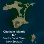
This project is a modified version of the Chatham_Islands.zip project which allows my landclass and airports to work seamlessly with the free Chatham Islands scenery available from Vector Land Class New Zealand. This package allows the user to switch back and forth easily between the different scenery combinations and also provides standalone Chatham and Pitt Island airports which can be used with the Vector Land Class (VLC) scenery on its own. It also allows the user to take advantage of the 15m terrain mesh and added water detail that comes with the VLC scenery. A modified Pitt Island AI runway is also included that is compatible with the 15m mesh. Chatham Islands/Tuuta Airport (NZCI), Napier (NZNR), and the Pitt Island Airstrip (NZPI) are included here. Scenery was created using Airport Design Editor X v1.47.07, SBuilderX 3.13, and the FSX Object Placement Tool. Scenery objects were added and modified from stock FSX scenery to resemble as closely as possible the actual airports.
| Filename: | Chatham_Islands_for_Vector_Land_Class_New_Zealand.zip |
| License: | Freeware |
| Added: | 15th July 2011, 21:54:43 |
| Downloads: | 931 |
| Author: | Carlyle Sharpe |
| Size: | 3.78 MB |
| Category: Flight Simulator 2004 - Scenery | |
| RAF Woodvale, EGOW |
|
File Description:
Back in January 2001 Danny Rowland of the AI Scenery Club released a freeware scenery of RAF Woodvale for use in FS2000. The files included in this zip will enable users to install this fine piece of scenery within FS2004 with all facilties working for AI traffic to inhabit RAF Woodvale.
This zip includes; AF2 file for Woodvale, fully tested flightplans, amended FS2004 default bgl file to prevent AI Traffic floating above ground level, especially for for users of Eddie Denney's freeware UK SRTM Mesh Scenery, I have not tested the scenery with the FS2004 default terrain mesh which I don't use.
Also included are screenshots of RAF UAS Bulldog aircraft "thrashing" the circuit at Woodvale, and full instructions of how to set this up for yourself, with locations of freeware aircraft and zip file names for you to download to achieve this.
Thanks once more to Danny Rowland for his Woodvale scenery, which incidentally does not show it's age when used in FS2004.
| Filename: | RAF_Woodvale_EGOW.zip |
| License: | Freeware, limited distribution |
| Added: | 11th March 2004, 20:45:52 |
| Downloads: | 1,425 |
| Author: | Bill Hughes |
| Size: | 202.42 KB |
| Category: Flight Simulator 2004 - Scenery | |
| Frozen rivers and lakes for winter ski operations along the Canada/USA border and Alaska |
|
Images related to this file:
File Description:
This "freezes" lakes and rivers in a wide strip along both sides of the Canadian and US border and part of Alaska (and is reversible with a tick in the FS9 library) and can be landed on with skis or wheels for winter operations. The area covered is from east of Quebec City to west of Calgary and Edmonton, with an extension north to cover Hudson Bay, so from from 70 west to 100 west and 40 north to 56 north (65 north in the Hudson Bay area). This includes large parts of Quebec, Ontario, Manitoba, Saskatchewan, Alberta, Michigan, Wisconsin, and Minnesota, and most of North Dakota and Montana, and the Alaska north shore and around Anchorage.
This is really for use with Ultimate Terrain, though it will work without it. But as UT is what gets all the lakes and rivers there and in the right place it would be a shame not to be using UT.
| Filename: | Frozen_rivers_and_lakes_for__winter_ski_operations.zip |
| License: | Freeware, limited distribution |
| Added: | 18th February 2010, 14:33:41 |
| Downloads: | 629 |
| Author: | Roger Wensley |
| Size: | 424.36 KB |
| Category: Flight Simulator 2004 - AI Aircraft | |
| Alaska Airlines - Boeing 737-900 wl |
|
File Description:
Boeing 737-900wl in Alaska Airlines repaint it has been realized for your FS2004 AI traffic.
| Filename: | Alaska_Airlines__Boeing_737900_wl.zip |
| License: | Freeware |
| Added: | 25th May 2008, 00:59:15 |
| Downloads: | 2,877 |
| Author: | Carlo Priori |
| Size: | 312.36 KB |
| Category: Flight Simulator 2004 - AI Aircraft | |
| Alaska Central Express Beechcraft 1900C |
|
File Description:
Beechcraft 1900C Alaska Central Express(two variants) for the Beechcraft 1900C AI model by Henry Tomkiewicz
| Filename: | Alaska_Central_Express_Beechcraft_1900C.zip |
| License: | Freeware |
| Added: | 19th December 2008, 00:07:13 |
| Downloads: | 2,399 |
| Author: | Mikhail Ankudinov |
| Size: | 967.32 KB |
| Category: Flight Simulator 2004 - AI Aircraft | |
| Tanana Air Service Piper PA31-325 Navajo |
|
Images related to this file:
File Description:
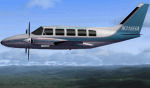
Tanana Air Service, McGrath, Alaska. Piper PA31-325 Navajo. Textures only. Model by Dee Waldron required.
| Filename: | Tanana_Air_Service_Piper_PA31325_Navajo.zip |
| License: | Freeware |
| Added: | 9th May 2010, 01:45:27 |
| Downloads: | 396 |
| Author: | Stefan Schroeder |
| Size: | 71.48 KB |
| Category: Flight Simulator 2004 - Aircraft Repaints, Textures and Modifications | |
| Alaska Airlines, Boeing 737-700w (N648AS) |
|
File Description:
High quality Alaska Airlines Boeing 737-700w repaint. To be used with iFly Boeing 737-800.
| Filename: | Alaska_Airlines_Boeing_737700w_N648AS.zip |
| License: | Freeware, limited distribution |
| Added: | 28th August 2010, 20:56:12 |
| Downloads: | 1,477 |
| Author: | Mateusz Stabryla - MK Studios |
| Size: | 9.99 MB |


© 2001-2026 AVSIM Online
All Rights Reserved
Privacy Policy |