
Where Flight Simulation Enthusiasts Gather from Around the World!
AVSIM Library - Search Results

| Category: Flight Simulator X - Scenery | |
| RAF Bottlesford - Lincolnshire, England |

|
File Description:
Royal Air Force Station Bottesford or more simply RAF Bottesford is a former Royal Air Force station located on the Leicestershire-Lincolnshire county border, 6.8 miles (10.9 km) north west of Grantham, Lincolnshire and 7.6 miles (12.2 km) south of Newark-on-Trent, Nottinghamshire and about 107 miles (172 km) north-northwest of London, England.
Opened in 1942, it was used by both the Royal Air Force (RAF) and United States Army Air Forces (USAAF). During the war it was used primarily as a troop carrier airfield for paratroopers and as a bomber airfield before closing in 1948.
Today the remains of the airfield are located on private property with the technical site being used as an industrial estate.
Third party add-on's will be required to see all the building included in the scenery, you will need Ted Andrews RAF Small Buildings and his hanger library, for the vehicles Ian Pearson FSX Object library will be required, the RAF Ensign hedges are the from Mike Hudson's scenery. All of which are available from Ian Pearsons' website; www.ianpsdarkcorner.co.uk.
| Filename: | RAF_Bottlesford___Lincolnshire_England.zip |
| License: | Freeware |
| Added: | 10th October 2015, 11:37:40 |
| Downloads: | 347 |
| Author: | Terry Boissel |
| Size: | 15.94 KB |
| Category: Flight Simulator X - Scenery | |
| Aeropuerto Internacional Ministro Pistarini (SAEZ), Buenos Aires, Argentina |
|
Images related to this file:
File Description:
This is a reasonably accurate and up-to-date version of Ezeiza International Airport, with two optional files and made only for FSX users, not suitable for use in P3D: There is one version with the Crosswind runway 11/29 activated where both runways will be used for takeoff/landing and one version as the default airport one runway operation: This update now includes the new terminal design and its gates, cargo ramp also updated, assigned parking as per their website where possible with extra parking including a Gate for the A380 (Gate 3) all gates now numbered correctly, taxiways and taxi signs updated to the latest charts, extra fuel trucks, support vehicle roads rebuilt and many other scenery improvements and objects added, airport views are from the roof of the control tower (when in tower view) please view the readme before installation
| Filename: | Aeropuerto_Internacional_Ministro_Pistarini_SAEZ_B.zip |
| License: | Freeware, limited distribution |
| Added: | 13th January 2021, 03:19:06 |
| Downloads: | 42,887 |
| Author: | Ray Smith |
| Size: | 2.26 MB |
| Category: Flight Simulator X - Scenery | |
| Airport update for Ninoy Aquino Intl (RPLL) Manila, Philippines |
|
Images related to this file:
File Description:
This is a reasonably accurate and up-to-date version of NAIA Intl Airport with two optional files made only for FSX users, not made or suitable for use in P3D: There is one version with the Crosswind runway activated where both runways will be used for takeoff/landing and one version as the default airport one runway operation: I have given this airport a complete makeover including all 4 terminals, all gates/parking numbered correctly where possible, assigned parking as per their website with extra overflow parking, new control tower, aprons, taxiways and taxi signs updated to the latest charts, extra fuel trucks, support vehicle roads rebuilt and many other scenery improvements and objects added, airport views are from inside the new control tower (when in tower view) please view the readme before installation.
| Filename: | Airport_update_for_Ninoy_Aquino_Intl_RPLL_Manila_P.zip |
| License: | Freeware, limited distribution |
| Added: | 21st July 2021, 01:27:21 |
| Downloads: | 42,887 |
| Author: | Ray Smith |
| Size: | 2.76 MB |
| Category: Flight Simulator X - Scenery | |
| Charlotte/Douglas Intl - KCLT - North Carolina, USA |
|
Images related to this file:
File Description:
This is a reasonably accurate and up-to-date version of Charlotte/Douglas Intl airport with two optional files made only for FSX users, do not use in P3D: There is one version with the Crosswind runway 5/23 activated where all 4 runways will be used for takeoff/landing and one version as the default airport runway operation: I have given this airport a complete makeover, assigned parking as per their website where possible with extra parking, the new northern extension for concourse A now included, taxiways and taxi signs updated to the latest charts, ILS approaches also updated to the latest charts where possible, extra fuel trucks, support vehicle roads rebuilt and many other scenery improvements and objects added, airport views are from the roof of the control tower (when in tower view) please view the readme before installation
| Filename: | CharlotteDouglas_Intl__KCLT___North_Carolina_USA.zip |
| License: | Freeware, limited distribution |
| Added: | 20th May 2020, 17:31:50 |
| Downloads: | 43,593 |
| Author: | Ray Smith |
| Size: | 5.38 MB |
| Category: Flight Simulator X - Scenery | |
| RAF Lasham Airfield |
|
File Description:
RAF Lasham opened in November 1942 as a Forward fighter airfield. It was situated 6 miles south east of Basingstoke in Hampshire. It was initally home to 38 Wing, Army Co-operation Command and was transferred to Fighter Command, in June 1943. The base became home to 175 Sqn flying Hurricanes and Typhoons, 181, 182 and 183 Sqns flying Typhoons, 412 and 602 Sqns with Spitfires. In August 1943 it was transferred to No 2 Group, Tactical AF, becoming home to 320 Sqn flying Mitchells, 107, 613 and 305 Sqns flying Mosquitoes. These squadrons were Heavily involved in Operations Overlord and Market Garden. In November 1944 Lasham was transfered to No 84 Group Support Unit and used for the training replacement aircrews. After the war it became a Group Disbandment Centre. and was fianlly home to 49 MU. and General Aircraft Ltd based servicing RAF Mosquitoes.
| Filename: | RAF_Lasham_Airfield.zip |
| License: | Freeware |
| Added: | 18th March 2009, 13:45:46 |
| Downloads: | 510 |
| Author: | Chris Smith |
| Size: | 1.04 MB |
| Category: Flight Simulator X - Scenery | |
| RAF Ridgewell airfield |
|
File Description:
RAF Ridgewell 71/z miles northwest of Halstead in Essex Was used by the US Eighth Air Force, which installed the 381st Bombardment Group and its four B-17s squadrons. The 381st remained at Ridgewell for two years during which time it flew 296 missions and lost 131 B-17s in action.Typical of World War II airfields Ridgewell had three crossed runways, main runway of 6000yd's and two more of 4200yd's. This was a busy airfield and one of the main B17 bases in England.
| Filename: | RAF_Ridgewell_airfield.zip |
| License: | Freeware |
| Added: | 22nd March 2009, 01:27:05 |
| Downloads: | 752 |
| Author: | Chris Smith |
| Size: | 224.22 KB |
| Category: Flight Simulator X - Scenery | |
| RAF Molesworth Update!!!! |
|
File Description:
This is a update to the original download I put up on January 16th 2009. Just unzip and place in the Addon Scenery/scenery folder and replace. If original was not downloaded then just download this one.
| Filename: | RAF_Molesworth_Update.zip |
| License: | Freeware |
| Added: | 21st January 2009, 01:21:12 |
| Downloads: | 567 |
| Author: | Scott Berge |
| Size: | 22.72 KB |
| Category: Flight Simulator X - Scenery | |
| RAF Mount Pleasant |
|
Images related to this file:
File Description:
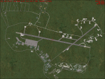
RAF Mount Pleasant (EGYP) in the Falkland Islands. It includes aircraft hangars, aircraft shelters, workshops, accomodation buildings, and the magazine areas. It includes night textures. It also requires the download and installation of some free third party libraries for best effect.
| Filename: | RAF_Mount_Pleasant.zip |
| License: | Freeware |
| Added: | 3rd December 2009, 23:57:26 |
| Downloads: | 3,384 |
| Author: | Mike hudson |
| Size: | 12.07 MB |
| Category: Flight Simulator X - Scenery | |
| RAF North Creake |
|
File Description:
RAF North Creake is a former Royal Air Force station located 3.3 miles (5.3 km) southwest of Wells-next-the-Sea, Norfolk and 5.7 miles (9.2 km) northwest of Fakenham, Norfolk, England.
Originally used in 1941 as a decoy site for RAF Docking, construction of this Class A airfield began in October 1942, with the station being provided with accommodation for 2,951 male and 411 female staff. The airfield had 36 loop type hardstandings, two T2 hangars and one B1 hangar.
By December 1943 the airfield had passed to 100 Group, although it did not immediately become operational as consideration was given to upgrading the airfield to Very Heavy Bomber Standard. In the event, this did not take place, with RAF Sculthorpe being selected for upgrade.
Short Stirling III's from 199 Squadron arrived in May 1944 to complete Window and Mandrel operations against enemy radar tracking of Bomber Command raids, however, in March 1945 these were changed to Handley Page Halifax III's. In September 1944, No. 199's 'C' Flight was used to re-form 171 Squadron, who contributed to 100 Group's radio counter-measures activities with Halifaxes.
The RAF relinquished the station in 1947, and the area is now used for agriculture, though some evidence of runways, buildings and facilities remains. Seventeen aircraft were lost from the airfield, eight Stirling's and nine Halifax's.
The control tower survives, and has been converted into a house, offering bed and breakfast.
Source: Wikipedia
| Filename: | RAF_North_Creake.zip |
| License: | Freeware |
| Added: | 13th February 2016, 12:50:51 |
| Downloads: | 238 |
| Author: | Terry Boissel |
| Size: | 1.73 MB |
| Category: Flight Simulator X - Scenery | |
| RAF Bradwell Bay |
|
File Description:
RAF Bradwell Bay is a former Royal Air Force station located 9.5 miles (15.3 km) east of Maldon, Essex, England and 3.1 miles (5.0 km) south west of West Mersea, Essex.
The airfield was first used as grass landing strip for the nearby firing ranges before being turned into a RAF station with concrete runways and hangars.The station is unique as it was the only fighter station where the Fog Investigation and Dispersal Operation (FIDO) was used.
Part of the site is currently being used by the Bradwell nuclear power station. Several of the hangars are still used as storage by the local farmers and the control tower is now a private house. Agricultural buildings, built in the '70s and '80s on runways one and two, are now home to several local businesses.
If you would like a more detailed history follow the following link. http://www.worldwar2heritage.com/en/page/9069/189/Bradwell-Bay-Airfield
| Filename: | RAF_Bradwell_Bay.zip |
| License: | Freeware |
| Added: | 26th January 2017, 20:05:03 |
| Downloads: | 139 |
| Author: | Terry Boissel |
| Size: | 18.06 MB |


© 2001-2026 AVSIM Online
All Rights Reserved
Privacy Policy |