
Where Flight Simulation Enthusiasts Gather from Around the World!
AVSIM Library - Search Results

| Category: Flight Simulator X - Scenery | |
| YWPE - Walpole, Western Australia |

|
File Description:
YWPE Walpole - a fire strip owned by the Department of Environment and Conservation - small portion of forest added. REQUIRES Blencowe_LibraryKit.zip
REQUIRES blencowe_librarykit_309494.zip (Available HERE)
| Filename: | YWPE__Walpole_Western_Australia.zip |
| License: | Freeware |
| Added: | 28th February 2013, 17:08:10 |
| Downloads: | 280 |
| Author: | Alan Blencowe |
| Size: | 1.93 MB |
| Category: Flight Simulator X - Scenery | |
| YMOA Moora, Western Australia |
|
File Description:
YMOA Moora is unusual in that the town strip exists as an easement on private property. REQUIRES Blencowe_LibraryKit.zip
REQUIRES blencowe_librarykit_309494.zip (Available HERE)
| Filename: | YMOA_Moora_Western_Australia.zip |
| License: | Freeware |
| Added: | 28th February 2013, 13:58:00 |
| Downloads: | 219 |
| Author: | Alan Blencowe |
| Size: | 2.7 MB |
| Category: Flight Simulator X - Scenery | |
| Kasane (FBKE), Botswana V2 |
|
File Description:
Elevation fix, corrected airport layout, scenery enhancements and GA AI traffic.
New in Version 2:
I try to learn modeling and FSX Materials to build my own airport buildings. I hope it's acceptable for the first try.
Furthermore, heading of the windsocks has been corrected, tower view has been corrected, minor improvements to the scenery and i made a freeway traffic exclude for the airport area.
| Filename: | Kasane_FBKE_Botswana_V2.zip |
| License: | Freeware |
| Added: | 18th January 2009, 17:46:56 |
| Downloads: | 1,876 |
| Author: | Nils Besemer |
| Size: | 4.14 MB |
| Category: Flight Simulator X - Scenery | |
| Aruba Patch |
|
File Description:
Queen Beatrix International Airport (TNCA) located in Oranjestad, Aruba. The terminal have been designed and are as realistic as possible.
To remove buildings on the taxiways
| Filename: | Aruba_Patch.zip |
| License: | Freeware |
| Added: | 9th June 2016, 22:43:12 |
| Downloads: | 1,593 |
| Author: | Michel Boivin |
| Size: | 13.26 MB |
| Category: Flight Simulator X - Scenery | |
| Aruba |
|
File Description:
Queen Beatrix International Airport (TNCA) located in Oranjestad, Aruba. The terminal have been designed and are as realistic as possible.
| Filename: | Aruba.zip |
| License: | Freeware |
| Added: | 9th June 2016, 22:42:58 |
| Downloads: | 684 |
| Author: | Michel Boivin |
| Size: | 13.26 MB |
| Category: Flight Simulator X - Scenery | |
| Lien Khuong Airport, Dalat, Vietnam |
|
Images related to this file:
File Description:
Lien Khuong Airport (IATA: DLI, ICAO: VVDL) (Vietnamese: Sân bay Liên KhÆ°Æ¡ng) is the largest among 4 airports of Lâm Äồng Province in the Central Highlands region of Vietnam. The airport is located in Äức Trá»ng District, about 30 km south of Da Lat. The major reconstruction in order to handle bigger aircraft was completed in December 2009. In here, there are Vietjet Air, Vietnam Airlines and Jetstar Pacific flying from and to here every day.
| Filename: | Lien_Khuong_Airport_Dalat_Vietnam.zip |
| License: | Freeware |
| Added: | 1st July 2017, 07:08:11 |
| Downloads: | 1,410 |
| Author: | VNFS |
| Size: | 10.12 MB |
| Category: Flight Simulator X - Scenery | |
| Hawes Aerial Operations Facility |
|
Images related to this file:
File Description:

Hawes Aerial Operations Facility is a reimagined version of an abandoned World War II auxiliary airstrip formerly known as Hawes AAF Aux #1. It was built in the mojave desert, just east of Edwards AFB (then Muroc AAF) during WWII as one of 4 satellite fields for Victorville AAF. After the war, Hawes as used as a private civilian airfield until it's closure in the early 1960's. It is now reborn in FSX as a UAV base by Nevada Systems. Due to it's location in the Mojave desert and the presence of many thermals in FSX, it was also used in production of the Aeroworks ARX-1 civilian glider concept. This scenery uses many custom macros as well as default macros from the Acceleration Expansion Pack, which is required for best performance. Scenery and custom macros by Joshua B. Nyhus and Jason L. Terry
| Filename: | Hawes_Aerial_Operations_Facility.zip |
| License: | Freeware |
| Added: | 7th December 2012, 15:58:27 |
| Downloads: | 539 |
| Author: | Jason L Terry and Josh Nyhus |
| Size: | 5.91 MB |
| Category: Flight Simulator X - Scenery | |
| FSX Scenery KCEF Westover ARB Massachusetts |
|
Images related to this file:
File Description:
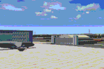
Custom built hangars and buildings for Westover Air Reserve Base
(formerly Westover AFB). Photoreal backdrops. Night lighting.
Terminal and other buildings with transparent windows for
interior views. Parking coded for MAIW East Coast C-5 package.
By Dan French.
| Filename: | FSX_Scenery_KCEF_Westover_ARB_Massachusetts.zip |
| License: | Freeware, limited distribution |
| Added: | 6th May 2022, 04:24:57 |
| Downloads: | 219 |
| Author: | Dan French |
| Size: | 24.14 MB |
| Category: Flight Simulator X - Scenery | |
| South America Mesh Scenery, MeshX_C5 |
|
File Description:
Mesh terrain scenery for the whole continental South America, based on SRTM 90m
dem geotiff files resampled to 76 meter of horizontal resolution (LOD 9). The new files have
improved the vertical resolution from 16m to 10m, resulting in more details
and accuracy over previous versions. There are 50 files, compatible with FS 9
and FS X, identified in a map by column letter and line number, covering the
contiguous countries and states. Boundaries: N = 11º 15' S; S = 16º 52.5' S;
E = 56º 15' W; W = 63º 45' W.
| Filename: | South_America_Mesh_Scenery_MeshX_C5.zip |
| License: | Freeware |
| Added: | 28th October 2006, 23:27:21 |
| Downloads: | 1,457 |
| Author: | Oséas Dourado and José Lôbo |
| Size: | 35.44 MB |
| Category: Flight Simulator X - Scenery | |
| South America Mesh Scenery, MeshX_C4 |
|
File Description:
Mesh terrain scenery for the whole continental South America, based on SRTM 90m
dem geotiff files resampled to 76 meter of horizontal resolution (LOD 9). The new files have
improved the vertical resolution from 16m to 10m, resulting in more details
and accuracy over previous versions. There are 50 files, compatible with FS 9
and FS X, identified in a map by column letter and line number, covering the
contiguous countries and states. Boundaries: N = 5º 37.5' S; S = 11º 15' S;
E = 56º 15' W; W = 63º 45' W.
| Filename: | South_America_Mesh_Scenery_MeshX_C4.zip |
| License: | Freeware |
| Added: | 28th October 2006, 23:27:57 |
| Downloads: | 1,442 |
| Author: | Oséas Dourado and José Lôbo |
| Size: | 39.66 MB |


© 2001-2026 AVSIM Online
All Rights Reserved
Privacy Policy |