
Where Flight Simulation Enthusiasts Gather from Around the World!
AVSIM Library - Search Results

| Category: Flight Simulator X - Scenery | |
| Mayaguana (MYMM) - The Bahamas |

|
Images related to this file:
File Description:
Mayaguana is the easternmost island in the Bahamas with Bahamasair providing Nassau and Inagua air connections. The airport utilizes part of an abandoned 11,000 foot USAF runway. The runway is listed as 7300 foot long, but 2400 feet on the east end is closed indefinitely. A new terminal building was completed, but no apron or taxiway connects it to the runway so it is unoccupied. Construction was started on another terminal, apron and taxiway as well as runway repaving, but the project is currently abandoned. All of the aforegoing is represented by this scenery. The scenery includes custom scenery objects; placement of library objects and landclass changes. Scenery is based on Bing Maps and photos taken locally, and it is optimized for use with UTX-TAC.
| Filename: | Mayaguana_MYMM__The_Bahamas.zip |
| License: | Freeware |
| Added: | 20th April 2013, 20:18:45 |
| Downloads: | 1,125 |
| Author: | Art Poole |
| Size: | 1.04 MB |
| Category: Flight Simulator X - Scenery | |
| OSDI Damascus fix 2 |
|
File Description:
Corrections for build crash Fsx Damascus scenery fix2.
| Filename: | OSDI_Damascus_fix_2.zip |
| License: | Freeware |
| Added: | 12th October 2008, 20:35:24 |
| Downloads: | 1,052 |
| Author: | vedat sencan |
| Size: | 538.87 KB |
| Category: Flight Simulator X - Scenery | |
| EGPR - Barra - UK Airfields - Volume 27 v2 |
|
Images related to this file:
File Description:
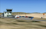
My volume 27 is a version 2 of my Barra-EGPR, which is on the foreshore of Traigh Mhor Bay, Island of Barra, Outer Hebrides, Scotland. For this update of my 2008 Barra I have replaced the original Generic buildings with custom made ones.The FSX Stock Barra is wrongly placed in the middle of the north end of the island. Landings are actually done on the sand in Traigh Mhor Bay at low tide.
I also enclose a small mod to my Vol.26 Lashenden in case anyone is still having problems removing the black unpainted static aircraft.
| Filename: | EGPR__Barra__UK_Airfields__Volume_27_v2.zip |
| License: | Freeware |
| Added: | 14th March 2013, 14:17:48 |
| Downloads: | 2,669 |
| Author: | Alf Denham |
| Size: | 2.84 MB |
| Category: Flight Simulator X - Scenery | |
| Mesh for St.Eustatius - Caribbean |
|
Images related to this file:
File Description:
This file "FSX_St-Eustatius_CARIBB_photo_scenery_MESH", partially handmade.
Requires: Photo_scenery of St.Eustatius (Statia) in the Caribbean with the airport F.D. Roosevelt (TNCE).
"FSX__St.Eustatius_CARIBB_photo_scenery.zip".
Optional : "FSX_St-Eustatius_CARIBB_photo_scenery_aditional_tanks2_OBX.zip"
| Filename: | Mesh_for_StEustatius__Caribbean.zip |
| License: | Freeware |
| Added: | 5th December 2012, 03:12:28 |
| Downloads: | 523 |
| Author: | Harald Sandvik |
| Size: | 172.35 KB |
| Category: Flight Simulator X - Scenery | |
| ITATIBA P1 - Photo Realistic Scenery |
|
File Description:
ITATIBA P1 - 1/2
This is the complement of Campinas to cover ITATIBA region. This scenery is composed by five parts. Folow instructions on Readme.txt and have a nice visual flight.
Is a good idea install the FSX Mesh South America parts F7 and F8 cordinates in the map to have the essential mesh terrain.
| Filename: | ITATIBA_P1__Photo_Realistic_Scenery.zip |
| License: | Freeware |
| Added: | 11th August 2008, 08:27:11 |
| Downloads: | 1,356 |
| Author: | Gilson A. Rocchetti |
| Size: | 47.69 MB |
| Category: Flight Simulator X - Scenery | |
| Hong Kong Photo Scenery |
|
File Description:
This photo scenery add-don covers the entire Hong Kong region and part of Shen Zhen. Terrain mesh is not included.
| Filename: | Hong_Kong_Photo_Scenery.zip |
| License: | Freeware, limited distribution |
| Added: | 27th August 2011, 19:54:29 |
| Downloads: | 7,514 |
| Author: | Alex Lo |
| Size: | 52.08 MB |
| Category: Flight Simulator X - Scenery | |
| Mesh South America / MeSA Galapagos |
|
File Description:
This terrain mesh file is a part of a whole project covering all the Continent of South America and some islands, divided in tiles identified in a map by its column (letters) and rows (numbers). Those files were multi-LOD compiled from 90m SRTM2 source data, reprocessed with 3DEM to remove voids and spikes, providing a 76.4m (LOD9) horizontal resolution topography intended for use only in FSX updated with SP1.
Although not well documented, to improve performance, the updated FSX loads DEM files in threads and only the closer terrain (about 5 NM from the point of view) is rendered in high detail, while at far distances FSX shows up its default low resolution mesh, when there is not a third part terrain mesh compiled in all others intermediate level of details (multi-LOD).
| Filename: | Mesh_South_America__MeSA_Galapagos.zip |
| License: | Freeware |
| Added: | 10th June 2007, 21:03:25 |
| Downloads: | 1,349 |
| Author: | Hely Heck Jr. and José Lôbo |
| Size: | 1.81 MB |
| Category: Flight Simulator X - Scenery | |
| Axalp / Ebenfluh |
|
Images related to this file:
File Description:
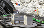
Axalp / Ebenfluh Shooting Range is unique in its location at 2200m above sea level in the Swiss Mountains, close to Meiringen AB. Each year during October, aviation enthusiasts make the arduous climb to enjoy this very special event. Scenery includes all buildings, targets, navaids, tower view, helicopter landing pads, animated flags and static helicopters. Requires FS Global 2008.
| Filename: | Axalp__Ebenfluh.zip |
| License: | Freeware |
| Added: | 22nd October 2010, 23:08:30 |
| Downloads: | 1,873 |
| Author: | Dave Torkington |
| Size: | 4.28 MB |
| Category: Flight Simulator X - Scenery | |
| Mesh South America / MeSA B09 |
|
File Description:
FSX Mesh South America Project:
This terrain mesh file is a part of a whole project covering all the Continent of South America and some islands, divided in tiles identified in a map by its column (letters) and rows (numbers).
Those files were multi-LOD compiled from 90m SRTM2 source data, reprocessed with 3DEM to remove voids and spikes, providing a 76.4m (LOD9) horizontal resolution topography intended for use only in FSX updated with SP1.
Although not well documented, to improve performance, the updated FSX loads DEM files in threads and only the closer terrain (about 5-10 NM from the point of view) is rendered in high detail, while at far distances FSX shows up its default low resolution mesh, when there is not a third part terrain mesh compiled in all others intermediate level of details (multi-LOD).
THIS FILE:
FSX_MeSA_B09 (Column B x Row 09
covers the area inside the boundaries:
N = 33º 45' S; S = 39º 22,5' S;
W = 82º 30' W; E = 75º 0' W;
AUTHORS:
Hely Heck Junior - Magrao ( [email protected] )
and Jose Lobo ( [email protected] )
TerraBrasilis: www.terra-brasilis.org
| Filename: | Mesh_South_America__MeSA_B09.zip |
| License: | Freeware |
| Added: | 11th June 2007, 22:11:00 |
| Downloads: | 1,197 |
| Author: | Hely Heck Jr. and José Lôbo |
| Size: | 1.53 MB |
| Category: Flight Simulator X - Scenery | |
| South America Mesh Scenery, MeshX_E3 |
|
File Description:
Mesh terrain scenery for the whole continental South America, based on SRTM 90m
dem geotiff files (at: ftp://ftp.glcf.umiacs.umd.edu/glcf/SRTM/Degree_Tiles/),
resampled to 76 meter of horizontal resolution (LOD 9). The new files have
improved the vertical resolution from 16m to 10m, resulting in more details
and accuracy over previous versions. There are 50 files, compatible with FS 9
and FS X, identified in a map by column letter and line number, covering the
contiguous countries and states. Boundaries: N = 0º 0' S; S = 5º 37.5' S;
E = 41º 15' W; W = 48º 45' W;
| Filename: | South_America_Mesh_Scenery_MeshX_E3.zip |
| License: | Freeware |
| Added: | 28th October 2006, 05:54:49 |
| Downloads: | 1,610 |
| Author: | Oséas Dourado and José Lôbo |
| Size: | 27.48 MB |


© 2001-2026 AVSIM Online
All Rights Reserved
Privacy Policy |