
Where Flight Simulation Enthusiasts Gather from Around the World!
AVSIM Library - Search Results

| Category: Flight Simulator X - Scenery | |
| Mayaguana (MYMM) - The Bahamas |

|
Images related to this file:
File Description:
Mayaguana is the easternmost island in the Bahamas with Bahamasair providing Nassau and Inagua air connections. The airport utilizes part of an abandoned 11,000 foot USAF runway. The runway is listed as 7300 foot long, but 2400 feet on the east end is closed indefinitely. A new terminal building was completed, but no apron or taxiway connects it to the runway so it is unoccupied. Construction was started on another terminal, apron and taxiway as well as runway repaving, but the project is currently abandoned. All of the aforegoing is represented by this scenery. The scenery includes custom scenery objects; placement of library objects and landclass changes. Scenery is based on Bing Maps and photos taken locally, and it is optimized for use with UTX-TAC.
| Filename: | Mayaguana_MYMM__The_Bahamas.zip |
| License: | Freeware |
| Added: | 20th April 2013, 20:18:45 |
| Downloads: | 1,125 |
| Author: | Art Poole |
| Size: | 1.04 MB |
| Category: Flight Simulator X - Scenery | |
| Tokyo Skytree |
|
Images related to this file:
File Description:
Tokyo Skytree is the 2nd tallest completed skyscraper in the world. Built in 2012, it is not included in the default FSX scenery. This addon places it into FSX. It has not been tested with other Tokyo sceneries, however it should still work.
Modeled with Blender and converted with ModelConverterX.
| Filename: | Tokyo_Skytree.zip |
| License: | Freeware |
| Added: | 16th November 2019, 22:05:14 |
| Downloads: | 723 |
| Author: | Jeremy Sletmen |
| Size: | 2.72 MB |
| Category: Flight Simulator X - Scenery | |
| Argentine |
|
File Description:
This is the first FSX upgrade for the VM Project. This are very operative airport of Republica Argentina (SABE, SAEZ, SAZB, SADF, SADQ, SADD, SAAP, SADL, SAZF, and SAZH), with all navaids and the objects in this correct place. This is not photorealistic scenery. ONLY FOR FSX. Building with SceneGenX 1.0 Build 61 of Tom Hiscox and some objects of RWY12.
| Filename: | Argentine.zip |
| License: | Freeware, limited distribution |
| Added: | 12th March 2007, 01:14:32 |
| Downloads: | 7,420 |
| Author: | carlos maida |
| Size: | 873.11 KB |
| Category: Flight Simulator X - Scenery | |
| Mesh South America / MeSA Islands |
|
File Description:
FSX Mesh South America Project:
This terrain mesh file is a part of a whole project covering all the Continent of South America and some islands, divided in tiles identified in a map by its column (letters) and rows (numbers).
Those files were multi-LOD compiled from 90m SRTM2 source data, reprocessed with 3DEM to remove voids and spikes, providing a 76.4m (LOD9) horizontal resolution topography intended for use only in FSX updated with SP1.
Although not well documented, to improve performance, the updated FSX loads DEM files in threads and only the closer terrain (about 5 NM from the point of view) is rendered in high detail, while at far distances FSX shows up its default low resolution mesh, when there is not a third part terrain mesh compiled in all others intermediate level of details (multi-LOD).
THIS FILE: FSX_MeSA_Islands (Ascencion, Georgia, Gough and Trindade)
| Filename: | Mesh_South_America__MeSA_Islands.zip |
| License: | Freeware |
| Added: | 10th June 2007, 23:59:44 |
| Downloads: | 1,141 |
| Author: | Hely Heck Junior and José Lôbo |
| Size: | 2.75 MB |
| Category: Flight Simulator X - Scenery | |
| Ferihegy Intl Airport - LHBP - Budapest, Hungary |
|
Images related to this file:
File Description:
This scenery is for Ferihegy Airport to reflect the changes taking place there and made only for FSX: The terminal and its concourses completely rebuilt which includes the new pier B with all the gates correctly numbered, assigned parking as per their website with extra parking, new control tower, taxiways and taxi signs updated and corrected to the latest charts, extra fuel trucks, support vehicle roads rebuilt and many other scenery improvements and objects added, airport views are from the roof of the control tower (when in tower view) please view the readme before installation.
| Filename: | Ferihegy_Intl_Airport__LHBP__Budapest_Hungary.zip |
| License: | Freeware, limited distribution |
| Added: | 4th September 2017, 23:33:17 |
| Downloads: | 26,316 |
| Author: | Ray Smith |
| Size: | 2.02 MB |
| Category: Flight Simulator X - Scenery | |
| Nordhorn Air To Ground Weapon Range EDR-37A |
|
Images related to this file:
File Description:
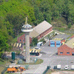
Nordhorn Air To Ground Weapon Range EDR-37A for FSX SP2/Acceleration/P3D V2.X & V3.X.
Features in this version:
- Accurate Targets and its locations;
- Accurate Building incl. Range Tower;
- Accurate Landclass based on photoreal ground (no photoreal background included)
| Filename: | Nordhorn_Air_To_Ground_Weapon_Range_EDR37A.zip |
| License: | Freeware, limited distribution |
| Added: | 27th April 2016, 15:37:22 |
| Downloads: | 627 |
| Author: | Felix Gradtke |
| Size: | 1.51 MB |
| Category: Flight Simulator X - Scenery | |
| Mesh South America / MeSA A01 |
|
File Description:
FSX Mesh South America Project:
This terrain mesh file is a part of a whole project covering all the Continent of South America and some islands, divided in tiles identified in a map by its column (letters) and rows (numbers).
Those files were multi-LOD compiled from 90m SRTM2 source data, reprocessed with 3DEM to remove voids and spikes, providing a 76.4m (LOD9) horizontal resolution topography intended for use only in FSX updated with SP1.
Although not well documented, to improve performance, the updated FSX loads DEM files in threads and only the closer terrain (about 5 NM from the point of view)is rendered in high detail, while at far distances FSX shows up its default low resolution mesh, when there is not a third part terrain mesh compiled in all others intermediate level of details (multi-LOD).
THIS FILE: FSX_MeSA_A01
(Column A x Row 01)
This file covers the area inside the boundaries:
N = 16º 52,5' N; S = 11º 15' N;
W = 90º 0' W; E = 82º 30' W;
AUTHORS:
Hely Heck Junior - Magrao ( [email protected] )
and Jose Lobo ( [email protected] )
TerraBrasilis: www.terra-brasilis.org
| Filename: | Mesh_South_America__MeSA_A01.zip |
| License: | Freeware |
| Added: | 11th June 2007, 00:03:00 |
| Downloads: | 1,960 |
| Author: | Hely Heck Jr. and José Lôbo |
| Size: | 49.55 MB |
| Category: Flight Simulator X - Scenery | |
| Mesh South America / MeSA B06 |
|
File Description:
FSX Mesh South America Project:
This terrain mesh file is a part of a whole project covering all the Continent of South America and some islands, divided in tiles identified in a map by its column (letters) and rows (numbers).
Those files were multi-LOD compiled from 90m SRTM2 source data, reprocessed with 3DEM to remove voids and spikes, providing a 76.4m (LOD9) horizontal resolution topography intended for use only in FSX updated with SP1.
Although not well documented, to improve performance, the updated FSX loads DEM files in threads and only the closer terrain (about 5-10 NM from the point of view) is rendered in high detail, while at far distances FSX shows up its default low resolution mesh, when there is not a third part terrain mesh compiled in all others intermediate level of details (multi-LOD).
THIS FILE:
FSX_MeSA_B06 (Column B x Row 06)
This file covers the area inside the boundaries:
N = 11º 15' S; S = 16º 52,5' S;
W = 82º 30' W; E = 75º 0' W;
AUTHORS:
Hely Heck Junior - Magrao ( [email protected] )
and Jose Lobo ( [email protected] )
TerraBrasilis: www.terra-brasilis.org
| Filename: | Mesh_South_America__MeSA_B06.zip |
| License: | Freeware |
| Added: | 11th June 2007, 22:10:10 |
| Downloads: | 1,425 |
| Author: | Hely Heck Jr. and José Lôbo |
| Size: | 12.99 MB |
| Category: Flight Simulator X - Scenery | |
| South America Mesh Scenery, MeshX_E7 |
|
File Description:
Mesh terrain scenery for the whole continental South America, based on SRTM 90m
dem geotiff files (at: ftp://ftp.glcf.umiacs.umd.edu/glcf/SRTM/Degree_Tiles/),
resampled to 76 meter of horizontal resolution (LOD 9). The new files have
improved the vertical resolution from 16m to 10m, resulting in more details
and accuracy over previous versions. There are 50 files, compatible with FS 9
and FS X, identified in a map by column letter and line number, covering the
contiguous countries and states. Boundaries: N = 22º 30' S; S = 28º 7.5' S;
E = 41º 15' W; W = 48º 45' W.
| Filename: | South_America_Mesh_Scenery_MeshX_E7.zip |
| License: | Freeware |
| Added: | 28th October 2006, 15:08:43 |
| Downloads: | 1,805 |
| Author: | Oséas Dourado and José Lôbo |
| Size: | 12.69 MB |
| Category: Flight Simulator X - Scenery | |
| South America Mesh Scenery, MeshX_D3 |
|
File Description:
Mesh terrain scenery for the whole continental South America, based on SRTM 90m
dem geotiff files resampled to 76 meter of horizontal resolution (LOD 9). The new files have
improved the vertical resolution from 16m to 10m, resulting in more details
and accuracy over previous versions. There are 50 files, compatible with FS 9
and FS X, identified in a map by column letter and line number, covering the
contiguous countries and states. Boundaries: N = 0º 0' S; S = 5º 37.5' S;
E = 48º 45' W; W = 56º 15' W.
| Filename: | South_America_Mesh_Scenery_MeshX_D3.zip |
| License: | Freeware |
| Added: | 28th October 2006, 19:50:25 |
| Downloads: | 1,478 |
| Author: | Oséas Dourado and José Lôbo |
| Size: | 38.77 MB |


© 2001-2026 AVSIM Online
All Rights Reserved
Privacy Policy |