
Where Flight Simulation Enthusiasts Gather from Around the World!
AVSIM Library - Search Results

| Category: Flight Simulator X - Scenery | |
| KPEO - Penn Yan Airport - Penn Yan, NY |

|
Images related to this file:
File Description:
Here is an improved version of the stock Penn Yan Airport. I adjusted aprons, taxiways and added roads to match the actual airport. I replaced every default building, added static vehicles, aircraft and other objects. Adjusted the boundary fence and made cuts where the fence crossed roads.
Penn Yan Airport is located on the shore of Keuka Lake, is owned by Yates County, and is home to Seneca Flight Operations.
| Filename: | KPEO__Penn_Yan_Airport__Penn_Yan_NY.zip |
| License: | Freeware |
| Added: | 7th December 2009, 10:37:29 |
| Downloads: | 603 |
| Author: | Jim Cook |
| Size: | 7.71 KB |
| Category: Flight Simulator X - Scenery | |
| Ota Air Base |
|
File Description:
The Ota Air Base (BA2), created on December 31, 1937, was inaugurated on April 14, 1940, near the town of Ota, about 50KM from Lisbon (Portugal). Lodged aircraft such as Gloster Gladiator, Junkers JU-52, Junkers JU-86, Hawker Hurricane and Supermarine Spitfire. In 1953 are received the first jet aircraft of FAP, two De Havilland Vampire and the first 25 planes Republic F-84 G Thunderjet, making BA2 the most important Air Force Base until the end of the 1950s. In 1960 the BA2 changed radically, no longer a basis for an Operational Base Instruction. In November 1976 was created the Centro de Instrucao 2 (CI2), for elementary education pilot (with DHC Chipmunk), radar experts and the integration of training schools and military preparation technique. In 1992 the designation of Air Base 2 is amended to Centro de Formacao Militar e Tecnica da Forca Aerea (CFMTFA) which gives the training military, humanistic, scientific and technical staff of the Air Force, whose scope is not covered by other organs of the Air Force, with the aerodrome is currently closed to air activity. This scenery was the fact that it has in the FS aircraft that operated in Ota, such as the DHC Chipmunk, the Republic F-84G or the Junkers Ju-52. This scenary was made in ADE9X. Tested in FSX, I do not know if it works in FS2004.
| Filename: | Ota_Air_Base.zip |
| License: | Freeware |
| Added: | 8th December 2009, 01:09:33 |
| Downloads: | 1,849 |
| Author: | Jorge Ferreira |
| Size: | 1.35 MB |
| Category: Flight Simulator X - Scenery | |
| Quebec Elevation 38m (LOD10) (2/5) |
|
File Description:
FSX 38m (Lod10) terrain mesh files of the province of Quebec, Canada (range : N45-N52, W56-W80) (5 zip files).
**********************
Donnees d'elevation de terrain (FSX - 38 metres) de la province de Quebec, Canada (couverture : N45-N52, W56-W80)
| Filename: | Quebec_Elevation_38m_LOD10_25.zip |
| License: | Freeware, limited distribution |
| Added: | 22nd December 2009, 12:28:21 |
| Downloads: | 6,474 |
| Author: | Gilles Gauthier |
| Size: | 44.94 MB |
| Category: Flight Simulator X - Scenery | |
| Quebec Elevation 38m (LOD10) (4/5) |
|
File Description:
FSX 38m (Lod10) terrain mesh files of the province of Quebec, Canada (range : N45-N52, W56-W80) (5 zip files).
*************************
Donnees d'elevation de terrain (FSX - 38 metres) de la province de Quebec, Canada (couverture : N45-N52, W56-W80)
| Filename: | Quebec_Elevation_38m_LOD10_45.zip |
| License: | Freeware, limited distribution |
| Added: | 22nd December 2009, 12:33:37 |
| Downloads: | 2,940 |
| Author: | Gilles Gauthier |
| Size: | 43.2 MB |
| Category: Flight Simulator X - Scenery | |
| Everglades Airpark Florida U.S.A |
|
Images related to this file:
File Description:
This is Everglades airpark in Florida U.S.A.It is freeware and made from custom designed hangars and buildings.I also used default FSX scenery librarys.Everglades Airpark is situated in the Everglades region (Colier County) in Florida U.S.A.Immediately outside the environs of this 29-acre airpark are a number of environmentally sensitive, protected lands. The airpark is situated immediately southwest of the Big Cypress National Preserve, and is surrounded on three sides by the waters of Everglades National Park.
| Filename: | Everglades_Airpark_Florida_USA.zip |
| License: | Freeware |
| Added: | 26th December 2009, 02:14:05 |
| Downloads: | 1,029 |
| Author: | Jacques Botha |
| Size: | 301.37 KB |
| Category: Flight Simulator X - Scenery | |
| Springhill Aerodrome (New Zealand) |
|
Images related to this file:
File Description:
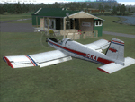
SpringHill (ICAO: NZSL) is a small airstrip between Warkworth and Wellsford, north of Auckland in New Zealand. It is privately owned tarseal strip with offset thresholds giving usable landing lengths of 680m and 700m for RWY 16 and 34 respectively, a width of 10m and a group rating of 5. The runway is aligned 16/34. The tar seal strip is supplemented by a grass strip of the same length but 30m wide. No night lighting or fuel is available.
I decided to model it after doing a roadtrip north of Auckland and taking lots of reference photos of the smaller airfields suitable for the size of aircraft I fly in real life. I am also planning to model Parakai aerodrome in the near future and Kaipara flats has already been modelled.
It contains fully custom Gmax buildings and phototextures.
| Filename: | Springhill_Aerodrome_New_Zealand.zip |
| License: | Freeware, limited distribution |
| Added: | 28th December 2009, 11:49:01 |
| Downloads: | 1,142 |
| Author: | Tim Barnes (Visualise IT) |
| Size: | 1.11 MB |
| Category: Flight Simulator X - Scenery | |
| Astor Column JJAC |
|
File Description:
The Astoria Column was erected in 1926 at an elevation of 600 feet atop Coxcomb Hill, the location of the first permanent American Settlement west of the Rockies. It has been listed in the National Register of Historic Places since 1974, and was refurbished in 1995. This impressive Oregon Coast historical monument is the only one of its kind in the world!
JJAC will place you at the foot of the tower. You can also reach it, of course, from Astoria, OR. Enjoy. e-mail is in astor.txt if you wish to contact me. Bob
| Filename: | Astor_Column_JJAC.zip |
| License: | Freeware |
| Added: | 29th December 2009, 01:24:12 |
| Downloads: | 401 |
| Author: | Robert Lacy |
| Size: | 4.57 MB |
| Category: Flight Simulator X - Scenery | |
| Enhanced Shore waves for FSX and FS2004 |
|
Images related to this file:
File Description:
The default waves are too small, not random enough, they flicker like a tadpole tail, and move about 100 mph. These new ones are slower, more randon in shape and size, and move eventually into shore for a more realistic effect and not as cartoony.
| Filename: | Enhanced_Shore_waves_for_FSX_and_FS2004.zip |
| License: | Freeware |
| Added: | 29th December 2009, 14:26:37 |
| Downloads: | 4,420 |
| Author: | David Cotton |
| Size: | 76.72 KB |
| Category: Flight Simulator X - Scenery | |
| CTH3 Canada, Quebec, Les Grandes-Bergeronnes |
|
Images related to this file:
File Description:
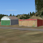
This is the scenery Les Grandes Bergeronnes ( CTH3 ) which represents the reality. Les Grandes Bergeronnes is a small village located on Northern bank of the St-Laurent river of Quebec at Canada. This scenery is design with FSDS and it accepts Mesh of Gilles Gauthier.This scenery has the function for FS-X.
| Filename: | CTH3_Canada_Quebec_Les_GrandesBergeronnes.zip |
| License: | Freeware |
| Added: | 31st December 2009, 04:53:04 |
| Downloads: | 567 |
| Author: | Regis Dassylva |
| Size: | 725.14 KB |
| Category: Flight Simulator X - Scenery | |
| CYLP Canada, Quebec, Longue-Pointe de Mingan |
|
Images related to this file:
File Description:
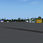
This scenery represents real the airport of Longue-Pointe of Mingan (CYLP).I carried out this scenery with FSDS. Longue-Pointe of Mingan is localised on northern bank of the St-Laurent river in Quebec, Canada. This scenery is built for FS-X.
| Filename: | CYLP_Canada_Quebec_LonguePointe_de_Mingan.zip |
| License: | Freeware |
| Added: | 31st December 2009, 04:53:13 |
| Downloads: | 2,295 |
| Author: | Regis Dassylva |
| Size: | 4.86 MB |


© 2001-2026 AVSIM Online
All Rights Reserved
Privacy Policy |