
Where Flight Simulation Enthusiasts Gather from Around the World!
AVSIM Library - Search Results

| Category: Flight Simulator X - Scenery | |
| South America Mesh Scenery, MeshX_C10 |

|
File Description:
Mesh terrain scenery for the whole continental South America, based on SRTM 90m
dem geotiff files (at: ftp://ftp.glcf.umiacs.umd.edu/glcf/SRTM/Degree_Tiles/),
resampled to 76 meter of horizontal resolution (LOD 9). The new files have
improved the vertical resolution from 16m to 10m, resulting in more details
and accuracy over previous versions. There are 50 files, compatible with FS 9
and FS X, identified in a map by column letter and line number, covering the
contiguous countries and states. Boundaries: N = 39º 22.5' S; S = 45º 0' S;
E = 56º 15' W; W = 63º 45' W.
| Filename: | South_America_Mesh_Scenery_MeshX_C10.zip |
| License: | Freeware |
| Added: | 29th October 2006, 03:14:25 |
| Downloads: | 1,724 |
| Author: | Oséas Dourado and José Lôbo |
| Size: | 3.74 MB |
| Category: Flight Simulator X - Scenery | |
| Whales in the Ocean V1.0 |
|
File Description:
This is a SimConnect EXE file that adds Humpback Whales off the coast of Nova Scotia. They travel off the coast near Halifax - See if you can find them - Lat/Long Hint provided in the Readme.
| Filename: | Whales_in_the_Ocean_V10.zip |
| License: | Freeware |
| Added: | 29th October 2006, 03:14:45 |
| Downloads: | 1,725 |
| Author: | Ron Haertel |
| Size: | 145.8 KB |
| Category: Flight Simulator X - Scenery | |
| Alderney Airport (EGJA) |
|
File Description:
Alderney Airport (EGJA) is located on the island of Alderney in the Channel Islands. I have travelled in and out of the island on many occasions and, despite the lack general lack of information on the internet about the airport, this is a pretty accurate representation. Features include accurate control tower, accurate terminal building, grass parking area, static aircraft, ground vehicles, car park, fire-station, surrounding trees, perimeter fencing and more. Many night textures and custom AFCAD file included. The airport is at N49 42 44 and W002 12 88. This scenery is for FSX but should also work under FS2004. It may even work in earlier versions of FS but this is untested.
| Filename: | Alderney_Airport_EGJA.zip |
| License: | Freeware, limited distribution |
| Added: | 29th October 2006, 03:17:06 |
| Downloads: | 8,387 |
| Author: | Tim Clayton |
| Size: | 2.29 MB |
| Category: Flight Simulator X - Scenery | |
| Liverpool John Lennon (Speke) Airport (EGGP) Ver 5.0 |
|
Images related to this file:
File Description:
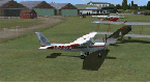
This all new version has been specifically created to fit with the Default FSX airport layout, as I'm currently unable to edit the AFD to make it more realistic!!
Version 5.0 contains all new buildings and textures including full night textures. The buildings have been produced in-line with the FSX SDK using Blender and Gmax. This scenery will only work with FSX.
Thanks go to Peter Leadbeater for testing the scenery prior to release (and for the ever present windsock!).
Special thanks also go to Dave Graham and the rest of the guys at North West Air News without whose photo's and information none of my scenery would exist!
| Filename: | Liverpool_John_Lennon_Speke_Airport_EGGP_Ver_50.zip |
| License: | Freeware |
| Added: | 29th October 2006, 10:33:55 |
| Downloads: | 10,981 |
| Author: | Paul Derbyshire |
| Size: | 3.58 MB |
| Category: Flight Simulator X - Scenery | |
| Derbosoft Scenery Patches for FSX Ver 1.0 |
|
File Description:
These files are designed to improve the compatibility of my various Landmark and Liverpool City Centre scenery packages with FSX.
| Filename: | Derbosoft_Scenery_Patches_for_FSX_Ver_10.zip |
| License: | Freeware |
| Added: | 29th October 2006, 10:36:22 |
| Downloads: | 4,893 |
| Author: | Paul Derbyshire |
| Size: | 186.49 KB |
| Category: Flight Simulator X - Scenery | |
| South America Mesh Scenery, MeshX_Z234 |
|
File Description:
Mesh terrain scenery for the whole continental South America, based on SRTM 90m
dem geotiff files resampled to 76 meter of horizontal resolution (LOD 9). The new files have
improved the vertical resolution from 16m to 10m, resulting in more details
and accuracy over previous versions. There are 50 files, compatible with FS 9
and FS X, identified in a map by column letter and line number, covering the
contiguous countries and states. Boundaries: N = 1º 24.375' N; S = 8º 26.25' S;
E = 78º 45' W; W = 82º 30' W.
| Filename: | South_America_Mesh_Scenery_MeshX_Z234.zip |
| License: | Freeware |
| Added: | 29th October 2006, 10:41:03 |
| Downloads: | 1,657 |
| Author: | Oséas Dourado and José Lôbo |
| Size: | 19.95 MB |
| Category: Flight Simulator X - Scenery | |
| South America Mesh Scenery, MeshX_A3 |
|
File Description:
Mesh terrain scenery for the whole continental South America, based on SRTM 90m
dem geotiff files (at: ftp://ftp.glcf.umiacs.umd.edu/glcf/SRTM/Degree_Tiles/),
resampled to 76 meter of horizontal resolution (LOD 9). The new files have
improved the vertical resolution from 16m to 10m, resulting in more details
and accuracy over previous versions. There are 50 files, compatible with FS 9
and FS X, identified in a map by column letter and line number, covering the
contiguous countries and states. Boundaries: N = 0º 0' S; S = 5º 37.5' S;
E = 71º 15' W; W = 78º 45' W.
| Filename: | South_America_Mesh_Scenery_MeshX_A3.zip |
| License: | Freeware |
| Added: | 29th October 2006, 15:43:18 |
| Downloads: | 1,980 |
| Author: | Oséas Dourado and José Lôbo |
| Size: | 37.85 MB |
| Category: Flight Simulator X - Scenery | |
| South America Mesh Scenery MeshX_A9 |
|
File Description:
Mesh terrain scenery for the whole continental South America, based on SRTM 90m
dem geotiff files resampled to 76 meter of horizontal resolution (LOD 9). The new files have
improved the vertical resolution from 16m to 10m, resulting in more details
and accuracy over previous versions. There are 50 files, compatible with FS 9
and FS X, identified in a map by column letter and line number, covering the
contiguous countries and states. Boundaries: N = 33º 45' S; S = 39º 22.5' S;
E = 71º 15' W; W = 78º 45' W.
| Filename: | South_America_Mesh_Scenery_MeshX_A9.zip |
| License: | Freeware |
| Added: | 30th October 2006, 00:33:36 |
| Downloads: | 2,132 |
| Author: | Oséas Dourado and José Lôbo |
| Size: | 12.6 MB |
| Category: Flight Simulator X - Scenery | |
| South America Mesh Scenery MeshX_A10 |
|
File Description:
Mesh terrain scenery for the whole continental South America, based on SRTM 90m
dem geotiff files resampled to 76 meter of horizontal resolution (LOD 9). The new files have
improved the vertical resolution from 16m to 10m, resulting in more details
and accuracy over previous versions. There are 50 files, compatible with FS 9
and FS X, identified in a map by column letter and line number, covering the
contiguous countries and states. Boundaries: N = 39º 22.5' S; S = 45º 0' S;
E = 71º 15' W; W = 78º 45' W.
| Filename: | South_America_Mesh_Scenery_MeshX_A10.zip |
| License: | Freeware |
| Added: | 30th October 2006, 00:49:28 |
| Downloads: | 2,803 |
| Author: | Oséas Dourado and José Lôbo |
| Size: | 17.38 MB |
| Category: Flight Simulator X - Scenery | |
| South America Mesh Scenery, MeshX_B11 |
|
File Description:
Mesh terrain scenery for the whole continental South America, based on SRTM 90m
dem geotiff files (at: ftp://ftp.glcf.umiacs.umd.edu/glcf/SRTM/Degree_Tiles/),
resampled to 76 meter of horizontal resolution (LOD 9). The new files have
improved the vertical resolution from 16m to 10m, resulting in more details
and accuracy over previous versions. There are 50 files, compatible with FS 9
and FS X, identified in a map by column letter and line number, covering the
contiguous countries and states. Boundaries: N = 45º 0' S; S = 50º 37.5' S;
E = 63º 45' W; W = 71º 15' W.
| Filename: | South_America_Mesh_Scenery_MeshX_B11.zip |
| License: | Freeware |
| Added: | 30th October 2006, 05:44:41 |
| Downloads: | 1,843 |
| Author: | Oséas Dourado, José Lôbo |
| Size: | 19.15 MB |


© 2001-2026 AVSIM Online
All Rights Reserved
Privacy Policy |