
Where Flight Simulation Enthusiasts Gather from Around the World!
AVSIM Library - Search Results

| Category: Flight Simulator 2004 - Scenery | |
| Lake Powell, Navajo Mountain (04UT), Utah/Arizona, Photo-Scenery (FS9 & FSX) |

|
Images related to this file:
File Description:
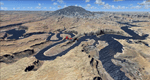
This package contains the center of Lake Powell and the Navajo Nation around Navajo Mountain. It contains remote areas of stunning beauty. Wonderful sandstone formations in bright shades of red and pink. Contains landmarks like the Rainbow Bridge National Monument and the confluence of the Colorado and San Juan Rivers. Extends my Monument Valley scenery to the west and brings you another 3.500 sq km in 4.7m/pix quality. To explore the scenery depart from Navajo Mountain dirt strip (04UT). High resolution versions of this scenery for FS9 and FSX (much sharper, but larger and multiple downloads) are available at www.blueskyscenery.com/CNY_South3West2.html . The screenies are taken from the high-res versions, so expect this version to be slightly more blurry. YourDonation@Work: Joaquin, Donald and Scott.
| Filename: | Lake_Powell_Navajo_Mountain_04UT_UtahArizona_Photo.zip |
| License: | Freeware, limited distribution |
| Added: | 23rd January 2010, 23:06:49 |
| Downloads: | 1,790 |
| Author: | Gottfried Razek - blueskyscenery.com |
| Size: | 91.43 MB |
| Category: Flight Simulator 2004 - Scenery | |
| Modified SRTM relief 76 m for Slovakia |
|
File Description:
This Slovak terrain mesh 76 m (LOD9) is made from the 3arc-sec SRTM. The voids in the source data were filled by the interpolation. Both the primary processing of the 3arc-sec data and the rendering of the terrain in the FS cause flattening and simplifying of the real shape of the terrain. This phenomenon was partially compensated by the sharpening of the source data.
Made by the programs Surfer (Golden Software) and MS Terrain SDK 2000 and 2002. The relief covers the area N49.9219 E016.1719 to N47.4609 E022.9687 in the boundaries of the LOD9 quadrants. This scenery contains only the elevation data. The other elements of the basic terrain as the landclass, locally used airborne photos, vector roads, rivers and lakes are available in different sceneries by other authors and they are continuously developed.
| Filename: | Modified_SRTM_relief_76_m_for_Slovakia.zip |
| License: | Freeware, limited distribution |
| Added: | 28th May 2010, 19:40:13 |
| Downloads: | 4,609 |
| Author: | Vladimir Stoje |
| Size: | 19.36 MB |
| Category: Flight Simulator 2004 - Scenery | |
| Italy, Campania 2, Naples (Napoli), Photo Real |
|
Images related to this file:
File Description:
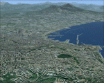
Campania, Italy, Photoreal Scenery Part 2 Naples (Napoli).
The photoreal scenery covers a great area of Campania around the city of Naples (Napoli). The airports of Napoli (ICAO code LINR) and Pontecagnano (LIRI) are founds inside the scenery (see map). For the best results, use it in association with other parts of Campania photoreal: Campania 1 Caserta, Campania 3 San Severo, Campania 4 Benevento, Campania 5 Melfi, Campania 6 Palinuro.
| Filename: | Italy_Campania_2_Naples_Napoli_Photo_Real.zip |
| License: | Freeware |
| Added: | 31st May 2010, 17:41:08 |
| Downloads: | 9,686 |
| Author: | Fulvio Mazzokan |
| Size: | 75.74 MB |
| Category: Flight Simulator 2004 - Scenery | |
| Alps LOD10 Topo Mesh - Austria and Italy |
|
Images related to this file:
File Description:
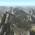
Yet another terrain mesh package of the European Alps? Well, this one is different in that it is NOT primarily based on the Shuttle Radar (SRTM) data with their incomplete coverage of prominent peaks and ridges. Instead, most of the source data for this project were developed over many months by Jonathan de Ferranti using detailed topographic maps. While Jonathan's work is unrelated to flight simulation he kindly gave me permission to compile his data for use in FS. The result is a wonderful improvement in detail and accuracy over any existing SRTM- or DTED-based mesh file, freeware or commercial (a link to an extensive set of screenshot comparisons is included in the read-me file).
I've compiled the source data at LOD10 (38-m) grid resolution because the coverage area is smaller than most existing mesh files. Thus, anyone can use these files without having to first uninstall their current mesh set. Also included are LOD9 and LO8 buffer mesh files. Note: if you own Austria Professional 2004 with its 1:50,000 scale terrain mesh then you don't need this package!
| Filename: | Alps_LOD10_Topo_Mesh__Austria_and_Italy.zip |
| License: | Freeware, limited distribution |
| Added: | 30th May 2010, 09:46:58 |
| Downloads: | 62,961 |
| Author: | Holger Sandmann, Jonathan de Ferranti |
| Size: | 73.32 MB |
| Category: Flight Simulator 2004 - Scenery | |
| Italy, Liguria 1, La Spezia, Photo Real |
|
File Description:
Liguria, Italy, Photoreal Scenery Part 1 (La Spezia).
The photoreal scenery covers a great area of Liguria around the city of La Spezia. The airport of Luni-Sarzana (ICAO code LIQW) is found inside the scenery (see map). For the best results, use it in association with other parts of Liguria photoreal: Liguria 2 Savona, Liguria 3 Imperia, Genova VFR.
| Filename: | Italy_Liguria_1_La_Spezia_Photo_Real.zip |
| License: | Freeware |
| Added: | 20th October 2008, 02:18:20 |
| Downloads: | 9,319 |
| Author: | Fulvio Mazzokan |
| Size: | 67.03 MB |
| Category: Flight Simulator 2004 - Scenery | |
| Italy, Marche 1, Ascoli Piceno, Photo Real |
|
Images related to this file:
File Description:
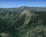
Marche, Italy, Photoreal Scenery Part 1 (Ascoli Piceno). The photoreal scenery covers a great area of Marche around the city of Ascoli Piceno. The airport of Ancona (ICAO code LIBP) is found near the scenery (see map). For the best results, use it in association with other parts of Marche photoreal: Marche 2 Macerata, Marche 3 Ancona.
| Filename: | Italy_Marche_1_Ascoli_Piceno_Photo_Real.zip |
| License: | Freeware |
| Added: | 31st May 2010, 10:29:40 |
| Downloads: | 5,004 |
| Author: | Fulvio Mazzokan |
| Size: | 86.72 MB |
| Category: Flight Simulator 2004 - Scenery | |
| Zurich Airport LSZH |
|
File Description:
This scenery is fewer done for players, but for flight-fanatics. It will give up each type of playing consciously (= more FPS). At the buildings became only the from MS " ugly " dock E replace through a glass-construction. Special attention was given the taxiways and parkings. Almost all taxiways and -signs was adjusted again and lacking again creates. Also the South-approach on RWY 34 with ILS and the Parking-Sectors 1 to 4 is with it. Indstructions in Deutsch and English. By HOUSE-RP, Switzerland
| Filename: | Zurich_Airport_LSZH.zip |
| License: | Freeware, limited distribution |
| Added: | 16th July 2006, 04:39:07 |
| Downloads: | 13,077 |
| Author: | HOUSE-RP, Robby Pauletto |
| Size: | 1.76 MB |
| Category: Flight Simulator 2004 - Scenery | |
| Asslar Hütte |
|
File Description:
The airfield Asslar Hütte is a small sailplane airfield between Breitscheid (EDGB) and Giessen Lützelinden (EDFL). This is my first Scenery for FS2004. Please read the readme!!!
| Filename: | Asslar_Htte.zip |
| License: | Freeware, limited distribution |
| Added: | 19th September 2005, 16:13:28 |
| Downloads: | 964 |
| Author: | Lukas Schäffner, Jan Diehl |
| Size: | 25.95 MB |
| Category: Flight Simulator 2004 - Scenery | |
| KCLT Charlotte Douglas International Airport |
|
Images related to this file:
File Description:
In 2008 runway 18R/36L at KCLT was renamed 18C/36C in anticipation of a third parallel under construction. The new runway was to be designated 18R/36L and was finally activated on January 6, 2010. This scenery adds that new runway to the default Charlotte Douglas International Airport (KCLT). This is a complete rebuild of my previous upload, KCLT2010 (not required) that inadvertently removed approximately 30 airports in the Charlotte area, including Fayetteville and Spartanburg. It also includes Terminal E, which was added in 2002, but never made it into the default FS2004 scenery.
I used Airport Design Editor (ADE9x) to modify the default FS2004 KCLT file, renaming the default 18R/36L to 18C/36C, create the new taxiways, taxi signs, NavAids, 18R-36L runway, and Terminal E. I used Abacus EZ-Scenery to add jetways, gate markings, and ramp lights. All files, libraries, and textures are either default or included. No additional downloads are required. AI Aircraft were acting normally on my system. I sat at Taxiway W2 for the new Runway 18R/36L and watched AI Aircraft land and take off from it after creating this scenery.
| Filename: | KCLT_Charlotte_Douglas_International_Airport.zip |
| License: | Freeware, limited distribution |
| Added: | 12th January 2011, 22:34:51 |
| Downloads: | 3,568 |
| Author: | Randy Tyndall |
| Size: | 1022.34 KB |
| Category: Flight Simulator 2004 - Scenery | |
| VFR of Lario, Area C1 - Como lake, Italy |
|
Images related to this file:
File Description:
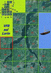
This is the third scenery of the "VFR of Lario" project, with photorealistic terrain and some 3D GMax realistic objects.
Information: this third scenery covers approximately an area of 7.5x6 kmt, from Pellio Intelvi/Ramponio (NW) to Colonno (NE), and from Almanno/Vesbio (SW) to Cavagnola locality (SE) and includes some details (GMax) of Argegno town, as NLC pier, some Holtel and Restaurants, the SS. Trinity church, some bridges and walls on Telo torrent and the cableway Argegno-Pigra (animated); it is also enclosed the unique small museum of financial police and smuggling, on Erbonne.
Contents: GMax objects as above and other buidings, minor piers and boats together with autogen buildings and trees are fully spreaded on the scenery.
| Filename: | VFR_of_Lario_Area_C1__Como_lake_Italy.zip |
| License: | Freeware |
| Added: | 16th February 2012, 00:17:59 |
| Downloads: | 1,777 |
| Author: | Aldo Della Vedova, Daniele Lanfranchi, Gian Mario Verga e Diego Caligiuri |
| Size: | 12.98 MB |


© 2001-2026 AVSIM Online
All Rights Reserved
Privacy Policy |