
Where Flight Simulation Enthusiasts Gather from Around the World!
AVSIM Library - Search Results

| Category: Flight Simulator 2004 - Scenery | |
| LTBA rwy 05-23 and rwy 35-17 afcad fix reupload |

|
File Description:
Reupload of afcad files for Istanbul Ataturk Airport LTBA, with texture files those forgetten at first upload. Runways 05 23, runways 35R -17L and 35L-17R redesigned as real.Added scenery approach lights with poles to all runways. Added texture files for these lights poles in this upload.
| Filename: | LTBA_rwy_0523_and_rwy_3517_afcad_fix_reupload.zip |
| License: | Freeware |
| Added: | 20th December 2010, 21:51:20 |
| Downloads: | 6,288 |
| Author: | Vedat Kocabeyoglu |
| Size: | 3.39 MB |
| Category: Flight Simulator 2004 - Scenery | |
| Istanbul Ataturk Airport - 2012 Update! |
|
Images related to this file:
File Description:
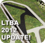
This update includes new modifications for Istanbul Ataturk Airport layout like new apron, rapid exits, taxiways and more according to the latest charts available for the airport. The package is a part of my previous Final Touch series to be used with (ltba_2008_v1.21.zip) by Gokhan Bayrakdar. For more details on this and previous updates, please read the doc file inside.
| Filename: | Istanbul_Ataturk_Airport__2012_Update.zip |
| License: | Freeware |
| Added: | 9th May 2012, 20:57:29 |
| Downloads: | 7,686 |
| Author: | Nuhaid Abdulkhaleq |
| Size: | 3.35 MB |
| Category: Flight Simulator 2004 - Scenery | |
| Mary River CMR2 on Baffin Island in Nunavut Canada |
|
Images related to this file:
File Description:
This is a very early version of an airfield in Nunavut built to serve an iron ore mine some 100 miles south of Pond Inlet on Baffin Island. In 2004 the airstrip was just being built, with a very basic camp set up for the construction crew who then went on to develop the roads etc in the immediate area. The original plan was for an opencast mine, with ore being transported south on a new (and expensive) railroad link to a new port on the south shore of Baffin Island. This plan was later changed to a (much cheaper) road to Milne Inlet, north of Mary River. And there my story rests, as although production has now started I have no further information about the operating mine. Nolinor currently flies regular supply flights into the camp; the AI here is for the early days. The gravel runway is 4,800 feet long and 150 feet wide, aligned 124T-304T as all runway headings in the north are given as true rather than the unreliable magnetic, which would be 12-30. Runway lighting and PAPI was installed early on and is included here; signage is not and the apron is the early version.
| Filename: | Mary_River_CMR2_on_Baffin_Island_in_Nunavut_Canada.zip |
| License: | Freeware, limited distribution |
| Added: | 18th August 2018, 02:57:19 |
| Downloads: | 137 |
| Author: | Roger Wensley |
| Size: | 4.82 MB |
| Category: Flight Simulator 2004 - Scenery | |
| FS2004 - Kamloops, British Columbia, Canada - Kamloops airport - CYKA |
|
File Description:
Kamloops was an outdated airport and extended runway with improvement in more detail.
| Filename: | FS2004__Kamloops_British_Columbia_Canada__Kamloops.zip |
| License: | Freeware |
| Added: | 15th September 2020, 17:05:27 |
| Downloads: | 231 |
| Author: | Stuart John Gilbert II |
| Size: | 4.59 MB |
| Category: Flight Simulator 2004 - Scenery | |
| Shepherd Bay CWSB in Nunavut, Canada |
|
Images related to this file:
File Description:
This was a DEW line Auxiliary Station on the western shore of the lower reaches of the Boothia Peninsula, 50 miles south of Taloyoak and 60 miles east of Gjoa Haven. The station was closed in 1989 but is almost intact except for a diesel tank or two. There are also other buildings nearby, and others on the beach landing area. A NWS automated station was opened in the same year as the Dew station was closed. The runway is also still there and is around 4,500 feet of gravel 100' wide, aligned 027T/207T. There are no lights, signage, or windsock, but the usual large hangar which was built at all Auxiliary Stations still survives. This is one of the more interesting DEW line stations to visit and walk around.
| Filename: | Shepherd_Bay_CWSB_in_Nunavut_Canada.zip |
| License: | Freeware, limited distribution |
| Added: | 22nd November 2012, 16:28:45 |
| Downloads: | 225 |
| Author: | Roger Wensley |
| Size: | 2 MB |
| Category: Flight Simulator 2004 - Scenery | |
| Knoxville Municipal KOXV |
|
Images related to this file:
File Description:
FS2004 Scenery - The Knoxville Municipal Airport, (KOXV) renamed Jim Bellamy Field, serves the greater Knoxville community and the surrounding areas of Marion County, Iowa. The airport is comprised of 120 acres, and is located at the southern edge of Knoxville, adjacent to the Highway 14 & Highway 5/92 interchange. The 4,000 foot (by 75 foot) single runway is constructed of concrete, with parallel taxiway. The facility is at an elevation of 928 feet at a distance of about 2 miles from Knoxville. Created for your flying pleasure by John B Loney, Jr.
| Filename: | Knoxville_Municipal_KOXV.zip |
| License: | Freeware, limited distribution |
| Added: | 13th October 2012, 17:16:54 |
| Downloads: | 296 |
| Author: | John B. Loney, Jr. |
| Size: | 29.77 MB |
| Category: Flight Simulator 2004 - Scenery | |
| Northern Canada Mining CYOA & CHB3 in Canada |
|
Images related to this file:
File Description:
These are two airfields in northern Canada, serving two mining operations. The furthest north is Hope Bay CHB3 in Nunavut. It is in a sheltered inlet less than 3 miles from the northern mainland coast and around 65 miles southwest of Cambridge Bay. The owner is Hope Bay Mining Ltd, and their operation mines gold out of a tunnel rather than open cast. The airfield is incorporated into the road that leads north to the sea; traffic is halted by traffic lights when a flight is expected. The runway is 3,000 feet of gravel aligned 01-19 and with PAPI at both ends.
The second airfield serves the Ekati diamond mine and is some 265 miles southwest of Hope Bay, in the Northwest Territories. Ekati was the first Canadian diamond mine and is 195 miles northeast of Yellowknife and less than 20 miles north of a later mine, Diavik (by Sid and Pete). CYOA reflects the relative value of the two mining operations and is far better equipped than Hope Bay. It can be described as an airport while Hope Bay remains an airfield. The runway is 6,400 feet of gravel aligned 36-18 with PAPI and strobe approach lights at both ends. The scale of the mining operation can only be described as huge.
| Filename: | Northern_Canada_Mining_CYOA__CHB3_in_Canada.zip |
| License: | Freeware, limited distribution |
| Added: | 11th August 2018, 22:59:06 |
| Downloads: | 219 |
| Author: | Roger Wensley |
| Size: | 8.24 MB |
| Category: Flight Simulator 2004 - Scenery | |
| CYXE Saskatoon,Saskatchewan |
|
File Description:
CYXE Saskatoon is a small airport but does have alot going for it being this is my home base.
I hope you enjoy the scenery .Some of the features are a set of 4 scenery files to chose from
depending on your needs, there is a lot to look at so happy flying !!!!
| Filename: | CYXE_SaskatoonSaskatchewan.zip |
| License: | Freeware |
| Added: | 3rd December 2003, 23:02:41 |
| Downloads: | 1,918 |
| Author: | Bruce Ellison |
| Size: | 3.44 MB |
| Category: Flight Simulator 2004 - Scenery | |
| Orlando-Sanford SFB / KSFB |
|
Images related to this file:
File Description:

This is a complete remake of Orlando-Sanford International Airport. This project was created from a blank slate. All default buildings, including that wierd interpretation of the main terminal, have been replaced by much more correctly sized, shaped, and placed structures. Many static vehicles litter the landscape bringing this neglected airport to life. This scenery was built with Flight1's Instant Scenery program and AFX.
| Filename: | OrlandoSanford_SFB__KSFB.zip |
| License: | Freeware |
| Added: | 5th September 2011, 14:17:56 |
| Downloads: | 2,789 |
| Author: | William Morgan, www.FRFStudio.net |
| Size: | 23.74 MB |
| Category: Flight Simulator 2004 - Scenery | |
| Woodward Field Airport KCDN |
|
Images related to this file:
File Description:
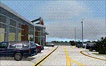
Woodward Field Airport is a county-owned public-use general aviation airport. It is sometimes called Kershaw County Airport, and many people also know it as the Camden Airport. It is located approx. 6.9 miles northeast of the historical city of Camden, South Carolina and currently does not serve scheduled airline flights. It is host to several vintage aircraft events and fly-in's annually. Scenery was designed with ADE9X v1.47 and Google Maps.(for placement references) Requires EZ-Scenery and RWY12 library collections for proper display of scenery objects. ez_1.zip and rwy12_1.zip
| Filename: | Woodward_Field_Airport_KCDN.zip |
| License: | Freeware |
| Added: | 20th November 2011, 00:02:58 |
| Downloads: | 485 |
| Author: | Glenn Mullis |
| Size: | 3.22 MB |


© 2001-2026 AVSIM Online
All Rights Reserved
Privacy Policy |