
Where Flight Simulation Enthusiasts Gather from Around the World!
AVSIM Library - Search Results

| Category: Flight Simulator 2004 - Scenery | |
| Modification of Province of Quebec Landclass |

|
File Description:
FOR FS2002 AND 2004. This modification adds or makes more visible many villages,
for those that fly VFR, around Montreal/St-Hubert CYHU. *DO* READ INFOS.TXT
Cette modif ajoute ou rend plus visibles plusieurs villages, pour ceux qui volent
VFR, dans les environs de Montreal CYUL, ou CYHU. *LIRE* INFOS.TXT
| Filename: | Modification_of_Province_of_Quebec_Landclass.zip |
| License: | Freeware |
| Added: | 25th June 2010, 01:38:12 |
| Downloads: | 1,735 |
| Author: | Jean Morissette |
| Size: | 32 KB |
| Category: Flight Simulator 2004 - Scenery | |
| Paro Airport VQPR, Bhutan |
|
Images related to this file:
File Description:
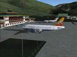
Enjoy this new scenery located inside himalyan mountain. Paro airport is the only international airport in Bhutan and one company operates there : DRUK AIR, the Royal Bhutan Airlines. Try taking off and landing there with one of the two A319 and two BAe-146 operated by DRUK AIR and enjoy mountain trekking in this magnificient contry !!
| Filename: | Paro_Airport_VQPR_Bhutan.zip |
| License: | Freeware |
| Added: | 12th January 2010, 20:16:14 |
| Downloads: | 13,593 |
| Author: | David Cuvillier |
| Size: | 1.65 MB |
| Category: Flight Simulator 2004 - Scenery | |
| Iles de la Madeleine CYGR in Quebec Canada |
|
Images related to this file:
File Description:
The Iles de la Madeleine are a group of spit islands linked by bridges in the Gulf of St Lawrence. They are east of New Brunswick, north of Cape Breton Island, west of the Island of Newfoundland, and south of the mainland coast of Quebec. On a southwest to northeast axis they are 40 miles in length and the airport CYGR is pretty much at the midpoint of the southern line of islands. Take a look at the overhead from FS9 to see what I mean. CYGR has two runways, one is aligned 08-26 and is just under 4,400 feet long and 150 feet wide with lighting and PAPI at both ends. The second is aligned 16-34 and is 3,600 feet long and 150 feet wide, without lights or PAPI. Both are asphalt. The apron is not huge, and a newish (in 2010) hangar was built with separate access to the 16-34 runway. There are daily flights by Air Canada and Pascan Aviation included in the AI. The AI also includes some boats and a ferry, and I first used these with my Dutch Harbor scenery, so if you have that already.... This scenery also includes Cindy Hook, a small boat harbour just 2 miles southwest of the airport, and the larger harbour at Cap aux Meules a further 3 miles away that accommodates the daily ferry trips, along with fishing boats etc. Also included here is a further addition to the Homer PAHO scenery in the shape of a boat that is included in the Homer Spit harbour. Just add the contents of the scenery folder to the Homer scenery folder of your Homer installation, and the texture folder contents to the Homer texture folder. This is hopefully the last PAHO addition, and again apologies. If you find an error email me please, and note that my email address has been changed to rogwens at Gmail dot com.
| Filename: | Iles_de_la_Madeleine_CYGR_in_Quebec_Canada.zip |
| License: | Freeware, limited distribution |
| Added: | 28th July 2021, 17:02:18 |
| Downloads: | 192 |
| Author: | Roger Wensley |
| Size: | 26.7 MB |
| Category: Flight Simulator 2004 - Scenery | |
| EDDB Berlin Brandenburg Airport 2012 |
|
Images related to this file:
File Description:
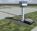
This is an update of my FS2004 freeware scenery for EDDB, BER (former
Berlin Schoenefeld after its extension to Berlin Brandenburg Airport).
Changes:
- Updated taxiway and apron positions according to AIP docs I got
in 2012 (thanks to Benjamin).
- Updated ILS (has DME) and approach routes with official waypoints taken from
this docs.
- Remove of EDDT and EDDI (EDDI already closed, EDDT should be closed 2012/6/3).
- Rebuild the old GAT area (the planned cargo area there isn't built yet),
updated layout as everything is built by now.
- New tower and SMR (Surface Movement Radar) towers.
- Corrects small errors (taxi labels, lines, lights).
- Parking spots at apron E.
- Modified colours of pier buildings.
Gernot Zander, [email protected], 2006-08-07, 2011-09-20, 2012-05-01
| Filename: | EDDB_Berlin_Brandenburg_Airport_2012.zip |
| License: | Freeware |
| Added: | 6th May 2012, 23:47:08 |
| Downloads: | 4,850 |
| Author: | Gernot Zander |
| Size: | 4.82 MB |
| Category: Flight Simulator 2004 - Scenery | |
| France-Pontoise |
|
File Description:
France Pontoise (LFPT-Corneilles en Vexin) fictionnal scenery for FS2004 with AFCAD file.
| Filename: | FrancePontoise.zip |
| License: | Freeware |
| Added: | 6th December 2003, 07:27:09 |
| Downloads: | 4,825 |
| Author: | Claude Schmist |
| Size: | 2.98 MB |
| Category: Flight Simulator 2004 - Scenery | |
| KTNT Dade-Collier Training and Transition Airport |
|
File Description:
This scenery package adds new fictional ramp, hanger building and training facility for Meridian Virtual Airlines. Scenery by Gary Hayes.
Scenery features Meridian Airlines hanger with animated doors and is large enough to fit a Boeing 747-400 or triple 7.
For more info visit: www.flymeridian.com
| Filename: | KTNT_DadeCollier_Training_and_Transition_Airport.zip |
| License: | Freeware |
| Added: | 5th December 2008, 01:53:09 |
| Downloads: | 309 |
| Author: | Gary Hayes |
| Size: | 2.08 MB |
| Category: Flight Simulator 2004 - Scenery | |
| Kounos Airfield, Greece |
|
File Description:
FS2002/FS2004 Greek Scenery -- Kounos, Greece.
A small (fictional) grass airfield in Kounos,
southern Peloponnessos. Features broad
grass airstrips in classic X-layout and old
fashioned buildings which work particularly
well with 'older' classic aircraft. Includes
bonus sceneries: the Corinth Canal and the
'Themis(tocles) Float-plane Airfield, Marina,
which also features a 2,132 ft. dirt RW.
By Tia & Björn Hall
| Filename: | Kounos_Airfield_Greece.zip |
| License: | Freeware |
| Added: | 16th September 2003, 22:31:19 |
| Downloads: | 1,714 |
| Author: | Tia & Björn Hall |
| Size: | 7.77 MB |
| Category: Flight Simulator 2004 - Scenery | |
| NW Arkansas Regional Airport |
|
Images related to this file:
File Description:
Re-upload. My original version of Northwest Arkansas Regional Airport - KXNA
| Filename: | NW_Arkansas_Regional_Airport.zip |
| License: | Freeware |
| Added: | 7th June 2010, 09:16:41 |
| Downloads: | 2,258 |
| Author: | JC McCormick |
| Size: | 1.75 MB |
| Category: Flight Simulator 2004 - Scenery | |
| DBWsim: Johnston Atoll 2004 |
|
File Description:
This DBWsim scenery for Flightsim2004 covers Johnston Atoll in its entirety. This scenery pack includes fully updated and improved scenery for facilities on the main island and the islands and lagoon surrounding the atoll. The scenery is representative of Johnston Atoll circa 1995, as today there is virtually nothing on the island, not even an airstrip.
Highlights of the scenery are numerous and include; the main street, golf course and outdoor cinema, and Munitions Demilitarization facilities.
| Filename: | DBWsim_Johnston_Atoll_2004.zip |
| License: | Freeware |
| Added: | 10th April 2004, 03:59:16 |
| Downloads: | 4,715 |
| Author: | Derek and Brendan Webb |
| Size: | 2.96 MB |
| Category: Flight Simulator 2004 - Scenery | |
| Athens 04 |
|
File Description:
FS2004 PIRAEUS/ATHENS (LGAV) Coastline Scenery.
Detailed coastline scenery for the port
of Piraeus/Athens, Greece, adds interest to your
visual approach to Athens airport.
| Filename: | Athens_04.zip |
| License: | Freeware, limited distribution |
| Added: | 31st August 2005, 08:59:00 |
| Downloads: | 9,601 |
| Author: | Alan McGaughey |
| Size: | 72.22 KB |


© 2001-2026 AVSIM Online
All Rights Reserved
Privacy Policy |