
Where Flight Simulation Enthusiasts Gather from Around the World!
| Category: Flight Simulator 2004 - Scenery | |
| Puntzi Mountain CYPU in British Columbia Canada |
|
Images related to this file:
File Description:
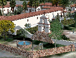
Puntzi Mountain is near a village called Chilanko Forks, approximately midway between Bella Coola and Williams Lake and just north of the Chilcotin to Bella Coola Highway. It is what remains of a military base and which currently shows in FS9 as a town, reduced in my scenery version to what remains after the base was closed and cleared. All that remains of the base is now the runway, over 6,000 feet of asphalt aligned 04-22, unlit, at 2,985 feet above sea level, and with centre line markings that are almost invisible. The runway is used in the summer for whatever local fire-fighting operations are needed by ConAir and there are some buildings and fuel tanks for this. It is also used for local flights such as those for a lodge on Puntzi Lake to the north. I have added three AT-802 textures with additional tail numbers for use in the AI. These are to be added to an aircraft that you very likely already have and which was included in Don Grovestine's posting of Abbotsford CYXX. I have also included the revised config file that adds the planes to Don's original; save the original config under another name and replace it with mine. Put the three new texture folders in with the original, which is called "CYXX-AI_Air Tractor AT-802 (Wheels)". If you do not have Don's scenery I suggest you get it, as his work is worth having and like Greg Putz he puts in a lot more effort than I do. The L188 Electra should already be with you if you downloaded my Smithers CYYD scenery. If you find a defect, email me.
| Filename: | Puntzi_Mountain_CYPU_in_British_Columbia_Canada.zip |
| License: | Freeware, limited distribution |
| Added: | 20th November 2020, 05:33:01 |
| Downloads: | 173 |
| Author: | Roger Wensley |
| Size: | 10.33 MB |
| Category: Flight Simulator 2004 - Scenery | |
| Durban Island CWFB FOX-E DEW line station in Nunavut, Canada |
|
Images related to this file:
File Description:
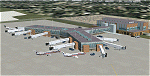
Durban Island is 40 miles north of Cape Dyer on the southeast corner of Baffin Island, and around 60 miles southeast of Qikiqtarjuaq (known as Broughton until recently). Sitting on the top of the island is FOX-E, an intermediate station that was part of the DEW line. There is no runway (and once you have seen the island you will know why) and the station and its (usually) five man crew were supported by helicopter flights from Cape Dyer. The main feature is a 300' high mast, topped by comms gear to link both to Broughton to the north and Cape Dyer to the south. There was only one really habitable building, 80' x 30' in round figures, and this contained the generators, technical spaces, sleeping areas, kitchen, mess, and showers etc. There were also what were known as Anderson shelters, originally put up to house the construction crew and used in the summer for any maintenance people who visited for short periods. There was also a garage for a snow cat and tanks for fuel. And a view.
This post also includes new bgls for Cape Dyer to provide the 300' tower there too.
| Filename: | Durban_Island_CWFB_FOXE_DEW_line_station_in_Nunavu.zip |
| License: | Freeware, limited distribution |
| Added: | 1st July 2011, 22:11:33 |
| Downloads: | 315 |
| Author: | Roger Wensley |
| Size: | 1.87 MB |
| Category: Flight Simulator 2004 - Scenery | |
| Clyde River CYCY & Cape Christian in Nunavut Canada |
|
Images related to this file:
File Description:
Clyde River is a village on the northeast coast of Baffin Island, 250 miles above the Arctic Circle and around 150 miles north of Cape Hooper. It is on the shore of Patricia Bay at the entrance to Cylde Inlet, a fjord which stretches over 60 miles inland. The population is around 880 folks, and it was named by the explorer John Ross in 1818. The airfield is just east of the village and the lighted runway is 3,501' of 100' wide gravel at 87' ASL, aligned 018 True 198 True; "True" as opposed to magnetic in the Northern Domestic Airspace. There are two aprons, one with the new terminal building and one with the old terminal and the garage. Five miles northeast of Clyde River is Cape Christian, where there is a gravel runway around 3,000' long and adjacent to the beach, built to serve what was started as a weather station and later became a LORAN navigation system station. The station is still there, though it was closed some time ago and is now the subject of decontamination work. The runway is usable, though only for light planes as it is a bit rough. First Air and Canadian North are the AI planes visting Clyde River.
| Filename: | Clyde_River_CYCY__Cape_Christian_in_Nunavut_Canada.zip |
| License: | Freeware |
| Added: | 14th July 2011, 20:26:14 |
| Downloads: | 456 |
| Author: | Roger Wensley |
| Size: | 3.33 MB |
| Category: Flight Simulator 2004 - Scenery | |
| Fort Liard CYJF in the Northwest Territories, Canada |
|
Images related to this file:
File Description:
Fort Liard is the seventh in a series of airfields that follow (approximately) the Mackenzie River. At the far northern end of the river there is Tuktoyaktuk, then Inuvik, Fort McPherson, Fort Good Hope, Deline, Wrigley, and then Fort Simpson Island and Fort Simpson, all posted. Fort Liard is at 708 feet asl and on the east bank of the the Liard River, around 130 miles south of Fort Simpson where the Liard and Mackenzie join, and about 25 miles from the borders with both British Columbia and the Yukon. The town has a population of about 560 folks.
The airport is next to the town, and has almost 3,000 feet of gravel runway. I have no information regarding when it was built but it may be from the WW2 time; the cleared and grassed area is long enough for a runway 0f 6,000 feet. There are no scheduled flights but North Cariboo Air have a base at the airport for local charters to support survey teams etc. and are almost an on-demand-scheduled airline. I have also added a Buffalo DC3 and GA. There is fuel available, but only by prior arrangement with North Cariboo. Right hand circuits for runway 20.
| Filename: | Fort_Liard_CYJF_in_the_Northwest_Territories_Canad.zip |
| License: | Freeware, limited distribution |
| Added: | 11th July 2014, 13:38:49 |
| Downloads: | 303 |
| Author: | Roger Wensley |
| Size: | 10.07 MB |
| Category: Flight Simulator 2004 - Scenery | |
| Cape Hooper CWFH and FOX-4 DEW Line Station in Nunavut, Canada |
|
Images related to this file:
File Description:
Cape Hooper is around 60 miles north of Kivitoo (FOX-D) and 140 miles south of Clyde River CYCY on the northeast-facing coast of Baffin Island. FOX-4 is still in use as a new and mostly-unmanned North Warning System site was established there in 1990 before the DEW line station was closed in 1991. Actually the DEW line station was not "closed" as such, they just stopped using it. The site of FOX-4 is on the top of a bump at the end of one of many long promontories that stick out into the Davis Strait between Baffin Island and Greenland, close to the far eastern end that is called Cape Hooper. There is a gravel runway to the west, down at 65' ASL; it is only just over 3,000' long and most material was delivered by sea to the beach at the southern end of the runway. The runway is signed as
"324T - 144T" as this is Northern Domestic Airspace where all runways are signed "true" and not "magnetic"; it is 013/193 magnetic with a huge magnetic variation of 48.9 degrees in this area where the magnetic field is mostly vertical, and so useless for navigation.
| Filename: | Cape_Hooper_CWFH_and_FOX4_DEW_Line_Station_in_Nuna.zip |
| License: | Freeware |
| Added: | 11th July 2011, 00:28:40 |
| Downloads: | 413 |
| Author: | Roger Wensley |
| Size: | 1.65 MB |
| Category: Flight Simulator 2004 - Scenery | |
| Port Armstrong, for Holger Sandmann's Tongass Fjords scenery |
|
Images related to this file:
File Description:
This is a fish farm, at the southern end of Baranof Island and Chatham Strait in southern Alaska. It is named on the chart of the area, and there is a section of the chart included here. This scenery is designed specifically for use in the Tongass Fjord scenery. The fish farm (or hatchery, the description varies) has an identifying code so it will show up on a gps as PAG. There is no interaction with atc as there are no designated water runways, so PAG on the gps just acts as a waypoint. I may have incorrectly identified Tongass Fjords as being required for Hawk Logging when Glacier Bay is needed. Ah well, it is one or the other of them. I still find these scenery areas by Holger and his crew the most satisfying in FS9.
| Filename: | Port_Armstrong_for_Holger_Sandmanns_Tongass_Fjords.zip |
| License: | Freeware, limited distribution |
| Added: | 18th November 2014, 15:14:57 |
| Downloads: | 220 |
| Author: | Roger Wensley |
| Size: | 3.89 MB |
| Category: Flight Simulator 2004 - Scenery | |
| Cordova Smith PACV & Municipal CKU in Alaska US |
|
Images related to this file:
File Description:
Cordova is on the south coast of Alaska, around 150 miles east of Anchorage and 45 miles south of Valdez. The town is mainly built on a small but relatively flat area between the east side of Prince William Sound and Eyak Lake, and has a population of around 2,350 in 2010, the approximate date of this scenery.
The Municipal Airfield CKU is on the north side of Eyak Lake to the east of Cordova, with the runway that is 1,800 feet of unlit gravel squeezed between the lake and the road that runs around the lake. The hangars and parking aprons are reached by taxiing across, and to some extent along, the road. Float planes are also taken from the lake to an apron to the west of the runway.
Cordova Airport PACV (named in the real world "Merle K. (Mudhole) Smith", and I will leave you to research this) is known as Cordova Smith in FS9 and is 10 miles to the east of the town on relatively flat ground between mountains to the north and the sea to the south. The runway is 8,080 feet of lit asphalt aligned 09-27 with ILS on runway 27 and VASI on both ends. The aprons are to the north side of the runway and are reached by back-taxiing; there are no taxiways parallel to the runway. The main apron serves Alaska Air via the western of two taxiways. The GA parking and hangars are mainly reached by using the eastern taxiway, though there is in fact a connecting taxiway between the two (for GA, but definitely not for airliner use). The taxiway further to the west serves the separated Alaska Coastguard apron and hangar, which is mainly for helicopter use. There is a nominally grass runway 1,900 feet long and aligned 16-34 to the south of the main runway; in fact it appears to be more gravel than grass. I have left this inactive as otherwise AI Alaska Air planes would be attempting to use this when the wind made it seem like a good idea.
The AI includes Alaska Air (twice a day) and also Coastguard helicopters, along with GA.
| Filename: | Cordova_Smith_PACV__Municipal_CKU_in_Alaska_US.zip |
| License: | Freeware, limited distribution |
| Added: | 22nd January 2022, 21:53:03 |
| Downloads: | 148 |
| Author: | Roger Wensley |
| Size: | 16.93 MB |
| Category: Flight Simulator 2004 - Scenery | |
| KADW Joint Base Andrews Naval Air Facility, Maryland, USA (Andrews Air Force Base) |
|
Images related to this file:
File Description:
This is the first version of my scenery for the Joint Base Andrews Naval Air Facility, Maryland, USA - better known as Andrews Air Force Base.
The main buildings, fences, tanks and other objects are completely self-created, modeled with GMAX and covered with self-created textures. For this I have used GIMP - and of course DXTBMP.
For the trees, cars and other items I have used already existing libraries and others like Matt Tomkins' MTtrees, Sidney Schwartz' ESDG Ramp Lights and Lars Hoyer's Extra Objects. Furthermore MAIW's (Military AI Works) airplanes are used to fill the apron with static aircraft. A complete list of used libraries you will find in the readme file.
| Filename: | KADW_Joint_Base_Andrews_Naval_Air_Facility_Marylan.zip |
| License: | Freeware |
| Added: | 5th July 2011, 03:58:27 |
| Downloads: | 3,860 |
| Author: | Uwe Kunzak |
| Size: | 71.13 MB |
| Category: Flight Simulator 2004 - Scenery | |
| Whaler's Cove Lodge for Holger Sandmann's Tongass Fjords scenery |
|
Images related to this file:
File Description:
This is a fishing lodge on Killisnoo Island, just off the western shore of Admiral Island near Angoon. It is not marked on the chart of the area but there is a section of the chart here with a pointer to the island. This scenery is designed specifically for use in the Tongass Fjord scenery. The lodge has an identifying code so it will show up on a gps as a waypoint, PWCL. There is a nearby float base called Angoon which serves the small town of the same name, and this is visible in one of the screen shots. I still find these scenery areas by Holger and his crew the most satisfying in FS9, and at the time they were made they were spectacularly better than anything else.
| Filename: | Whalers_Cove_Lodge_for_Holger_Sandmanns_Tongass_Fj.zip |
| License: | Freeware, limited distribution |
| Added: | 26th November 2014, 23:03:22 |
| Downloads: | 421 |
| Author: | Roger Wensley |
| Size: | 3.57 MB |
| Category: Flight Simulator 2004 - Scenery | |
| AI for Inuvik CYXT in the Northwest Territories, Canada |
|
Images related to this file:
File Description:
This traffic file for Inuvik CYEV has several planes making flights to and from Inuvik. The DC3 C-GGKG goes north to Tuktoyaktuk on the coast and then back. C-GKBO goes to Norman Wells and back. C-GMAG visits early direct from Yellowknife, then C-GBFA and C-GECN, and in the late afternoon C-FAVO does the same and stays for around 3 hours. The screen shots show the different AI aircraft at different times of day. You will need to have installed my Inuvik scenery and to know how to download and install planes and textures for those planes.
| Filename: | AI_for_Inuvik_CYXT_in_the_Northwest_Territories_Ca.zip |
| License: | Freeware |
| Added: | 8th October 2010, 14:02:21 |
| Downloads: | 816 |
| Author: | Roger Wensley |
| Size: | 959.88 KB |
