
Where Flight Simulation Enthusiasts Gather from Around the World!
AVSIM Library - Search Results

| Category: Flight Simulator 2004 - Scenery | |
| Grass For Milano Malpensa ISD LIMC |

|
File Description:
I put a little 'grass in 3D (not that one!)in a wonderfull scenery of Mlapensa Milan by Isd Project. A bit' here a little 'and hope you like it. While I was there I put a little 'trees runway 35L and R to give the idea of a better approach on the Lambro Park Forest. It installs as a normal scenario.
Try a little 'and then tell me, I know the purists will be pleased to fs9
| Filename: | Grass_For_Milano_Malpensa_ISD_LIMC.zip |
| License: | Freeware, limited distribution |
| Added: | 18th December 2012, 01:01:31 |
| Downloads: | 2,894 |
| Author: | Fabio Ferrari |
| Size: | 6.18 MB |
| Category: Flight Simulator 2004 - Scenery | |
| ISD Project Milan Malpensa (LIMC) Compatibily Patch |
|
File Description:
Fs2004 compatibility patch for our LIMC Milan Malpensa airport. Just install in your old ISD-LIMC folder, and that'all. All texture issues have been solved. An afcad2 with real airlines and parking size configurations is included.Visit us at www.isdproject.com
| Filename: | ISD_Project_Milan_Malpensa_LIMC_Compatibily_Patch.zip |
| License: | Freeware |
| Added: | 18th November 2003, 23:37:10 |
| Downloads: | 60,167 |
| Author: | ISD Project |
| Size: | 9.76 MB |
| Category: Flight Simulator 2004 - Scenery | |
| Opa Locka Airport (KOPF) |
|
File Description:
FS2004 Scenery-Opa Locka Airport (KOPF) serves Miami and Dade County and is owned by Dade County Aviation Dept. The airport has more than one runway. The longest is a paved runway extending 8002 feet. The facility is at an elevation of 10 feet at a distance of about 10 miles from Miami. This scenery was created with FSDS2, Rwy12, FSE, AFCAD2 and Traffic Tools2x. Textures included.
| Filename: | Opa_Locka_Airport_KOPF.zip |
| License: | Freeware |
| Added: | 11th September 2005, 23:00:11 |
| Downloads: | 2,107 |
| Author: | John B. Loney, Jr. |
| Size: | 1.27 MB |
| Category: Flight Simulator 2004 - Scenery | |
| Olbia Costa Smeralda (LIEO) Compatibility Patch |
|
File Description:
FS2004 compatibility patch for our LIEO Milan Malpensa airport. Just install in your old ISD-LIEO folder, and that's all. All texture issues have been solved.
| Filename: | Olbia_Costa_Smeralda_LIEO_Compatibility_Patch.zip |
| License: | Freeware, limited distribution |
| Added: | 4th February 2004, 04:11:21 |
| Downloads: | 14,123 |
| Author: | ISD Project |
| Size: | 5.75 MB |
| Category: Flight Simulator 2004 - Scenery | |
| Milano Malpensa (LIMC) AI Traffic Patch |
|
File Description:
This patch, for FS2004 only, fixes the problem of AI Traffic in LIMC2002 scenery. A new AFCAD2 file is included.
| Filename: | Milano_Malpensa_LIMC__AI_Traffic_Patch.zip |
| License: | Freeware, limited distribution |
| Added: | 4th February 2004, 04:12:55 |
| Downloads: | 35,765 |
| Author: | ISD Project |
| Size: | 511.14 KB |
| Category: Flight Simulator 2004 - Scenery | |
| GERMANY 2004 SRTM MESH SCENERY |
|
File Description:
Based on SRTM 3 arc.sec data.
Unfortunately SRTM DATA have many holes and data loss, so I made a resampling and an oversampling with other data with lower resolution, but with better coverege (like data from swiss topographic federal istitute or from italian IGM, and finally with DTED Level 0.) with geo cad software like Grass and GlobalMapper for projection convertion.
Compression and conversion to bgl with MS Flight simulator SDK at LOD 9
This scenery cover the entire Germany teritory, the part of Swiss and Austria territories not included in my Italian scenery. Parts of Belgium and Netherlands and Luxembourg are included too (Till E005); next quite the whole territory of Czech Republic and part of Poland till E017.
| Filename: | GERMANY_2004_SRTM_MESH_SCENERY.zip |
| License: | Freeware |
| Added: | 23rd November 2003, 23:18:46 |
| Downloads: | 25,898 |
| Author: | Pietro Mauri |
| Size: | 62.08 MB |
| Category: Flight Simulator 2004 - Scenery | |
| Autogen around Munich for RealGermany3 - Version 2 |
|
File Description:
This is version 2 of the autogen for the wonderful Scenery "Real Germany 3" aroung the Munich airport, direction Munich downtown.
I'm using the autogen building textures build by Anselm Jäger and myself "Alternative Autogen Building Textures for Swiss / Europe" available at AVSIM.
| Filename: | Autogen_around_Munich_for_RealGermany3__Version_2.zip |
| License: | Freeware |
| Added: | 11th May 2006, 23:09:46 |
| Downloads: | 6,552 |
| Author: | Thomas Schröder |
| Size: | 7.11 MB |
| Category: Flight Simulator 2004 - Scenery | |
| Marin Eco-Light Club (LSGM) |
|
File Description:
FS2004 Marin Eco-Light Club (LSGM)
Fictionnal swiss ultralight airfield. With cars, trucks, fence, hangars,meteo station,terminal, static glider, static aircraft, AFCAD, etc... Located to 8 nm in the east of Neuchâtel (LSGN). Grass runway (700fts x 40fts). All files included. See the read-me for macro credits.
| Filename: | Marin_EcoLight_Club_LSGM.zip |
| License: | Freeware |
| Added: | 21st August 2005, 03:59:39 |
| Downloads: | 658 |
| Author: | Jean-Jacques Parel |
| Size: | 5.48 MB |
| Category: Flight Simulator 2004 - Scenery | |
| France SRTM Mesh |
|
File Description:
Based on SRTM 3 arc.sec data.
Unfortunately SRTM DATA have many holes and data loss, so I made a resampling and an oversampling with other data with lower resolution, but with better coverege (like data from swiss topographic federal istitute or from italian IGM, and finally with DTED Level 0.) with geo cad software like Grass and GlobalMapper for projection convertion.
Compression and conversion to bgl with MS Flight simulator SDK at LOD 9
This scenery cover the part of France territories not included in my Italian and Spanish sceneries;thus these sceneries are required to cover entire France country. Parts of Belgium and Netherlands are included too (Till E005)
| Filename: | France_SRTM_Mesh.zip |
| License: | Freeware |
| Added: | 23rd November 2003, 11:48:22 |
| Downloads: | 25,754 |
| Author: | Pietro Mauri |
| Size: | 46.44 MB |
| Category: Flight Simulator 2004 - Scenery | |
| Catalonia version II |
|
Images related to this file:
File Description:
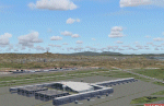
Catalonia is my small country located among Spain northeast and France southeast. Its surface it is 32000 km2 in its south area and of about 2000 kn2
In its area north. Your coastal fringe in the Mediterranean is about 630 kms. This is the whole Catalonia.
Their capital is Barcelona where the olympic games was played in recent years.
It is headquarters of the cathedral of Gaudi.It contains 7 big airports 7 airclubs and two seaports. The port of Barcelona is the first tourist port of the mediterranean of the they leave the big tourist cruises.
Airport LEBL is reconstructed with new great terminal
This scenery contents the new airport LEDA in Lleida city
| Filename: | Catalonia_version_II.zip |
| License: | Freeware |
| Added: | 17th March 2010, 23:29:15 |
| Downloads: | 7,105 |
| Author: | Toni Agramont |
| Size: | 74.05 MB |


© 2001-2026 AVSIM Online
All Rights Reserved
Privacy Policy |