
Where Flight Simulation Enthusiasts Gather from Around the World!
AVSIM Library - Search Results

| Category: Flight Simulator 2004 - Scenery | |
| Santa Fe Airport - Argentina |

|
Images related to this file:
File Description:
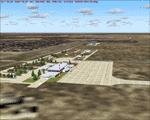
Sauce Viejo airport serves the city of Santa Fe, capital city of the homonymous province. Among the buildings represented are the terminal (and control tower), the service area of the airport (fuel and other related buildings) and hangars belonging to the Government of Santa Fe and general aviation hangars in the south area of the airport.
| Filename: | Santa_Fe_Airport__Argentina.zip |
| License: | Freeware |
| Added: | 12th February 2010, 10:40:01 |
| Downloads: | 1,592 |
| Author: | Ramon Sola |
| Size: | 8.05 MB |
| Category: Flight Simulator 2004 - Scenery | |
| Mar Del Plata Airport - Argentina |
|
Images related to this file:
File Description:
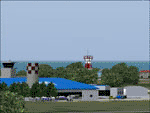
The Mar del Plata International Airport "Brigadier Bartolome de la Colina" is the most important airport of the coast of Buenos Aires province. This scenery includes a photoreal representation of the airport and near environs. Besides the airport itself and thanks to Marcelo Schettini's contribution, the project includes a better representation of Mar del Plata city, whose coastline was properly modified.
| Filename: | Mar_Del_Plata_Airport__Argentina.zip |
| License: | Freeware |
| Added: | 12th February 2010, 10:41:49 |
| Downloads: | 3,855 |
| Author: | Ramon Sola |
| Size: | 10.96 MB |
| Category: Flight Simulator 2004 - Scenery | |
| Necochea Airport - Argentina |
|
Images related to this file:
File Description:
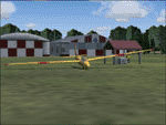
Being the aerodrome of one of the most important cities of the Atlantic Coast in Buenos Aires province, Necochea airport is an entrance door to agro-related businesses and Quequen harbor. This scenery includes the representation of the air terminal, the two grass runways (missing in the default airport) and the hangars and flying club facilities.
| Filename: | Necochea_Airport__Argentina.zip |
| License: | Freeware |
| Added: | 12th February 2010, 11:01:14 |
| Downloads: | 890 |
| Author: | Ramon Sola |
| Size: | 3.46 MB |
| Category: Flight Simulator 2004 - Scenery | |
| Trelew Naval Air Station - Argentina |
|
Images related to this file:
File Description:
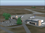
The Almirante Zar NAS is the operational base of the 6th Naval Air Square of the
Argentine Navy. The scenery includes the representation of both commercial and military platforms, as well as all their complementary buildings.
| Filename: | Trelew_Naval_Air_Station__Argentina.zip |
| License: | Freeware |
| Added: | 12th February 2010, 11:04:39 |
| Downloads: | 1,387 |
| Author: | Ramon Sola |
| Size: | 2.14 MB |
| Category: Flight Simulator 2004 - Scenery | |
| Campbell River floats CAE3 in BC Canada |
|
Images related to this file:
File Description:
Campbell River is a medium sized town on Vancouver Island, some 50 miles north of Vancouver. The base is just north and west of the town on Spit Road. And Ultimate Terrain is required for the cost to be in the right place. The docks are on the south side of the spit, on the (relatively) sheltered river side, though take offs and landings are requested to take place outside the harbour if conditions permit. The base is noted as used and run by Corilair, though in fact there is also another company based there, Vancouver Island Air, who like Coril Air also have two docks, one for boarding passengers and one for maintenance and refuelling tie-ups. At the river mouth there is a small marina, run by the same folks who run the trailer park, and next to that a dock for visiting float planes. There is a seventh dock at the end furthest from the river mouth; I don't know what that is used for but it is next to Vancouver Island Air and might be theirs. At low tide there are numerous sandbanks (and more permanent islands with bushes and trees) in the mouth of the Campbell River and I decided to ignore installing these with all the problems they would cause me. The main buildings and most of the others are modeled specifically for this scenery; minor items like parked cars are RWY12.
| Filename: | Campbell_River_floats_CAE3_in_BC_Canada.zip |
| License: | Freeware, limited distribution |
| Added: | 12th February 2010, 18:45:00 |
| Downloads: | 881 |
| Author: | Roger Wensley |
| Size: | 5.3 MB |
| Category: Flight Simulator 2004 - Scenery | |
| EDOV-04 |
|
Images related to this file:
File Description:
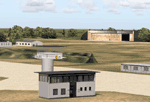
FS2004 scenery--Borstel airport EDOV near
Stendal in Sachsen Anhalt Germany.
Originally a WWII paratroops base, later
base of soviet jetfighters and helicopters,
but now in civilian use. By Thomas Erthner.
| Filename: | EDOV04.zip |
| License: | Check within download |
| Added: | 13th February 2010, 01:04:00 |
| Downloads: | 1,071 |
| Author: | Thomas Erthner |
| Size: | 2.25 MB |
| Category: Flight Simulator 2004 - Scenery | |
| Fremont County, Colorado, Photo-Scenery |
|
Images related to this file:
File Description:
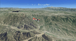
Fremont County, Colorado, Photo-Scenery (FS9 & FSX)
Covers the gap between my Buena Vista and Colorado Springs South sceneries and provides you with continuous coverage for longer cross country flights. High resolution versions of this scenery for FS9 and FSX (much sharper, but larger and multiple downloads) are available at www.blueskyscenery.com/GNB_South3.html . The screenies are taken from the high-res versions, so expect this version to be slightly more blurry. YourDonation@Work: Dedicated to Senges and Dennis.
| Filename: | Fremont_County_Colorado_PhotoScenery.zip |
| License: | Freeware, limited distribution |
| Added: | 13th February 2010, 14:33:42 |
| Downloads: | 1,339 |
| Author: | Gottfried Razek, blueskyscenery.com |
| Size: | 92.11 MB |
| Category: Flight Simulator 2004 - Scenery | |
| Kansas City Airport circa 1958 |
|
Images related to this file:
File Description:
Kansas City area Airports of the 50's (KMKC) Kansas City Municipal & KKCK (Kansas City Fairfax).
| Filename: | Kansas_City_Airport_circa_1958.zip |
| License: | Freeware |
| Added: | 14th February 2010, 23:09:08 |
| Downloads: | 1,945 |
| Author: | Paul Young w/Tom Gibson |
| Size: | 1.19 MB |
| Category: Flight Simulator 2004 - Scenery | |
| Chelsea Dams on the Gatineau River |
|
Images related to this file:
File Description:
The Chelsea Dams are on the Gatineau River, just north of Rockcliffe airfield. I have used the plural as while there is only one dam as such, there is a second generating station just south of the dam; so "it" is more generally called "the Chelsea Dams". The dams mark the point where, if you are flying south down the Gatineau River towards Rockcliffe, you should be either below 1,500 feet or talking to the Ottawa control tower. While not a reporting point as noted in the supplement notes about flying vfr in the Ottawa area the dams are still the natural reporting point when approaching Rockcliffe and announcing landing intentions. Plus they are a visible landmark from way off, so here they are.
| Filename: | Chelsea_Dams_on_the_Gatineau_River.zip |
| License: | Freeware, limited distribution |
| Added: | 14th February 2010, 23:11:15 |
| Downloads: | 256 |
| Author: | Roger Wensley |
| Size: | 879.08 KB |
| Category: Flight Simulator 2004 - Scenery | |
| Turkey Mesh, Part 2 of 5 |
|
File Description:
Created from 3 arc second data and re-sampled @LOD9 (best fit for this data). The created area extends from N35E025(lower left corner) to N44E047(upper right corner). You need all the five bgl-files plus the two correction files to cover the whole area. Otherwise you will have only a coverage of the corresponding file. Matthew Style's SRTM_3ARCSEC_TO_BGL program was used to interpolate the srtm data and automate the bgl file creation (Many Thanks to Matthew for his great utility).
| Filename: | Turkey_Mesh_Part_2_of_5.zip |
| License: | Freeware |
| Added: | 15th February 2010, 09:32:47 |
| Downloads: | 8,697 |
| Author: | Abdulkadir Ozturk |
| Size: | 40.8 MB |


© 2001-2026 AVSIM Online
All Rights Reserved
Privacy Policy |