
Where Flight Simulation Enthusiasts Gather from Around the World!
AVSIM Library - Search Results

| Category: Flight Simulator 2004 - Scenery | |
| Moffet Federal Airfield (KNUQ) - Mountain View, California |

|
Images related to this file:
File Description:
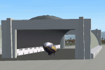
Moffet Federal Airfield (KNUQ) version 2. Now with open blimp hangar, improved models and texturing, and AI Goodyear blimp courtesy of David (Opa) Marshall and Bill Lyons. This is a complete scenery and no other downloads are required.
| Filename: | Moffet_Federal_Airfield_KNUQ__Mountain_View_Califo.zip |
| License: | Freeware |
| Added: | 2nd February 2010, 10:58:59 |
| Downloads: | 2,537 |
| Author: | John Stinstrom & David "Opa" Marshall |
| Size: | 6.65 MB |
| Category: Flight Simulator 2004 - Scenery | |
| Collings and Mansfield |
|
File Description:
FS2004 Scenery - In 1979 the Collings Foundation was founded to support "living history" events involving transportation. Originally founded with the focus of automobiles, the foundation moved to aircraft as the need for quality aviation history exhibits grew. Mansfield Municipal Airport (1B9) serves Mansfield and Bristol County, MA and is owned by the Town Of Mansfield. The airport has more than one runway. The longest is a paved runway extending 3498 feet. The facility is at an elevation of 122 feet. Created using Instant Scenery by John B. Loney, Jr.
| Filename: | Collings_and_Mansfield.zip |
| License: | Freeware, limited distribution |
| Added: | 3rd February 2010, 02:07:34 |
| Downloads: | 247 |
| Author: | John B. Loney, Jr. |
| Size: | 1.78 MB |
| Category: Flight Simulator 2004 - Scenery | |
| Exploring Our World - Part 3 - The Wine Country of Chile. |
|
Images related to this file:
File Description:

Exploring Our World - Part 3 - The Wine Country of Chile. Here is your opportunity to explore the Wine Country of Northern Chile with stopovers at four delightful GA airfields (SCAD-SCMI-SCOV-SCVN) enhanced by Cesar Carrasco. Along the way you will enjoy some very beautiful scenery. This package includes revised Afcads for the airports and a small Traffic file using default aircraft plus a challenge to find an observatory which I have added. Please read the documentation for further details. Designed to work with the default FS2004 scenery, no additional mesh is required. Please unzip (using folders option) to a temporary folder and follow the simple installation instructions which are in .doc and .pdf formats. Compiled for your flying enjoyment by David "Opa" Marshall.
| Filename: | Exploring_Our_World__Part_3__The_Wine_Country_of_C.zip |
| License: | Freeware |
| Added: | 3rd February 2010, 02:08:43 |
| Downloads: | 1,472 |
| Author: | David "Opa" Marshall |
| Size: | 1.19 MB |
| Category: Flight Simulator 2004 - Scenery | |
| Tinian 1945 |
|
Images related to this file:
File Description:
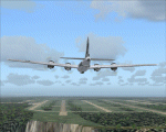
Tinian and the Marianas Island as they (nearly) were in 1945. It includes 8 detailed airfields, with traffic AI (you will need to download original aircraft) : Tinian, Saipan, Rota (fictionous place for the famous VMF-214 Black Sheeps squadron of Greg "Papy" Boyington), Guam. Read carefully the instructions.
| Filename: | Tinian_1945.zip |
| License: | Freeware |
| Added: | 3rd February 2010, 02:16:05 |
| Downloads: | 639 |
| Author: | Daniel Gauthier |
| Size: | 40.46 MB |
| Category: Flight Simulator 2004 - Scenery | |
| Beaverton CBV2 and Beaverton North fields near Lake Simcoe, Ontario, Canada |
|
File Description:
The town of Beaverton is on the east shore of Lake Simcoe. Just a bit over three miles to the east of the town is Beaverton airfield CBV2, with a grass runway 12/30 that appears to be 2,100 feet long, rather than the listed 2,400 feet. The field is new enough to be omitted from FS9, and though there are plans to build hangars I don't know if anything has been built in the year since I last saw it, so the only buildings here are farm-related. The second field to the northwest is Beaverton North, which is privately owned. It has 2,000 feet or so of grass runway and a large hangar (or storage shed?) and that about sums up all I know about it. There are two airfield scenery folders, two landclass files to provide the grass airfield areas, and a third landclass folder that modifies the terrain around Beaverton CBV2.
| Filename: | Beaverton_CBV2_and_Beaverton_North_fields_near_Lak.zip |
| License: | Freeware |
| Added: | 3rd February 2010, 02:16:36 |
| Downloads: | 324 |
| Author: | Roger Wensley |
| Size: | 1.05 MB |
| Category: Flight Simulator 2004 - Scenery | |
| Changi Airport [WSSS] Edits |
|
File Description:
CHANGES TO THE DEFAULT WSSS AIRPORT.
UPDATES the runway surface, control tower, and 02C/20C..
THANKS TO SK YEK'S CONTROL TOWER.
FPS FRIENDLY AND TESTED.
NOT TO BE USED WITH SAMSOFT THE VERY SINGAPORE
| Filename: | Changi_Airport_WSSS_Edits.zip |
| License: | Freeware |
| Added: | 3rd February 2010, 02:26:40 |
| Downloads: | 1,808 |
| Author: | S.T. |
| Size: | 90.84 KB |
| Category: Flight Simulator 2004 - Scenery | |
| Emsdale CNA4 & Emsdale South fields in Ontario, Canada |
|
Images related to this file:
File Description:
Emsdale is on Hwy 11 about midway between North Bay and Lake Simcoe. A mile north of the town is Emsdale airfield CNA4, with two grass runways that are 12/30 2,500 feet long, and 17/35 2,000 feet long. There is only one hangar, no fuel, and in general there does not appear to be a lot of action. "Grass" may be a generous description of the runway surface, particularly for 12/30.
The second field is two miles southwest of Emsdale and privately owned. It has 2,700 feet or so of asphalt runway and a parallel grass runway (which is short at under 800 feet, plus a hangar at the north end!). There are six buildings, between hangars and office or club house and that about sums up all I know about it. If anyone knows more about this field please let me know.
| Filename: | Emsdale_CNA4__Emsdale_South_fields_in_Ontario_Cana.zip |
| License: | Freeware |
| Added: | 3rd February 2010, 15:35:35 |
| Downloads: | 390 |
| Author: | Roger Wensley |
| Size: | 1.91 MB |
| Category: Flight Simulator 2004 - Scenery | |
| Park County, Colorado, Photo-Scenery (FS9 & FSX) |
|
Images related to this file:
File Description:

Covers the gap between my Leadville and Colorado Springs North sceneries and provides you with continuous coverage for longer cross country flights. High resolution versions of this scenery for FS9 and FSX (much sharper, but larger and multiple downloads) are available at www.blueskyscenery.com/GNB_South2.html . The screenies are taken from the high-res versions, so expect this version to be slightly more blurry. YourDonation@Work: Dedicated to Arthur and Pierre-Alain.
| Filename: | Park_County_Colorado_PhotoScenery_FS9__FSX.zip |
| License: | Freeware, limited distribution |
| Added: | 3rd February 2010, 22:19:58 |
| Downloads: | 1,423 |
| Author: | Gottfried Razek - blueskyscenery.com |
| Size: | 89.49 MB |
| Category: Flight Simulator 2004 - Scenery | |
| Talkeetna Village AK44 in Alaska, home of Don Sheldon's Talkeetna Air Service |
|
Images related to this file:
File Description:
Talkeetna is around 75 miles north of Anchorage in Alaska on the east shore of the Susitna River. The town is where Don Sheldon got off the train in 1938, and where, ten years later, he started Talkeetna Air Services. There are two airfields in Talkeetna, PATK with its long asphalt runway and Talkeetna Village AK44 in the middle of the town. This is AK44; the default FS version with Ultimate Terrain installed had the runway half in the river, but there is still space for the 900 feet of runway that is described in the book "Wager With The Wind" that tells Don's story. The result is a step back in time to 1973, when the second hangar was built. If you also want to install PATK do a search. I have partially populated the village with cabins, and UT is probably required for the river to be there; I haven't tested this without it.
| Filename: | Talkeetna_Village_AK44_in_Alaska_home_of_Don_Sheld.zip |
| License: | Freeware |
| Added: | 4th February 2010, 01:24:40 |
| Downloads: | 565 |
| Author: | Roger Wensley |
| Size: | 3.66 MB |
| Category: Flight Simulator 2004 - Scenery | |
| Snowden Farm CF39, in Ontario Canada |
|
Images related to this file:
File Description:
Another airfield close to Highway 11, further south towards Lake Simcoe. Snowden Farm is a bit over five miles south of Huntsville and east of of highway 11. The grass runway 12/30 is just over 2,000 feel long and sandwiched between Penfold Lake to the north, and on the south side a large pond with a creek that connects to the much larger Mary Lake to the east. There is a hangar and a shed at the eastern end of the runway. There is one airfield scenery file, and two landclass files to provide the grassed area and the large pond and creek. I presume that the pond was just a little too small to register with Ultimate Terrain. The scenery might work without Ultimate Terrain but I haven't tested it, and for sure without it Penfold Lake and probably Mary Lake won't appear.
| Filename: | Snowden_Farm_CF39_in_Ontario_Canada.zip |
| License: | Freeware, limited distribution |
| Added: | 5th February 2010, 03:51:07 |
| Downloads: | 296 |
| Author: | Roger Wensley |
| Size: | 837.43 KB |


© 2001-2026 AVSIM Online
All Rights Reserved
Privacy Policy |