
Where Flight Simulation Enthusiasts Gather from Around the World!
AVSIM Library - Search Results

| Category: Flight Simulator 2004 - Scenery | |
| LFID 2006 - Herret Airfield |

|
Images related to this file:
File Description:

FS2004 Scenery--Herret Airfield (LFID), v2.1. Herret is situated in the southwest of France (between the towns of Condom and Valence-sur-Baise) and is used by GA aircraft and gliders. This scenery comes with appropriate AFCAD and traffic files. Compatible with payware Ultimate Terrain Europe and Raimondo Taburet's Roads of France. By Philippe Tonin.
| Filename: | LFID_2006__Herret_Airfield.zip |
| License: | Freeware, limited distribution |
| Added: | 7th May 2015, 00:23:23 |
| Downloads: | 320 |
| Author: | Philippe Tonin |
| Size: | 4.9 MB |
| Category: Flight Simulator 2004 - Scenery | |
| Rio Vista Municipal Airport 2015 |
|
Images related to this file:
File Description:
FS2004 Scenery-Rio Vista Municipal Airport (FAA LID: O88) is a public airport located three miles (4.8 km) northwest of Rio Vista, serving Solano County, California, USA. This general aviation airport covers 273 acres (110 ha) and has two runways and one helipad. The airport is the current base of operations for the Travis AFB Aero Club. It opened in 1993, replacing the original Rio Vista Airport which closed in 1995. By John B. Loney, Jr.
| Filename: | Rio_Vista_Municipal_Airport_2015.zip |
| License: | Freeware, limited distribution |
| Added: | 18th May 2015, 12:53:35 |
| Downloads: | 217 |
| Author: | John B. Loney, Jr. |
| Size: | 5.52 MB |
| Category: Flight Simulator 2004 - Scenery | |
| Rio Vista Municipal Airport 2015 - Fix |
|
Images related to this file:
File Description:
FS2004 Scenery - This file contains the photo-real textures left out of the Rio Vista 2015 scenery (rio_vista_municipal_airport_o88_fs9.zip) without which the sim will crash if they are not present when loading the scenery. My apologies to the flightsim community. By John B. Loney, Jr.
| Filename: | Rio_Vista_Municipal_Airport_2015__Fix.zip |
| License: | Freeware, limited distribution |
| Added: | 20th May 2015, 14:04:17 |
| Downloads: | 134 |
| Author: | John B. Loney, Jr. |
| Size: | 489.25 KB |
| Category: Flight Simulator 2004 - Scenery | |
| Z19O - Hamat Airbase - Batroun, Lebanon |
|
Images related to this file:
File Description:
Hamat is a village near the coast of Lebanon, around 25 miles north of Beirut. The airport runway was built during the civil war to the west of Hamat in the late 1970's, between Hamat and another village called Wuajh Al Hajar. The intention was have an alternative to Beirut airport, which could be (and often was) closed by shell fire from any or all of the sides involved in the civil war, or by bombing by those who were not directly part of the civil war but occasionally joined in. It has been used for drag racing, occasional freefall parachuting (this may continue) and is now an army base with mostly helicopter use. The runway is around 5,600 feet of asphalt, 90 feet wide and aligned 02/20. There is no lighting. The apron is set well back from the runway and has hangars at each end; one set is four hangars long, and at the other end of the apron there are three hangars. There are also the remains of some radar to the west of the apron, bombed (in 1982?). The runway has been repositioned and the surrounding landclass modified to reduce one village to it's approximate actual size and to create a second village which was missing entirely. An intrusive road has been deleted, and the airfield grass area also modified.
| Filename: | Z19O__Hamat_Airbase__Batroun_Lebanon.zip |
| License: | Freeware, limited distribution |
| Added: | 23rd May 2015, 10:03:10 |
| Downloads: | 224 |
| Author: | Roger Wensley |
| Size: | 8.53 MB |
| Category: Flight Simulator 2004 - Scenery | |
| CZNL - Nelson - Nelson, British Columbia, Canada |
|
Images related to this file:
File Description:
Nelson is a town with a population of around 10,000, located 250 miles or so east of Vancouver on the southern shore of an east-west offshoot of Kootenay Lake. The surrounding landscape can be described as "steep" without fear of contradiction, and the diagram of arrival and departure routes (included here) shows that straight finals to either end of the runway are non-existant. The airport is right beside the water, with a single runway 3,100 feet long and 75 feet wide, aligned 04/22. The apron is at the western end. There are a number (3?) of helicopter companies based at the western end of the apron, and there is also a terminal building, though there are in fact no regular scheduled flights; there are occasional charters to cater for town events during the summer tourist season. There is no runway lighting, or taxiway or apron lights, so usage is effectively restricted to daylight hours (though not legally stated as such). All circuits are over the water and not the town, though even this means you climb quickly and dog-leg to follow the water until you have gained enough altitude to turn. Winter maintenance is limited. And if all this is not enough you are advised to "watch for wildlife on the rwy". The nature of the surrounding terrain makes AI hit-and-miss; mostly hit. AI Planes will taxi out and then take off, and provided you don't follow them until they fly into a mountain it will all appear normal. Planes that are arriving will appear by magic on their parking spots, as they have crashed before they arrive. To avoid repetitive unrealistic arrivals I have limited the AI to only 3 planes. The scenery includes some of the nearby buidings and landmarks, as shown in the screenshots.
| Filename: | CZNL__Nelson__Nelson_British_Columbia_Canada.zip |
| License: | Freeware, limited distribution |
| Added: | 7th June 2015, 10:23:49 |
| Downloads: | 425 |
| Author: | Roger Wensley |
| Size: | 17.84 MB |
| Category: Flight Simulator 2004 - Scenery | |
| CYEY - Amos-Magny Airport - Quebec, Canada |
|
Images related to this file:
File Description:
FS9 Scenery - Amos/Magny Airport (IATA: YEY, ICAO: CYEY) is located 5 nautical miles (9.3 km; 5.8 mi) west of Amos, Quebec, Canada. Amos is a small airport in northern Quebec near many good fishing spots. For your flying pleasure by John B. Loney, Jr.
| Filename: | CYEY__AmosMagny_Airport__Quebec_Canada.zip |
| License: | Freeware, limited distribution |
| Added: | 30th June 2015, 01:57:18 |
| Downloads: | 228 |
| Author: | John B. Loney, Jr. |
| Size: | 4.31 MB |
| Category: Flight Simulator 2004 - Scenery | |
| CPR5 - Woodstock - Ontario, Canada |
|
Images related to this file:
File Description:
This is the first of a south Ontario series. Woodstock is a town with a population of around 38,000, located 50 miles west of Lake Ontario. The airfield is 3 miles west of the town, with a single grass runway just over 3,000 feet long and 100 plus feet wide, aligned 05/23 in FS9 (in fact it is now 06/24 due to the magnetic north wandering off during the last 10 years). There have been at different times varying amounts of gravel mixed in with the grass on both runway and taxiway; the majority surface by far is grass and I have left it all as such, as there is no visually convincing way to mix the two without unreal sharp edges. The apron is on the northern side of the runway, and is now modified in shape to maximise the area available for crops. There are 10 "T" hangars and a small clubhouse in a single long building. There is no fuel, runway lighting, or taxiway or apron lights so usage is effectively restricted to daylight hours. To the east of CPR5 and on the edge of the town is a private airstrip with 2,800 feet of asphalt runway; I have added this as a visual reference, along with several large grain silos on the other side of the road. Hidden in plain sight amid the surrounding farmland, the first sighting of CPR5 is actually always of the adjacent and far more visible buildings just to the east of the apron, which are owned by a company that deals with everything to do with boats, up to and including fishing gear. These have been included. As ditches cannot be effectively duplicated in FS9 I have included some fences which do not exist in real life, to give some needed visual clues.
| Filename: | CPR5__Woodstock__Ontario_Canada.zip |
| License: | Freeware, limited distribution |
| Added: | 8th July 2015, 13:36:05 |
| Downloads: | 186 |
| Author: | Roger Wensley |
| Size: | 5.57 MB |
| Category: Flight Simulator 2004 - Scenery | |
| Central Appalachia Land Class |
|
Images related to this file:
File Description:
I've used default textures (tiles) for villages MS left out of the sim. I didn't place all of the missing villages on the project sheet, though. I did not need to make custom tiles, neither. Most highways are connected the default villages now. I was satisfied with the default tiles MS uses. Most highways are connected the default villages now. Mountain ridge lines better contrast with valleys now. But, I did get it all...
| Filename: | Central_Appalachia_Land_Class.zip |
| License: | Freeware |
| Added: | 9th July 2015, 01:47:21 |
| Downloads: | 147 |
| Author: | Rick Connolly |
| Size: | 1.31 MB |
| Category: Flight Simulator 2004 - Scenery | |
| KCRW - Kanawha River Valley - West Virginia, USA |
|
Images related to this file:
File Description:

This scenery is made to blend with autogen scenery and the defaults of FS9. Transits crossing the southern Allegheny Mountains will follow this valley seeing some of the landmark bridges and dams of the central WV area. The New river bridge scenery is not included in this package because (not only my own version which works default mesh), but another fellow has made one. It also fits with this package and looks real good. This package blends well with default or compliments my Land Class Central Appalachia package.
| Filename: | KCRW__Kanawha_River_Valley__West_Virginia_USA.zip |
| License: | Freeware |
| Added: | 9th July 2015, 17:26:13 |
| Downloads: | 228 |
| Author: | Rick Connolly |
| Size: | 2.33 MB |
| Category: Flight Simulator 2004 - Scenery | |
| WV71 - Lieving Airport - West Virginia, USA |
|
Images related to this file:
File Description:
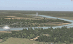
Racine Locks & Dam is a local vfr landmark for transits across the lower Allegheny Plateau. Included files are xml autogen, ezlandclass and custom bgl files with textures. I've named the files so that they are self explainable. This scenery is made to blend with autogen scenery (default) for FS9 and my Central Appalachia Land Class project. I've added the lower Big Sandy Valley project, too. It corrects a few default mistakes and adds bridges like at I-64 and in the Ashland Kentucky and Huntington WV area.
| Filename: | WV71__Lieving_Airport__West_Virginia_USA.zip |
| License: | Freeware |
| Added: | 9th July 2015, 17:29:21 |
| Downloads: | 213 |
| Author: | Rick Connolly |
| Size: | 5.64 MB |


© 2001-2026 AVSIM Online
All Rights Reserved
Privacy Policy |