
Where Flight Simulation Enthusiasts Gather from Around the World!
AVSIM Library - Search Results

| Category: Flight Simulator 2004 - Scenery | |
| Naval Air Station Lemoore, CA USA |

|
Images related to this file:
File Description:

Custom scenery for NAS Lemoore, CA. Scenery includes custom FSDS objects and photoreal ground textures at default resolution. Project scenery can be used as stand-alone but may benefit from addtional downloads (see readme inside). Designed for use with MAIW's excellent Lemoore AI package available at MilitaryAIWorks.com.
User Note: this package replaces basic scenery included with MAIW package.
| Filename: | Naval_Air_Station_Lemoore_CA__USA.zip |
| License: | Freeware, limited distribution |
| Added: | 12th July 2012, 17:07:09 |
| Downloads: | 1,186 |
| Author: | John Stinstrom |
| Size: | 6.22 MB |
| Category: Flight Simulator 2004 - Scenery | |
| Buffalo Narrows CYVT in Saskatchewan, Canada |
|
Images related to this file:
File Description:
Buffalo Narrows is a small town (around 1,400 folks) 130 miles west and a bit north of La Ronge in Saskatchewan, and I discovered that the Buffalo Narrows airfield, wrongly positioned in FS9, had been flooded out by Ultimate Terrain's lake; this is the rescue package. Actually that would be several lakes as the place is surrounded by water including Churchill Lake, Little Peter Pond Lake, and of course Big Peter Pond Lake.
There are two runways, the longest being 5,006' of 100' wide asphalt aligned 11/29, and the other 2,297 and 75' wide, also asphalt. Both runways are lit, and there is JetA and 100LL fuel available. I have placed taxiway lights, but I haven't made proper signage or placed runway lights, or a ton of other things, but it is now landable and with the buildings and fire chemical retarder tanks etc, and there is AI that includes a CL-415. The roads have also been modified to fit.
| Filename: | Buffalo_Narrows_CYVT_in_Saskatchewan_Canada.zip |
| License: | Freeware, limited distribution |
| Added: | 15th July 2012, 19:31:20 |
| Downloads: | 499 |
| Author: | Roger Wensley |
| Size: | 1.8 MB |
| Category: Flight Simulator 2004 - Scenery | |
| Ruissellet Strip CF03 in Ontario, Canada |
|
Images related to this file:
File Description:
Ruissellet Strip is in Ontario just a few miles southeast of ottawa. It is a real grass strip, cut out of the trees next to the house of its owner, and close to Russel Farm and Indian Creek (both also real, and posted). This version has a different name as I misread the name on the road map, so it replaces Russellet which should be deleted from your system. This version has the right hangar now that I revisited and identified the correct hangar photo that I took the first time I was there. Drat.
| Filename: | Ruissellet_Strip_CF03_in_Ontario_Canada.zip |
| License: | Freeware, limited distribution |
| Added: | 15th July 2012, 19:33:15 |
| Downloads: | 212 |
| Author: | Roger Wensley |
| Size: | 8.12 MB |
| Category: Flight Simulator 2004 - Scenery | |
| Komakuk Beach & Storm Hills DEW sites in Yukon and Northwest Territories, Canada |
|
Images related to this file:
File Description:
These are DEW line sites in northern mainland Canada, to the west of Tuktoyaktuk.
Komakuk Beach CWKB is not included in FS9 and is in the Yukon, only 20 miles from the Alaska border. It is, as the name suggests, close to the sea, and the gravel runway 3,600' by 125' has its western end almost on the beach.
There is no lighting and no signage and the airfield is officially listed as closed, but in fact is used during the annual maintenance and refuelling of the automated NWS (North Warning Station) close by and for any unscheduled servicing. This replaced the previous much older DEW station that was manned year round and had a lot more buildings.
Storm Hills CWSH is in the Northwest Territories, 43 miles south-southwest of Tuktoyaktuk, up on higher land at 810 feet ASL. The NWS (there was no previous DEW station at this site) is serviced by helicopter from Tuktoyaktuk and has a gravel landing pad on the north side of the station. It will show on a gps and it is 5 miles west of the distinctively shaped and large Parsons Lake. This too was not in FS9.
| Filename: | Komakuk_Beach__Storm_Hills_DEW_sites_in_Yukon_and_.zip |
| License: | Freeware, limited distribution |
| Added: | 16th July 2012, 18:56:09 |
| Downloads: | 306 |
| Author: | Roger Wensley |
| Size: | 1.68 MB |
| Category: Flight Simulator 2004 - Scenery | |
| Mulhouse - Centre Hospiatlier Emile Muller, France |
|
Images related to this file:
File Description:

Scenery add-on for France VFR Alsace VFR base pack.
The Centre Hospitalier Emile Muller is the main hospital of Mulhouse. The helipad can support an helicopter up to 10 tons and is the home base of the Agusta A109 Power from SAMU 68.
Not tested without France VFR Alsace VFR base pack but should be compatible with default scenery.
By HAUGER Fredo.
| Filename: | Mulhouse__Centre_Hospiatlier_Emile_Muller_France.zip |
| License: | Freeware |
| Added: | 16th July 2012, 19:04:13 |
| Downloads: | 525 |
| Author: | HAUGER Fredo |
| Size: | 3.67 MB |
| Category: Flight Simulator 2004 - Scenery | |
| T57 - Garland DFW Heloplex - Dallas, USA |
|
Images related to this file:
File Description:
This is a small version made mostly in sketchup of the Garland heliport (T57) located just south of Dallas.
| Filename: | T57__Garland_DFW_Heloplex__Dallas_USA.zip |
| License: | Freeware |
| Added: | 13th April 2015, 17:25:32 |
| Downloads: | 83 |
| Author: | Anders Samuelsson |
| Size: | 6.77 MB |
| Category: Flight Simulator 2004 - Scenery | |
| NZGS - Gisborne Airport - Gisborne, New Zealand |
|
Images related to this file:
File Description:
Gisborne (NZGS) ia a small airport in the north east (North Island) of New Zealand.
This scenery is fully compatible with the great Coromandel Peninsula Photoreal Scenery
and the Photoreal Scenery for Gisborne Airport (by GodZone -TM-). Gisborne airport has daily service to Auckland, Hamilton, Napier, Rotorua, Tauranga and Whakatane serviced by Air New Zealand and Sunair Aviation.
| Filename: | NZGS__Gisborne_Airport__Gisborne_New_Zealand.zip |
| License: | Freeware |
| Added: | 27th April 2015, 13:11:57 |
| Downloads: | 490 |
| Author: | David Kolas |
| Size: | 13.28 MB |
| Category: Flight Simulator 2004 - Scenery | |
| Naknek (5NK) and Naknek South (WSN) - Alaska, USA |
|
Images related to this file:
File Description:
Naknek and Naknek South are two towns close to the mouth of the Naknek River and on opposite banks. King Salmon is approximately 15 miles to the east. The canneries on both banks of the river are the reason for the existence of both towns and airfields, with fishing for salmon being the primary industry of the area. This takes place from the beach by individuals, by small boats in the river and the immediate sea area, and offshore by larger craft. There is a picture of one boat unloading in Naknek which will be known to anyone who has watched the most famous television fishing programme of all, Deadliest Catch. Cornelia Marie is better known for the crab fishing based in Dutch Harbor, but this area too is just as productive though without the drama. Naknek 5NK has two gravel runways and a float runway in the adjoining lake; all three are just under 2,000 feet long. Naknek South WSN has two gravel runways, 12-30 being 3,300 feet long and 04-22 2,260 feet. As the road connecting to King Salmon is on the north bank it is probable that more seasonal workers are brought into the southern canneries by air, hence the longer runway (and with PAPI on 12). Grant Aviation run scheduled flights into both and there are numerous seasonal charter flights. The AI is a further modification of that posted with King Salmon PAKN and includes these flights, and presumes that you have already downloaded PAKN.
| Filename: | Naknek_5NK_and_Naknek_South_WSN__Alaska_USA.zip |
| License: | Freeware, limited distribution |
| Added: | 29th April 2015, 20:44:31 |
| Downloads: | 217 |
| Author: | Roger Wensley |
| Size: | 6.09 MB |
| Category: Flight Simulator 2004 - Scenery | |
| NZHN - Hamilton International Airport - Hamilton, New Zealand *Update* |
|
File Description:
This Update add a more realistic Terminal building to the Hamilton International Airport scenery. A previous installation of the Hamilton International Airport scenery is necessary.
| Filename: | NZHN__Hamilton_International_Airport__Hamilton_New.zip |
| License: | Freeware |
| Added: | 4th May 2015, 08:59:59 |
| Downloads: | 419 |
| Author: | David Kolas |
| Size: | 36.64 KB |
| Category: Flight Simulator 2004 - Scenery | |
| LFRK 2005 - Caen-Carpiquet Airport |
|
Images related to this file:
File Description:
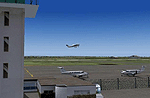
FS2004 Caen-Carpiquet Airport (LFRK) scenery. The scenery can be used with Ultimate Terrain Europe, MAAM cemetery and Taburet's roads add-ons. We recommend to use LFRK AI GA Traffic available on Avsim (lfrk_ga_traffic.zip). By Normansim (Frederik Bilhaut, Jean-Michel Magniez and Philippe Tonin).
| Filename: | LFRK_2005__CaenCarpiquet_Airport.zip |
| License: | Freeware, limited distribution |
| Added: | 7th May 2015, 00:23:15 |
| Downloads: | 430 |
| Author: | Philippe Tonin, Frederik Bilhaut, Jean-Michel Magniez (Normansim) |
| Size: | 4.92 MB |


© 2001-2026 AVSIM Online
All Rights Reserved
Privacy Policy |