
Where Flight Simulation Enthusiasts Gather from Around the World!
AVSIM Library - Search Results

| Category: Flight Simulator 2004 - Scenery | |
| Warsaw Airport (EPWA) 2010, current construction state |

|
File Description:
Addon for version 1.3 of Warsaw scenery. Few diggers, new runway surface and 'closed' signs.
| Filename: | Warsaw_Airport_EPWA_2010_current_construction_stat.zip |
| License: | Freeware, limited distribution |
| Added: | 20th March 2011, 20:32:01 |
| Downloads: | 1,706 |
| Author: | Mateusz Stabryla, MK Studios |
| Size: | 194.39 KB |
| Category: Flight Simulator 2004 - Scenery | |
| Igloolik CYGT in Nunavut Canada |
|
Images related to this file:
File Description:
Igloolik is a village of 1,600 or so inhabitants at N 69 22 W 81 49 on Igloolik Island, off the northeast corner of the Melville Peninsula. It's name means approximately "Place With A House". The village does not feature in FS9 but is included in this scenery with approximately the right shape, as were the series of northern sceneries before this one. The airfield runway is 4,095 feet of gravel 100 feet wide and is at 173 feet above sea level. There is a gradient to it, but unfortunately this cannot be replicated in FS. I added the roads, a new airfield background, plus of course there is the scenery file and the AFCAD and AI, which has two planes visiting, a First Air HS748 and a Canadian North Dash 8-100.
| Filename: | Igloolik_CYGT_in_Nunavut_Canada.zip |
| License: | Freeware, limited distribution |
| Added: | 23rd December 2010, 02:28:26 |
| Downloads: | 523 |
| Author: | Roger Wensley |
| Size: | 2.7 MB |
| Category: Flight Simulator 2004 - Scenery | |
| Sabzevar Airport(OIMS) |
|
File Description:
First design of Sabzevar airport(OIMS)for Flight Simulator 2004 .
| Filename: | Sabzevar_AirportOIMS.zip |
| License: | Freeware |
| Added: | 24th December 2010, 08:13:05 |
| Downloads: | 436 |
| Author: | Amir Esparham |
| Size: | 159.76 KB |
| Category: Flight Simulator 2004 - Scenery | |
| Burgas LBBG - final v1.0 |
|
File Description:
Burgas (Bourgas) International Airport (IATA: BOJ, ICAO: LBBG), (Bulgarian: Летище БургаÑ) is the airport of the city of Burgas, Bulgaria. It is one of the biggest international Bulgarian airports. It's location is on the coast of the Black Sea and is a popular tourist destination during the summer months, when it is subject to heavy traffic.
The airport has one long runway - concrete; direction 04/22; it is 3200m (10,500ft) in length and is capable of accepting the biggest airplanes in the world.
| Filename: | Burgas_LBBG__final_v10.zip |
| License: | Freeware |
| Added: | 24th December 2010, 17:38:24 |
| Downloads: | 1,233 |
| Author: | Vasil Madjarov, AFCAD by Evgeny Genchev |
| Size: | 9.08 MB |
| Category: Flight Simulator 2004 - Scenery | |
| 14 Wing Greenwood Nova Scotia (CYZX), Canada |
|
Images related to this file:
File Description:
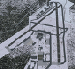
Re-upload. 14 Wing Greenwood, home of the CP-140 Aurora and 413 Search and Rescue Squadron.
Scenery includes a detailed airport.
| Filename: | 14_Wing_Greenwood_Nova_Scotia_CYZX_Canada.zip |
| License: | Freeware, limited distribution |
| Added: | 2nd January 2011, 03:57:09 |
| Downloads: | 2,727 |
| Author: | Serge Duguay |
| Size: | 4.03 MB |
| Category: Flight Simulator 2004 - Scenery | |
| Pudding Hill - NZPH |
|
Images related to this file:
File Description:
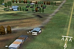
44nm east from Christchurch, New Zealand. 22nm from Ashburton.
Pudding Hill Lodge and Holiday Park. Skydiving area. Choice of 2 runways. Made for Christian Stock's NZ mesh in the form of "Mountains of New Zealand" and topo in the form of "Lakes and Rivers of New Zealand".
| Filename: | Pudding_Hill__NZPH.zip |
| License: | Freeware |
| Added: | 2nd January 2011, 21:56:28 |
| Downloads: | 287 |
| Author: | Godfrey Tier |
| Size: | 1.15 MB |
| Category: Flight Simulator 2004 - Scenery | |
| Oristano Fenosu, LIER, Patch1. |
|
File Description:
Patch 1 for LIER Oristano Fenousu.
| Filename: | Oristano_Fenosu_LIER_Patch1.zip |
| License: | Freeware |
| Added: | 2nd January 2011, 22:40:19 |
| Downloads: | 869 |
| Author: | Ivano Marongiu |
| Size: | 326.66 KB |
| Category: Flight Simulator 2004 - Scenery | |
| Missing ILS Frequency for VDSR Siem Reap Airport, Cambodia |
|
File Description:
This BGL file when installed, will add the missing ILS radio frequency to the landing runway (05) found in the FS9 (FS2004) payware Siem Reap International Airport scenery (VDSR) in Cambodia, published by THAI CREATION. Created with Lee Swordy's AFCAD 2.21 utility.
Full instructions included. NOTE - YOU MUST OWN THE COMMERCIAL PAYWARE VDSR SCENERY FROM THAI CREATION FOR FS9 (FS2004) FOR THIS TO WORK.
| Filename: | Missing_ILS_Frequency_for_VDSR_Siem_Reap_Airport_C.zip |
| License: | Freeware |
| Added: | 17th July 2012, 18:33:01 |
| Downloads: | 252 |
| Author: | Lee James |
| Size: | 2.43 KB |
| Category: Flight Simulator 2004 - Scenery | |
| Nicholson Peninsula CWNP & Liverpool Bay CWLB DEW sites in Northwest Territories, Canada |
|
Images related to this file:
File Description:
These are DEW line sites in northern mainland Canada, to the east of Tuktoyaktuk.
Nicholson Peninsula is 100 miles east of Tuktoyaktuk and was not included in FS9. The peninsula is sometimes more like an island than a peninsula as it is barely connected to the mainland and at times is not connected at all (see the current Gogle Earth!). At the northern end there is another long and narrow gravel bar that is formed by the tide and currents and the gravel runway is on the top of this. It is now officially closed, but is still usable. The annual refuelling and maintenance to the NSW station up on the hills is carried out from a barge that lands tanker trucks onto the shore for the drive up the existing gravel roads that have been there since the early DEW station was established.
Liverpool Bay is 50 miles east of Tuktoyaktuk, up on higher land at around 300 feet ASL. The NWS (there was no previous DEW station at this site) is serviced by helicopter from Tuktoyaktuk or from a barge a mile away on the beach. There is a gravel landing pad on the north side of the station. To answer your question, the three little houses on stilts are actually fuel tanks for the generators, shaped to shed snow.
| Filename: | Nicholson_Peninsula_CWNP__Liverpool_Bay_CWLB_DEW_s.zip |
| License: | Freeware, limited distribution |
| Added: | 17th July 2012, 18:55:24 |
| Downloads: | 236 |
| Author: | Roger Wensley |
| Size: | 1.84 MB |
| Category: Flight Simulator 2004 - Scenery | |
| Clinton Point CWCP, Horton River CWHR & Keats Point CWKP; DEW sites in Northwest Territories, Canada |
|
Images related to this file:
File Description:
These are three DEW line sites in northern mainland Canada, to the east of Tuktoyaktuk.
Clinton Point is almost 300 miles east of Tuktoyaktuk and on the Northwest Territories and Nunavut border. It is the site of a closed DEW station (closed in 1993) and all the buildings have been removed, unlike many other sites where buildings are still almost complete. The roads and the gravel runway down by the beach are still there.
Horton River is 150 miles east of Tuktoyaktuk, up on higher land above the cliffs at around 500 feet ASL. The NWS (North Warning System) replaced the I site which was there previously and which ceased operations in 1963. The NWS is serviced by helicopter from a barge 400 yards away on the beach.
Keats Point is 270 miles east of Tuktoyaktuk, 7 miles from the coast but significantly close to a lake, which was probably used for float plane delivery in the summer (or ski plane delivery in the winter) of NWS station elements during construction.
| Filename: | Clinton_Point_CWCP_Horton_River_CWHR__Keats_Point_.zip |
| License: | Freeware, limited distribution |
| Added: | 17th July 2012, 18:57:08 |
| Downloads: | 282 |
| Author: | Roger Wensley |
| Size: | 2.07 MB |


© 2001-2026 AVSIM Online
All Rights Reserved
Privacy Policy |