
Where Flight Simulation Enthusiasts Gather from Around the World!
AVSIM Library - Search Results

| Category: X-Plane - Scenery | |
| KOGD - Ogden-Hinkley - Ogden, Utah |

|
Images related to this file:
File Description:
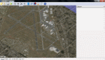
This scenery is to celebrate the return of commercial air service to Ogden-Hinkley. Allegiant now offers service IWA-OGD-IWA! This scenery takes some creative liberty but matches the airport as closely as possible. No substantial frame-rate hit. Enjoy!
| Filename: | KOGD__OgdenHinkley__Ogden_Utah.zip |
| License: | Freeware |
| Added: | 2nd December 2012, 22:36:18 |
| Downloads: | 122 |
| Author: | Aaron Cook |
| Size: | 339.79 KB |
| Category: X-Plane - Scenery | |
| KSGU Scenery Lite for X Plane 10 |
|
Images related to this file:
File Description:
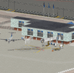
Simple scenery of the new SGU airport (formerly DXZ.) Enjoy!
| Filename: | KSGU_Scenery_Lite_for_X_Plane_10.zip |
| License: | Freeware |
| Added: | 2nd December 2012, 22:57:24 |
| Downloads: | 69 |
| Author: | Aaron Cook |
| Size: | 168.9 KB |
| Category: X-Plane - Scenery | |
| ED11- Kamen V2.0 for X-Plane Version 10.22 |
|
File Description:
Airport "ED11 Kamen" Version 2.0 for X-Plane Version 10.22
This Version replaces the previous version 1.0!
Version History:
1.0 First Version - ED11 Kamen
2.0 ED11 Kamen better landscape with lake, river and more buildings
This version needs the OpenSceneryX Library!
| Filename: | ED11_Kamen_V20_for_XPlane_Version_1022.zip |
| License: | Freeware |
| Added: | 17th October 2013, 19:07:39 |
| Downloads: | 115 |
| Author: | Juergen Depping |
| Size: | 4.22 MB |
| Category: X-Plane - Scenery | |
| ENNM - Namsos Airport - Namsos, Norway |
|
Images related to this file:
File Description:
This Namsos scenery corresponds to the current Airport Layout of ENNM. The near surroundings are designed based on a satellite photo so that VFR flights and VFR orientation should be very easy. The second bridge a bit far west of the airport is included, also the City of Namsos, a cruise ship dock and the marina south of the Namsos Bridge.
I used some parts of freeware libraries, which are already included in this package.
The airport buildings are converted from the famous FS2004 scenery from Kjell Arild Bersaas & Arne Sundsboe.
I did some small changes which were absolutely necessary to fit the new airport layout. Finally I only deleted a fence which blocked the new apron.
This scenery is converted from my ENNM-FSX scenery and the reworked with WED and OverlayEditor. The library "OpenSceneryX" must be installed first:
http://www.opensceneryx.com/
| Filename: | ENNM__Namsos_Airport__Namsos_Norway.zip |
| License: | Freeware |
| Added: | 17th May 2015, 08:59:30 |
| Downloads: | 140 |
| Author: | Wolfgang Allers |
| Size: | 16.75 MB |
| Category: X-Plane - Scenery | |
| EPGO - Goraszka 2007 for X-Plane 8 |
|
Images related to this file:
File Description:

EPGO GORASZKA 2007 SCENERY FOR X-PLANE 8
----- ABOUT THE AIRPORT -----
EPGO Goraszka airport is located 12nm (20km) south-east of Warsaw downtown and Warsaw Frederic Chopin International Airport. It was built in 1994 and belongs to General Aviation company, which offers aero-taxi flights, air transport and special flights (air photo, patrol) and airport services. The airport has a 800m-long runway and a lightened helipad, which can be used by helicopters up to 5700kg weight. General Aviation's fleet includes Antonov AN-2, PZL-104 Wilga 80, Bell 407 and 427. Since 1996 the International Air Picnic Goraszka is organized every year by "Polish Eagles" Foundation created on initiative of Zbigniew Niemczycki.
----- SCENERY FEATURES -----
This airstrip has never been included in any of X-plane series default airports list and this is the first, detailed scenery of EPGO. Main features of the scenery are:
-Ground photo texture for the surrounding area - perfect for VFR approaches (four seasons + night textures)
-Airport ground high resolution textures - feel the grass when taxiing (four seasons + night textures)
-Highly detailed 3D objects, all photo textured - we made over 300 photos to have them all realistically textured
-Detailed autogen for the whole area - almost every building and every tree
-Tower view - feel like an air traffic controller
| Filename: | EPGO__Goraszka_2007_for_XPlane_8.zip |
| License: | Freeware, limited distribution |
| Added: | 27th October 2015, 15:16:51 |
| Downloads: | 25 |
| Author: | Drzewiecki Design |
| Size: | 50.53 MB |
| Category: X-Plane - Scenery | |
| EPGO - Goraszka 2007 for X-Plane 9 |
|
Images related to this file:
File Description:

EPGO GORASZKA 2007 SCENERY FOR X-PLANE 9
----- ABOUT THE AIRPORT -----
EPGO Goraszka airport is located 12nm (20km) south-east of Warsaw downtown and Warsaw Frederic Chopin International Airport. It was built in 1994 and belongs to General Aviation company, which offers aero-taxi flights, air transport and special flights (air photo, patrol) and airport services. The airport has a 800m-long runway and a lightened helipad, which can be used by helicopters up to 5700kg weight. General Aviation's fleet includes Antonov AN-2, PZL-104 Wilga 80, Bell 407 and 427. Since 1996 the International Air Picnic Goraszka is organized every year by "Polish Eagles" Foundation created on initiative of Zbigniew Niemczycki.
----- SCENERY FEATURES -----
This airstrip has never been included in any of X-plane series default airports list and this is the first, detailed scenery of EPGO. Main features of the scenery are:
- Ground photo texture for the surrounding area - perfect for VFR approaches (four seasons + night textures)
- Airport ground high resolution textures - feel the grass when taxiing (four seasons + night textures)
- Highly detailed 3D objects, all photo textured - we made over 300 photos to have them all realistically textured
- Detailed autogen for the whole area - almost every building and every tree
- Tower view - feel like an air traffic controller
| Filename: | EPGO__Goraszka_2007_for_XPlane_9.zip |
| License: | Freeware, limited distribution |
| Added: | 27th October 2015, 15:18:36 |
| Downloads: | 49 |
| Author: | Drzewiecki Design |
| Size: | 44.65 MB |
| Category: X-Plane - Scenery | |
| Hawaii Photoreal - Niihau, Lehua and Kaula |
|
File Description:
The Hawaii Photoreal project from FSX is proud to bring a gorgeous island to X-Plane, Niihau! This is the first Hawaii Photoreal Scenery available with HD Mesh for X-Plane 10! Installation instructions are included. You must download both files for full HD Mesh experience. This scenery will not align correctly with default terrain and coastlines or those available with AlpilotX's HD Mesh 2. It should also be noted that this scenery will explode upon decompression - the true size of the folder is 341MB, whereas the download size is only 88MB. Make sure you aren't almost out of space. Niihau for X-Plane 10 includes customized HD Mesh for the entire island, including Lehua and Kaula. This isn't just processed DEM data - we have reviewed and perfected the coastlines and cliffs for ideal appearance. Please show support for this project by considering donating to the Hawaii Photoreal Project through the website.
| Filename: | Hawaii_Photoreal__Niihau_Lehua_and_Kaula.zip |
| License: | Freeware, limited distribution |
| Added: | 27th March 2016, 19:27:43 |
| Downloads: | 149 |
| Author: | Colin Stepney |
| Size: | 86.31 MB |
| Category: X-Plane - Scenery | |
| BR SP SBSJ - Sao Jose dos Campos Embraer Airport v1.0.0 |
|
Images related to this file:
File Description:

This is an X-Plane 11 and X-Plane 10 scenery package for São José dos Campos-Professor Urbano Ernesto Stumpf Airport (IATA: SJK, ICAO: SBSJ), is the airport serving São José dos Campos, Brazil. It includes corrected aprons, ramps, gates, taxiways, lighting system, city buildings, ortho-photoscenery for the airfield area, and (XP11 only) airport ground services (like push back). Embraer main plant and headquarters is the main operator. This scenery was tested and is operational (as of March 18, 2017) in "X-Plane 11 Public Beta #15 64 bit", Windows 10 Home. It was also tested and is also operational (as of March 18, 2017) in "X-Plane 10.51 64 bit", Windows 10 Home. Only the default X-Plane 11 libraries, by Laminar Research, are needed. No third party libraries are used.
| Filename: | BR_SP_SBSJ__Sao_Jose_dos_Campos_Embraer_Airport_v1.zip |
| License: | Freeware |
| Added: | 19th March 2017, 08:13:08 |
| Downloads: | 111 |
| Author: | Rui Mesquita |
| Size: | 15.45 MB |
| Category: X-Plane - Scenery | |
| BR SP SBGP - Gaviao Peixoto Embraer Airport v1.0.0 |
|
Images related to this file:
File Description:
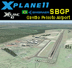
This is an X-Plane 11 and X-Plane 10 scenery package for Embraer Unidade Gavião Peixoto Airport (ICAO: SBGP, no IATA code) is a private airport located in a rural area near Gavião Peixoto and Araraquara, in Brazil. It is owned and operated by Embraer and used as for testing civil and military aircraft. Additionally, this scenery also includes a grass airstrip (SJAW Fazenda Citrica Airfield), a rural citrical farm facility for agricultural aviation. You can try landing there with your favorite prop aircraft. It's located around 1nm or 2nm northeast of SBGP airport. It includes corrected aprons, ramps, gates, taxiways, lighting system, Araraquara city buildings, ortho-photoscenery for the airfield area, and (XP11 only) airport ground services (like push back). This scenery was tested and is operational (as of March 18, 2017) in "X-Plane 11 Public Beta #15 64 bit", Windows 10 Home. It was also tested and is also operational (as of March 18, 2017) in "X-Plane 10.51 64 bit", Windows 10 Home. Only the default X-Plane 11 libraries, by Laminar Research, are needed. No third party libraries are used.
| Filename: | BR_SP_SBGP__Gaviao_Peixoto_Embraer_Airport_v100.zip |
| License: | Freeware |
| Added: | 19th March 2017, 08:13:27 |
| Downloads: | 95 |
| Author: | Rui Mesquita |
| Size: | 21.63 MB |
| Category: X-Plane - Scenery | |
| BR PE SBFN - Fernando de Noronha Airport v1.0.0 |
|
Images related to this file:
File Description:
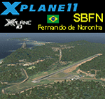
This is an X-Plane 11 and X-Plane 10 scenery package for Gov. Carlos Wilson Airport (IATA: FEN, ICAO: SBFN), which is the airport serving the island of Fernando de Noronha, Pernambuco, Brazil. Brazil. It is the easternmost airport of Brazil and the only one that is located in the Brazilian oceanic islands. It includes corrected aprons, ramps, gates, taxiways, lighting system, ortho-photoscenery for the airfield area, and (XP11 only) airport ground services (like push back). This scenery was tested and is operational (as of March 19, 2017) in "X-Plane 11 Public Beta #15 64 bit", Windows 10 Home. It was also tested and is also operational (as of March 19, 2017) in "X-Plane 10.51 64 bit", Windows 10 Home. Only the default X-Plane 11 libraries, by Laminar Research, are needed. No third party libraries are used.
| Filename: | BR_PE_SBFN__Fernando_de_Noronha_Airport_v100.zip |
| License: | Freeware |
| Added: | 19th March 2017, 18:21:44 |
| Downloads: | 162 |
| Author: | Rui Mesquita |
| Size: | 35.09 MB |


© 2001-2026 AVSIM Online
All Rights Reserved
Privacy Policy |