
Where Flight Simulation Enthusiasts Gather from Around the World!
AVSIM Library - Search Results

| Category: Flight Simulator 2004 - Aircraft Repaints, Textures and Modifications | |
| CFS2/FS2004 Republic Mk.II Thunderbolt Bubble Top, KJ159/30 |

|
File Description:
CFS2/FS2004 Republic Mk.II Thunderbolt Bubble Top, KJ159/30, 73rd Operational Training Unit RAF, Fayid, Egypt, 1945. This repaint is for the ALPHASIM model which can be found at: http://www.alphasim3.com/store/advanced_search_result.php?keywords=P-47&x=7&y=9. Alpha Channel is applied to the fuslage texture file, as to eliminate (make transparent) the stabilizer rib. Repaint by Evan G. Butterbrodt (revev).
| Filename: | CFS2FS2004_Republic_MkII_Thunderbolt_Bubble_Top_KJ.zip |
| License: | Freeware |
| Added: | 28th August 2008, 04:19:14 |
| Downloads: | 78 |
| Author: | Evan G. Butterbrodt |
| Size: | 1.15 MB |
| Category: Flight Simulator 2004 - Aircraft Repaints, Textures and Modifications | |
| CFS2/FS2004 Republic Mk.II Thunderbolt Bubble Top, KJ137/8, |
|
File Description:
CFS2/FS2004 Republic Mk.II Thunderbolt Bubble Top, KJ137/8, 73rd Operational Training Unit RAF, Fayid, Egypt, 1945. This repaint is for the ALPHASIM model which can be found at: http://www.alphasim3.com/store/advanced_search_result.php?keywords=P-47&x=7&y=9. Alpha Channel is applied to the fuslage texture file, as to eliminate (make transparent) the stabilizer rib. Repaint by Evan G. Butterbrodt (revev).
| Filename: | CFS2FS2004_Republic_MkII_Thunderbolt_Bubble_Top_KJ.zip |
| License: | Freeware |
| Added: | 3rd September 2008, 19:09:43 |
| Downloads: | 88 |
| Author: | Evan G. Butterbrodt |
| Size: | 1.06 MB |
| Category: Flight Simulator X - Scenery | |
| OLBAX V1.0 (Rafik Hariri / Beirut International Airport) |
|
Images related to this file:
File Description:

OLBAX V1.0 is the latest edition of Rafik Hariri International Airport, Beirut / Lebanon for FSX by Lebor Simulations. OLBAX V1.0 features a photorealistic ground layout courtesy of Bureau Stephan, detailed and accurate terminal, buildings and hangars as well as static 3D objects. Jad Abizeid worked on this scenery for almost 4 years.
This scenery requires: Lebanon Terrain X v1.5 by Lebor Simulations
| Filename: | OLBAX_V10_Rafik_Hariri__Beirut_International_Airpo.zip |
| License: | Freeware |
| Added: | 4th February 2013, 02:37:56 |
| Downloads: | 15,530 |
| Author: | Lebor Simulations (Jad Abizeid, Michel Karam) |
| Size: | 130.93 MB |
| Category: Flight Simulator X - Utilities | |
| FS Earth 5.2 for Google Earth and FSX |
|
Images related to this file:
File Description:
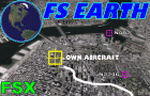
This program acts as a link between Flight Simulator X and Google Earth, letting to follow a flight in real time, over the satellite images generated by Google Earth. Flights can be saved, and many options are available for fine tuning the performance, as well as the map's style (zoom, tilt, orientation). Works on a single computer running FSX and Google Earth all together or, for best experience, can be used on two networked computers running respectively FSX (master) and Google Earth (slave). AI and Multiplayer traffic is also displayed in Google Earth, with course prediction and other information. Requires Flight Simulator X and Google Earth. The program running in trial mode works only around Anchorage, Alaska, (PANC / ANC) for a maximum of five minutes per flight session. Version 5.2 has new aircraft icons & labels and improves the compatibility with Windows Vista. A version for FS2004 is available also.
| Filename: | FS_Earth_52_for_Google_Earth_and_FSX.zip |
| License: | Shareware, time limited |
| Added: | 3rd May 2010, 07:38:23 |
| Downloads: | 2,701 |
| Author: | Luciano Napolitano |
| Size: | 3.46 MB |
| Category: Flight Simulator X - Scenery | |
| Provincetown Municipal Airport (KPVC) |
|
Images related to this file:
File Description:
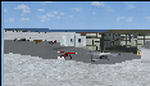
This airport was made using Airport Facilitator X, and Instant Scenery 2. Provincetown Municipal Airport is a small airport located in Provincetown, Massachusetts. Cape Air is the only airline that flies there. I added a more accurate terminal, and an aircraft hangar. I put three fuel trucks on the ramp with a fuel station. I made the taxiways the correct length and width. I also put static aircraft on the ramp and added more gates. I made a parking lot with many cars in it. If you choose to start off from a DOCK gate, you will start off inside the aircraft hanger. Taxiing or starting off inside of the hanger will cause a crash unless you have crashes turned off. This is all based on Google Earth and Bing Maps. Please read the readme for instructions on how to install. This is for Flight Simulator X only.
| Filename: | Provincetown_Municipal_Airport_KPVC.zip |
| License: | Freeware |
| Added: | 21st January 2012, 20:08:09 |
| Downloads: | 607 |
| Author: | Tyler Lawrence |
| Size: | 6.86 MB |
| Category: Flight Simulator X - AFCAD Files | |
| PASD - Sand Point, Alaska |
|
Images related to this file:
File Description:
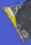
The airport of Sand Point (PASD) has been extended since Microsoft has modeled it and even after the upgrade through Scenery Solution's Ultimate Terrain X Alaska has been produced. This AFCAD is built on the UTX version of the airport and is intended to be used in this environment only.
The file considers the extended runway, VASI4 at both ends with 3.6 deg glideslope and the necessary new water-polygon. Due to the specific coastline bitmaps used by UTX I had to change to Microsoft's default ones being accessible through the wonderful tool Airport Design Editor X. Some additional landclass in the airport's vicinity and three (default) buildings close to the apron are completing the changes. I did not touch the easterly landing stage (or whatever it could have been) even if Google suggests that it disappeared meanwhile except some remaining piles in the water - it's just looking nice. ;-)
| Filename: | PASD__Sand_Point_Alaska.zip |
| License: | Freeware |
| Added: | 17th October 2013, 18:55:00 |
| Downloads: | 377 |
| Author: | Axel Birsul |
| Size: | 646.25 KB |
| Category: Flight Simulator X - Utilities | |
| FS Earth 4.2 for Google Earth |
|
File Description:
This program acts as an interface between Flight Simulator X and Google Earth, letting to follow a flight in real time, over the satellite images generated by Google Earth. Flights can be saved, and many options are available for fine tuning the performance, as well as the map's style (zoom, tilt, orientation). Works on a single computer running FSX and Google Earth all together or, for best experience, can be used on two networked computers running respectively FSX (master) and Google Earth (slave). AI and Multiplayer traffic is also displayed in Google Earth, with course prediction and other information. Requires Flight Simulator X and Google Earth. The program running in trial mode works only around Anchorage, Alaska, (PANC / ANC) for a maximum of five minutes per flight session. Version 4.2 has improved compatibility with Windows Vista and minor bug fixes. A version for FS2004 is available also. By Luciano Napolitano.
| Filename: | FS_Earth_42_for_Google_Earth.zip |
| License: | Shareware, time limited |
| Added: | 9th March 2007, 13:39:05 |
| Downloads: | 2,213 |
| Author: | Luciano Napolitano |
| Size: | 2.44 MB |
| Category: Flight Simulator X - Utilities | |
| FS Earth 5.0 for Google Earth |
|
File Description:
This program acts as an interface between Flight Simulator X and Google Earth, letting to follow a flight in real time, over the satellite images generated by Google Earth. Flights can be saved, and many options are available for fine tuning the performance, as well as the map's style (zoom, tilt, orientation). Works on a single computer running FSX and Google Earth all together or, for best experience, can be used on two networked computers running respectively FSX (master) and Google Earth (slave). AI and Multiplayer traffic is also displayed in Google Earth, with course prediction and other information. Requires Flight Simulator X and Google Earth. The program running in trial mode works only around Anchorage, Alaska, (PANC / ANC) for a maximum of five minutes per flight session. Version 5.0 has improved compatibility with latest releases of Google Earth and several additional improvements. A version for FS2004 is available also.
| Filename: | FS_Earth_50_for_Google_Earth.zip |
| License: | Shareware, time limited |
| Added: | 19th July 2007, 00:46:27 |
| Downloads: | 1,104 |
| Author: | Luciano Napolitano |
| Size: | 2.44 MB |
| Category: Flight Simulator 2004 - Original Aircraft | |
| Piaggio PD-808GE |
|
File Description:
NEEDS FS9_pd808rm.ZIP TO WORK. THIS PACKAGE DOES NOT INCLUDE THE NEEDED PANEL, GAUGES AND SOUNDS.
This is a complete simulation of the Piaggio PD-808. It includes advanced engine management, realistic systems, and some failure modeling. The model features a complete 3-D virtual cockpit,and a 2-D panel. The external model features all typical animations plus a load of custom ones. Also incluides all custom special effects, including different selectable floodlights for the virtual cockpit (by simply flicking ON the proper light switch on the cockpit itself). Plus with a fly-on-the-numbers flight dynamics file. Includes full documentation. THIS IS THE FS-2004 RELEASE. IT WILL NOT WORK PROPERLY WITH FS-X. THERE IS ALSO A FS-X RELEASE THAT WILL NOT WORK PROPERLY WITH FS-2004. THis is the "GE" variant of the aircraft and requires the base package "FS9_PD808RM.zip" to work.
| Filename: | Piaggio_PD808GE.zip |
| License: | Freeware |
| Added: | 15th February 2009, 11:53:18 |
| Downloads: | 1,601 |
| Author: | Mario Noriega |
| Size: | 14.19 MB |
| Category: Flight Simulator X - Utilities | |
| FlyLive |
|
Images related to this file:
File Description:

FlyLive is a fully free and fully featured* flight simulation streaming suite.
Looking to beef up your FSX/P3D livestream for zero charge? You're at the right place! FlyLive is dedicated to satisfying even the most serious flight simulator streamers. The features are packed together in a sophisticated yet simple and user friendly interface - making it surprisingly easy to set up, with the help of the documentation.
The purpose of FlyLive is to inject flight data from your simulator into your livestream, so your audience don’t have to look at the tiny numbers on the flight instruments to know what’s going on. It is designed specifically for streamers who want to “up their game†in Flight Simulation streaming, but don’t have the knowledge to code something.
Perquisites
FlyLive relies on FSUIPC to extract data from the Simulator. You MUST have FSUIPC installed (free or registered) on your computer to use this software. FSUIPC can be downloaded from http://www.schiratti.com/dowson.html
You must have a broadcaster/recorder that can read from text files constantly. OBS Studio is an excellent, open source free broadcasting suite which FlyLive supports. OBS can be downloaded from https://www.obsproject.com
A *legal* working copy of any FSX version or P3D (except v1) with FSUPC must be installed on your computer.
*compared to similar programs
| Filename: | FlyLive.zip |
| License: | Freeware |
| Added: | 19th May 2017, 16:40:58 |
| Downloads: | 370 |
| Author: | Mark Ng |
| Size: | 100.24 KB |


© 2001-2026 AVSIM Online
All Rights Reserved
Privacy Policy |