
Where Flight Simulation Enthusiasts Gather from Around the World!
AVSIM Library - Search Results

| Category: Flight Simulator X - AFCAD Files | |
| PAGY - Skagway Airport | Skagway, Alaska |

|
File Description:
PAGY - Skagway Airport | Skagway, Alaska. The amount of parking, as well as AI-Traffic handling efficiency is now double what it was before at this airport. Day & Night visual effects and performance have also been considerably enhanced. This was designed using Flight 1's excellent "Airport Facilitator X" program.
| Filename: | PAGY__Skagway_Airport_____Skagway_Alaska.zip |
| License: | Freeware |
| Added: | 5th January 2009, 13:01:00 |
| Downloads: | 744 |
| Author: | Dakota Smith / Smith Graphics |
| Size: | 84.44 KB |
| Category: Flight Simulator X - Scenery | |
| LFPA Persan-Beaumont airfield |
|
Images related to this file:
File Description:
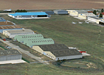
Photorealistic scenery
v 1.0 for MS Flight Simulator X (SP2)
Day and summer configuration only.
Persan Beaumont is located in the north suburbs of Paris (10min from Pontoise).
3 runways (2 grass and 1 macadam) are used by light general aviation planes and ultralights.
| Filename: | LFPA_PersanBeaumont_airfield.zip |
| License: | Freeware, limited distribution |
| Added: | 5th June 2013, 21:04:30 |
| Downloads: | 1,793 |
| Author: | Benoit Gaurant and Dan Guimbert |
| Size: | 32.24 MB |
| Category: Flight Simulator X - AI Aircraft | |
| TBAI Piper PA34 Seneca II |
|
Images related to this file:
File Description:

Updated model and repaints of my Piper PA34 Seneca II. Improvements to the animations and textures. Includes new model, and new 2048 x 2048 PSD layered paintkit. Includes (6) repaints in 32bit BMP and DXT5 format. Includes new updated CFG file to correct some issues with the previous file.
| Filename: | TBAI_Piper_PA34_Seneca_II.zip |
| License: | Freeware, limited distribution |
| Added: | 9th May 2020, 18:41:35 |
| Downloads: | 481 |
| Author: | Todd Bolgrin |
| Size: | 7.63 MB |
| Category: Flight Simulator X - AI Aircraft | |
| Piper PA23-150 Apache V2 |
|
Images related to this file:
File Description:

Version 2 of my PA23-150 Piper Apache designed for FSX. Upgrade to the original FSDS 3.5 AI model, with better animations, better alignment for repaints, and a new 2048 x 2048 paintkit. Includes 6 BMP texture files to use to add repaints. ( See Readme file for details )
| Filename: | Piper_PA23150_Apache_V2.zip |
| License: | Freeware |
| Added: | 27th April 2018, 03:12:24 |
| Downloads: | 494 |
| Author: | Todd Bolgrin |
| Size: | 8.28 MB |
| Category: Prepar3D V1-4 - Scenery | |
| LOLH-Airport |
|
Images related to this file:
File Description:

LOLH is mainly used for HB aircraft repair factory, but the HB funclub can as well use it on the weekend.
This airfield is transfered, with kind permission from Mr. Gerhard Scholz, from his x-plane Version with ADE.
have a look on his homepage http://www.x-plane.at.
| Filename: | LOLHAirport.zip |
| License: | Freeware |
| Added: | 6th October 2017, 18:50:40 |
| Downloads: | 446 |
| Author: | Karl Malle |
| Size: | 3.31 MB |
| Category: Navigation and ATC - Navigation | |
| Whitehorse Sectional Chart Chunks Optimized For Moving Map Application |
|
File Description:
Sectional chart chunks made from the August 2009 Sectional charts at the original scale, formatted in the WGS84 lat/lon geographic coordinate system for GPS, moving map application for flight simulation use.
These chart chunks were converted to the JPEG format for compatibility and size. Coverage is the full Sectional area North and South divided into JPEG tiles. They are about 3k x 3k pixels at 2.5mb with coverage of 90nm x 130nm per tile. Included is also the projection files and world files.
Note: This type of map is a equal grid and no further calibration is needed, only the two points referenced in the world file. Example: for users of FSM Moving Map, just mass import, done.
| Filename: | Whitehorse_Sectional_Chart_Chunks_Optimized_For_Mo.zip |
| License: | Freeware |
| Added: | 28th February 2010, 06:29:44 |
| Downloads: | 145 |
| Author: | David Myers |
| Size: | 16.1 MB |
| Category: Navigation and ATC - Navigation | |
| Western Aleutian Islands Sectional Chart Chunks Optimized For Moving Map Application |
|
File Description:
Sectional chart chunks made from the August 2009 Sectional charts at the original scale, formatted in the WGS84 lat/lon geographic coordinate system for GPS, moving map application for flight simulation use.
These chart chunks were converted to the JPEG format for compatibility and size. Coverage is the full Sectional area North and South divided into JPEG tiles. They are about 3k x 3k pixels at 2.5mb with coverage of 90nm x 130nm per tile. Included is also the projection files and world files.
Note: This type of map is a equal grid and no further calibration is needed, only the two points referenced in the world file. Example: for users of FSM Moving Map, just mass import, done.
| Filename: | Western_Aleutian_Islands_Sectional_Chart_Chunks_Op.zip |
| License: | Freeware |
| Added: | 28th February 2010, 06:32:04 |
| Downloads: | 166 |
| Author: | David Myers |
| Size: | 7.82 MB |
| Category: Navigation and ATC - Navigation | |
| Point Barrow Sectional Chart Chunks Optimized For Moving Map Application |
|
File Description:
Sectional chart chunks made from the August 2009 Sectional charts at the original scale, formatted in the WGS84 lat/lon geographic coordinate system for GPS, moving map application for flight simulation use.
These chart chunks were converted to the JPEG format for compatibility and size. Coverage is the full Sectional area North and South divided into JPEG tiles. They are about 3k x 3k pixels at 2.5mb with coverage of 90nm x 130nm per tile. Included is also the projection files and world files.
Note: This type of map is a equal grid and no further calibration is needed, only the two points referenced in the world file. Example: for users of FSM Moving Map, just mass import, done.
| Filename: | Point_Barrow_Sectional_Chart_Chunks_Optimized_For_.zip |
| License: | Freeware |
| Added: | 28th February 2010, 06:32:41 |
| Downloads: | 158 |
| Author: | David Myers |
| Size: | 18.64 MB |
| Category: Navigation and ATC - Navigation | |
| Nome Sectional Chart Chunks Optimized For Moving Map Application |
|
File Description:
Sectional chart chunks made from the August 2009 Sectional charts at the original scale, formatted in the WGS84 lat/lon geographic coordinate system for GPS, moving map application for flight simulation use.
These chart chunks were converted to the JPEG format for compatibility and size. Coverage is the full Sectional area North and South divided into JPEG tiles. They are about 3k x 3k pixels at 2.5mb with coverage of 90nm x 130nm per tile. Included is also the projection files and world files.
Note: This type of map is a equal grid and no further calibration is needed, only the two points referenced in the world file. Example: for users of FSM Moving Map, just mass import, done.
| Filename: | Nome_Sectional_Chart_Chunks_Optimized_For_Moving_M.zip |
| License: | Freeware |
| Added: | 28th February 2010, 06:39:38 |
| Downloads: | 184 |
| Author: | David Myers |
| Size: | 16.46 MB |
| Category: Navigation and ATC - Navigation | |
| McGrath Sectional Chart Chunks Optimized For Moving Map Application |
|
File Description:
Sectional chart chunks made from the August 2009 Sectional charts at the original scale, formatted in the WGS84 lat/lon geographic coordinate system for GPS, moving map application for flight simulation use.
These chart chunks were converted to the JPEG format for compatibility and size. Coverage is the full Sectional area North and South divided into JPEG tiles. They are about 3k x 3k pixels at 2.5mb with coverage of 90nm x 130nm per tile. Included is also the projection files and world files.
Note: This type of map is a equal grid and no further calibration is needed, only the two points referenced in the world file. Example: for users of FSM Moving Map, just mass import, done.
| Filename: | McGrath_Sectional_Chart_Chunks_Optimized_For_Movin.zip |
| License: | Freeware |
| Added: | 28th February 2010, 14:08:28 |
| Downloads: | 148 |
| Author: | David Myers |
| Size: | 15.39 MB |


© 2001-2026 AVSIM Online
All Rights Reserved
Privacy Policy |