
Where Flight Simulation Enthusiasts Gather from Around the World!
AVSIM Library - Search Results

| Category: Flight Simulator 2004 - Scenery | |
| FS2004 & FSX Transatlantic Flying Boat water runways |

|
File Description:
Water runways added to seven default airports, to allow Clipper type flying boats such as the B314 to operate the Transatlantic routes between Europe and the USA. The European terminals are at Southampton Water, Foynes (Shannon), and Lisbon Town; American terminals at Botwood (Gander), Shediac (Moncton), and New York (La Guardia); Atlantic stations at Bermuda and Horta (Azores). RDF stations (NDB), light beacons, and surface ships are added as NAVAIDS, but no other buildings or equipment. Made with ADE 9 for Noble Air VA by John McKeon ([email protected]).
| Filename: | transatlantic_clipper.zip |
| License: | Freeware |
| Added: | 27th January 2011, 22:26:55 |
| Downloads: | 847 |
| Author: | John McKeon |
| Size: | 431 KB |
| Category: Flight Simulator X - Scenery | |
| Whistler/Green Lake Water Aerodrome - CAE5 (FSX) |
|
File Description:
Whistler’s Green Lake Water Aerodrome (as it is listed), can be a busy float plane center. At this writing, Google Earth shows a Twin Otter floating at the docks. I find this area to be one of my most favorite to fly in. All scenery objects are sourced from FSX Deluxe. VANCOUVER PLUS is required for this scenery to work.
| Filename: | cae5_whistler.zip |
| License: | Freeware, limited distribution |
| Added: | 16th April 2009, 05:05:30 |
| Downloads: | 1,256 |
| Author: | Will Jones |
| Size: | 5.97 MB |
| Category: Flight Simulator 2002 - Helicopters | |
| Fire Fighting Bell 205 w/ Water Drop |
|
File Description:
fs2002 Bell 205 fire fighting helicopter, repainted in the colors of th Seminole County Sheriff Dept.
Great water drop effect, a new panel with various features, HUD, ACSGPS, Alti-callout and more. Features a uniques set of sounds for the alti-callout.
| Filename: | bell205a1.zip |
| License: | Freeware |
| Added: | 2nd December 2002, 20:10:13 |
| Downloads: | 3,026 |
| Author: | Helicopter by L. Rogers and J. Moore. Repaint and panel by D. Levin |
| Size: | 4.76 MB |
| Category: Flight Simulator X - Scenery | |
| South Florida and The Bahamas Water Class |
|
Images related to this file:
File Description:
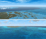
The coverage area begins in the western end of the Florida Keys at The Dry Tortugas, heads north to Tampa, over to Grand Bahama, south to the Cay Sal Bank and eastward to Great Inagua covering all of the Florida Keys and the entire Bahamas Island chain. The scenery also corrects island position errors overlooked by UTX-USA and UTX-TAC in the Dry Tortugas, on the Cay Sal Bank, adding the missing Cays there and also on the Bahama Bank. Lighthouse placement error corrections are also included.
For those pilots with REX Essentials + Overdrive (REX3) a section of the manual is devoted to creating a custom selection of REX3 textures. by Wally-Bob
| Filename: | s-fl_bahamas_wc.zip |
| License: | Freeware, limited distribution |
| Added: | 21st August 2014, 18:50:02 |
| Downloads: | 2,554 |
| Author: | Walter Roberts |
| Size: | 9.26 MB |
| Category: Flight Simulator X - Scenery | |
| NWT Landscape - Canada |
|
File Description:
Elevation data (mesh-Lod10 - 38m), land cover, water polygons, rivers, stream lines, lanes and shorelines around airports of Northwest Territories, Canada.
| Filename: | nwt_landscape.zip |
| License: | Freeware, limited distribution |
| Added: | 9th February 2011, 17:43:21 |
| Downloads: | 3,331 |
| Author: | Gilles Gauthier |
| Size: | 89.21 MB |
| Category: Flight Simulator 2004 - Aircraft Repaints, Textures and Modifications | |
| InLand Waters |
|
Images related to this file:
File Description:
These are some of the most realistic water textures I could find for inland waters such as lakes dams and rivers.
| Filename: | meer_water.zip |
| License: | Freeware |
| Added: | 30th June 2019, 16:28:48 |
| Downloads: | 162 |
| Author: | moleki Kay (maiden) |
| Size: | 5.12 MB |
| Category: Flight Simulator 2002 - Miscellaneous Files | |
| Extra 300S Splash Effect 2 |
|
File Description:
A very Unusal effect! Press i on your keyboard, watch a few splashes of water form from beside the Extra 300S Aircraft in FS2002, followed by a string of splashes of water from beside the Extra, and finally followed by lots of small splashes and strings of water from beside the Extra! and while all that is happening, the Extra seems to be in a green mist! Important Note: This is not an upgrade for my previous splash effect. This is a different and new effect. If you liked my previous splash effect, then hopefully you will like this one.
| Filename: | e300spef22002.zip |
| License: | Freeware |
| Added: | 26th October 2002, 16:16:39 |
| Downloads: | 116 |
| Author: | Michael O'Sullivan |
| Size: | 240 KB |
| Category: Fly! II - TerraScene | |
| Mansfield (Ohio Project) TerraScene Project Pack |
|
File Description:
This is a TerraScene 2.1 Project pack for the area of Mansfield, Ohio, including all of global tile 197,159. This pack includes updated Tiger Census (2000) shapefile data, adding new water areas, new highways, and other details. All scenery data files are included: USGS data, shapefiles, and a complete water mask. Requires TerraScene 2.1 and Fly!II patched to v230 or later.
| Filename: | mansfield.zip |
| License: | Freeware |
| Added: | 5th April 2003, 10:38:31 |
| Downloads: | 157 |
| Author: | Randall Rocke |
| Size: | 43.73 MB |
| Category: Flight Simulator X - Scenery | |
| YELE Belele Station, Western Australia |
|
File Description:
YELE Belele Station originally part owned by Sir Ernest Lee Steere. A remote sheep property near Meekatharra and on the edge of the Great Victoria Desert having no permanent water holes. (The lake only holds water in FSX) REQUIRES Blencowe_LibraryKit.zip
REQUIRES blencowe_librarykit_309494.zip (Available HERE)
| Filename: | blencowe_belele.zip |
| License: | Freeware |
| Added: | 25th February 2013, 09:19:31 |
| Downloads: | 252 |
| Author: | Alan Blencowe |
| Size: | 3.21 MB |
| Category: Flight Simulator X - Scenery | |
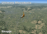
| Ultimate Macedonia v1.2 |
|
Images related to this file:
File Description: Vector scenery for Macedonia based on data from 'European Environment Agency'
(land cover) and 'OpenStreetMap'(road, rail and water). Included data: road and
rail networks, water bodies, rivers, streams, continuous urban fabric,
discontinuous urban fabric, industrial or commercial units, mineral extraction
sites, forest, pastures, vineyards etc. Data covers the whole country.
This upload supersedes file: fsx_ultimate_macedonia.zip
| Filename: | fsx_ultimate_macedonia_1.2.zip |
| License: | Freeware, limited distribution |
| Added: | 1st May 2014, 17:34:38 |
| Downloads: | 1,060 |
| Author: | Sami Toronen |
| Size: | 14.15 MB |
© 2001-2025 AVSIM Online
All Rights Reserved