
Where Flight Simulation Enthusiasts Gather from Around the World!
AVSIM Library - Search Results

| Category: Flight Simulator 2004 - Miscellaneous Files | |
| Flight Assistant Profile fa172 v1.0 |

|
File Description:
This package is only for use with the Flight Assistant program by Timm Linder located here in the library or at his website:
Download Main Flight Assistant & Other Required Files Here
This Profile was created by Joseph Ranos, (Sonar5) & includes 256 Voice Commands that can be executed with a voice response.
Approximately 190+ voice Commands will Execute a MSFS2004 Key command as well as a Voice response. (voice response may be limited if you do not have all programs installed according to main Flight Assistant website). Approximately 60+ have a response but do not execute a key command. These are used for Cabin Crew Calls, Jokes, and optimized with Cessna 172 Checklists to show you the possibility of what the program is capable of.
| Filename: | Flight_Assistant_Profile_fa172_v10.zip |
| License: | Freeware, limited distribution |
| Added: | 20th December 2004, 02:49:48 |
| Downloads: | 1,678 |
| Author: | Joseph Ranos |
| Size: | 363.24 KB |
| Category: Orbiter - Spaceships | |
| Surveyor Lunar Lander 1.0 |
|
File Description:
The Surveyor program consisted of seven unmanned lunar missions that were launched between May 1966 and January 1968. Five of these spacecraft, Surveyor 1, 3, 5, 6, and 7 successfully soft-landed on the lunar surface. In addition to demonstrating the feasibility of lunar surface landings, the Surveyor missions obtained lunar and cislunar photographs and both scientific and technological information needed for the Apollo manned landing program. Four spacecraft, Surveyor 1, 3, 5, and 6, returned data from selected mare sites from Apollo program support, and Surveyor 7 provided data from a contrasting rugged highland region.
The Orbiter version brings to you the historical flight of this unmanned lunar landing probe. The flight plan should bring you within 10,000 km of the Lunar surface. With one mid course correction, and enough practice, you can land it the moon.
| Filename: | Surveyor_Lunar_Lander_10.zip |
| License: | Freeware |
| Added: | 8th December 2004, 14:57:05 |
| Downloads: | 872 |
| Author: | James Williams |
| Size: | 1.97 MB |
| Category: Flight Simulator 2004 - Aircraft Repaints, Textures and Modifications | |
| Saab Safir Ethiopian Air Force |
|
File Description:
The Ethiopian Air Force bought 16 Safir A's in 1946, with an additional 14 C models in 1960. In May 1947, the Swedish advisor to Haile Selassie Count Carl Gustaf von Rosen made good publicity for the SAAB Safir by flying a 91A from Sweden to Ethiopia during a 31 hour non-stop flight. The aircraft was a standard one, just extra fuel tanks were installed. The Saabs were based in Debre Zeyit, close to Addis Abeba, and initially, the Ethiopian pilots were trained by a group of Swedish instructors under von Rosen. This repaint represents one of the second batch of 91C models, numbered 136. At least 18 airframes survived well into the 90's, when they were sold to South Africa. It is not clear whether 136 is one of them.. Repaint for the SibWings Saab Safir by jan Kees Blom.
| Filename: | Saab_Safir_Ethiopian_Air_Force.zip |
| License: | Freeware |
| Added: | 23rd July 2008, 14:56:54 |
| Downloads: | 192 |
| Author: | Jan Kees Blom |
| Size: | 2.59 MB |
| Category: Flight Simulator 2004 - Aircraft Repaints, Textures and Modifications | |
| QANTAS Airbus A330-202 VH-EBJ in New QANTAS Paint Scheme |
|
File Description:
PSS A330-202 update for PSS A330 - VH-EBJ "Margaret River" (MSN 940) in Domestic two-class configuration (34J,265Y). This aircraft first flew on 20 May 2008 and was delivered to QANTAS on 8 June 2008. Designed for domestic routes, this aircraft started her revenue service on the busy Sydney-Melbourne route before taking over from the venerable B747-300s on the Melbourne-Perth route at the beginning of July 2008. Future deliveries of the type will completely replace the 747-300s on the Sydney-Perth route also. The aircraft is painted in the new QANTAS paint scheme which was unveiled in July 2007. These textures are exclusively for use with the PSS A330-200 software, still available through good flight simulator software providers. Textures provided only. Instructions for installation are in the README file.
| Filename: | QANTAS_Airbus_A330202_VHEBJ_in_New_QANTAS_Paint_Sc.zip |
| License: | Freeware |
| Added: | 28th July 2008, 17:52:16 |
| Downloads: | 334 |
| Author: | Mark Taylor |
| Size: | 762.97 KB |
| Category: Flight Simulator X - AFCAD Files | |
| Eagles Nest Airport (31E), NJ |
|
File Description:
Located 02 miles N of West Creek, New Jersey on 80 acres of land, Eagles Nest Airport is a small single strip that hosts several single engine aircraft. No services are provided to transient aircraft, tie down spots are available on the tarmac adjacent to Runway 14. AI paths have been added to this airport in case you would like to direct any GA AI there. Trees are summer ONLY.
Scenery constructed with use of satellite images/streetview, the author has not been there in person.
This scenery is meant to be used in conjunction with MegaScenery Earth New Jersey/Delaware 003. It is not required, but apron use is minimized to allow satellite scenery to show through as much as possible, and objects are placed based on the MSE textures - lack of it may make scenery look out of place.
| Filename: | Eagles_Nest_Airport_31E_NJ.zip |
| License: | Freeware |
| Added: | 15th October 2010, 20:43:02 |
| Downloads: | 345 |
| Author: | Drew Sikora |
| Size: | 496.59 KB |
| Category: Flight Simulator X - Scenery | |
| Salmon Point, Chenega, Alaska |
|
Images related to this file:
File Description:
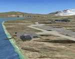
Salmon Point, Chenega, Alaska is fictitous. It has a completely new airport with a 3500' gravel runway, 2 landable helipads, NDB (309.0) and VOR/DME (115.60), runway has night lights and an aircraft service/maintenance area with a ramp for floatplanes which leads up to an elevated platform. The area is filled with private homesites with docks and boats/floatplanes, a few fishing boats at dock and at sea, cabins, a lighthouse, windmill and an old nickel mine with buildings and a few other objects. A couple of crashed plane remnants too.
Salmon Point is locted approx 70 miles east Seward and 65 miles SSW Valdez.
Designed without addons such as Ultimate Alaska X so objects may appear where they were not intended to be if you have such addons.
Designed to enhance your flight sim world. Please enjoy........savagegle
| Filename: | Salmon_Point_Chenega_Alaska.zip |
| License: | Freeware |
| Added: | 20th August 2010, 22:26:09 |
| Downloads: | 488 |
| Author: | Tim Durham |
| Size: | 1.09 MB |
| Category: Flight Simulator X - Scenery | |
| WashDCX beta for FSX |
|
File Description:
WashDCX beta is a complete upgrade to the default FSX Washington D.C. scenery. You will find included in this download: Satellite images; traffic files; and additional significant landmarks and buildings surrounding the downtown National Mall area. See the Readme file for a complete list. I have imported several models from Google Sketchup taking great care to minimize drawcalls for each one. Although all models may not appear "perfect" in the beta version, I have shown it can be done and it is something that can be improved on. You will find a drastic improvement of flying over Washington D.C. when compared to the default FSX scenery. This is the first beta release. I encourage feedback, comments, suggestions, and collaboration on this project if you wish. Please visit my website: www.myflightsimblog.com and leave me an email at [email protected] .
Enjoy!
LARRY
| Filename: | WashDCX_beta_for_FSX.zip |
| License: | Freeware |
| Added: | 21st December 2010, 14:34:19 |
| Downloads: | 991 |
| Author: | lkrobbins |
| Size: | 49.4 MB |
| Category: Flight Simulator X - AFCAD Files | |
| Pemberton Airport (3N7), NJ |
|
File Description:
Located 01 miles NW of Pemberton, New Jersey on 14 acres of land, Pemberton Airport is a private airstrip. Tie down areas are available at the Runway 22 end. The single parking space is a tie down - do not use if your aircraft's wingspan is greater than 50 feet. Note that the actual listing for this airport in real world databases is 3NJ1. Trees are summertime ONLY.
Scenery constructed with use of satellite images/streetview, the author has not been there in person.
This scenery is meant to be used in conjunction with MegaScenery Earth New Jersey/Delaware 002. It is not required, but apron use is minimized to allow satellite scenery to show through as much as possible, and objects are placed based on the MSE textures - lack of it may make scenery look out of place.
| Filename: | Pemberton_Airport_3N7_NJ.zip |
| License: | Freeware |
| Added: | 23rd November 2010, 22:32:59 |
| Downloads: | 184 |
| Author: | Drew Sikora |
| Size: | 1.12 MB |
| Category: Flight Simulator X - AFCAD Files | |
| Marlboro Airport (2N8), NJ |
|
File Description:
Marlboro Airport in Matawan, NJ was closed in 2002. The runway has been modified to reflect its closed status and all taxiways, buildings, etc have been stripped to show satellite textures. FSX doesn't simulate old broken down runways possibly breaking your landing gear so if you still want to hit that with a Touch and Go I'm sure the virtual FAA won't notice.
Scenery constructed with use of satellite images/streetview, the author has not been there in person.
This scenery is meant to be used in conjunction with MegaScenery Earth New Jersey/Delaware 001. It is not required, but apron use is minimized to allow satellite scenery to show through as much as possible, and objects are placed based on the MSE textures - lack of it may make scenery look out of place.
| Filename: | Marlboro_Airport_2N8_NJ.zip |
| License: | Freeware |
| Added: | 24th October 2010, 18:52:50 |
| Downloads: | 178 |
| Author: | Drew Sikora |
| Size: | 197.29 KB |
| Category: Civil Flight Simulators - Looking Glass Flight Unlimited 3 | |
| FU3 Outer Terrain Tag File Information |
|
File Description:
These Excel spreadsheets contain information about the contents of the outer terrain's 3 tag files:
- outtaga.tag
- outtagb.tag
- outtagc.tag
The file outer_tag_offsets.xls contains a complete list of the file offsets of each file within the three tag files, i.e. the starting position (as byte number) of the level 0, level 2, level 5 .geo files and corresponding gtl files within each tag file. The last three columns of each worksheet contain the relevant information: filename, file position, and file size.
The file outer_tag_x&y.xls lists all the L0 .geo megatiles within each tag file and provides the position of each megatile within the OT region as an X and Y co-ordinate. Columns K, T, U and V provide the relevant information.
These spreadsheets may be of use to anyone wishing to develop the outer terrain region.
| Filename: | FU3_Outer_Terrain_Tag_File_Information.zip |
| License: | Freeware |
| Added: | 21st November 2009, 23:24:58 |
| Downloads: | 29 |
| Author: | Jonathan Stonehouse |
| Size: | 1.08 MB |


© 2001-2026 AVSIM Online
All Rights Reserved
Privacy Policy |