
Where Flight Simulation Enthusiasts Gather from Around the World!
AVSIM Library - Search Results

| Category: Flight Simulator 2004 - Aircraft Repaints, Textures and Modifications | |
| US Airways Airbus A319-112 (N700UW) "STAR ALLIANCE" |

|
File Description:
I am proud to present this detailed, realistic repaint of the US Airways A319-112 in the STAR ALLIANCE livery, registration N700UW. This airframe was the first A319 for US Airways. It makes appearances at airports throughout the US, Canada and the Caribbean as a medium-haul workhorse for US Airways. I actaully flew on this very aircraft last week from KMDT to KCLT, which inspired me to repaint it. I did my fullest to pay attention to detail and realism in this repaint. This full installation package includes the Project Airbus A19 CFM model and air files. Most repainted textures are 32-bit with no mipmaps. Uses default 737-400 panel and sounds. Please see Readme.txt for installation details.
| Filename: | US_Airways_Airbus_A319112_N700UW_STAR_ALLIANCE.zip |
| License: | Freeware, limited distribution |
| Added: | 12th August 2008, 14:57:08 |
| Downloads: | 1,056 |
| Author: | Project Airbus, Jeffrey S. Bryner |
| Size: | 8.42 MB |
| Category: Flight Simulator 2004 - Panels | |
| C172 Panel using AVG, a NEW Gauge Technology - DEMO |
|
Images related to this file:
File Description:
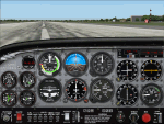
TAKE ADVANTAGE OF SUB-PIXEL RESOLUTION, ANTI-ALIASING AND SMOOTH ANIMATION FOR ALL YOUR ANALOG INSTRUMENTS. The AVG technology is designed for Flight Simulator analog gauges and provides smooth animation, especially for rotating parts (no more degree-per-degree rotation), no impact on performance and full compatibility with FS2004 and FSX, 2D or 3D panel. The panel provided here is a technology demonstrator. It is a C172 modified panel with AVG-based gauges that use the same graphics as the standard C172 gauges to let you compare the gauge animation and rendering. For more information, see this website: http://emarciano.free.fr/AVGHome
The usage of the panel is limited to 30 minutes after FS has started!
| Filename: | C172_Panel_using_AVG_a_NEW_Gauge_Technology__DEMO.zip |
| License: | Freeware, limited distribution |
| Added: | 12th December 2010, 14:11:16 |
| Downloads: | 314 |
| Author: | Eric Marciano |
| Size: | 1.07 MB |
| Category: Flight Simulator X - Panels | |
| C172 Panel using AVG, a NEW Gauge Technology - DEMO |
|
Images related to this file:
File Description:
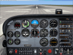
TAKE ADVANTAGE OF SUB-PIXEL RESOLUTION, ANTI-ALIASING AND SMOOTH ANIMATION FOR ALL YOUR ANALOG INSTRUMENTS. The AVG technology is designed for Flight Simulator analog gauges and provides smooth animation, especially for rotating parts (no more degree-per-degree rotation), no impact on performance and full compatibility with FS2004 and FSX, 2D or 3D panel. The panel provided here is a technology demonstrator. It is a C172 modified panel with AVG-based gauges that use the same graphics as the standard C172 gauges to let you compare the gauge animation and rendering. For more information, see this website: http://emarciano.free.fr/AVGHome
The usage of the panel is limited to 30 minutes after FS has started!
| Filename: | C172_Panel_using_AVG_a_NEW_Gauge_Technology__DEMO.zip |
| License: | Freeware, limited distribution |
| Added: | 12th December 2010, 14:26:01 |
| Downloads: | 576 |
| Author: | Eric Marciano |
| Size: | 1.81 MB |
| Category: Flight Simulator 2004 - Aircraft Repaints, Textures and Modifications | |
| Brirish Caledonian Airways Boeing 767-304(ER)EM - ETOPS Modified |
|
Images related to this file:
File Description:
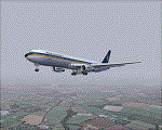
British Caledonian Airways Boeing 767-304(ER)EM - ETOPS modified, for Level D Simulations excellent Boeing 767 aircraft. This is a ficticious repaint of this aircraft for BCAL, registered G-MKOK and named after the founder and chairman,'Sir Adam Thomson'. This repaint is for FS9, not tested in FSX.I decided to paint this aircraft in this livery after an exhaustive search on the Internet and I couldn't find one for FS9. Had BCAL been around today, I believe that they would have this aircraft in their fleet, to replace their ageing DC10's on Trans Atlantic And Middle/Far Eastern Routes. Painted and saved in 32 Bit formats for better clarity and performance, full details in the 'Read Me' file,Please ENJOY !!!
| Filename: | Brirish_Caledonian_Airways_Boeing_767304EREM__ETOP.zip |
| License: | Freeware, limited distribution |
| Added: | 26th March 2011, 19:56:47 |
| Downloads: | 369 |
| Author: | Mick Kreiner MK Designs |
| Size: | 8.63 MB |
| Category: Flight Simulator 2004 - Aircraft Repaints, Textures and Modifications | |
| Air Canada Boeing 777-333ER - 'C-FITU' |
|
Images related to this file:
File Description:

This is the Air Canada Boeing 777-333ER registered, 'C-FITU'. It is painted on the fantastic Project Opensky 777-300 V2. Model features High resolution textures, Dynamic flexing wings, Body gear steering, Nose gear steering, Rudder lock, Ground spoilers, Low speed aileron locks at high speed, Fully animated control surfaces, Fully independent suspension, Trim Animation, Opening Passenger Doors, Animated tilting bogies, semi-transparent fan textures [carried over from the -200 series], Rolling wheels, Animated thrust reverser's with reverser block doors, Detailed textures, Full night lighting, Crash affects, Ground Service Vehicles And more. Model Designer Hiroshi Igami/Yosuke Ube. Flight Dynamics Designer Brandon D Henry. Tested by Project Open Sky Members. Textures by Ben Jones/Yosuke Ube. Note: This package includes only textures. Paint by Oscar Carl.
| Filename: | Air_Canada_Boeing_777333ER__CFITU.zip |
| License: | Freeware, limited distribution |
| Added: | 3rd November 2009, 19:54:17 |
| Downloads: | 2,331 |
| Author: | Oscar Carl |
| Size: | 16.57 MB |
| Category: Navigation and ATC - Navigation | |
| Lake Huron Chart Chunks Optimized For Moving Map Application |
|
File Description:
Sectional chart chunks made from the August 2009 Sectional charts at the original scale, formatted in the WGS84 lat/lon geographic coordinate system for GPS, moving map application for flight simulation use.
These chart chunks were converted to the JPEG format for compatibility and size. Coverage is the full Sectional area North and South divided into 8 JPEG tiles. They are about 3k x 3k pixels at 2.5mb with coverage of 90nm x 130nm per tile. Included is also the projection files and world files.
Note: This type of map is a equal grid and no further calibration is needed, only the two points referenced in the world file. Example: for users of FSM Moving Map, just mass import, done.
| Filename: | Lake_Huron_Chart_Chunks_Optimized_For_Moving_Map_A.zip |
| License: | Freeware |
| Added: | 20th February 2010, 22:08:53 |
| Downloads: | 129 |
| Author: | David Myers |
| Size: | 20.82 MB |
| Category: Navigation and ATC - Navigation | |
| Kansas City Chart Chunks Optimized For Moving Map Application |
|
File Description:
Sectional chart chunks made from the August 2009 Sectional charts at the original scale, formatted in the WGS84 lat/lon geographic coordinate system for GPS, moving map application for flight simulation use.
These chart chunks were converted to the JPEG format for compatibility and size. Coverage is the full Sectional area North and South divided into 8 JPEG tiles. They are about 3k x 3k pixels at 2.5mb with coverage of 90nm x 130nm per tile. Included is also the projection files and world files.
Note: This type of map is a equal grid and no further calibration is needed, only the two points referenced in the world file. Example: for users of FSM Moving Map, just mass import, done.
| Filename: | Kansas_City_Chart_Chunks_Optimized_For_Moving_Map_.zip |
| License: | Freeware |
| Added: | 20th February 2010, 23:07:30 |
| Downloads: | 116 |
| Author: | David Myers |
| Size: | 18.54 MB |
| Category: Navigation and ATC - Navigation | |
| Jacksonville Chart Chunks Optimized For Moving Map Application |
|
File Description:
Sectional chart chunks made from the August 2009 Sectional charts at the original scale, formatted in the WGS84 lat/lon geographic coordinate system for GPS, moving map application for flight simulation use.
These chart chunks were converted to the JPEG format for compatibility and size. Coverage is the full Sectional area North and South divided into 8 JPEG tiles. They are about 3k x 3k pixels at 2.5mb with coverage of 90nm x 130nm per tile. Included is also the projection files and world files.
Note: This type of map is a equal grid and no further calibration is needed, only the two points referenced in the world file. Example: for users of FSM Moving Map, just mass import, done.
| Filename: | Jacksonville_Chart_Chunks_Optimized_For_Moving_Map.zip |
| License: | Freeware |
| Added: | 20th February 2010, 23:07:56 |
| Downloads: | 106 |
| Author: | David Myers |
| Size: | 12.62 MB |
| Category: Navigation and ATC - Navigation | |
| Houston Chart Chunks Optimized For Moving Map Application |
|
File Description:
Sectional chart chunks made from the August 2009 Sectional charts at the original scale, formatted in the WGS84 lat/lon geographic coordinate system for GPS, moving map application for flight simulation use.
These chart chunks were converted to the JPEG format for compatibility and size. Coverage is the full Sectional area North and South divided into 8 JPEG tiles. They are about 3k x 3k pixels at 2.5mb with coverage of 90nm x 130nm per tile. Included is also the projection files and world files.
Note: This type of map is a equal grid and no further calibration is needed, only the two points referenced in the world file. Example: for users of FSM Moving Map, just mass import, done.
| Filename: | Houston_Chart_Chunks_Optimized_For_Moving_Map_Appl.zip |
| License: | Freeware |
| Added: | 20th February 2010, 23:08:11 |
| Downloads: | 122 |
| Author: | David Myers |
| Size: | 15.21 MB |
| Category: Navigation and ATC - Navigation | |
| Halifax Chart Chunks Optimized For Moving Map Application |
|
File Description:
Sectional chart chunks made from the August 2009 Sectional charts at the original scale, formatted in the WGS84 lat/lon geographic coordinate system for GPS, moving map application for flight simulation use.
These chart chunks were converted to the JPEG format for compatibility and size. Coverage is the full Sectional area North and South divided into 8 JPEG tiles. They are about 3k x 3k pixels at 2.5mb with coverage of 90nm x 130nm per tile. Included is also the projection files and world files.
Note: This type of map is a equal grid and no further calibration is needed, only the two points referenced in the world file. Example: for users of FSM Moving Map, just mass import, done.
| Filename: | Halifax_Chart_Chunks_Optimized_For_Moving_Map_Appl.zip |
| License: | Freeware |
| Added: | 20th February 2010, 23:08:21 |
| Downloads: | 146 |
| Author: | David Myers |
| Size: | 17.73 MB |


© 2001-2026 AVSIM Online
All Rights Reserved
Privacy Policy |