
Where Flight Simulation Enthusiasts Gather from Around the World!
AVSIM Library - Search Results

| Category: Flight Simulator 2004 - Aircraft Repaints, Textures and Modifications | |
| Korean Air and Jin Air Boeing 737-800 (HL8240 and HL7563) |

|
Images related to this file:
File Description:
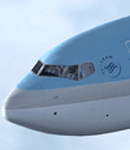
A B737-800 in the two variants of the Korean Air livery (small and large titles) plus a Jin Air livery. These are textures only, so the basepack developed by Tenkuu Developers Studio (TDS) is required. The windows and night lighting have been optimized. Model features high resolution textures, dynamic flexing wings, nose gear steering, rudder lock, ground spoilers, low speed aileron locks at high speed, fully animated control surfaces, fully independent suspension, trim animation, opening passenger doors, rolling wheels, animated thrust reversers with reverser block doors, detailed textures, full night lighting, ground service vehicles and more. Model design by Hiroshi Igami. Flight dynamics design by Nick Wilkinson and David Biggar. Master textures by Kyle Schurb.
| Filename: | Korean_Air_and_Jin_Air_Boeing_737800_HL8240_and_HL.zip |
| License: | Freeware |
| Added: | 16th January 2014, 21:08:27 |
| Downloads: | 1,029 |
| Author: | Mike Jahncke | Tenkuu Developers Studio (TDS) |
| Size: | 28.2 MB |
| Category: Flight Simulator X - Aircraft Repaints, Textures and Modifications | |
| Air India Express "Indian Jewellery" Boeing 737-800 |
|
Images related to this file:
File Description:
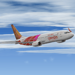
AIR INDIA EXPRESS " INDIA JEWELLERY " texture set for the TDS Boeing 737-800 (not included, must download base package). Model developed by Tenkuu Developers Studio, features high resolution textures, dynamic flexing wings, nose gear steering, rudder lock, ground spoilers, low speed aileron locks at high speed, fully animated control surfaces, fully independent suspension, trim animation, opening passenger doors, rolling wheels, animated thrust reverser's with reverser block doors, detailed textures, full night lighting, ground service vehicles and more. Model design by Hiroshi Igami. Flight dynamics design by Nick Wilkinson, with assistance from David Biggar. Master textures and paint kit by Kyle Schurb. Painted by Triadi Sudarmawan for the great TDS model.Also works with FS2004.
| Filename: | Air_India_Express_Indian_Jewellery_Boeing_737800.zip |
| License: | Freeware |
| Added: | 23rd January 2014, 11:36:29 |
| Downloads: | 498 |
| Author: | Triadi Sudarmawan |
| Size: | 4.91 MB |
| Category: Flight Simulator X - Aircraft Repaints, Textures and Modifications | |
| Nok Air "Flamingo" Boeing 737-83N |
|
Images related to this file:
File Description:
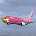
NOK AIR " FLAMINGO " texture set for the TDS Boeing 737-800 (not included, must download base package). Model developed by Tenkuu Developers Studio, features high resolution textures, dynamic flexing wings, nose gear steering, rudder lock, ground spoilers, low speed aileron locks at high speed, fully animated control surfaces, fully independent suspension, trim animation, opening passenger doors, rolling wheels, animated thrust reversers with reverser block doors, detailed textures, full night lighting, ground service vehicles and more. Model design by Hiroshi Igami. Flight dynamics design by Nick Wilkinson, with assistance from David Biggar. Master textures and paint kit by Kyle Schurb. Painted by Triadi Sudarmawan for the great TDS model. Also works with FS2004.
| Filename: | Nok_Air_Flamingo_Boeing_73783N.zip |
| License: | Freeware |
| Added: | 27th January 2014, 11:28:34 |
| Downloads: | 1,009 |
| Author: | Triadi Sudarmawan |
| Size: | 3.83 MB |
| Category: Flight Simulator 2004 - Aircraft Repaints, Textures and Modifications | |
| TUIfly German Boeing 737-800 |
|
Images related to this file:
File Description:
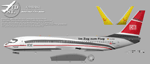
TDS Boeing 737-800 Special TUIFLY Livery Package includes: D-ATUE, D-ATUC and D-AHFR.
Developed by Tenkuu Developers Studio (TDS). Model features high resolution textures, dynamic flexing wings, nose gear steering, rudder lock, ground spoilers, low speed aileron locks at high speed, fully animated control surfaces, fully independent suspension, trim animation, opening passenger doors, rolling wheels, animated thrust reversers with reverser block doors, detailed textures, full night lighting, ground service vehicles and more. Model design by Hiroshi Igami. Flight dynamics design by Nick Wilkinson and David Biggar. Master textures by Kyle Schurb.
TEXTURES ONLY... Requires TDS 737-800 basepack http://library.avsim.net/download.php?DLID=181913
Textures by Dietmar Hanne.
| Filename: | TUIfly_German_Boeing_737800.zip |
| License: | Freeware |
| Added: | 31st January 2014, 11:59:40 |
| Downloads: | 295 |
| Author: | Dietmar Hanne |
| Size: | 16.32 MB |
| Category: Flight Simulator X - Aircraft Repaints, Textures and Modifications | |
| Arik Air, Enter Air, Travel Service - Boeing 737-800 4 Pack |
|
Images related to this file:
File Description:
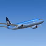
ARIK AIR, ENTER AIR, TRAVEL SERVICE (HUNGARY AND TELEFONIA O2)texture set for the TDS Boeing 737-800 (not included, must download base package). Model developed by Tenkuu Developers Studio, features high resolution textures, dynamic flexing wings, nose gear steering, rudder lock, ground spoilers, low speed aileron locks at high speed, fully animated control surfaces, fully independent suspension, trim animation, opening passenger doors, rolling wheels, animated thrust reversers with reverser block doors, detailed textures, full night lighting, ground service vehicles and more. Model design by Hiroshi Igami. Flight dynamics design by Nick Wilkinson, with assistance from David Biggar. Master textures and paint kit by Kyle Schurb. Painted by Triadi Sudarmawan for the great TDS model. Also works with FS2004.
| Filename: | Arik_Air_Enter_Air_Travel_Service__Boeing_737800_4.zip |
| License: | Freeware |
| Added: | 5th February 2014, 09:56:52 |
| Downloads: | 862 |
| Author: | Triadi Sudarmawan |
| Size: | 12.76 MB |
| Category: Flight Simulator 2004 - Scenery | |
| RNAS Yeovilton - HMS Heron |
|
Images related to this file:
File Description:

FS2004 scenery for RNAS Yeovilton (HMS Heron) as it is today. Yeovilton is the current home to various helicopter squadrons flying the Sea King, Commando, Lynx and the new Wildcat. It is also home to fix wing flying with the likes of Hawks of the Naval Flying Standards Flight with the Hawk, 727 Sqn with Grob Tutors and not forgetting the Royal Navy Historic Aircraft Flight, flying the Swordfish, Sea Fury, Sea Hawk and Chipmunk.
This scenery is made up from objects obtained from various MAIW scenery libraries, which are all available to download, and will be needed in order to get the fullest benefit of this station. Full details in the enclosed documentation.
| Filename: | RNAS_Yeovilton__HMS_Heron.zip |
| License: | Freeware, limited distribution |
| Added: | 11th November 2013, 21:19:33 |
| Downloads: | 1,406 |
| Author: | Brian Clarke, Daryl Payne |
| Size: | 943.61 KB |
| Category: Flight Simulator X - Aircraft Repaints, Textures and Modifications | |
| Air Canada Boeing 737-700 |
|
Images related to this file:
File Description:
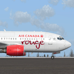
AIR CANADA Rouge texture set for the TDS Boeing 737-700 (not included, must download base package). Model developed by Tenkuu Developers Studio, features high resolution textures, dynamic flexing wings, nose gear steering, rudder lock, ground spoilers, low speed aileron locks at high speed, fully animated control surfaces, fully independent suspension, trim animation, opening passenger doors, rolling wheels, animated thrust reversers with reverser block doors, detailed textures, full night lighting, ground service vehicles and more. Model design by Hiroshi Igami. Flight dynamics design by Nick Wilkinson, with assistance from David Biggar. Master textures and paint kit by Kyle Schurb. Painted by Triadi Sudarmawan for the great TDS model. Also works in FS2004.
| Filename: | Air_Canada_Boeing_737700.zip |
| License: | Freeware |
| Added: | 13th November 2013, 22:05:00 |
| Downloads: | 776 |
| Author: | Triadi Sudarmawan |
| Size: | 2.53 MB |
| Category: Flight Simulator X - Utilities | |
| Flight Log Client V 27 |
|
Images related to this file:
File Description:
This is a windows client software that allows you to log your flights to a database and keep a lifetime flight data history, you can connect to your members area and view all your logged flights in a map.
The SERIES 2 of FLC was born, now with full V.A. itegration and ability to create and submit flightplans to our network, you can also save them in "FPL IVAO compatible format" locally in your hard disk to share with your IVAO application or load them in further flight logs. You can also flight for a V.A. or ask your V.A. to integrate our services.
1,183 hours of flight time logged with our software.
| Filename: | Flight_Log_Client_V_27.zip |
| License: | Freeware |
| Added: | 22nd November 2013, 23:30:22 |
| Downloads: | 141 |
| Author: | Mario Dantas |
| Size: | 4.82 MB |
| Category: Flight Simulator X - Aircraft Repaints, Textures and Modifications | |
| Southwest Airlines "Sports Illustrated" Boeing 737-700 |
|
Images related to this file:
File Description:
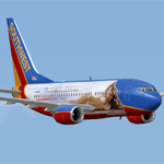
SOUTHWEST AIRLINES SPORTS ILLUSTRATED texture set for the TDS Boeing 737-700 (not included, must download base package). Model developed by Tenkuu Developers Studio, features high resolution textures, dynamic flexing wings, nose gear steering, rudder lock, ground spoilers, low speed aileron locks at high speed, fully animated control surfaces, fully independent suspension, trim animation, opening passenger doors, rolling wheels, animated thrust reversers with reverser block doors, detailed textures, full night lighting, ground service vehicles and more. Model design by Hiroshi Igami. Flight dynamics design by Nick Wilkinson, with assistance from David Biggar. Master textures and paint kit by Kyle Schurb. Painted by Triadi Sudarmawan for the great TDS model. Also works in FS2004.
| Filename: | Southwest_Airlines_Sports_Illustrated_Boeing_73770.zip |
| License: | Freeware |
| Added: | 4th January 2014, 14:25:31 |
| Downloads: | 716 |
| Author: | Triadi Sudarmawan |
| Size: | 4.29 MB |
| Category: Flight Simulator X - Aircraft Repaints, Textures and Modifications | |
| GLOBESPAN Boeing 737-600 / -800 |
|
Images related to this file:
File Description:
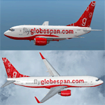
GLOBESPAN BOEING 737-600 / -800 texture set for the TDS Boeing 737-600 and Boeing 737-800 (not included, must download base package). Model developed by Tenkuu Developers Studio, features high resolution textures, dynamic flexing wings, nose gear steering, rudder lock, ground spoilers, low speed aileron locks at high speed, fully animated control surfaces, fully independent suspension, trim animation, opening passenger doors, rolling wheels, animated thrust reversers with reverser block doors, detailed textures, full night lighting, ground service vehicles and more. Model design by Hiroshi Igami. Flight dynamics design by Nick Wilkinson, with assistance from David Biggar. Master textures and paint kit by Kyle Schurb. Painted by Triadi Sudarmawan for the great TDS model. Also works with FS2004.
| Filename: | GLOBESPAN_Boeing_737600__800.zip |
| License: | Freeware |
| Added: | 26th May 2014, 14:04:07 |
| Downloads: | 283 |
| Author: | Triadi " ACHONK " Sudarmawan |
| Size: | 7.99 MB |


© 2001-2026 AVSIM Online
All Rights Reserved
Privacy Policy |