
Where Flight Simulation Enthusiasts Gather from Around the World!
AVSIM Library - Search Results

| Category: Flight Simulator 2004 - AFCAD Files | |
| El Hierro (Canary Island) Sim Wings |

|
File Description:
This a AFCAD 2 file for the excellent addon airport for FS2004 El Hierro (Canary Islands) GCHI from Sim-Wings, non static traffic. Este es el archivo AFCAD 2 para el escenario de Sim-Wings del aeropuerto de El Hierro (Islas Canarias) GCHI, esta diseñado sin tráfico estático. Progresivamente iré haciendo el resto de los escenarios canarios. A disfrutarlo.
| Filename: | El_Hierro_Canary_Island_Sim_Wings.zip |
| License: | Freeware |
| Added: | 7th November 2003, 03:34:42 |
| Downloads: | 1,230 |
| Author: | Jose Angel Suarez |
| Size: | 1.6 KB |
| Category: Flight Simulator 2004 - AFCAD Files | |
| El Berriel (Canary Island) Sim Wings |
|
File Description:
This a AFCAD 2 file for the excellent addon airport for FS2004 El Berriel (Canary Islands) GCLB from Sim-Wings, non static traffic. Este es el archivo AFCAD 2 para el escenario de Sim-Wings del aeródromo de El Berriel (Islas Canarias) GCLB, esta diseñado sin tráfico estático. Progresivamente iré haciendo el resto de los escenarios canarios. A disfrutarlo.
| Filename: | El_Berriel_Canary_Island_Sim_Wings.zip |
| License: | Freeware |
| Added: | 7th November 2003, 03:36:05 |
| Downloads: | 1,155 |
| Author: | Jose Angel Suarez |
| Size: | 1.13 KB |
| Category: Flight Simulator 2002 - Scenery | |
| Landclass file for Fuerteventura, Canary Islands/Islas Canarias |
|
File Description:
Scenery for Fuerteventura (GCFV). Just a few small towns.
You can see them for the finals on RWY.01
Also ships in the bay of Puerto del Rosario, the capital of this
Canary Island. And a few ships between Fuerteventura and Lanzarote.
| Filename: | Landclass_file_for_Fuerteventura_Canary_IslandsIsl.zip |
| License: | Freeware |
| Added: | 18th December 2003, 00:35:25 |
| Downloads: | 1,295 |
| Author: | Cornelis Boersma |
| Size: | 1.56 MB |
| Category: Flight Simulator X - Original Aircraft | |
| Binter Mediterraneo CASA CN235 |
|
Images related to this file:
File Description:
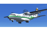
Binter Mediterranean was a Spanish airline, created in the likeness of Binter Canarias, and a subsidiary of Iberia LAE, based in Madrid, with a fleet of for 5 CASA CN-235 aircraft. It was based at Malaga Airport, Malaga. Model by J.E.Narcizo & RanchoJEN, adaptation for FSX, panel and VC by Philippe Wallaert, texture by Juan Villamor. Full aircraft. More in http://simrepaints.envaldemoro.com.
| Filename: | Binter_Mediterraneo_CASA_CN235.zip |
| License: | Freeware |
| Added: | 8th July 2015, 11:46:31 |
| Downloads: | 1,035 |
| Author: | Juan Villamor |
| Size: | 2.83 MB |
| Category: Fly! II - TerraScene | |
| Toledo (Ohio Project) TerraScene Project Pack |
|
File Description:
This is a TerraScene 2.1 Project pack for northwestern Ohio. It covers all of global tile 196,160 with Toledo in the center. It extends into Michigan to the north, including the southern part of Detroit. I have included a grass underlay for Detroit Grosse Ile Airport, which sits on Grosse Ile island. This pack includes updated Tiger Census (2000) shapefile data, adding new water areas, new highways, and other details. All scenery data files are included: USGS data, shapefiles, and a complete water mask. Requires TerraScene 2.1 and Fly!II patched to v240.
| Filename: | Toledo_Ohio_Project_TerraScene_Project_Pack.zip |
| License: | Freeware |
| Added: | 11th April 2003, 23:53:22 |
| Downloads: | 189 |
| Author: | Randall Rocke |
| Size: | 48.69 MB |
| Category: Fly! II - TerraScene | |
| Mansfield (Ohio Project) TerraScene Project Pack |
|
File Description:
This is a TerraScene 2.1 Project pack for the area of Mansfield, Ohio, including all of global tile 197,159. This pack includes updated Tiger Census (2000) shapefile data, adding new water areas, new highways, and other details. All scenery data files are included: USGS data, shapefiles, and a complete water mask. Requires TerraScene 2.1 and Fly!II patched to v230 or later.
| Filename: | Mansfield_Ohio_Project_TerraScene_Project_Pack.zip |
| License: | Freeware |
| Added: | 5th April 2003, 10:38:31 |
| Downloads: | 157 |
| Author: | Randall Rocke |
| Size: | 43.73 MB |
| Category: Fly! II - TerraScene | |
| Brunswick (Carolinas Project) TerraScene Project Pack |
|
File Description:
This is a TerraScene 2.1 Project pack for the area of Brunswick and the southern portion of Savannah, GA, including all of global tile 198,151. Combine this global tile with the Hilton Head tile to prevent the "capitation" of Savannah. Savannah sits directly on the tile borders, so this will give you the whole city. This tile continues the GA coastline to just south of Brunswick and Glynco Jetport. This pack includes updated Tiger Census (2000) shapefile data, adding new water areas, new highways, and other details. All scenery data files are included: USGS data, shapefiles, and a complete custom water mask. Requires TerraScene 2.1 and Fly!II patched to v230 or later.
| Filename: | Brunswick_Carolinas_Project_TerraScene_Project_Pac.zip |
| License: | Freeware |
| Added: | 4th June 2003, 12:19:47 |
| Downloads: | 194 |
| Author: | Randall Rocke |
| Size: | 24.24 MB |
| Category: Fly! II - TerraScene | |
| Wilmington (Carolinas Project) TerraScene Project Pack |
|
File Description:
This TerraScene 2.1 Project pack covers all of global tile 200,153, with the Atlantic coastline running from Topsoil Beach in the NE past Wilmington and finishing at North Myrtle Beach and Grand Strand. To the north you will find Lake Waccamaw and the Green Swamp. This pack includes updated Tiger Census (2000) shapefile data, adding new water areas, new highways, and other details. All scenery data files are included: USGS data, shapefiles, and a complete custom water mask. Requires TerraScene 2.1 and Fly!II patched to v230 or later.
| Filename: | Wilmington_Carolinas_Project_TerraScene_Project_Pa.zip |
| License: | Freeware |
| Added: | 4th June 2003, 15:45:24 |
| Downloads: | 159 |
| Author: | Randall Rocke |
| Size: | 47.54 MB |
| Category: Fly! II - TerraScene | |
| Maysville (Ohio Project) TerraScene Project Pack |
|
File Description:
This is a TerraScene 2.1 Project pack for southern Ohio and portions of northern Kentucky. It covers all of global tile 196,157 with Maysville, KY in the center. Above the Ohio River, you will find a portion of southern Ohio, with rolling hills and small towns, extending from Portsmouth, OH in the east to just below Cincinnati in the west. This pack includes updated Tiger Census (2000) shapefile data, adding new water areas, new highways, and other details. All scenery data files are included: USGS data, shapefiles, and a complete water mask. Requires TerraScene 2.1 and Fly!II patched to v230 or later.
| Filename: | Maysville_Ohio_Project_TerraScene_Project_Pack.zip |
| License: | Freeware |
| Added: | 4th May 2003, 14:51:31 |
| Downloads: | 174 |
| Author: | Randall Rocke |
| Size: | 61.6 MB |
| Category: Fly! II - TerraScene | |
| Charlotte (Carolinas Project) TerraScene Project Pack |
|
File Description:
This TerraScene 2.1 Project pack covers all of global tile 198,154, centering on Charlotte, North Carolina with Lake Wylie and the Rock Hill, SC region to the southwest. It adjoins the Spartanburg global tile to the west and the Winston-Salem tile to the north. This pack includes updated Tiger Census (2000) shapefile data, adding new water areas, new highways, and other details. All scenery data files are included: USGS data, shapefiles, and a complete water mask. Requires TerraScene 2.1 and Fly!II patched to v230 or later.
| Filename: | Charlotte_Carolinas_Project_TerraScene_Project_Pack.zip |
| License: | Freeware |
| Added: | 15th September 2003, 14:23:31 |
| Downloads: | 283 |
| Author: | Randall Rocke |
| Size: | 68.88 MB |
© 2001-2026 AVSIM Online
All Rights Reserved
Privacy Policy |