
Where Flight Simulation Enthusiasts Gather from Around the World!
AVSIM Library - Search Results

| Category: Flight Simulator 2004 - AI Aircraft | |
| Lockheed C130H Libyan Arab Air Force |

|
Images related to this file:
File Description:
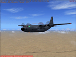
HTAI Lockheed C130H Libyan Arab Air Force, painted in the new grey colour scheme.
Texture, AFCADs and traffic files by Luciano Franchini.
You need the original Henry Tomkievicz's model available at htaimodels.com
| Filename: | Lockheed_C130H_Libyan_Arab_Air_Force.zip |
| License: | Freeware |
| Added: | 11th May 2010, 01:29:31 |
| Downloads: | 392 |
| Author: | Luciano Franchini |
| Size: | 796.61 KB |
| Category: Flight Simulator 2002 - Miscellaneous Files | |
| San Antonio Sectional Chart |
|
File Description:
The San Antonio sectional joins the Albuquerque sectional on our way eastwards to Texas. You may use this chart "as is" without any other software, but it will develop its full potential if used as moving map with SimSystem´s FSFlightMax or FSGarmin. It wouldn´t have been possible to offer this chart without Richard Harvey and his love to flightsimming, so please consider this file to be "donationware" and make a however small contribution to the Richard Harvey Endowed Scholarship.
| Filename: | San_Antonio_Sectional_Chart.zip |
| License: | Check within download |
| Added: | 30th March 2003, 02:44:01 |
| Downloads: | 944 |
| Author: | Uwe Rademacher |
| Size: | 16.31 MB |
| Category: Flight Simulator 2002 - Miscellaneous Files | |
| Las Vegas Sectional Chart |
|
File Description:
If you plan a virtual flight to some of the States´ most beautiful National Parks, this chart is for you. The 5300*4200 pixel chart merges the front and back of the Las Vegas sectional and covers Las Vegas, the Grand Canyon, Bryce Canyon, Death Valley, Lake Mead, Marble Canyon... The desert states have a lot to offer! Take off from Richard "Georender" Goldstein´s Escalante and aim for Hurricane, at Bryce Canyon (KBCE) you may have a soft drink and practice high altitude take-offs and landings. While it can be used "as is" without any other software, it will develop its full potential if used as moving map with SimSystem´s FSFlightMax or FSGarmin. It wouldn´t have been possible to offer this chart without Richard Harvey and his love to flightsimming, so please consider this file to be "donationware" and make a however small contribution to the Richard Harvey Endowed Scholarship.
| Filename: | Las_Vegas_Sectional_Chart.zip |
| License: | Check within download |
| Added: | 24th March 2003, 13:41:22 |
| Downloads: | 2,031 |
| Author: | Uwe Rademacher |
| Size: | 15.23 MB |
| Category: Navigation and ATC - Navigation | |
| Bethel Sectional Chart Chunks |
|
File Description:
Sectional chart chunks made from the August 2009 Sectional charts at the original scale, formatted in the WGS84 lat/lon geographic coordinate system for GPS, moving map application for flight simulation use.
These chart chunks were converted to the JPEG format for compatibility and size. Coverage is the full Sectional area North and South divided into JPEG tiles. They are about 3k x 3k pixels at 2.5mb with coverage of 90nm x 130nm per tile. Included is also the projection files and world files.
Note: This type of map is a equal grid and no further calibration is needed, only the two points referenced in the world file. Example: for users of FSM Moving Map, just mass import, done.
| Filename: | Bethel_Sectional_Chart_Chunks.zip |
| License: | Freeware |
| Added: | 7th March 2010, 20:50:48 |
| Downloads: | 177 |
| Author: | David Myers |
| Size: | 14.67 MB |
| Category: Navigation and ATC - Navigation | |
| Twin Cities Sectional Chart Chunks for Aerosoft's FSMap |
|
File Description:
Sectional chart chunks made from the August 2009 Sectional charts at the original scale, formatted in the WGS84 lat/long geographic coordinate system for the FSMap, moving map application for flight simulation use.
The chart chunks are the full sectional divided by 2 tiles (east/west) and converted from the geotiffs to baseline 8bit tiffs with packbit compression applied, not for size but for efficiency. The images are about 6,000x6,000 pixels at about 25mb each, also included is the FSMap fsm Calibration file for importing.
**Note: The files in this download are the largest of the split sectionals, 6,000x7,000 due to the Lake of the Woods region extending the northern border. These should work in the gauge just fine, having tested the full sectional area tiff that is 12,000x7,000 at 60mb in size in the gauge the only difference was that the zoom in was limited to 10nm with these larger images (see the notes in the zip file).
| Filename: | Twin_Cities_Sectional_Chart_Chunks_for_Aerosofts_F.zip |
| License: | Freeware |
| Added: | 19th March 2010, 01:17:18 |
| Downloads: | 334 |
| Author: | David Myers |
| Size: | 34.27 MB |
| Category: Flight Simulator X - AFCAD Files | |
| Missing Asian Airports - ZBMZ (NZH) - ZSWZ (WNZ) - ZMDN (ULZ) |
|
File Description:
Missing airports/afcads for FSX, ZBMZ(NZH) Manzhouli Xijiao Airport,China - ZSWZ(WNZ) Wenzhou Yongqiang Airport,China - ZMDN(ULZ) Donoi Airport (aka New Uliastai Airport),Mongolia. Tested with FSX Acceleration SP2, UTX/GEX.
| Filename: | Missing_Asian_Airports__ZBMZ_NZH__ZSWZ_WNZ__ZMDN_U.zip |
| License: | Freeware, limited distribution |
| Added: | 16th June 2014, 06:37:55 |
| Downloads: | 1,327 |
| Author: | Kevin Wynn |
| Size: | 11.74 KB |
| Category: Navigation and ATC - Navigation | |
| Kodiak Sectional Chart Chunks Optimized For Moving Map Application |
|
File Description:
Sectional chart chunks made from the August 2009 Sectional charts at the original scale, formatted in the WGS84 lat/lon geographic coordinate system for GPS, moving map application for flight simulation use.
These chart chunks were converted to the JPEG format for compatibility and size. Coverage is the full Sectional area North and South divided into JPEG tiles. They are about 3k x 3k pixels at 2.5mb with coverage of 90nm x 130nm per tile. Included is also the projection files and world files.
Note: This type of map is a equal grid and no further calibration is needed, only the two points referenced in the world file. Example: for users of FSM Moving Map, just mass import, done.
| Filename: | Kodiak_Sectional_Chart_Chunks_Optimized_For_Moving.zip |
| License: | Freeware |
| Added: | 1st March 2010, 22:12:20 |
| Downloads: | 149 |
| Author: | David Myers |
| Size: | 11.37 MB |
| Category: Navigation and ATC - Navigation | |
| Ketchikan Sectional Chart Chunks Optimized For Moving Map Application |
|
File Description:
Sectional chart chunks made from the August 2009 Sectional charts at the original scale, formatted in the WGS84 lat/lon geographic coordinate system for GPS, moving map application for flight simulation use.
These chart chunks were converted to the JPEG format for compatibility and size. Coverage is the full Sectional area North and South divided into JPEG tiles. They are about 3k x 3k pixels at 2.5mb with coverage of 90nm x 130nm per tile. Included is also the projection files and world files.
Note: This type of map is a equal grid and no further calibration is needed, only the two points referenced in the world file. Example: for users of FSM Moving Map, just mass import, done.
| Filename: | Ketchikan_Sectional_Chart_Chunks_Optimized_For_Mov.zip |
| License: | Freeware |
| Added: | 2nd March 2010, 00:30:36 |
| Downloads: | 193 |
| Author: | David Myers |
| Size: | 7.32 MB |
| Category: Navigation and ATC - Navigation | |
| Juneau Sectional Chart Chunks Optimized For Moving Map Application |
|
File Description:
Sectional chart chunks made from the August 2009 Sectional charts at the original scale, formatted in the WGS84 lat/lon geographic coordinate system for GPS, moving map application for flight simulation use.
These chart chunks were converted to the JPEG format for compatibility and size. Coverage is the full Sectional area North and South divided into JPEG tiles. They are about 3k x 3k pixels at 2.5mb with coverage of 90nm x 130nm per tile. Included is also the projection files and world files.
Note: This type of map is a equal grid and no further calibration is needed, only the two points referenced in the world file. Example: for users of FSM Moving Map, just mass import, done.
| Filename: | Juneau_Sectional_Chart_Chunks_Optimized_For_Moving.zip |
| License: | Freeware |
| Added: | 2nd March 2010, 00:33:13 |
| Downloads: | 218 |
| Author: | David Myers |
| Size: | 12.81 MB |
| Category: Navigation and ATC - Navigation | |
| Fairbanks Sectional Chart Chunks Optimized For Moving Map Application |
|
File Description:
Sectional chart chunks made from the August 2009 Sectional charts at the original scale, formatted in the WGS84 lat/lon geographic coordinate system for GPS, moving map application for flight simulation use.
These chart chunks were converted to the JPEG format for compatibility and size. Coverage is the full Sectional area North and South divided into JPEG tiles. They are about 3k x 3k pixels at 2.5mb with coverage of 90nm x 130nm per tile. Included is also the projection files and world files.
Note: This type of map is a equal grid and no further calibration is needed, only the two points referenced in the world file. Example: for users of FSM Moving Map, just mass import, done.
| Filename: | Fairbanks_Sectional_Chart_Chunks_Optimized_For_Mov.zip |
| License: | Freeware |
| Added: | 3rd March 2010, 05:55:56 |
| Downloads: | 182 |
| Author: | David Myers |
| Size: | 18.33 MB |
© 2001-2026 AVSIM Online
All Rights Reserved
Privacy Policy |