
Where Flight Simulation Enthusiasts Gather from Around the World!
AVSIM Library - Search Results

| Category: Fly! II - Navigation | |
| PLOTTING MAP II |

|
File Description:
Improved display since first version.
The files included in this zip package can be used
to display the area covered by coast and rivers data
(used with ROTW moving map instruments), or to display
a flight user trace between airports and navaids.
Improved display since first version.
Only for PC : OpenGlide rendering.
Tested with XP and NVIDIA GeForce MX 420 64 Mb
| Filename: | PLOTTING_MAP_II.zip |
| License: | Freeware |
| Added: | 14th March 2004, 17:52:00 |
| Downloads: | 151 |
| Author: | laurent claudet (rotw) |
| Size: | 252.59 KB |
| Category: Flight Simulator 2002 - AFCAD Files | |
| EDDI GA 4 |
|
File Description:
AFCAD-File for EDDI (Berlin-Tempelhof) with 27 parking positions.
Only to use with GA 4 (German Airports 4) for FS 2002.
Both runways in use. Need Lee Swordy's AFCAD to install this file.
It's my first work, because there is no AFCAD-File for this airport to download right now.
I hope you enjoy it. Have a nice flight. Greetings from Berlin.
| Filename: | EDDI_GA_4.zip |
| License: | Freeware |
| Added: | 4th February 2004, 16:24:07 |
| Downloads: | 452 |
| Author: | Thomas Kurzweg (Germany) |
| Size: | 2.94 KB |
| Category: Flight Simulator 2004 - Aircraft Repaints, Textures and Modifications | |
| British United BAC One-Eleven 201 G-ASJJ 1965 |
|
File Description:
This was the tenth of the intial order from British United and the second to be delivered. It made many visits to airports throughout the UK and Europe on route proving flights before the type entered service. At the time it was hailed as the "Bus-stop Jet". You will need the BAC 1-11 200 Model by David Maltby.
| Filename: | British_United_BAC_OneEleven_201_GASJJ_1965.zip |
| License: | Freeware |
| Added: | 29th September 2004, 16:21:29 |
| Downloads: | 320 |
| Author: | Garry Russell |
| Size: | 592.48 KB |
| Category: Flight Simulator 2004 - AI Flight Plans | |
| FlyMe - Winter 2005 |
|
File Description:
FlyMe is a Swedish airline with a scheduled service in Sweden serving a small number of airports from its hub at Stockholm. Currently they own 4 Boeing 737-300 aircraft and have 2 more on lease from Falcon Air. These plans make use of all 6 aircraft and are valid from the 26th September to the 18th December 2005 and are fully accurate.
| Filename: | FlyMe__Winter_2005.zip |
| License: | Freeware, limited distribution |
| Added: | 5th November 2005, 14:24:46 |
| Downloads: | 1,188 |
| Author: | Ben Clark |
| Size: | 4.35 KB |
| Category: Flight Simulator 2004 - AI Flight Plans | |
| Orex Orbit Express Airlines - Winter 2005 |
|
File Description:
Orex Orbit Express Airlines, were founded not long ago in November 2002 and since then has grown to cover a small yet important handful of airports in Europe, with links to the rest of the world thanks to other carriers. Offering both scheduled and charter flight's, I present here for you the scheduled flights as rostered on the Orex website. Updated.
| Filename: | Orex_Orbit_Express_Airlines__Winter_2005.zip |
| License: | Freeware, limited distribution |
| Added: | 6th November 2005, 01:11:52 |
| Downloads: | 1,126 |
| Author: | Ben Clark |
| Size: | 5.82 KB |
| Category: Flight Simulator 2004 - AI Flight Plans | |
| British NorthWestern Airlines - Winter 2005 |
|
File Description:
BNWA have a long history behind them starting as Flykeen Airways in 1990, then later changing names in 2005 to A2B Airways and most recently to BNWA. Based out of Blackpool, they serve the busy Blackpool to Isle of Man and Belfast routes with their single Piper PA-31 Navajo aircraft offering a reliable daily service between all 3 airports.
| Filename: | British_NorthWestern_Airlines__Winter_2005.zip |
| License: | Freeware, limited distribution |
| Added: | 7th March 2006, 01:31:35 |
| Downloads: | 390 |
| Author: | Ben Clark |
| Size: | 6.26 KB |
| Category: Flight Simulator 2004 - Flight Plans | |
| Canadian Boeing 767 Procedures |
|
File Description:
This is a complete overhaul of the Level-D 767 procedures for every airport that has scheduled 763 service in Canada. Every single published SID, STAR and APP are included for the airports of CYEG, CYHZ, CYOW, CYUL, CYVR, CYWG, CYXY, CYYC, CYYT, and CYYZ. Procedures are based and are current on Canada Air Pilot charts valid August 3rd, 2006.
| Filename: | Canadian_Boeing_767_Procedures.zip |
| License: | Freeware |
| Added: | 3rd August 2006, 04:01:26 |
| Downloads: | 2,110 |
| Author: | Daniel Kelly / Level-D |
| Size: | 33.21 KB |
| Category: Flight Simulator X - Aircraft Repaints, Textures and Modifications | |
| Hamburg Airways Airbus A320-114 [D-AHHC] |
|
Images related to this file:
File Description:
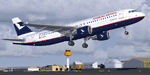
Project Airbus. Hamburg Airways Luftverkehrgesellschaft mbH is a German start-up airline based at Hamburg, operating scheduled and chartered holiday flights on behalf of tour operators. The airline operates flights out of several German airports, with its maintenance base being located at Hamburg Airport. Flights are operated throughout Europe, Eurasia, the Middle East and Africa. The aircraft is VC equipped.
| Filename: | Hamburg_Airways___Airbus_A320114___DAHHC.zip |
| License: | Freeware |
| Added: | 4th September 2011, 00:54:14 |
| Downloads: | 583 |
| Author: | Marco Fischbach |
| Size: | 14.16 MB |
| Category: Flight Simulator X - Flight Plans | |
| Alpine Lakes Explored |
|
File Description:
A series of ten flights through beautiful Alpine scenery from one lake to another, including some well-known and some lesser-known lakes and towns.
The flights require an amphibian aircraft of your choice, and there are recommendations for downloads of airports visited.
Full flight plans are included along with a Flight Briefing which has useful notes on places seen on the trips.
| Filename: | Alpine_Lakes_Explored.zip |
| License: | Freeware |
| Added: | 24th September 2012, 19:35:36 |
| Downloads: | 599 |
| Author: | Gordon Wilkinson |
| Size: | 51.44 MB |
| Category: Flight Simulator X - Utilities | |
| GETCha (Google Earth Taxi Chart Generator) v1.1 |
|
Images related to this file:
File Description:
This is a simple utility to draw airport taxiway chart to view with Google Earth, using Flight Simulator's AFCAD data. It can generate taxiway chart of any airport in the world (as long as it exists in FS). If it's hard or troublesome for you to find taxiway charts of all the airports you visit, this utility can be helpful.
| Filename: | GETCha_Google_Earth_Taxi_Chart_Generator_v11.zip |
| License: | Freeware |
| Added: | 8th October 2012, 19:42:27 |
| Downloads: | 629 |
| Author: | Dongjin Shin |
| Size: | 4.93 MB |
© 2001-2026 AVSIM Online
All Rights Reserved
Privacy Policy |