
Where Flight Simulation Enthusiasts Gather from Around the World!
AVSIM Library - Search Results

| Category: Flight Simulator 2004 - AI Flight Plans | |
| Vieques Air Link AI Flight Plans NEW COLORS |

|
Images related to this file:
File Description:
-This package have flight plans,updates for the AI models,AFCAD for the different airports and the Call Sign for VAL.
-Vieques Air Link(VAL) is a small regional airline that travel to sAN Juan,Isla Grande(Dominici),St. Croix,Ceiba(Roosevelt Roads) and Culebra
from Vieques,Puerto Rico.
-The flight plans are a combination of Real Schedule Operations of the airline plus some fictional plans that we think
will become real very soon(ST.Thomas,Punta Cana and la Romana).
-Models courtesy of Henry Tomkiewicz and the Repaints courtesy of Roberto Ayala and his website www.robertoayala.com
-In order for the package to work properly you need to have the Puertorico2004v2 scenery from Roberto Ayala installed,
you may find it at his website and youll need also the Blue Print TJSJ Scenery(freeware),you can find the link at Roberto's
website.
-The AI Models can be found at www.avsim.com or www.robertoayala.com with also more files of Roberto's work at the sim
community.To add the Trislander you have to downloaded and install it also on your Flight Simulator Aircraft Folder.
It require the Vieques Air Link AI MODELS NEW COLORS
| Filename: | Vieques_Air_Link_AI_Flight_Plans_NEW_COLORS.zip |
| License: | Freeware |
| Added: | 7th February 2010, 00:04:50 |
| Downloads: | 568 |
| Author: | Rafael Ortiz,Roberto Ayala |
| Size: | 361.05 KB |
| Category: Flight Simulator 2004 - AI Flight Plans | |
| VAL New Models |
|
Images related to this file:
File Description:
-This package have flight plans,updates for the AI models,AFCAD for the different airports and the Call Sign for VAL.
-Vieques Air Link(VAL) is a small regional airline that travel to sAN Juan,Isla Grande(Dominici),St. Croix,Ceiba(Roosevelt Roads) and Culebra
from Vieques,Puerto Rico.
-The flight plans are a combination of Real Schedule Operations of the airline plus some fictional plans that we think
will become real very soon(ST.Thomas,Punta Cana and la Romana).It require the Vieques Air Link AI Models New Colors zip
-Models courtesy of Henry Tomkiewicz and the Repaints courtesy of Roberto Ayala and his website www.robertoayala.com
-In order for the package to work properly you need to have the Puertorico2004v2 scenery from Roberto Ayala installed,
you may find it at his website and youll need also the Blue Print TJSJ Scenery(freeware),you can find the link at Roberto's
website.
-The AI Models can be found at www.flightsim.com or www.robertoayala.com with also more files of Roberto's work at the sim
community.To add the Trislander you have to downloaded and install it also on your Flight Simulator Aircraft Folder.
| Filename: | VAL_New_Models.zip |
| License: | Freeware |
| Added: | 7th February 2010, 11:18:52 |
| Downloads: | 461 |
| Author: | Roberto Ayala,Rafael Ortiz |
| Size: | 361.05 KB |
| Category: Flight Simulator 2004 - Scenery | |
| Hewanorra TLPL on Saint Lucia in the eastern Caribbean |
|
Images related to this file:
File Description:
St Lucia island is to the north of the Grenadines, between Martinique and Saint Vincent. St Lucia is nearly 30 miles long and has a population of 175,000, with two airports. Hewanorra International is at the southern end of the island, the end furthest from the capital, Castries. The reason for this is that at the southern end it was possible to build a runway almost 9,000 feet long, while the airport in the north (Vigie) could not be extended further to accomodate the largest jets. The airport was originally a USAAF base, converted to commercial use.
All buildings are made with photographic textures and include the new terminal and a new control tower. The apron has been extended so that 747's etc can be accommodated, and there are regular international flights by Virgin, BA, Air Canada, Air France, etc and local connecting flights by LIAT; the AI includes both major international airlines and LIAT. The towns around the airport (Vieux Fort etc) are included here: the scenery is based on the "Lesser Antilles Mesh" which is required and can be downloaded for free.
| Filename: | Hewanorra_TLPL_on_Saint_Lucia_in_the_eastern_Carib.zip |
| License: | Freeware, limited distribution |
| Added: | 11th June 2013, 16:23:49 |
| Downloads: | 836 |
| Author: | Roger Wensley |
| Size: | 4.25 MB |
| Category: Flight Simulator X - Scenery | |
| Odense Airport (EKOD), Funen, Denmark |
|
Images related to this file:
File Description:
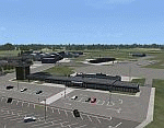
Odense Lufthavn (Odense Airport) is situated close the village of Beldringe, a few km north of Odense, the main city on the island of Funen, Denmark. Like several other Danish airports it was established as an airbase by the Germans during World War II. It was taken over by the Danish state after the war and owned by the state until 1998, at which time it was taken over by a consortium of local authorities, including the city of Odense.
Since the opening of the Great Belt Lin in 1997 there has been no regular passenger flights, apart from some charter traffic during the summer season. But there is a lot of traffic with one- and two-motor craft (including rotor craft) due to the many companies based in the airport.
The package is a complete scenery of the airport, including a few buildings around it. It includes approach lights, runway lights, taxiway lights and light on the apron, the car parking area and the surrounding roads. A traffic file with the (limited) charter traffic of the airport is also included.
| Filename: | Odense_Airport_EKOD_Funen_Denmark.zip |
| License: | Freeware, limited distribution |
| Added: | 31st October 2009, 10:29:34 |
| Downloads: | 3,731 |
| Author: | Peter H. Poulsen |
| Size: | 13.63 MB |
| Category: Flight Simulator X - Scenery | |
| Active ILS, VHHX (Hong Kong Kai Tak Airport) |
|
File Description:
This FSX Airport is more then just an enhanced style Airport. As most know the Approach and Final (VMC) for AI Traffic in FSX is a straight in type landing and does not always consider real world approaches. This is due to the way that the coding is written in FSX and it puts limits on IFR arriving aircraft. At certain airports the AI Traffic will fly directly through a mountain once it is established on Final for a runway. What you will see with my files is a different type approach used for both the way I control AI and User Airplane Traffic in FSX. My AI Aircraft Approach coding system for FSX uses a visual offset approach so AI Traffic does not fly through the mountains but flys the IGS/LDA 13 approach to the Checkerboard. Try your skill flying a Large Heavy Airplane vectored by ATC onto the approach course of the IGS/LDA 13 approach to Kai Tak. Read the text file for all the enhancements added to the FSX VHHX Airport along with a full understanding of how the new Approaches work *** Full set of Freeware Approach Charts included ***
| Filename: | Active_ILS_VHHX_Hong_Kong_Kai_Tak_Airport.zip |
| License: | Freeware, limited distribution |
| Added: | 19th September 2007, 11:57:46 |
| Downloads: | 27,450 |
| Author: | Jim Vile |
| Size: | 3.61 MB |
| Category: Flight Simulator X - Scenery | |
| 2016 Kigali Intl (HRYR) Rwanda |
|
Images related to this file:
File Description:
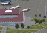
This sequel to the 2009 Kigali Intl (HRYR) Rwanda scenery (by Jacques Botha and Frits Beyer) brings it up to date with the current layout and enables full compliance with FTX Global/Vector and FSX. Buildings are added and adjusted to their real-world locations, and the new taxiway and south apron are added according to the May 2016 satellite imagery. In addition to real-world gate locations, custom apron markings are added along with apron lighting. The landclass around Kigali is also updated, and SRTMGL1 (30m) mesh is included. This scenery can be complemented by the Goma (FZNA) and Gisenyi (HRYG) scenery (FSX_FZNA-HRYG_CS.zip), and GA flightplans are included to supplement the commercial traffic at Kigali and provide more activity at FZNA and HRYG.
Updates were created or rebuilt in a manner which carefully aligns airport data with current satellite imagery. Scenery was created using Airport Design Editor X v1.70.6042, SBuilderX 3.13, and the FSX Object Placement Tool. Scenery objects were added and modified from stock FSX scenery to resemble as closely as possible the actual airports. The FSX apron lights included are from the set created by Jim Dhaenens.
| Filename: | 2016_Kigali_Intl_HRYR_Rwanda.zip |
| License: | Freeware |
| Added: | 4th August 2016, 21:10:09 |
| Downloads: | 3,387 |
| Author: | Carlyle Sharpe, Jacques Botha, and Frits Beyer |
| Size: | 17.12 MB |
| Category: Flight Simulator X - AFCAD Files | |
| Active ILS - KATL (Hartsfield - Jackson Atlanta Intl Airport) |
|
File Description:
Many know that KATL was not updated in FSX do to the airport data cutoff date. KATL now has the new Runway 10/28 but there are many additions added which are to numerous for listing here. Several key changes are all 5 parallel runways are ATC controlled Arrival runways for both the User and AI Plane Traffic. All Gates and Parking Spots have been updated so AI Airline Planes including Cargo, Commuter, and Corporate GA park in the correct places. New Approach code including the 5 new STAR's, RNAV (gps overlay's), many new Transitions and correct Runway data as per current Jeppesen Charts (freeware charts included). Many features have also been fixed such as Jetways that moved the wrong way, recoding the ILS CAT II Runway 28 frequency, updating KLZU ILS Runway 25 frequency, many scenery GUID's to support KATL based on how it looks today and additional ground support tracks that go to many more places including all Cargo Stands. Read the included Whats New Readme txt file for all the enhancements and how I coded ATC to use all 5 parallel runways for arrival vectors to decrease the go around issues at large airports.
| Filename: | Active_ILS__KATL_Hartsfield__Jackson_Atlanta_Intl_.zip |
| License: | Freeware, limited distribution |
| Added: | 1st January 2007, 22:57:34 |
| Downloads: | 30,376 |
| Author: | Jim Vile |
| Size: | 10.84 MB |
| Category: Flight Simulator X - Scenery | |
| ENHV - Honningsvag-Valan - Honningsvag, Norway |
|
Images related to this file:
File Description:
ENHV is the most northern airport in Europe (self-promotion of the airport). It it situated on a promontory 46 feet above the sea a few miles southeast of the Nordkap.
This scenery is not a stand-alone-scenery. It is an update of the Airports of Norway (AoN) where ENHV is already included. So AoN has to be installed first to see the buildings and the objects on this airport.
In addition the Nordkap is included with the rock, the museum and the viewing point.
AON you can download here:
http://www.flightsimnorway.com/addons/default.php?funct=dl&pack=aon
Also recommended is to install are the corresponding Photo sceneries AoN Phatopack 1 + 2:
http://www.flightsimnorway.com/addons/default.php?funct=dl&pack=aon
There are some errors corrected In ENHV that occur in the AoN:
1. The altitude is adjusted to the correct height of 46 feet.
2. The sea is where it should be.
3. The land classes are partially adjusted.
4. The town of Honningsvag is involved.
5. The Northern Cape is included, but can be installed separately.
| Filename: | ENHV__HonningsvagValan__Honningsvag_Norway.zip |
| License: | Freeware |
| Added: | 19th October 2015, 18:54:47 |
| Downloads: | 1,925 |
| Author: | Wolfgang Allers |
| Size: | 131.64 MB |
| Category: Flight Simulator X - Scenery Design | |
| Airfield Lights Toolbox (AFLT) |
|
File Description:
Airfield Lights Toolbox (or AFLT for short) is a comprehensive utility for the creation of standard airfield lights and light arrays for Microsoft Flight Simulator and Prepare3D v1.4 (collectively referred to as "FlightSim") airports. AFLT includes 3D models for the usual airfield light fixtures (runway/taxiway edge and centerline lights, runway threshold/end split lights, obstruction lights and beacons, PAPI/VASIs, wigwags and various approach light configurations) from which you should be able to create just about any airfield light arrangement. AFLT generates complete approach and threshold light arrays (including strobes) based on simple text configuration files. As well, pilot-control of airfield lighting is fully implemented.
The light sources in AFLT's light models are BGL_LIGHTs. Unfortunately, P3D Version 2 does not (yet) support BGL_LIGHTs and does not provide any alternative. (We had hoped that v2.1 would have fixed this, but "no joy". Hopefully, Lockheed Martin will see fit to rectify this deficiency.) Consequently, AFLT is only "P3Dv2-ready".
ALFT is not a library of airfield lights; it is a utility for creating object libraries and light arrays. A general knowledge of FlightSim scenery file organization and airport design is necessary for its use.
| Filename: | Airfield_Lights_Toolbox_AFLT.zip |
| License: | Freeware, limited distribution |
| Added: | 23rd February 2014, 01:21:14 |
| Downloads: | 1,796 |
| Author: | Don Grovestine |
| Size: | 3.85 MB |
| Category: Flight Simulator 2004 - Scenery | |
| KCLT Charlotte Douglas International Airport |
|
Images related to this file:
File Description:
In 2008 runway 18R/36L at KCLT was renamed 18C/36C in anticipation of a third parallel under construction. The new runway was to be designated 18R/36L and was finally activated on January 6, 2010. This scenery adds that new runway to the default Charlotte Douglas International Airport (KCLT). This is a complete rebuild of my previous upload, KCLT2010 (not required) that inadvertently removed approximately 30 airports in the Charlotte area, including Fayetteville and Spartanburg. It also includes Terminal E, which was added in 2002, but never made it into the default FS2004 scenery.
I used Airport Design Editor (ADE9x) to modify the default FS2004 KCLT file, renaming the default 18R/36L to 18C/36C, create the new taxiways, taxi signs, NavAids, 18R-36L runway, and Terminal E. I used Abacus EZ-Scenery to add jetways, gate markings, and ramp lights. All files, libraries, and textures are either default or included. No additional downloads are required. AI Aircraft were acting normally on my system. I sat at Taxiway W2 for the new Runway 18R/36L and watched AI Aircraft land and take off from it after creating this scenery.
| Filename: | KCLT_Charlotte_Douglas_International_Airport.zip |
| License: | Freeware, limited distribution |
| Added: | 12th January 2011, 22:34:51 |
| Downloads: | 3,566 |
| Author: | Randy Tyndall |
| Size: | 1022.34 KB |


© 2001-2026 AVSIM Online
All Rights Reserved
Privacy Policy |