
Where Flight Simulation Enthusiasts Gather from Around the World!
AVSIM Library - Search Results

| Category: Flight Simulator 2004 - AFCAD Files | |
| WAOI/WRBI Pangkalanbun/Iskandar, Indonesia |

|
Images related to this file:
File Description:
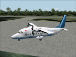
Googlyafcad A&F Data file for Iskandar, based on Google Earth satellite data. Iskandar is a small domestic airport in Pangkalanbun, on Borneo, Indonesia. Unfortunately, Microsoft have provided no facilities in Flight Simulator 2004 at this airport, which is served by a few flights a day operated by small airlines like Deraya Air Taxi and Indonesia Air Taxi. These files will allow you and your "AI" traffic to land, taxi, park and take off in a realistic manner.
Like many airports in Indonesia, the ICAO code has changed in recent years. Microsoft Flight Simulator 2004 uses the old code (WRBI) and these files allow you to continue using that code or change to the new one. [File re-uploaded at request of AVSIM]
| Filename: | WAOIWRBI_PangkalanbunIskandar_Indonesia.zip |
| License: | Freeware |
| Added: | 20th June 2010, 10:52:36 |
| Downloads: | 501 |
| Author: | John Hinson |
| Size: | 62.39 KB |
| Category: Microsoft Flight Simulator (2020) - Scenery | |
| WA17 Majerle STOLport 2.0 |
|
Images related to this file:
File Description:
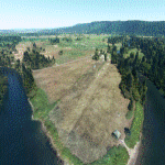
The default version of Majerle Field in Duvall, WA in MSFS has some tall trees at the end of the runway that weren’t really there when the STOLport was open, which make it unrealistically difficult to use. (The airport's closed in the real world because the new owner stopped mowing the runway.) If you'd like to check out Washington State's beautiful Snoqualmie Valley, or just practice your short-field takeoffs and landings in a beautiful area, I’ve cleaned up the excess foliage, mowed the runway, added a little more activity around the airport, and thrown in an easter egg or two. Release 2.0 is compiled with SDK 0.12.0.0, replaces one of the airport buildings, fixes the windsock direction, and had multiple smaller tweaks.
| Filename: | WA17_Majerle_STOLport_20.zip |
| License: | Freeware |
| Added: | 7th May 2021, 22:39:05 |
| Downloads: | 53 |
| Author: | Denny Atkin |
| Size: | 1.44 MB |
| Category: Fly! II - Scenery | |
| Alta, Northern Norway |
|
File Description:
Alta (ENAT) is a challening airport in northern Norway (69° 58,6' N, 23° 22,5' E), surrounded as it is by high mountains. One of the more difficult approaches is the circling approach, marked by lights in the terrain, for runway 30 (called runway 29 in Fly! 2).
Some approach and departure plates (SID's STAR's, ILS etc) are enclosed in the "Plates" folder.
| Filename: | Alta_Northern_Norway.zip |
| License: | Freeware |
| Added: | 16th August 2003, 04:01:15 |
| Downloads: | 264 |
| Author: | Krister Renard |
| Size: | 364.52 KB |
| Category: Flight Simulator X - Scenery | |
| LFFZ - Sezanne |
|
Images related to this file:
File Description:
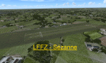
Scenery LFFZ Sezanne V1.0 for FSX
Tested with SP2 Acceleration + UTX Europe.
V1.0: Initial version
This file modifies the airfield Sezanne in FSX. It was made with ADE (Airport Design Editor), SbuilderX and Whisplacer.
Thank you to the respective authors and Patrick Renaudin for its objects.
Sezanne is a commune in the Marne department in Champagne-Ardenne region in north-eastern France.
| Filename: | LFFZ__Sezanne.zip |
| License: | Freeware |
| Added: | 2nd June 2010, 01:44:58 |
| Downloads: | 1,192 |
| Author: | Stephane Gouzon |
| Size: | 3.41 MB |
| Category: Flight Simulator X - Sounds | |
| 7CA0 Voicepack Mod |
|
File Description:
The purpose of this voicepack mod is to replace "7CA0 Traffic" with "Paramount Farming Traffic" in CTAF communications and also to replace "Choose option for 7CA0 Traffic" with "Choose option for Paramount Farming Traffic" in the ATC display window.
This airport is not included in default FSX and is modeled in Al Wheeler's Central California Coast scenery (ccfsxms.zip)
| Filename: | 7CA0_Voicepack_Mod.zip |
| License: | Freeware |
| Added: | 22nd September 2011, 12:41:21 |
| Downloads: | 135 |
| Author: | Drew Sikora |
| Size: | 2.09 KB |
| Category: Flight Simulator X - Scenery | |
| Bob Quinn Lake (CBW4) |
|
File Description:
Bob Quinn Lake, British Columbia - CBW4 (FSX).
This is a fictitious RCMP Ranger Station and campground rendition of an actual airport in British Columbia, Canada. (CBW4)
I took a boring airport and added some "eye-candy" in order to have something nice to look at in addition to the spectacular mountains.
I created this for my own use but thought I would share it. This is the Third scenery creation of my British Columbia series.
This is freeware. I hope you enjoy it.
Designed with the FS X Sdk Scenery function of the Mission builder and the Abacus Scenery shortcut tool.
This scenery is frame rate freindly.
| Filename: | Bob_Quinn_Lake_CBW4.zip |
| License: | Freeware |
| Added: | 21st January 2007, 00:09:12 |
| Downloads: | 1,653 |
| Author: | Bob Caparoula |
| Size: | 1.92 MB |
| Category: Flight Simulator X - Scenery | |
| KHGR - Hagerstown Regional Airport - Hagerstown, MD |
|
File Description:
Here is an improved version of the stock Hagerstown Regional Airport. I adjusted and added aprons,
taxiways, and roads to more closely match real life. Most default buildings were replaced and many
other buildings added. I moved the control tower to the correct location. Added static vehicles,
aircraft, light poles, etc.
Allegiant Air flies in and out of Hagerstown and I assigned gates to them. The runway has been
lengthened in real life to 7000'. I lengthened the runway in FSX but it didn't fit between I-81 and
Rt. 11. So much for accurate roads. I ended up making it 6000' which is still longer than the stock
airport.
| Filename: | KHGR__Hagerstown_Regional_Airport__Hagerstown_MD.zip |
| License: | Freeware |
| Added: | 12th December 2008, 01:51:19 |
| Downloads: | 976 |
| Author: | Jim Cook |
| Size: | 11.79 KB |
| Category: Flight Simulator 2004 - AI Flight Plans | |
| Direct Air Winter 2010 |
|
Images related to this file:
File Description:

Direct Air, formerly Myrtle Beach Direct Air, is a business based in Myrtle Beach, South Carolina, USA, with no airplanes operating upon its own FAA DOT Air Operator's Certificate. It operates domestic charter service using the aircraft of charter airlines. Its main base is Myrtle Beach International Airport. In December 2007 the airline opened a focus city at St. Petersburg-Clearwater International Airport, but closed the station in June 2008. Currently, Direct Air's flights are being operated by Xtra Airways, Vision Airlines, and Dynamic Airways. Flights are taken from FlightAware for the week of December 12 - 18, 2010 - with some minor adjustments. Schedule checked with TTools Companion with no errors.
| Filename: | Direct_Air_Winter_2010.zip |
| License: | Freeware |
| Added: | 2nd January 2011, 17:58:45 |
| Downloads: | 940 |
| Author: | Steve Lewis |
| Size: | 128.72 KB |
| Category: Flight Simulator X - AFCAD Files | |
| Great Lakes Airlines Airports Dump v0117 |
|
Images related to this file:
File Description:

GLA_DUMP_v0117.zip contains BGL files for the following 10 small
airports served by Great Lakes Airlines: KATY, KCYS, KFMN, KPGA
KPIR, KPRC, KPUB, KRIW, KSLN and KTEX.
KPGA, KPRC and KPUB have a compass rose. Follow instructions in
the read me file for optional installation.
I created an AP Diagram for KPGA showing the taxiways.
The BGL's include the airport, buildings, approaches and new
RNAV SID/STAR waypoints missing in FSX based on current charts.
FBO locations include fuel triggers at the fuel
pumps marked by a contrasting apron color.
Created for use with FSX Acceleration.
For replacing the default airport in FSX ONLY!!
| Filename: | Great_Lakes_Airlines_Airports_Dump_v0117.zip |
| License: | Freeware |
| Added: | 6th February 2017, 17:13:45 |
| Downloads: | 724 |
| Author: | Joe Bourgeois |
| Size: | 266.14 KB |
| Category: Flight Simulator X - AFCAD Files | |
| PAOT - Wien Meml - Kotzebue, Alaska |
|
Images related to this file:
File Description:
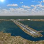
This AFCAD of the airport Wien Meml - Kotzebue (PAOT), Alaska, fixes some issues for Scenery Solution's UTX Alaska users who want to use mesh and texture resolutions better than 38 m and 1 m, respectively. Unfortunately this discloses some additional problems with lagoons surrounding runway 09/27. Some of the ponds had been elevated over apron level, the fence Microsoft had drawn around the airport ran through (elevated) water and so on. Runway 27 has no direct connection to the mainland like it is realized by UTX and furthermore a lot of water polygons (including the lagoons) had 'forgotten' shore line vectors. Included corrections are: fixed main waterpolygons around the airport (according to Google Maps), fixed airport layout, including aprons, GA parking, additional airport buildings (default FSX objects), fixed Runway designators (now 09/27 resp. 18/36 instead of 08/26 and 17/37, Nov. 2013), added shoreline vectors (compatible to UTX textures) and some more.
Again, THIS AFCAD IS INTENDED FOR USERS OF UTX ALASKA ONLY and will likely look horrible in other environments as it partially amends missing features only.
| Filename: | PAOT__Wien_Meml__Kotzebue_Alaska.zip |
| License: | Freeware, limited distribution |
| Added: | 3rd February 2014, 14:30:10 |
| Downloads: | 410 |
| Author: | Axel Birsul |
| Size: | 1.09 MB |


© 2001-2026 AVSIM Online
All Rights Reserved
Privacy Policy |