
Where Flight Simulation Enthusiasts Gather from Around the World!
AVSIM Library - Search Results

| Category: Fly! II - Miscellaneous Files | |
| Switzerland Flight Plan |

|
File Description:
This Switzerland Adventure starts at the St. Gallen Altenrheim Airport and ends at the Sion Airport. The flight plan has a total of 8 airports and is based on the airport scenery by Danny H. Masson. Your skills as a pilot will be fully tested. Take your time and explore the mountains. Have a fun and safe flight.
| Filename: | Switzerland_Flight_Plan.zip |
| License: | Freeware |
| Added: | 14th October 2003, 17:27:36 |
| Downloads: | 160 |
| Author: | Wayne Roberts |
| Size: | 10.57 KB |
| Category: Flight Simulator 2004 - Miscellaneous Files | |
| New taxiway markings (yellow with black) |
|
File Description:
This file provides new taxiway marks (yellow with a black line), as you can see in the thumbnail. It enhances the visibility in FS, but also is more realistic for many airports. File size is the same, so don't worry about framerates.
To view an example of what it looks like in FS, see the provided example.jpg.
| Filename: | New_taxiway_markings_yellow_with_black.zip |
| License: | Freeware |
| Added: | 14th January 2004, 23:00:15 |
| Downloads: | 11,061 |
| Author: | Kars Veling |
| Size: | 41 KB |
| Category: Flight Simulator 2002 - Miscellaneous Files | |
| PIC Boeing 767 SID/STAR for Canada |
|
File Description:
FMC data for Canadian Airports. Contains data for CYEG (Edmonton Int, Alberta), CYMX (Montreal-Mirabel Int, Quebec), CYOW (Ottawa-Macdonald Cartier Int, Ontario), CYQG (Windsor, Ontario), CYUL (Montreal-Dorval Int, Quebec), CYVR (Vancouver Int, British Columbia), CYYC (Calgary Int, Alberta), CYYJ (Victoria Int, British Columbia), CYYZ (Toronto-Pearson Int, Ontario). For use with Wilco's 767 Pilot In Command.
| Filename: | PIC_Boeing_767_SIDSTAR_for_Canada.zip |
| License: | Freeware |
| Added: | 6th December 2002, 03:15:35 |
| Downloads: | 964 |
| Author: | Kim Steingass |
| Size: | 50.71 KB |
| Category: Fly! II - Miscellaneous Files | |
| Maine Flight Plan No. 3 |
|
File Description:
This Maine Adventure No. 3 starts at the Holton International Airport and ends at the Machias Valley Airport. The flight plan has a total of 11 airports. A metar file has been included for those who want to fly in overcast conditions with low minumums. Take the challenge and test your IFR skills. Have a fun and safe flight.
| Filename: | Maine_Flight_Plan_No_3.zip |
| License: | Freeware |
| Added: | 10th June 2003, 04:29:46 |
| Downloads: | 127 |
| Author: | Wayne Roberts |
| Size: | 5.16 KB |
| Category: Fly! II - TerraScene | |
| Marblehead Global Tile (Rendered) |
|
File Description:
This is a TerraScene 2.1 global tile for the area of the Marblehead Peninsula in Ohio, including all of global tile 197,160. This scenery includes Canadian coastal areas and islands (created from less detailed DCW data), and updated landmarks, water, and highways. DEX files to add Put in Bay and Kelleys Island airports are also included.
| Filename: | Marblehead_Global_Tile_Rendered.zip |
| License: | Freeware |
| Added: | 5th April 2003, 09:29:01 |
| Downloads: | 165 |
| Author: | Randall Rocke |
| Size: | 136.67 MB |
| Category: Civil Flight Simulators - Looking Glass Flight Unlimited 3 | |
| AI planes for Gatwick and London City |
|
File Description:
For UK-SOUTH scenery. Now you will see AI planes on these three airports : Heathrow, Gatwick and London City, and flying between them.
Some of them will remain in the pattern, doing "Touch and go"...
I can't resolve some little problems with the AI traffic on the radio, but the sky of UK-SOUTH is now populated ....b
| Filename: | AI_planes_for_Gatwick_and_London_City.zip |
| License: | Freeware |
| Added: | 6th March 2003, 00:29:45 |
| Downloads: | 861 |
| Author: | Roland Wagener |
| Size: | 87.31 KB |
| Category: Flight Simulator 2002 - AI Flight Plans | |
| Hawkair AI Flight Plans |
|
File Description:
Flight plans for Vancouver BC based regional airline Hawkair. For the schedule beginning May 12, 2003. 100% accurate flight times, numbers, and aircraft registration numbers. Hawkair uses 3 deHavilland Dash8-100 aircraft. Includes all 80 scheduled weekly flights. Also includes 4 AFCAD files for the airports served by Hawkair that are not AI-capable by default.
| Filename: | Hawkair_AI_Flight_Plans.zip |
| License: | Freeware, limited distribution |
| Added: | 30th April 2003, 12:14:55 |
| Downloads: | 383 |
| Author: | Bill Schroeder |
| Size: | 6.45 KB |
| Category: Flight Simulator 2004 - Aircraft Repaints, Textures and Modifications | |
| Comair South Africa 737-400 ZS-OTG |
|
File Description:
ZS-OTG (cn 25840/2197). One of the many 737-400's flying in South Africa operated by Comair and Kulula. Comair is part of British Airways and flying with all major airports in Sotuh Africa.
This is the ZS-OTG for the Wilco/Feelthere 737-400. Hand painted and saved as 32 bit for the best quality.
| Filename: | Comair_South_Africa_737400_ZSOTG.zip |
| License: | Freeware |
| Added: | 7th March 2009, 12:53:28 |
| Downloads: | 849 |
| Author: | Filipe Spring |
| Size: | 6.7 MB |
| Category: Flight Simulator X - Scenery | |
| ZULS, Lhasa/Gonggar Airport, Tibet |
|
Images related to this file:
File Description:
Complete new setup. Lhasa/Gonggar Airport is 62km (39ml) from Lhasa, the capital of Tibet. It lies at an altutude of 3500m (11500ft) and is one of the highest airports in the world. It is build on the banks of the Yarlung Tsangpo River (Brahmaputra River) that is very wide at that point (not included in this scenery).
| Filename: | ZULS_LhasaGonggar_Airport_Tibet.zip |
| License: | Freeware |
| Added: | 17th August 2018, 16:36:31 |
| Downloads: | 965 |
| Author: | Tim van Ringen |
| Size: | 2.37 MB |
| Category: Flight Simulator X - Scenery | |
| Egypt VFR |
|
Images related to this file:
File Description:
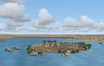
Whole scenery of Egypt. It Contains 22 airports and 416 populations plus the temples of Abu Simbel,Karnak,Luxor,Edfu,Queen Hatshepsut, Kom Ombo,Philae,
Egyptian museum of elCairo Tahrir square. Whole Cairo enhanced. It permits realizer some circuits on the river Nil and the Suez channel and much more See readme txt for more details
| Filename: | Egypt_VFR.zip |
| License: | Freeware |
| Added: | 14th May 2011, 17:01:50 |
| Downloads: | 2,883 |
| Author: | Toni Agramont |
| Size: | 100.55 MB |


© 2001-2026 AVSIM Online
All Rights Reserved
Privacy Policy |