
Where Flight Simulation Enthusiasts Gather from Around the World!
AVSIM Library - Search Results

| Category: Flight Simulator 2004 - Scenery | |
| USA Pack2 |

|
File Description:
FS2002/2004 USA Pack2 Soaring Scenery
This file add some thermals to default Microsoft scenery for several cities of California and Nevada States,USA:
1.San Francisco(KSFO).
2.Los Angeles(KLAX).
3.Las Vegas(KLAS).
4.Crystal,CA(L01) - Great Western Soaring Club.
5.San Diego(CA84) - Associated Glider Club of Southern California.
6.Hemet-Ryan(KHMT) - Cypress Soaring.
7.Skylark Field(CA89) - Lake Elsinore Soaring Club.
8.Truckee(KTRK) - Soar Truckee.
9.Hollister(3O7) - Hollister Gliding Club.
10.California City(L71) - Caracoles Soaring.
11.Chico Mun(KCIC) - Chico Soaring
12.Avenal(CA69) - Central California Soaring Club.
It is freeware.
By Francisco Vargas.
E-mail:[email protected]
| Filename: | usapack2.zip |
| License: | Freeware |
| Added: | 5th November 2005, 15:47:32 |
| Downloads: | 2,552 |
| Author: | Francisco Augusto Vargas Carneiro |
| Size: | 1.33 MB |
| Category: Flight Simulator X - Scenery | |
| LOLO - Linz-Ost Flugplatz, Austria |
|
Images related to this file:
File Description:
The Airfield Linz-Ost located ca. 12 km eastern from Airport Linz-Hoersching (blue danube Airport Linz / LOWL) in Upper Austria. He located in the industry site of the town Linz direct Danube River. He has a grass runway with 940 m length and was used from April - October from glider and GA. -----
Der Flugplatz Linz-Ost liegt ca. 12 km oestlich vom Flughafen Linz-Hoersching (blue danube Airport Linz / LOWL) in Oberoesterreich und liegt im Industriegelaende der Stadt Linz direkt an der Donau. Er besitzt eine Gras Landebahn mit einer Laenge von 940m und wird in den Monaten April bis Oktober von Motor- und Segelflugzeugen genutzt.
| Filename: | livelandbreever-linzost.zip |
| License: | Freeware |
| Added: | 30th January 2013, 19:42:57 |
| Downloads: | 3,036 |
| Author: | Oliver Brandl |
| Size: | 159.32 MB |
| Category: Flight Simulator 2002 - Scenery | |
| Willis Gliderport, 1X4. |
|
File Description:
1X4, Willis Gliderport, now designated FA44 by the FAA is a private community airport located in Boynton Beach, Florida. It was developed by my good friend Bill Willis who was my mentor when I was learning to fly gliders with the Central Florida Soaring Club which he supported and maintained for many years. This glider club operated from this airport for many years. This scenery file for FS2002 is a tribute to Bill and all he has accomplished and for all of the people he has supported and mentored over the years and to the friendly folks who live at the gliderport. Scenery requires the Nova Textures NovaTxt1.zip, Novatxt2.zip, and Novatxt3.zip available from http://www.fsnova.com/downova.htm.
| Filename: | 1x4_rev04.zip |
| License: | Freeware, limited distribution |
| Added: | 17th August 2002, 22:13:55 |
| Downloads: | 634 |
| Author: | Robert T. Brown III |
| Size: | 1.47 MB |
| Category: Flight Simulator X - Scenery | |
| KELM - Elmira Corning Regional Airport - New York |
|
File Description:
This is an airport package including all the most recent buildings at Elmira Corning Regional Airport KELM. Included are the Sikorsky building and recent runway extensions. I added some static aircraft to the now defunct National Warplane Museum, and Schweitzer plant. These are a historical reference to better days in the past for KELM. Now that Sikorsky has closed, there are a lot of disused structures there. I also added the local Mall and a local industrial park that was once home to an RC club, the field was sometimes used as a glider emergency landing field. It no longer exists in the real world.Look for it north east of the airport.
| Filename: | kelm_plus.zip |
| License: | Freeware |
| Added: | 7th June 2014, 05:32:22 |
| Downloads: | 601 |
| Author: | Jon Davidson |
| Size: | 2.35 MB |
| Category: Prepar3D V1-4 - Aircraft Repaints, Textures and Modifications | |
| VASP 1998 AI Package |
|
File Description:
VASP was the 2nd largest airline in Brazil, but was scaling down by 1998. VASP still had a great international network stretching to ATH/KIX/ICN/LAX/YYZ/JFK/BCN/ZRH ect. A fleet of 10 MD-11s did all the long haul flying, as well as plenty of domestic flights. 3 A300s and a large 737-200/300 fleet served the domestic routes. While VARIG was based in GIG, VASP was based in GRU and the planes tend to hang out there. There was only 1 special livery, which was a named MD-11, so not much variation unlike VARIG. VASP did serve SDU and CGH with mainline equipment, however, so these plans will help populate those airports. Included are repaints by Raphael Rodrigues for the FAIB 737-200, 737-300, FSPX MD-11, and TFS A300B4. Flightplans by Chasen Richardson. Part of the 1998 Flight Simulator Project. Follow us on Facebook at facebook.com/flightsim98 and on instagram as @bayviationsim. For more Retro AI, check out the forums at: http://retroai.proboards.com/
| Filename: | VASP_1998_AI_Package.zip |
| License: | Freeware, limited distribution |
| Added: | 29th October 2019, 07:18:35 |
| Downloads: | 280 |
| Author: | Raphael Rodrigues, Chasen Richardson/Bayviation |
| Size: | 4.51 MB |
| Category: Flight Simulator 2004 - Scenery | |
| AVL gliders airport - Alzate Brianza, Italy |
|
Images related to this file:
File Description:

"free version" of the same airport for gliders, that will be included inside the A2 scenery of "VFR on Lario" project. It is made for the use on FS9 standard, without any addition of photo-realistic terrain and/or specific extra meshes. It requests the use of "dva51" free library and the "TreePlanter" use.
This scenery represents the AVL airport, dedicated to Giancarlo Maestri, and seat of the homonymous Lariano Glider Aeroclub and related gliding school. It is situated inland SE Como, between the Alserio and Montorfano small lakes, in the municipality of Verzago. It has an asphalt runway of 1890x50 feet, ground communication frequency 123.50; ICAO code: LILB (Alzate Brianza).
Video available here: https://youtu.be/huKdtYar_uQ
| Filename: | lilb_avl-gmaestri.zip |
| License: | Freeware |
| Added: | 30th September 2013, 23:34:42 |
| Downloads: | 559 |
| Author: | Aldo Della Vedova, Daniele Lanfranchi, Gian Mario Verga |
| Size: | 5.88 MB |
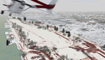
| Category: Flight Simulator 2004 - Scenery | |
| CNU8 - Toronto - Markham Airport (2008), Ontario, Canada |
|
Images related to this file:
File Description:
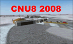
CNU8 - Toronto - Markham Airport (2008) - Markham v1. The airport is owned and operated by Markham Airport Inc., and is not part of the Greater Toronto Airport Authority.
The airport consists of a single 2,000 foot runway for small and private aircraft only (with night flying capabilities). The Royal Canadian Air Cadets Gliding Program uses the north side or the runway 09/27 for glider operations in the spring and fall months, and use a northern traffic pattern. This airport may disappear with the establishment of a planned Pickering Airport or re-location of Toronto/Buttonville Municipal Airport.
(This is a re-upload of the scenery to replace the original that was lost in the AVSIM hack. No changes have been made)
| Filename: | markham_v1.zip |
| License: | Freeware, limited distribution |
| Added: | 16th May 2010, 10:06:40 |
| Downloads: | 1,579 |
| Author: | Keith Murphy |
| Size: | 5.35 MB |
| Category: Flight Simulator X - Scenery | |
| Ridge Soaring 79N Julian PA |
|
Images related to this file:
File Description:
Ridge Soaring Gliderport (79N) is a public-use glider airport located two nautical miles (4 km) southwest of the central business district of Unionville, in Centre County, Pennsylvania, United States. It is privately owned by Knauff & Grove, Inc. Tom Knauff and Doris grove are among the whos who in American and International soaring community.
Portions of the 1999 movie The Thomas Crown Affair were filmed here.
Co-owner Thomas L. Knauff set five FAI world records, and over 50 NAA national records flying from this airport.
Co-owner Doris Grove set three FAI feminine world records flying from this airport, and was the first woman to fly a glider more than 1000 km.
This FBO airport is world famous for ridge, thermal and wave soaring. It is located on U.S. Route 220 (alternate) 8 miles south of Interstate 80, between Unionville and Julian, at the base of the Bald Eagle Mountain ridge. It is approximately 10 miles from State College and approximately midway between Altoona and Lock Haven in the Bald Eagle Valley. Visitors can look at an entire wall of U.S. National and World records that have been set from this airfield.
Sadly as with so many small airports, Ridge Soaring is in risk of disappearing. for sale for many years, with no takers it may be sold to developers and disappear forever.
In FSX the airport was on the wrong side of the highway and cut into a mountain, I moved it to its proper location and heading, made the runway the correct size and heading, and added all the current buildings.
| Filename: | ridge_soaring.zip |
| License: | Freeware |
| Added: | 11th June 2014, 16:24:59 |
| Downloads: | 291 |
| Author: | Jon Davidson |
| Size: | 16.52 MB |
| Category: Flight Simulator 2004 - Scenery | |
| Invermere CAA8 in British Columbia, Canada |
|
Images related to this file:
File Description:
This airfield is in the Columbia Mountains (which are part of the Rockies) on the border between BC and Alberta. Invermere is in the same valley as Golden, 65 miles south and midway between Golden and Cranbrook. The town is at the northern end of Lake Windermere, on the western side, with a population of around 3,400. The main touristic feature of Invermere appears to be the provision of a wide choice of golf courses. These are included in the scenery, as are some of the surrounding commercial buildings including a nearby hotel and retail units. Invermere CAA8 is half a mile northeast of the lake, and is home to the non-profit Canadian Rockies Soaring Club that trains pilots during the summer months. The Invermere Soaring Centre, a separate organisation, provides glider towing services and rides for the general public. During the summer the airfield can only be described as busy, with gliders taking advantage of the terrain for ridge soaring. The AI here includes gliders that will take off and then circle around north of the field. The take off is not a realistic glider style launch, and the wind should be from the north; these gliders do not taxi and then turn around at the far end of a runway too well. Once again, like Golden, there is no runway or taxiway lighting, so daylight use only. There are GA visitors to CAA8 between the gliders, presumably carrying golfers and clubs. Due to the surrounding terrain AI aircraft might impact high ground before landing and then just show up on their parking spot.
| Filename: | invermere.zip |
| License: | Freeware, limited distribution |
| Added: | 16th October 2018, 02:11:34 |
| Downloads: | 157 |
| Author: | Roger Wensley |
| Size: | 6.34 MB |
| Category: Flight Simulator X - Scenery | |
| RAF Keevil |
|
File Description:
The airfield was built on a site previously ear-marked for the purpose in the mid-1930s. Consisting of 3 long concrete
runways the airfield was used by the Royal Air Force and the United States Army Air Forces Eighth and Ninth Air
Forces.
In 1942 Keevil airfield was provided to the USAAF and it was assigned USAAF designation 471 (KV). Squadrons based at
the unit transported military freight and supplies using C-47 and C-53 aircraft.
RAF Fighter Command use
Short Stirlings of Nos. 196 and 299 Squadrons RAF lining the runway at RAF Keevil on the evening of 5 June 1944 before
emplaning paratroops of the 5th Parachute Brigade Group for the invasion of Normandy With the departure of the
Americans, the RAF used Keevil beginning in March 1944 for 196 and 299 Squadron Short Stirling glider tugs of No. 38
Group RAF arrived followed by a large number of Horsa gliders, crewed by Army pilots of the Glider Pilot Regiment.
The RAF Stirling aircraft were crewed by RAF, RCAF, RAAF, RNZAF and SAAF personnel and were engaged in SOE and SAS
drops. largely in France, and in glider towing. Their involvement in the Normandy invasion of France and Operation
Market-Garden is well remembered by Keevil and Steeple Ashton villagers. Casualties of army and air force personnel
were heavy and a number of aircraft were lost.
With the end of military control, Keevil airfield is virtually complete with all of its runways, perimeter track and
many of the hardstands still in place. It is used occasionally for British Army and RAF exercises. The airfield is
still frequently used by the RAF for training purposes such as air drops and parachuting, the gate is always locked
and access is restricted to authorized key holders only. Ref ~ http://www.wdrcfc.org.uk/wp/about-2/clubrules/
Since 1992 it has been home to the Bannerdown Gliding Club, an RAF Gliding and Soaring Association Club, affiliated to
RAF Brize Norton since the closure of nearby RAF station at Lyneham. The airfield is also used as a motorsport circuit
for various events. It is also the home of the Warminster and District Radio Control flying club.
In September 1994 the Keevil Society, organised by Paul Vingoe, held a Commemorative Day to mark the 50th anniversary
of the D-Day and Arnhem operations and to dedicate a memorial to all who served at Keevil, especially those who flew
from there and lost their lives.
Source:Wikipedia
| Filename: | RAF_Keevil.zip |
| License: | Freeware |
| Added: | 5th February 2017, 19:55:43 |
| Downloads: | 172 |
| Author: | Terry Boissel |
| Size: | 24.39 KB |
© 2001-2025 AVSIM Online
All Rights Reserved