
Where Flight Simulation Enthusiasts Gather from Around the World!
AVSIM Library - Search Results

| Category: Flight Simulator X - Scenery | |
| FSX/P3D Parma VFR scenery |

|
File Description:
FSX/P3D Scenery-Parma VFR. This scenery covers the area around Parma Airport (Emilia Romagna - Italy), for FSX/P3D. This freeware scenery, with seasons and night texture has been made with "SBuilderX" design tool and with google earth for geographical reference of the various polygons and FSX/P3D SDK annotator, etc.
| Filename: | FSXP3D_Parma_VFR_scenery.zip |
| License: | Freeware |
| Added: | 31st July 2020, 21:22:12 |
| Downloads: | 535 |
| Author: | Ivano Marongiu |
| Size: | 230.46 MB |
| Category: Flight Simulator X - AFCAD Files | |
| LEAL - Alicante Airport - Alicante, Spain |
|
Images related to this file:
File Description:
Alicante Airport, originally named El Altet, is the sixth busiest airport in Spain based on passenger numbers, and the main airport for the Valencian Community and the region of Murcia.
Using ADEx 1.55, aeronautical maps and Google Earth the default AFCAD has been completely reworked to reflect today´s situation.
| Filename: | LEAL__Alicante_Airport__Alicante_Spain.zip |
| License: | Freeware |
| Added: | 12th February 2015, 15:29:37 |
| Downloads: | 857 |
| Author: | Menno C. Robert |
| Size: | 3.24 MB |
| Category: Flight Simulator X - Scenery | |
| Innsbruck Airport - Innsbruck - Austria (LOWI) |
|
Images related to this file:
File Description:
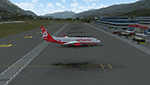
Frame rate friendly LOWI fix for the default airport. Designed to work with Orbx Vector and OpenLC Europe. The gates 1 to 10 are at the exact position as to Google Earth. In case of problems, mail me at "[email protected]". More airports and more information on https://sites.google.com/site/fsxvideosairports/.
| Filename: | Innsbruck_Airport__Innsbruck__Austria_LOWI.zip |
| License: | Freeware |
| Added: | 2nd February 2017, 15:25:01 |
| Downloads: | 9,931 |
| Author: | Rene Scharlach |
| Size: | 2.13 MB |
| Category: Flight Simulator X - Scenery | |
| Watsonville Municipal Airport (KWVI) |
|
File Description:
This is a scenery update for Watsonville Municipal Airport in Watsonville, California. Taxiways, runways, building positions, and other aspects were updated using satellite images from Google Earth for accuracy. Many default scenery objects from the FSX libraries were used. View Readme file for installation and notes. Compiled using Airport Design Editor.
| Filename: | Watsonville_Municipal_Airport_KWVI.zip |
| License: | Freeware |
| Added: | 17th October 2008, 09:52:09 |
| Downloads: | 898 |
| Author: | Phillip Coyle |
| Size: | 236.53 KB |
| Category: Flight Simulator 2004 - AFCAD Files | |
| Los Angeles KLAX |
|
File Description:
Realistic AFCAD for LAX. Features:
- 173 realistic placed gates (with the help of "google earth") with airline codes (also cargo)
- realistic runway overrun area (24R and 25L)
- hold-point free runway crossing (for best ai aircraft flow)
- 24L and 25R for departures and 24R and 25L for arrivals
- Tower view
| Filename: | Los_Angeles_KLAX.zip |
| License: | Freeware |
| Added: | 5th September 2005, 17:08:53 |
| Downloads: | 3,992 |
| Author: | Thomas Boscolo |
| Size: | 32.24 KB |
| Category: Flight Simulator X - Scenery | |
| KEMV - Emporia-Greenville Regional Airport - Virginia - USA |
|
Images related to this file:
File Description:
The airport is located 3 miles east of Emporia.
The runway was changed from 15/33 to 16/34. AirNav continues to list the runway as 15/33.
Changes were made based on Google Maps. Created with Airport Design Editor by ScruffyDuck Software using current FAA documentation and Google Earth measurements, this package offers a replacement for FSX's stock airport. All these enhancements are as close to the real airport as I can get with stock library objects.
| Filename: | KEMV__EmporiaGreenville_Regional_Airport__Virginia.zip |
| License: | Freeware |
| Added: | 11th September 2014, 00:41:51 |
| Downloads: | 300 |
| Author: | Wayne Roberts |
| Size: | 34.19 KB |
| Category: Flight Simulator X - AFCAD Files | |
| N32 - Blue Swan - Sayre, Pennsylvania (PA) - USA (Abandoned) |
|
Images related to this file:
File Description:
Located in Sayre PA, the Blue Swan airport Served northern Bradford County PA and Waverly NY. IT survived until 2004. Now it is impossible to find on Google Earth even if you know where it was. Replaced by huge industrial parking lots this once charming small town airport is another gone forever.
| Filename: | N32__Blue_Swan__Sayre_Pennsylvania_PA__USA_Abandon.zip |
| License: | Freeware |
| Added: | 25th June 2014, 18:30:09 |
| Downloads: | 134 |
| Author: | Jon Davidson |
| Size: | 3.25 KB |
| Category: Flight Simulator X - Scenery | |
| DAOR Bechar Airport |
|
File Description:
This is DAOR, Bechar airport, Algeria. Default FSX only has runways. This scenery adds taxiways, parking, air force dispersals etc (it is a mixed Civil/Military airport), placed according to Google Earth. Only default FSX objects have been used. This scenery will only work in FSX.
Built with ADE, from Scruffyduck Software
| Filename: | DAOR_Bechar_Airport.zip |
| License: | Freeware, limited distribution |
| Added: | 19th September 2008, 01:06:29 |
| Downloads: | 773 |
| Author: | Tim Arnot |
| Size: | 9.88 KB |
| Category: Flight Simulator X - Scenery | |
| Wings Field Airport KLOM aka N67 Blue Bell, Pennsylvania |
|
Images related to this file:
File Description:
Wings Field Airport is a general aviation airport located in Blue Bell Pennsylvania, within the Philadelphia area. Scenery included latest google earth photo scenery, with winter time textures. Autogen placed properly. Taxiways and Aprons depict real world. All scenery objects are custom made, no stock objects present. Static aircraft are included. Enjoy!!
| Filename: | Wings_Field_Airport_KLOM_aka_N67_Blue_Bell_Pennsyl.zip |
| License: | Freeware |
| Added: | 13th June 2011, 03:40:26 |
| Downloads: | 523 |
| Author: | Eric McCloud |
| Size: | 11.52 MB |
| Category: Flight Simulator X - AFCAD Files | |
| KBKT - Perkinson/Baaf Blackstone AAF, Virginia |
|
File Description:
Adjusted taxiways and aprons.Added buildings and taxi signs.
Created with Airport Design Editor 9X by ScruffyDuck Software using current FAA documentation and Google Earth measurements, this package offers a replacement for FSX's stock airport. All these enhancements are as close to the real airport as I can get with stock library objects.
| Filename: | KBKT___PerkinsonBaaf__Blackstone_AAF_Virginia.zip |
| License: | Freeware |
| Added: | 29th November 2012, 15:18:03 |
| Downloads: | 283 |
| Author: | Wayne Roberts |
| Size: | 248.13 KB |
© 2001-2026 AVSIM Online
All Rights Reserved
Privacy Policy |