
Where Flight Simulation Enthusiasts Gather from Around the World!
AVSIM Library - Search Results

| Category: Orbiter - Spaceships | |
| U.S.S. Enterprise 2702-D |

|
File Description:
The U.S.S. Enterprise NCC-1701-D was a Galaxy-class extended-duration starship and the flagship of Starfleet. The fifth starship to be named Enterprise, she was commanded by Captain Jean-Luc Picard. With a total of 42 decks, the U.S.S. Enterprise-D was twice the length and had eight times the interior space of the Constitution-class ships of over a century earlier; she carried a combined crew and passenger load of about 1,012.
Defensive systems included 10 phaser banks, 250 photon torpedoes, and a high capacity shield grid; there are some 4,000 power systems in all aboard ship.
Full acceleration time from reverse, sub-light impulse through nominal top warp speed, warp 9, was 0.03 milliseconds. The ship achieved maximum speed of warp 9.5 maximum when pursued by the entity known as "Q"; at warp 9.3 its engines had passed the red line.
By stardate 43205, she had already logged tens of thousands of light-years since setting out around stardate 41153.7 after Jean-Luc Picard formally became her first captain on stardate 41124.
An average day aboard ship, according to Lieutenant Commander Data, included four birthdays, two personnel transfers, two chess tournaments, a secondary school play, four promotions, the celebration of the Hindu Festival of Lights — and a birth and wedding.
Some 13 planets were represented among the ship's complement as of stardate 44247. During the Borg incursion of 2366, Decks 23-25 were sliced open by the enemy during the final battle over Earth and requiring a refit at Earth Station McKinley which lasted 5-6 weeks.
It was far less damage than the kamikaze warp-driven collision Commander Riker had readied as one last recourse, however. During that refit, the starship received a phaser upgrade as well as damage repair and a dilithium chamber articulation frame. It off-loaded the original three Runabouts and the first arriving officers at Deep Space Nine.
The U.S.S. Enterprise-D was destroyed in 2371 after an attack by renegade Klingons breached her warp core. Although the saucer section separated before the breach, the force of the explosion caused the section to crash on the planet Veridian III. Fortunately, losses were minimal.
| Filename: | USS_Enterprise_2702D.zip |
| License: | Freeware |
| Added: | 12th July 2004, 04:41:12 |
| Downloads: | 2,212 |
| Author: | Jim Williams |
| Size: | 1.45 MB |
| Category: X-Plane - Scenery | |
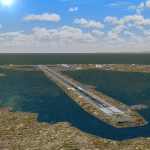
| WICN WI1A Susi Air Headquarters Indonesia v1.0.0 |
|
Images related to this file:
File Description:

This is an X-Plane 11 scenery for Nusawiru Airport (WICN, aka WI1A) in Pangandaran, West Java, Indonesia. In X-Plane 11, look for the old ICAO code WI1A. The current ICAO code is in fact WICN (in case you want to search for it in places like skyvector.com, and others). This scenery was It was tested and is operational (as of January 01, 2017) in "X-Plane 11 Public Beta #3 64 bit", Windows 10 Home.
This is the home headquarters airport of "PT ASI Pujiastuti Aviation", operating as Susi Air, an Indonesia airlines established in late 2004 by Mrs. Susi Pudjiastuti. Susi Air is pictured in the 2014 TV mini-series "Worst Place to be a Pilot", that follows the highs and lows in the lives of the young British pilots who work for Susi Air, as they fly and land their planes in some of the most breath-taking, remote and dangerous locations on earth. For more info, search for "Worst Place to be a Pilot" in YouTube.
| Filename: | WICN_WI1A_Susi_Air_Headquarters_Indonesia_v100.zip |
| License: | Freeware |
| Added: | 1st January 2017, 20:18:40 |
| Downloads: | 61 |
| Author: | Rui Mesquita |
| Size: | 1.52 MB |
| Category: Flight Simulator X - AFCAD Files | |
| Central Jersey Regional Airport (47N), NJ |
|
File Description:
Located 01 miles S of Manville, New Jersey on 119 acres of land, Central Jersey Regional Airport is a public asphalt strip. Hangars and tiedowns are offered for transient craft. The open hangar at the north of the airport is available for parking - it can be a bit of a tight fit taxiing in so I have disabled collision with the two planes nearby. You can also select the DOCK parking space to start inside the hangar. Fuel is available on the north tarmac by the fuel truck in front of the hangar, and on the south tarmac by the fuel tank. Trees are summertime ONLY.
Scenery constructed with use of satellite images/streetview, the author has not been there in person.
This scenery is meant to be used in conjunction with MegaScenery Earth New Jersey/Delaware 001. It is not required, but apron use is minimized to allow satellite scenery to show through as much as possible, and objects are placed based on the MSE textures - lack of it may make scenery look out of place.
| Filename: | Central_Jersey_Regional_Airport_47N_NJ.zip |
| License: | Freeware |
| Added: | 25th November 2010, 14:15:25 |
| Downloads: | 295 |
| Author: | Drew Sikora |
| Size: | 1.92 MB |
| Category: Flight Simulator X - AFCAD Files | |
| Woodbine Municipal Airport (1N4), NJ |
|
File Description:
Located 02 miles SE of Woodbine, New Jersey on 700 acres of land, Woodbine Municipal Airport serves small to large GA craft as well as gliders and ultralights. Tie downs are the only option for transient aircraft. The main parking area of the airport is located in the center tarmac area near the fuel station. The parking spots can accomodate aircraft with wingspans up to 50 feet. Anything larger should park off the side of the taxiway. Fuel is available by stopping near the fuel tank. It should be noted that this airport's real ICAO is KOBI.
Scenery constructed with use of satellite images/streetview, the author has not been there in person.
This scenery is meant to be used in conjunction with MegaScenery Earth New Jersey/Delaware 005. It is not required, but apron use is minimized to allow satellite scenery to show through as much as possible, and objects are placed based on the MSE textures - lack of it may make scenery look out of place.
| Filename: | Woodbine_Municipal_Airport_1N4_NJ.zip |
| License: | Freeware |
| Added: | 22nd October 2010, 06:03:35 |
| Downloads: | 202 |
| Author: | Drew Sikora |
| Size: | 352.7 KB |
| Category: Flight Simulator X - AFCAD Files | |
| Coombs Airport (7NJ7), NJ |
|
File Description:
Located 04 miles NE of Elmer, New Jersey, Coombs Airport is a private turf field 2000' in length wilth clear 20:1 approach and departure at each end of the runway. You'll find some surrounding buildings but they are all located several hundred yards from the runway. This is a good strip to keep in mind for emergencies if you're in the area. You will be landing on terrain so having your mesh complexity set as high as possible is recommended. This airport is not lit at night, daytime VFR operations only are suggested. There are no transient services offered.
Scenery constructed with use of satellite images/streetview/aerial photos - the author has not been there in person.
This scenery is meant to be used in conjunction with MegaScenery Earth New Jersey/Delaware 004. It is not required, but apron use is minimized to allow satellite scenery to show through as much as possible, and objects are placed based on the MSE textures - lack of it may make scenery look out of place.
| Filename: | Coombs_Airport_7NJ7_NJ.zip |
| License: | Freeware |
| Added: | 16th February 2011, 00:03:55 |
| Downloads: | 191 |
| Author: | Drew Sikora |
| Size: | 756.22 KB |
| Category: Flight Simulator X - AFCAD Files | |
| Rainbow's End Airport (JY39), NJ |
|
File Description:
Located 07 miles S of Salem, New Jersey on 20 acres of land, Rainbow's End Airport is a private turf strip 2200' in length. There are no services for transient aircraft and the airport is not lit at night, so daytime VFR operations only are recommended. If you have an aircraft with 40' or less of wingspan you can start at one of the parking spaces east or west of the runway by the hangars. Otherwise it is suggested you start on the runway. There is no hard surfaced runway so set your terrain mesh as high as possible.
Scenery constructed with use of satellite images/streetview/aerial photos - the author has not been there in person.
This scenery is meant to be used in conjunction with MegaScenery Earth New Jersey/Delaware 005 & New Jersey/Delaware 004. It is not required, but apron use is minimized to allow satellite scenery to show through as much as possible, and objects are placed based on the MSE textures - lack of it may make scenery look out of place.
| Filename: | Rainbows_End_Airport_JY39_NJ.zip |
| License: | Freeware |
| Added: | 12th May 2011, 00:58:29 |
| Downloads: | 173 |
| Author: | Drew Sikora |
| Size: | 626.46 KB |
| Category: Flight Simulator X - AFCAD Files | |
| Warren Grove Range Airport (NJ24), New Jersey |
|
File Description:
Located 03 miles SW of Burlington County, New Jersey, Warren Grove Range is a private concrete airfield 1800' in length. It is owned by the Department of Defense and exists in a restricted flight area. The bare sand of this area has washed out the satellite images tremendously from over-exposure thanks to reflected sunlight - you can't even make out the runway (which FSX places incorrectly over a mile away). Due to lack of ground definition and primary use as a military facility, this airport has not been developed by MSEAirports and the concrete runway has been removed.
Scenery constructed with use of satellite images/streetview/aerial photos - the author has not been there in person.
This scenery is meant to be used in conjunction with MegaScenery Earth New Jersey/Delaware 003. It is not required, but apron use is minimized to allow satellite scenery to show through as much as possible, and objects are placed based on the MSE textures - lack of it may make scenery look out of place.
| Filename: | Warren_Grove_Range_Airport_NJ24_New_Jersey.zip |
| License: | Freeware |
| Added: | 20th August 2011, 19:58:05 |
| Downloads: | 174 |
| Author: | Drew Sikora |
| Size: | 153.47 KB |
| Category: Flight Simulator 2004 - AI Flight Plans | |
| Republic of Korea Air Force 11th FW Complete AI Package |
|
Images related to this file:
File Description:

The members of Military AI Works are proud to bring you the this freeware AI package, produced by Mark Campbell in conjunction with Military AI Works This package features all 60 of the Republic of Korea Air Force Boeing F-15K Slam Eagles and the 20 stored F4D of the 11th Fighter Wing, based at Daegu AB RKTN.
These brand new AI models here are produced by the very talented AI modellers Kevin Reed, Mike Pearson and Nick Black with realistic FDE produced by Mick MacIntyre. Also included in this package is custom scenery of Daegu AB, produced by Tony Dalton. We also feature a first for MAIW with some very cool animated earth excavator equipment modelled by Mark Griggs.
Credits: Models by Kevin Reed, Mike Pearson and Nick Black, FDE/Effect by Mike MacIntyre, Steve Holland, Nick Needham and Henry Tomkiewicz, Repaints by Graham King, Mike Pearson and Mark Heimer, Flightplans by Mark Campbell, VCPs by Stewart Pearson, Custom Scenery etc., by John Stinstrom, Mark Griggs and Tony Dalton
| Filename: | Republic_of_Korea_Air_Force_11th_FW_Complete_AI_Pa.zip |
| License: | Freeware |
| Added: | 9th December 2012, 19:34:54 |
| Downloads: | 533 |
| Author: | Mark Campbell; Military AI Works (MAIW) |
| Size: | 76.11 MB |
| Category: Flight Simulator X - AFCAD Files | |
| PAOT - Wien Meml - Kotzebue, Alaska |
|
Images related to this file:
File Description:
This AFCAD of the airport Wien Meml - Kotzebue (PAOT), Alaska, fixes some issues for Scenery Solution's UTX Alaska users who want to use mesh and texture resolutions better than 38 m and 1 m, respectively. Unfortunately this discloses some additional problems with lagoons surrounding runway 09/27. Some of the ponds had been elevated over apron level, the fence Microsoft had drawn around the airport ran through (elevated) water and so on. Runway 27 has no direct connection to the mainland like it is realized by UTX and furthermore a lot of water polygons (including the lagoons) had 'forgotten' shore line vectors. Included corrections are: fixed main waterpolygons around the airport (according to Google Maps), fixed airport layout, including aprons, GA parking, additional airport buildings (default FSX objects), fixed Runway designators (now 09/27 resp. 18/36 instead of 08/26 and 17/37, Nov. 2013), added shoreline vectors (compatible to UTX textures) and some more.
Again, THIS AFCAD IS INTENDED FOR USERS OF UTX ALASKA ONLY and will likely look horrible in other environments as it partially amends missing features only.
| Filename: | PAOT__Wien_Meml__Kotzebue_Alaska.zip |
| License: | Freeware, limited distribution |
| Added: | 3rd February 2014, 14:30:10 |
| Downloads: | 409 |
| Author: | Axel Birsul |
| Size: | 1.09 MB |
| Category: Orbiter - Orbital Stations | |
| New Skylab 2, 3 And 4 Mission |
|
File Description:
Skylab 2
25 May 1973 13:00 GMT. Duration: 28.03 days. Call Sign: Skylab. Backup
Crew: McCandless, Musgrave, Schweickart. Nation: USA. Agency: NASA.
Launch Site: Cape Canaveral . Launch Complex: LC39B. Launch Vehicle:
Saturn IB . LV Configuration: Saturn IB s/n SA-206. Program: Skylab.
Class: Manned. Type: Lunar spacecraft. Spacecraft: Apollo CSM. Payload
: Apollo CSM 116. Mass: 19,979 kg. Location of Spacecraft: Naval
Aviation Museum, Pensacola, FL. Perigee: 427 km. Apogee: 439 km.
Inclination: 50.0 deg. Period: 93.2 min.
Epic repair mission which brought Skylab into working order. Included
such great moments as Conrad being flung through space by the whiplash
after heaving on the solar wing just as the debris constraining it
gave way; deployment of a lightweight solar shield, developed in
Houston in one week, which brought the temperatures down to tolerable
levels. With this flight US again took manned spaceflight duration
record.
When the meteoroid shield ripped loose, it disturbed the mounting of
workshop solar array "wing" two and caused it to partially deploy.
The exhaust plume of the second stage retro-rockets impacted the
partially deployed solar array and literally blew it into space.
Also, a strap of debris from the meteoroid shield overlapped solar
array "wing" number one such that when the programmed deployment
signal occurred, wing number one was held in a slightly opened
position where it was able to generate virtually no power.
In the meantime, the space station had achieved a near-circular orbit
at the desired altitude of 435 kilometers (270 miles). All other
major functions including payload shroud jettison, deployment of the
Apollo Telescope Mount (Skylab's solar observatory) and its solar
arrays, and pressurization of the space station occurred as planned.
Scientists, engineers, astronauts, and management personnel at the
NASA Marshall Space Flight Center and elsewhere worked throughout
the first ten-day period of Skylab's flight to devise the means for
its rescue. Simultaneously, Skylab--seriously overheating--was
maneuvered through varying nose-up attitudes that would best maintain
an acceptable "holding" condition. Because of the loss of the
meteoroid shield, however, this positioning caused workshop
temperatures to rise to 52 degrees Celsius (126 degrees F). During
that ten-day period and for some time thereafter, the space station
operated on less than half of its designed electrical system, in the
partially nose-up attitudes, was generating power at reduced
efficiency. The optimum condition that maintained the most favorable
balance between Skylab temperatures and its power generation
capability occurred at approximately 50 degrees nose-up.
The crew rendezvoused with Skylab on the fifth orbit. After making
substantial repairs, including deployment of a parasol sunshade which
cooled the inside temperatures to 23.8 degrees C (75 degrees F), by
June 4 the workshop was in full operation. In orbit the crew conducted
solar astronomy and Earth resources experiments, medical studies, and
five student experiments; 404 orbits and 392 experiment hours were
completed; three EVAs totalled six hours, 20 minutes.
Skylab 3
28 July 1973 11:10 GMT. Duration: 59.46 days. Call Sign: Skylab.
Backup Crew: Brand, Lenoir, Lind. Nation: USA. Agency: NASA. Launch
Site: Cape Canaveral . Launch Complex: LC39B. Launch Vehicle: Saturn
IB . LV Configuration: Saturn IB s/n SA-207. Program: Skylab. Class:
Manned. Type: Lunar spacecraft. Spacecraft: Apollo CSM. Payload:
Apollo CSM 117. Mass: 20,121 kg. Location of Spacecraft: NASA Lewis
Research Center, Cleveland, OH. Perigee: 422 km. Apogee: 442 km.
Inclination: 50.0 deg. Period: 93.2 min.
Continued maintenance of the Skylab space station and extensive
scientific and medical experiments. Installed twinpole solar shield
on EVA; performed major inflight maintenance; doubled record for
length of time in space. Completed 858 Earth orbits and 1,081 hours
of solar and Earth experiments; three EVAs totalled 13 hours, 43
minutes.
Skylab4
16 November 1973 14:01 GMT. Duration: 84.05 days. Call Sign: Skylab.
Backup Crew: Brand, Lenoir, Lind. Nation: USA. Agency: NASA. Launch
Site: Cape Canaveral . Launch Complex: LC39B. Launch Vehicle: Saturn
IB . LV Configuration: Saturn IB s/n SA-208. Program: Skylab. Class:
Manned. Type: Lunar spacecraft. Spacecraft: Apollo CSM. Payload:
Apollo CSM 118. Mass: 20,847 kg. Location of Spacecraft: National Air
and Space Museum (Smithsonian Institution), Washington, DC. Perigee:
422 km. Apogee: 437 km. Inclination: 50.0 deg. Period: 93.1 min.
Included observation and photography of Comet Kohoutek among numerous
experiments. Completed 1,214 Earth orbits and four EVAs totalling 22
hours, 13 minutes. Increased manned space flight time record by 50%.
Rebellion by crew against NASA Ground Control overtasking led to none
of the crew ever flying again.
| Filename: | New_Skylab_2_3_And_4_Mission.zip |
| License: | Freeware |
| Added: | 11th January 2003, 16:39:14 |
| Downloads: | 1,934 |
| Author: | Ronald Dandurand |
| Size: | 6.06 KB |
© 2001-2026 AVSIM Online
All Rights Reserved
Privacy Policy |