
Where Flight Simulation Enthusiasts Gather from Around the World!
AVSIM Library - Search Results

| Category: Flight Simulator X - Scenery | |
| SKCL - Alfonso Bonilla Aragón International Airport - Palmira, Colombia |

|
File Description:
Alfonso Bonilla Aragón International Airport (IATA:CLP, ICAO:SKLC) also known as Palmaseca International Airport is an airport located in Palimira, Colombia, serving Cali and its surrounding region.
The scenery includes a relocated runway and new taxiways, enlarged aprons, new termianals and airbridges, and other buildings.
This scenery was designed to be used with the default FSX scenery.
| Filename: | SKCL__Alfonso_Bonilla_Aragn_International_Airport_.zip |
| License: | Freeware |
| Added: | 12th November 2015, 16:09:08 |
| Downloads: | 4,696 |
| Author: | Bill Bridges |
| Size: | 9.08 KB |
| Category: Prepar3D V1-4 - Aircraft Repaints, Textures and Modifications | |
| TUI UK Boeing 737-8K5 (G-TAWO) |
|
File Description:
PMDG B737-8K5 TUI UK G-TAWO
This repaint is as real and accurate as it gets this is due to TUI UK/Thomson being my favorite airline. It features G-TAWO
one of the newer aircraft in the fleet at 4 years old. My repaint includes custom VC textures including correct SELCAL etc, Sky interior in the cabin and custom seats, Yoke textures and correct checklist, accurate placement of all logo's, correct colors on the tail fuselage and winglets, registration above cockpit, on the tail and gear and many more features.
Thanks for downloading my repaint and leave feedback using the email in the README file
Expect more aircraft in the TUI fleet in the near future with and also an aircraft with the 'old' Thomson branding!
Thanks Liam Feeney
| Filename: | TUI_UK_Boeing_7378K5_GTAWO.zip |
| License: | Freeware |
| Added: | 2nd July 2017, 19:16:11 |
| Downloads: | 1,605 |
| Author: | Liam Feeney |
| Size: | 40.08 MB |
| Category: Flight Simulator X - Scenery | |
| Kuujjuaq CYVP - v2 |
|
Images related to this file:
File Description:
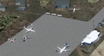
Kuujjuaq is in northern Quebec, Canada. At the southern end of Ungava Bay, and 30 miles up the Koksoak River. it was previously called Fort Chimo. Kuujjuaq is considered the capital of Nunavik, a well known northern caribou hunters and a large base of Air Inuit relay.
The scenery includes:
- The airport and its major buildings and objects,
- Weather radar on a hill northeast of the airport,
- The Zelada Desgagnes stranded facing the village and Sedna Desgagnes traveling between Kuujjuaq and the Ungava Bay,
- Large boats moving on the Koksoak River, near the island Koksoak,
- Hydrobase Stewart Lake, 2.3 miles north of the airport,
- A hunting camp (with caribou!), A geological camp and fishing camp (with cabins, tents and canoes).
| Filename: | Kuujjuaq_CYVP__v2.zip |
| License: | Freeware, limited distribution |
| Added: | 12th March 2014, 09:23:10 |
| Downloads: | 2,108 |
| Author: | Jean-Pierre Fillion, Pierre Gallant |
| Size: | 7.04 MB |
| Category: Flight Simulator X - AFCAD Files | |
| DABB - Rabah Bitat Airport - Annaba, Algeria |
|
Images related to this file:
File Description:
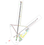
Rabah Bitat Airport (IATA: AAE, ICAO: DABB), formerly known as Les Salines Airport, and popularly as El Mellah Airport is an international airport located 9 km south of Annaba, a city in Algeria. It is named after Rabah Bitat, a president of Algeria (1978-1979). A new terminal is currently under construction which will help increase passenger capacity and replace the outdated current main terminal building. The airport is served by Air Algerie, Aigle Azur and Tassili Airlines.
Features:
*Expanded parking apron
*Taxiways properly designated and aligned
*Runway markings and lighting corrected
*Parking spots for commercial traffic
*Separate parking area for GA traffic
*Misc airport buildings added
*Construction of new terminal with cranes and construction vehicle and objects
*Airport vehicles and objects throughout the airport
*Fuel service vehicles
*Static aircraft
| Filename: | DABB__Rabah_Bitat_Airport__Annaba_Algeria.zip |
| License: | Freeware |
| Added: | 7th February 2014, 06:15:01 |
| Downloads: | 593 |
| Author: | Jaison Diaz / Endeavour ai |
| Size: | 71.41 KB |
| Category: Flight Simulator X - Scenery | |
| MYAM - Marsh Harbour, Andros, The Bahamas |
|
Images related to this file:
File Description:

Marsh Harbour is the third busiest airport in the Bahamas, and now has a new runway, a new terminal, and the addition of a control tower and fire station. Completion of scenery for Marsh Harbour has been delayed since beginning work on the Bahamas' airports due to construction and a long delay in opening the new facilities, which occurred on May 27, 2014. There are currently no plans for opening the control tower, and it is not operational in this scenery. The scenery includes custom scenery objects, placement of library objects and landclass changes. Scenery is based on Google Earth and photos taken locally, and it is optimized for use with UTX-TAC. Some scenery details have changed from what is shown in screenshots included with the installation package.
| Filename: | MYAM__Marsh_Harbour_Andros_The_Bahamas.zip |
| License: | Freeware |
| Added: | 28th June 2014, 05:54:38 |
| Downloads: | 890 |
| Author: | Art Poole |
| Size: | 2.5 MB |
| Category: Flight Simulator 2004 - Scenery | |
| PAWS - Wasilla - Anchorage, Alaska - USA |
|
Images related to this file:
File Description:
Wasilla PAWS is in Alaska, some 27 miles northeast of Anchorage and 11 miles due north of Birchwood, on the northern side of the Knik Arm. It is, like Birchwood, a small version of Merrill Field for mostly GA aircraft and private hangars, with some maintenance shops. The town of Wasilla is shown in FS9 and is quite large. There are a bunch of private airfields within a ten mile radius and some of these will be posted in this series, as will some other larger airfields. The main runway is around 3,700 feet long, aligned 03-21 and asphalted and lit, as are the taxiways. Again, like Birchwood, there is also a shorter and parallel runway that is grass and which receives no winter maintenance, for winter use by planes that are on skis.
| Filename: | PAWS__Wasilla__Anchorage_Alaska__USA.zip |
| License: | Freeware, limited distribution |
| Added: | 13th October 2014, 15:04:08 |
| Downloads: | 319 |
| Author: | Roger Wensley |
| Size: | 18.73 MB |
| Category: Flight Simulator X - Aircraft Repaints, Textures and Modifications | |
| "Black Bitch" Boeing B-17G |
|
Images related to this file:
File Description:
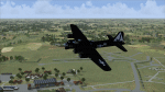
Repaint for the A2A B-17G in the colors of assembly ship B-17G-5-VE 42-39914 "The Black Bitch" of the 351st BG. It Was initially assigned as "Lucky Strike" and marked RQ-S of the 509th BS on 20 Jan 1944. She completed 38 missions and on 8 June 1944 landed and tore off a main wheel. Repaired and assigned to Grp HdQtrs. On 15 April 1945 it took part in a mission over Royan with the 351st BG. Returned Stateside on 6th June 1945 and was sent to Kingman AFB, AZ to be scrapped on 9 November 1945. Painted "Automotive Black" all over and had an over-large White Triangle and Blue Letter J on the vertical stabiliser and rudder.Repaint by Will "dafraz48" Turner, based on the A2A paintkit, October 2014.
| Filename: | Black_Bitch_Boeing_B17G.zip |
| License: | Freeware |
| Added: | 23rd October 2014, 08:41:31 |
| Downloads: | 131 |
| Author: | Will Turner |
| Size: | 7.06 MB |
| Category: Miscellaneous Files - Demos from Commercial Vendors | |
| German Airforce Luftwaffe Fighter Wing 73 Eurofighter Typhoon |
|
Images related to this file:
File Description:

The Eurofighter is a single-seat, twin-engine, agile combat aircraft which will be used in the air-to-air, air-to-ground and tactical reconnaissance roles. Developed by Europe's leading aerospace companies, Eurofighter Typhoon is now in service with the Air Forces of Germany, Spain, Italy and the United Kingdom and will fulfill Air Force requirements well into the 21st Century. Aircraft production is ongoing and with 638 aircraft under contract to the four Partner Nations and Austria, as the first export customer. The design of Eurofighter Typhoon is optimized for air dominance performance with high instantaneous and sustained turn rates, and specific excess power. Special emphasis has been placed on low wing loading, high thrust to weight ratio, excellent all round vision and carefree handling. - Author: A.Meyer.
| Filename: | German_Airforce_Luftwaffe_Fighter_Wing_73_Eurofigh.zip |
| License: | Commercial demo |
| Added: | 30th April 2011, 00:11:03 |
| Downloads: | 87 |
| Author: | Andreas Meyer |
| Size: | 7.86 MB |
| Category: Flight Simulator X - AFCAD Files | |
| ORSU - Sulaimaniyah Intl Airport - Sulaimaniyah, Iraq |
|
Images related to this file:
File Description:
ORSU - Sulaimaniyah International Airport, Kurdistan, Iraq
Sulaimaniyah International Airport is an airport 15 kilometers outside of the city of Sulaimaniyah, in the Kurdistan region of Iraq. The airport has facilities for both cargo and passengers. Sulaimaniyah International Airport has three terminals for departures, arrivals and VIP. The construction of the airport began in November 2003, and it was inaugurated in July 2005 and is unknown to FSX.
Airlines like AtlasJet, Germania, Iraqi airways and FlyDubai visit it regularly.
Using ADEx 1.51 and the IRAQ AIP this airport was built from scratch. Google Earth�´s images are too old (2004) to offer any help regarding buildings, vegetation and surrounding areas like offices, parkings and roads. With the help of pictures found on the real airport site, this is the best rendition for now.
| Filename: | ORSU__Sulaimaniyah_Intl_Airport__Sulaimaniyah_Iraq.zip |
| License: | Freeware |
| Added: | 10th August 2012, 16:53:12 |
| Downloads: | 887 |
| Author: | Menno C. Robert |
| Size: | 3.25 MB |
| Category: Flight Simulator 2004 - Scenery | |
| Israel, the Holy Land - 1North (ver. 01) |
|
File Description:
FS2002/FS2004 highly detailed landclass for Northern Israel, covering the Land of Upper and Lower Galilee, Lake of Galilee and the coastal area of North-Western Israel. Within this area there are many places with historical and Geographical significance for those who are interested in that part of the world. "Israel, the Holy Land 1" is the first released part of an ongoing effort to cover all of Israel with new, detailed landclass. The scenery is made in the highest LOD (level of detail) and shows realisticl coast lines, ports, highways, important secondary roads and rail roads, cities, towns and villages of 2,000 residents and above, accurate vegetation, sand dunes, quarries, and other landuses needed for VFR. The scenery is enhanced with night lighting to enable easy VFR navigation by night.
| Filename: | Israel_the_Holy_Land__1North_ver_01.zip |
| License: | Freeware |
| Added: | 24th October 2003, 16:36:42 |
| Downloads: | 5,804 |
| Author: | Seev Kahn |
| Size: | 2.37 MB |


© 2001-2026 AVSIM Online
All Rights Reserved
Privacy Policy |