
Where Flight Simulation Enthusiasts Gather from Around the World!
AVSIM Library - Search Results

| Category: Flight Simulator 2004 - Scenery | |
| USA Landclass AddOn - Vegetation Part 1 UPDATE 1.5 |

|
Images related to this file:
File Description:
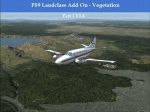
Complete Update, please delete all the old scenery folders. Compatible with Ultimate Terrain, incl. some fixes for UT. Sorry for the update 1.4 called final. Pleas note the readme file. Udate V1.5 concerns mainly British Columbia, the boring LC from CYLW to CYKA to CYWL to CYQZ and to CYXS. Now it is varied, made again with satellite maps. Also change the wrong green LC from KASE (Aspen) to KRIL (Glenwood Springs) and some LC Border correction. BC requires for one LC good replacement textures(026b2.bmp) to enjoy the changes or do it by yourself. Birds Eye View textures includes a good texture. For GEpro Users there is a example picture how to make it with texture 024b2 and 052b2 and a Paintshop Software. For a fast Textureswitch, Batch files are included, also inf and raw files for changing for your according to your taste.
| Filename: | USA_Landclass_AddOn__Vegetation__Part_1_UPDATE_15.zip |
| License: | Freeware |
| Added: | 5th March 2015, 19:32:31 |
| Downloads: | 292 |
| Author: | Markus Balz |
| Size: | 4.01 MB |
| Category: Flight Simulator 2004 - Scenery | |
| Armstrong Ontario; one airfield and two float bases |
|
File Description:
Armstrong CYYW airfield is 70 miles northeast of Thunder Bay, and close to Lake Nipigon. There isn't much of interest at the airfield by way of buildings (as there aren't many buildings!) and the only plane I saw was a fire fighting Canadaair CL 415. A basic airfield with one runway with lights and one without, and no maintenance. There is fuel, but it is locked up and not for sale.
The two float bases are 5 miles west (CJF6) and 10 miles southwest (CKN6) of Armstrong airfield. Lake Mackenzie is home to two companies, Armstrong Outposts (two Beavers) and Huron Air & Outfitters (an Otter and a Beaver) who both run fishing and hunting lodges. Wilderness North are further south on Lake Waweig, and I think they fly two Otters and a Beaver to their outpost camps. You need Ultimate Terrain, or there won't be any lakes!
| Filename: | Armstrong_Ontario_one_airfield_and_two_float_bases.zip |
| License: | Freeware |
| Added: | 24th February 2009, 00:51:42 |
| Downloads: | 894 |
| Author: | Roger Wensley |
| Size: | 7.03 MB |
| Category: Flight Simulator 2002 - AI Flight Plans | |
| TrafficBoard 2.0 With Active Aircraft |
|
File Description:
How often have you been asking yourself what a particular AI Aircraft is doing ? And why ? And where is it at all ? The answer is just a click away now: Select the flight in TrafficBoard and follow the path of the Active Aircraft on the map. Provided with real time Flíght Data and Flight Planning Information from TrafficBoard you will find the answers easily. With the Active Aircraft Concept TrafficBoard 2.0 is extending WYSIWYG for AI Traffic to levels unheard of yet: Monitoring AI Traffic visually on the TrafficBoard Map, listening in to ATC communications and linking AI flights back to their original flight plan has never been done before. With TrafficBoard and Active Aircraft you can build AI Traffic with ease in the WYSIWIG style - what you see is what you get !
| Filename: | TrafficBoard_20_With_Active_Aircraft.zip |
| License: | Shareware, limited functionality |
| Added: | 14th March 2003, 17:24:15 |
| Downloads: | 2,014 |
| Author: | Josef Dirnberger |
| Size: | 10.37 MB |
| Category: Flight Simulator 2004 - AI Flight Plans | |
| Default AI General Aviation V2 |
|
File Description:
These files are the default AI flight plans for all the general aviation flights as delivered in Flight Simulator 2004. They have been separated by aircraft and sorted by departure region/country.
These flightplans may be used as a basis for more realistic GA traffic. From replacing the tail numbers with realistic regionally accurate numbers to completely replacing the default flights with more realistic AI GA traffic on a regional basis. These files will also make it easier to shift GA traffic out of major commercial hub airports (so you won't be running over a Cessna 172 while on final approach into JFK any more).
This second version is to correct the Beech King Air 350 (AC#2). In the first version all the flight plans had somehow been doubled in the file.
| Filename: | Default_AI_General_Aviation_V2.zip |
| License: | Freeware |
| Added: | 9th January 2005, 17:53:58 |
| Downloads: | 3,608 |
| Author: | James Whitaker |
| Size: | 728.1 KB |
| Category: Microsoft Flight Simulator (2020) - Scenery | |
| EINN Shannon Airport MSFS 2020 |
|
Images related to this file:
File Description:

Shannon Airport (EINN) for MSFS 2020
Introducing a highly detailed rendition of Shannon Airport, with custom buildings, dynamic lighting, custom taxiways, detailed night lighting, static objects and more.
Shannon Airport (Aerfort na Sionnane) (ICAO: EINN) Is an international airport on the west coast of Ireland, situated between the city of Limerick and Ennis town. It is home to many daily movements, including scheduled traffic by operators such as Aer Lingus, Ryanair, Delta, United, along with scheduled freighter traffic and other charter operations. The airport has a long history as a primary transatlantic stopover, heavy maintenance base and catering for US Military traffic transiting to/ from USA.
Shannon is also listed as an alternate airport for NASA Space Shuttle returns from orbit due to the length of its RWY 06/24.
| Filename: | EINN_Shannon_Airport_MSFS_2020.zip |
| License: | Freeware |
| Added: | 26th February 2021, 19:54:48 |
| Downloads: | 558 |
| Author: | Robert Byrne & Chris Klose |
| Size: | 31.06 MB |
| Category: Flight Simulator X - Scenery | |
| Lesvos-Chios |
|
Images related to this file:
File Description:

AS REAL AS IT GETS.
This is a detailed photorealistic scenery of the islands of Lesvos, Chios, Oinouses and Psara.
Default FSX airports of Mytilini (LGMT), Polychnitos (LG0D) and Chios (LGHI) were completely redone, positioned to their exact location, and many buildings and objects were added in the airport compounds.
New LGMT and LG0D altitude change files.(Read the .txt file for installation instructions).
New aprons, taxi signs and plenty of aircraft parking.
New models for Chios airport terminal building (not original), airport terminal building signs, roadway-runway crossing gates and crossing signs for Polychnitos airport all with night textures.
The scenery contains plenty of autogen objects, buildings, vegetation and road traffic near the airports.
I have also included 3 aircraft traffic files and 1 helicopter traffic file.
| Filename: | LesvosChios.zip |
| License: | Freeware |
| Added: | 18th September 2011, 23:58:49 |
| Downloads: | 2,476 |
| Author: | Angelo Tassoglou |
| Size: | 141.62 MB |
| Category: Prepar3D V5 - Scenery | |
| EINN Shannon Airport P3dV5 |
|
Images related to this file:
File Description:

Shannon Airport (EINN) for P3dV5
Introducing a highly detailed rendition of Shannon Airport, with custom buildings, dynamic lighting, custom taxiways, transparent terminal window textures and more.
Shannon Airport (Aerfort na Sionnane) (ICAO: EINN) Is an international airport on the west coast of Ireland, situated between the city of Limerick and Ennis town. It is home to many daily movements, including scheduled traffic by operators such as Aer Lingus, Ryanair, Delta, United, along with scheduled freighter traffic and other charter operations. The airport has a long history as a primary transatlantic stopover, heavy maintenance base and catering for US Military traffic transiting to/ from USA.
Shannon is also listed as an alternate airport for NASA Space Shuttle returns from orbit due to the length of its RWY 06/24.
| Filename: | EINN_Shannon_Airport_P3dV5.zip |
| License: | Freeware |
| Added: | 26th February 2021, 19:54:15 |
| Downloads: | 2,179 |
| Author: | Robert Byrne & Chris Klose |
| Size: | 122.79 MB |
| Category: Flight Simulator X - AFCAD Files | |
| MGGT - La Aurora International Airport - Guatemala City, Guatemala |
|
Images related to this file:
File Description:

La Aurora International Airport (IATA: GUA, ICAO: MGGT) is the main airport in Guatemala City, Guatemala and the busiest airport in the country. The airport underwent a major expansion and renovation of its main terminal back in 2008 and is currently the fourth busiest airport in Central America by passenger traffic.
Features:
*Runway properly renumbered
*Taxiways properly designed and signs updated
*Expanded parking apron
*Redesigned terminal building to match 2008 renovations/expansion
*Accurate gate assignments
*Runway markings and lighting corrected
*Parking spots for commercial traffic
*Separate parking area for GA traffic
*Misc airport buildings added
*Airport vehicles and objects throughout the airport
*Fuel service vehicles
*Static vehicles (requires objlib-large-car-parking-fsx.zip)
*Light poles (requires fsx_lts.zip)
| Filename: | MGGT__La_Aurora_International_Airport__Guatemala_C.zip |
| License: | Freeware |
| Added: | 14th April 2014, 23:32:28 |
| Downloads: | 1,483 |
| Author: | Jaison Diaz / Endeavour ai |
| Size: | 201.52 KB |
| Category: Flight Simulator X - Scenery | |
| Kavala - Greece |
|
Images related to this file:
File Description:
Kavala DN
AS REAL AS IT GETS.
This is a highly detailed photorealistic scenery of the beautiful Kavala area
and the Island of Thasos WITH NIGHT TEXTURES.
The scenery contains many objects like cars, boats and buldings in many cities
like Kavala, Keramoti, Thasos and around the airport.
Default FSX airport Megas Alexandros (LGKV) and Amigdhaleon (LGKM) were
corrected and repositioned to their exact location, runway 05L was added,
many buildings and trees, aircraft hangers, airforce static aircraft and army vehicles.
Also I added 2 small aircraft traffic files and a small file for helicopter traffic.
Check the Oil Rig in Kavala Bay and try to land on the helipad.
The scenery also includes the customary autogen buildings, vegetation and
road traffic near the cities to enhance and animate the landscape.
| Filename: | Kavala__Greece.zip |
| License: | Freeware |
| Added: | 24th November 2016, 17:35:13 |
| Downloads: | 1,469 |
| Author: | Angelo Tassoglou |
| Size: | 200.36 MB |
| Category: Flight Simulator 2004 - Scenery | |
| North Tucson Photo Scenery |
|
File Description:
This is a photo scenery covering the area north of Tucson between Dan Relfe's Tucson photo scenery and MegaScenery Phoenix. It doesn't quite reach the Phoenix scenery, but it's close. La Cholla Airpark (57AZ) is included, with a custom AFCAD and AI traffic that use the roads. Some of the AI traffic is parked at the airport and some at the houses. Aircraft have the right of way on the roads at La Cholla. Full autogen is included for all photo tiles.
| Filename: | North_Tucson_Photo_Scenery.zip |
| License: | Freeware |
| Added: | 23rd January 2007, 04:24:09 |
| Downloads: | 1,598 |
| Author: | Kevin Burns |
| Size: | 26.73 MB |


© 2001-2026 AVSIM Online
All Rights Reserved
Privacy Policy |