
Where Flight Simulation Enthusiasts Gather from Around the World!
AVSIM Library - Search Results

| Category: Fly! II - TerraScene | |
| Charlotte (Carolinas Project) TerraScene Project Pack |

|
File Description:
This TerraScene 2.1 Project pack covers all of global tile 198,154, centering on Charlotte, North Carolina with Lake Wylie and the Rock Hill, SC region to the southwest. It adjoins the Spartanburg global tile to the west and the Winston-Salem tile to the north. This pack includes updated Tiger Census (2000) shapefile data, adding new water areas, new highways, and other details. All scenery data files are included: USGS data, shapefiles, and a complete water mask. Requires TerraScene 2.1 and Fly!II patched to v230 or later.
| Filename: | Charlotte_Carolinas_Project_TerraScene_Project_Pack.zip |
| License: | Freeware |
| Added: | 15th September 2003, 14:23:31 |
| Downloads: | 283 |
| Author: | Randall Rocke |
| Size: | 68.88 MB |
| Category: Fly! II - TerraScene | |
| Johnson City (Carolinas Project) TerraScene Project Pack |
|
Images related to this file:
File Description:
This TerraScene 2.1 Project pack covers all of global tile 197,155, centering on Johnson City and Elizabethton, TN. Following the Cherokee and Pisgah National Forests to the southwest takes you through Greenville, TN into the Smokies. This tile includes Kingsport, TN to the north and Morganton, NC to the east. This pack includes updated Tiger Census (2000) shapefile data, adding new water areas, new highways, and other details. All scenery data files are included: USGS data, shapefiles, and a complete custom water mask. Requires TerraScene 2.1 and Fly!II patched to v230 or later.
| Filename: | Johnson_City_Carolinas_Project_TerraScene_Project_.zip |
| License: | Freeware |
| Added: | 9th May 2010, 00:58:40 |
| Downloads: | 276 |
| Author: | Randall Rocke |
| Size: | 69.35 MB |
| Category: Fly! II - TerraScene | |
| Fontana Lake (Carolinas Project) TerraScene Project Pack |
|
Images related to this file:
File Description:
This TerraScene 2.1 Project pack covers all of global tile 196,154. Adjoining the Knoxville tile, it continues through the Great Smoky Mountains into Cherokee, NC and Fontana Lake. Continuing south, this scenery area extends through portions of western South Carolina and NE Georgia, including Toccoa and Hartwell Lake to the SE. This pack includes updated Tiger Census (2000) shapefile data, adding new water areas, new highways, and other details. All scenery data files are included: USGS data, shapefiles, and a complete custom water mask. Requires TerraScene 2.1 and Fly!II patched to v230 or later.
| Filename: | Fontana_Lake_Carolinas_Project_TerraScene_Project_.zip |
| License: | Freeware |
| Added: | 10th May 2010, 05:20:25 |
| Downloads: | 318 |
| Author: | Randall Rocke |
| Size: | 88.73 MB |
| Category: Civil Flight Simulators - Looking Glass Flight Unlimited 3 | |
| UK_South placeholder texture |
|
Images related to this file:
File Description:
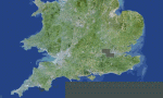
When you try to build the UK_South region for FU3 you will miss the blank water tile and there is a misplaced placeholder ground texture. This zip will correct this with a better ground from a painted map and the earler set of water tiles including the missed level 0 to 3 of them.
Do not apply this zip to other region or to a full UK_South installation then this is just for a starter kit and will overwrite useful tiles when applied to other region or full installation of UK_South.
| Filename: | UK_South_placeholder_texture.zip |
| License: | Freeware, limited distribution |
| Added: | 17th May 2010, 00:04:45 |
| Downloads: | 87 |
| Author: | Andr������© Meystre |
| Size: | 3.89 MB |
| Category: Fly! II - TerraScene | |
| Winston-Salem (Carolinas Project) TerraScene Project Pack |
|
Images related to this file:
File Description:
This TerraScene 2.1 Project pack covers all of global tile 198,155, centering on North Wilkesboro, North Carolina with Jefferson in the NW. To the SW you will find Hickory, while in the NE is Mount Airy. The Winston-Salem metro area is near the eastern border. This pack includes updated Tiger Census (2000) shapefile data, adding new water areas, new highways, and other details. All scenery data files are included: USGS data, shapefiles, and a complete water mask. Requires TerraScene 2.1 and Fly!II patched to v230 or later.
| Filename: | WinstonSalem_Carolinas_Project_TerraScene_Project_.zip |
| License: | Freeware |
| Added: | 21st May 2010, 01:55:45 |
| Downloads: | 15 |
| Author: | Randall Rocke |
| Size: | 62.73 MB |
| Category: Fly! II - TerraScene | |
| Kinston (Carolinas Project) TerraScene Project Pack |
|
File Description:
This TerraScene 2.1 Project pack covers all of global tile 200,154, extending the Atlantic shoreline a short distance north of Wilmington. Inland, it covers the cities of Kinston and Goldsboro, North Carolina. The tile includes Seymour Johnson AFB and numerous small strips along the I-95 and I-40 corridors. This pack includes updated Tiger Census (2000) shapefile data, adding new water areas, new highways, and other details. All scenery data files are included: USGS data, shapefiles, and a complete custom water mask. Requires TerraScene 2.1 and Fly!II patched to v230 or later.
| Filename: | Kinston_Carolinas_Project_TerraScene_Project_Pack.zip |
| License: | Freeware |
| Added: | 13th May 2010, 09:42:13 |
| Downloads: | 169 |
| Author: | Randall Rocke |
| Size: | 78.93 MB |
| Category: Fly! II - TerraScene | |
| Akron (Ohio Project) TerraScene Project Pack |
|
File Description:
This is a TerraScene 2.1 Project pack for northeastern Ohio. It covers all of global tile 198,159 with Akron in the NW. It continues south through New Philadelphia to Wheeling, WV in the southeast. Pittsburgh Intl. is included in the eastern portion of the tile. This pack includes updated Tiger Census (2000) shapefile data, adding new water areas, new highways, and other details. All scenery data files are included: USGS data, shapefiles, and a complete water mask. Requires TerraScene 2.1 and Fly!II patched to v230 or later.
| Filename: | Akron_Ohio_Project_TerraScene_Project_Pack.zip |
| License: | Freeware |
| Added: | 30th May 2010, 20:36:38 |
| Downloads: | 514 |
| Author: | Randall Rocke |
| Size: | 66.06 MB |
| Category: Fly! II - TerraScene | |
| Knoxville (Carolinas Project) TerraScene Project Pack |
|
Images related to this file:
File Description:
Re-upload. This TerraScene 2.1 Project pack covers all of global tile 199,155, including the Knoxville area and extending slightly south into Gatlinburg and the Great Smoky Mountains. It covers the area surrounding La Follette to the NW, continuing to Morristown and Newport in the east. This pack includes updated Tiger Census (2000) shapefile data, adding new water areas, new highways, and other details. All scenery data files are included: USGS data, shapefiles, and a complete custom water mask. Requires TerraScene 2.1 and Fly!II patched to v230 or later.
| Filename: | Knoxville_Carolinas_Project_TerraScene_Project_Pac.zip |
| License: | Freeware |
| Added: | 1st June 2010, 00:38:23 |
| Downloads: | 224 |
| Author: | Randall Rocke |
| Size: | 79.79 MB |
| Category: Flight Simulator 2004 - AI Flight Plans | |
| Floatplanes Starter Kit |
|
File Description:
This Starter Kit provides AI traffic of three floatplanes in the San Francisco Bay (Pier 39) and instructions for setting up other floatplanes and additional AFCAD2 water strips anywhere in the FS world. Simple installation! The AI floatplanes - Piper J-3C-65 Cub, Waco Classic Biplane, and Aviat A-1B Husky - have their contact points adjusted so that their floats are actually in the water. Realistic wake and spray effects. Also includes three additional floatplane templates for the default C208 Amphibian and a DHC-2 Beaver and Noorduyn Norseman (separate downloads).
| Filename: | Floatplanes_Starter_Kit.zip |
| License: | Freeware, limited distribution |
| Added: | 24th January 2004, 04:48:45 |
| Downloads: | 7,884 |
| Author: | Holger Sandmann |
| Size: | 2.31 MB |
| Category: Flight Simulator X - Scenery | |
| St. Augustine, FL - Northeast Florida Regional Airport (KSGJ) |
|
Images related to this file:
File Description:
Generic floating buildings have been replaced with custom and library objects, and the attached seaplane base is included with a functional ramp to the water. FSX does not include the water runways on the intercoastal waterway, but information from the St. Augustine-St. Johns County Airport Authority is included showing the runway locations. Scenery in this package is based on Virtual Earth (Bing) and Google Earth imagery. Landclass changes, roads, rework of taxiways and aprons, placement of library objects and a library of new airport buildings are included.
| Filename: | St_Augustine_FL__Northeast_Florida_Regional_Airpor.zip |
| License: | Freeware |
| Added: | 22nd September 2010, 02:31:03 |
| Downloads: | 1,755 |
| Author: | Art Poole |
| Size: | 1.59 MB |
© 2001-2026 AVSIM Online
All Rights Reserved
Privacy Policy |